CAPE
-
Posts
36,279 -
Joined
-
Last visited
Content Type
Profiles
Blogs
Forums
American Weather
Media Demo
Store
Gallery
Everything posted by CAPE
-
Snippet from Mount Holly AFD- While technically outside the current forecast period, it should be noted that an arctic outbreak with well below normal temperatures looks to be on the horizon beginning next weekend. A few consecutive days of temperatures on the order of 10-20 degrees below normal are possible.
-
Euro Ens has the potential wave preceding/along the Arctic front end of next week into the weekend. Maybe a shot of snow followed by H5 Avocado/surface Barney cold.
-
12/5: 1.3"
-
I mentioned this yesterday in a post. The orientation of that WPO block is somewhat flattening the PNA ridge. The other primary feature of influence is the southward displaced TPV lobe.
-
Yup, but pretty uncommon to see it actually verify at our latitude.
-
That was a fun little event, and my yard jacked with 3".
-
That storm was at least respectable here- 5", which fell short of the 12" forecast- and it wasn't too far east of my yard in DE where 10-12" did fall. I would take my chances with a similar set up again.
-
The advertised pattern is conducive for something next week- we need some luck as always.
-
Yeah this is only a few days out. That said some minor tweaks could get our region in on the northern edge(again). Probably gotta root for more amplification earlier.
-
This could easily trend north- probably too far north lol. Pretty nice h5 look in general. That vorticity lobe over the Canadian Maritimes is a bit problematic.
-
I just did an h5 analysis of that Euro run and the intricate interplay between multiple pieces of energy(vorticity) that allows the one that induces 'our' storm to sharpen and dig that far southward and it is pretty insane how it worked out. What would really help get a NS vort to track underneath is a sharper/more amped PNA ridge, but its being kept a bit 'flat' by the positively tilted WPO ridge and downstream trough.
-
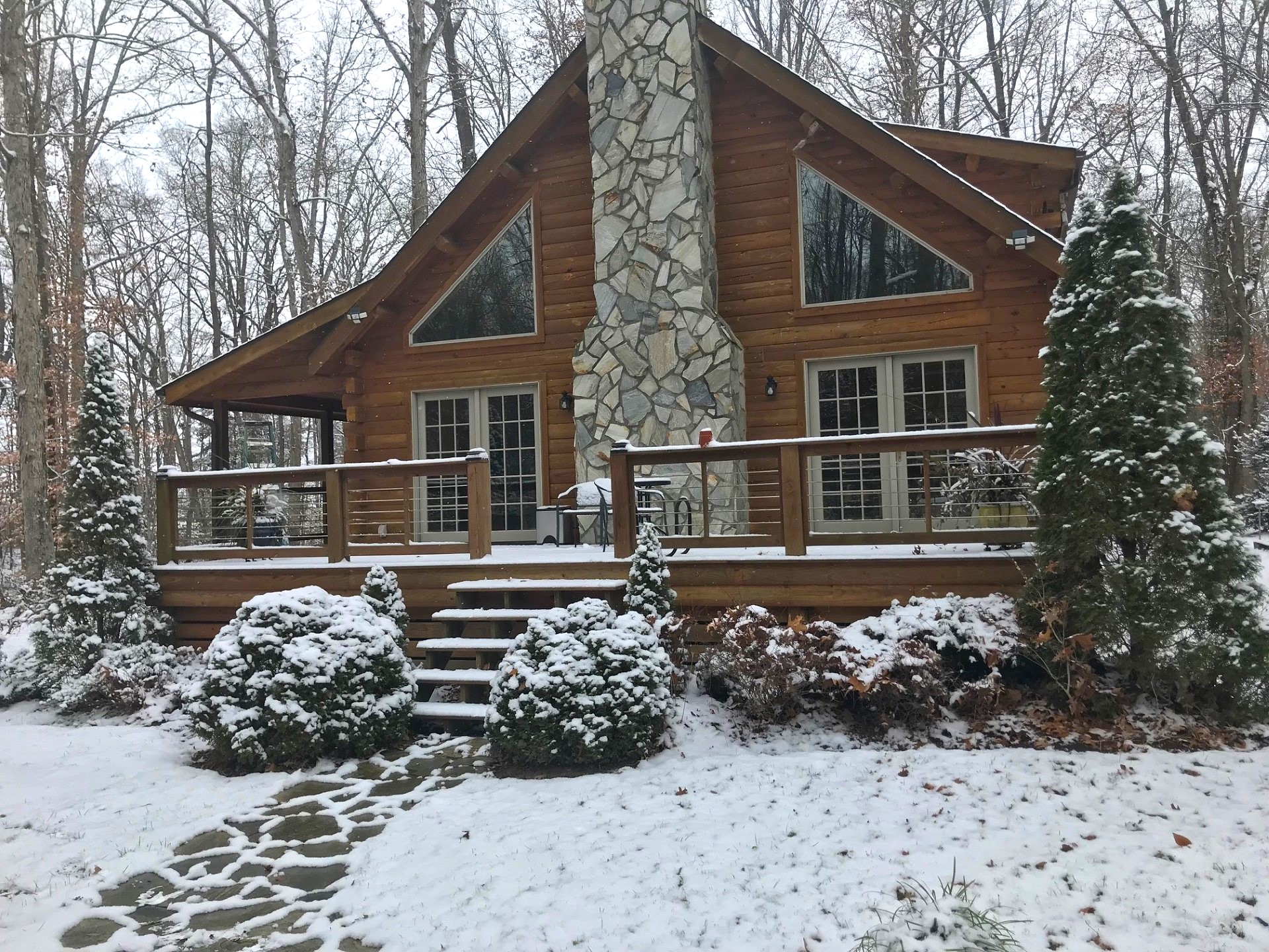
Obligatory cabin snow pic. Still quite a few leaves under that snow. I been slacking lately.

-
Back to some steadier snow now with decent flake size. See how long this lasts. Temp is 27.
-
Just got home. Measured 1.3" OTG. Probably 1.5+ fell but I wasn't here to measure properly. Still some non accumulating light snow falling and skies are brightening a bit. Nice wintry scene here in the woods.
-
About the same here on the west side. Back to some nice sized flakes falling currently. Pretty along the Miles River.
-
A little over a half inch otg here at work on the west side of Easton.
-
Just arrived at work in Easton. Steady snow falling here with a coating of snow on the ground and untreated surfaces. Just a few flakes in the air when I left my house.
-
Sadly I agree. IIRC he was a heavy smoker. Sigh.
-
Still wondering what happened to@WinterWxLuvr Hope he is ok.
-
32/23 Bring the dusting.
-
Noise. There is literally no difference. Okay a tenth less here lol. If it wasn't such a minuscule amount of snow it would be considered to be no difference.
-
Euro or bust.
-
A few more ticks north and much of the area will be in legit 1-2" range!
-
End of next week also looks intriguing at h5 but as it looks now on the ens mean we would need a piece of NS energy to dig further south to get us a little storm.
-
We got pieces in place on the ens run. Why sweat the run to run details on the op runs at this range- its literally going to change every run. Just no way to know how the NS vorticity will interact- but we have some digging energy taking the southern route to work with.