CAPE
-
Posts
36,289 -
Joined
-
Last visited
Content Type
Profiles
Blogs
Forums
American Weather
Media Demo
Store
Gallery
Everything posted by CAPE
-

January 28-29 2022 Miller abcdefu Storm Obs/Discussion
CAPE replied to mappy's topic in Mid Atlantic
Lol is that a vacation home or where you live? Did you get the 8.3 the model showed you? It's my house but it really is a perfect vacation home. I will probably market it as a retreat/hunting cabin when I go to sell it. Guidance ran the gamut here and the 18z GFS was the worst-still showing 10". Most other guidance had backed off to the 5-8" range. Ended up just short of 6". It played out just like I thought. These late developing scrapers will almost always give me some decent snow, but the best always stays east. The GFS love will maybe back off a bit as it was terrible with this event- way too far east for many runs then incrementally went west and ended up with more snow too far inland, as all other guidance corrected the other way.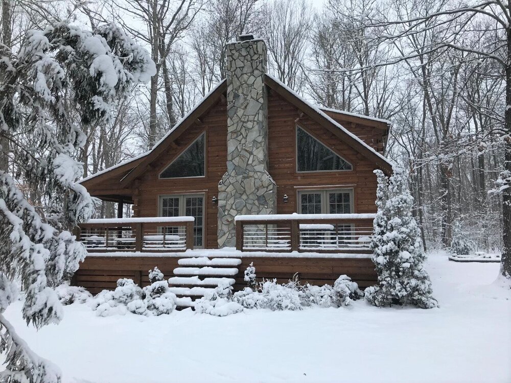
-
Mid-Atlantic forum winter 2021/22 snow totals thread
CAPE replied to North Balti Zen's topic in Mid Atlantic
1/3/22- 9.5" 1/7/22- 3.2" 1/16/22- 0.8" 1/29/22- 5.8" Total: 19.3" -
January 28-29 2022 Miller abcdefu Storm Obs/Discussion
CAPE replied to mappy's topic in Mid Atlantic
LOL Damn -
January 28-29 2022 Miller abcdefu Storm Obs/Discussion
CAPE replied to mappy's topic in Mid Atlantic
Maybe check some of the obs in this very thread from the beaches. -
January 28-29 2022 Miller abcdefu Storm Obs/Discussion
CAPE replied to mappy's topic in Mid Atlantic
bump -
January 28-29 2022 Miller abcdefu Storm Obs/Discussion
CAPE replied to mappy's topic in Mid Atlantic
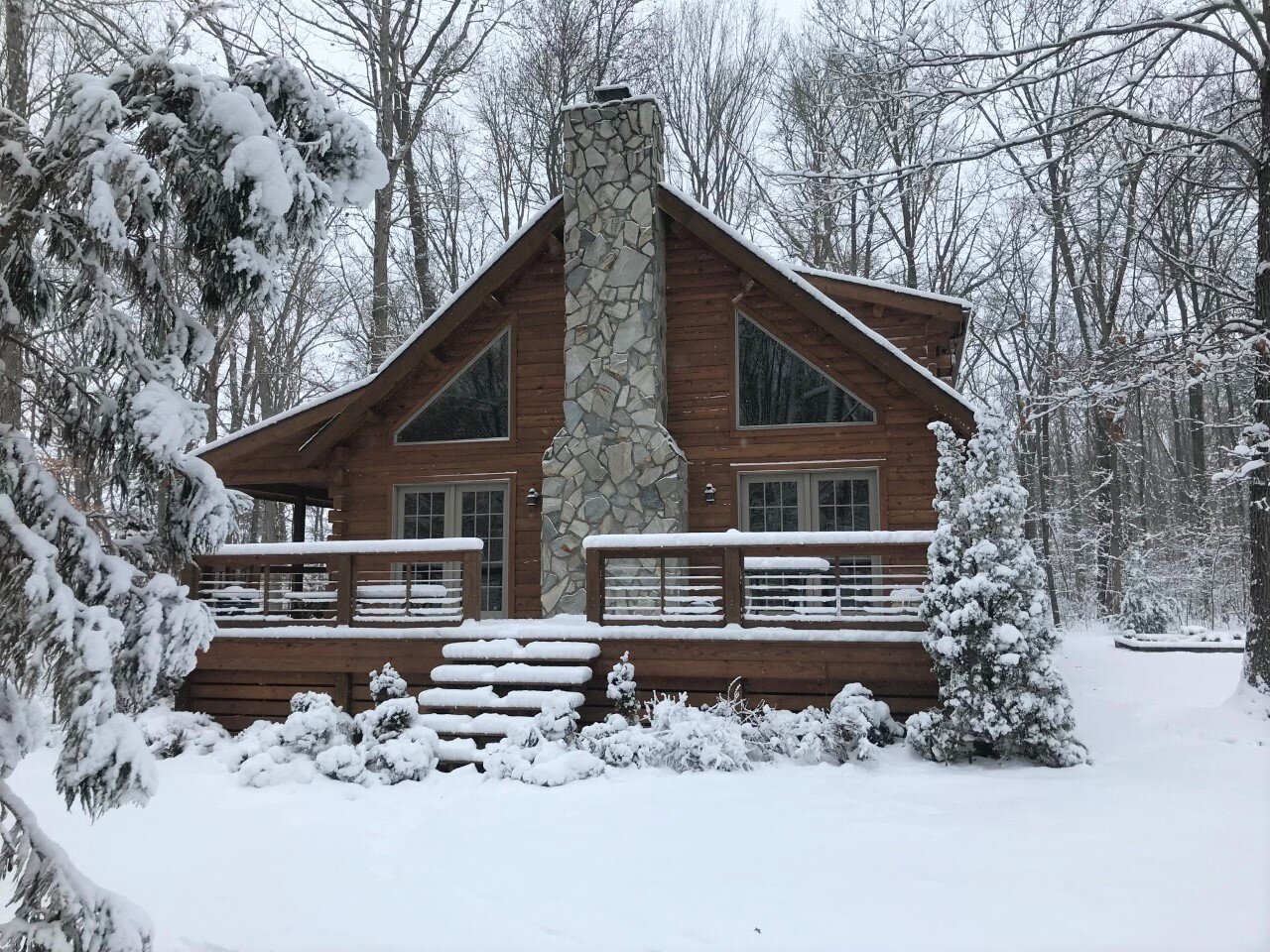
Obligatory cabin in the snow pic. @nj2va
-
January 28-29 2022 Miller abcdefu Storm Obs/Discussion
CAPE replied to mappy's topic in Mid Atlantic
19 and blustery. Looks like the back edge is slowly approaching, with a bit of 'enhanced' band. Might end with some light snow after hours of this super light stuff. -
January 28-29 2022 Miller abcdefu Storm Obs/Discussion
CAPE replied to mappy's topic in Mid Atlantic
The 2 good (best) winters out of the last 6 here have been Ninas. Even last winter was decent. -
January 28-29 2022 Miller abcdefu Storm Obs/Discussion
CAPE replied to mappy's topic in Mid Atlantic
The storm that had no chance. Imagine that! -
January 28-29 2022 Miller abcdefu Storm Obs/Discussion
CAPE replied to mappy's topic in Mid Atlantic
-
January 28-29 2022 Miller abcdefu Storm Obs/Discussion
CAPE replied to mappy's topic in Mid Atlantic
Persistent very light snow here still. Temp down to 20. Very pretty out. Looks like a solid 6" but I haven't ventured out yet. -
January 28-29 2022 Miller abcdefu Storm Obs/Discussion
CAPE replied to mappy's topic in Mid Atlantic
He is on the Jersey shore. -
January 28-29 2022 Miller abcdefu Storm Obs/Discussion
CAPE replied to mappy's topic in Mid Atlantic
How we doing over at the DE coast? Had a webcam of Lewes up before I went to bed and it looked impressive. -
January 28-29 2022 Miller abcdefu Storm Obs/Discussion
CAPE replied to mappy's topic in Mid Atlantic
Wind has definitely picked up and the snow is very powdery with the drop in temp. -
January 28-29 2022 Miller abcdefu Storm Obs/Discussion
CAPE replied to mappy's topic in Mid Atlantic
Nice storm here and about what I expected. That band that set up early on as the coastal was just getting going produced the best period of snow here, with big dendrites. Picked up 2" in that 2 hour period. The rest has been light to moderate and no big fluffies. -
January 28-29 2022 Miller abcdefu Storm Obs/Discussion
CAPE replied to mappy's topic in Mid Atlantic
Maybe but the radar doesn't have that look. More likely some drier air working in and probably not ideal upstairs in the DGZ. -
January 28-29 2022 Miller abcdefu Storm Obs/Discussion
CAPE replied to mappy's topic in Mid Atlantic
Actually just ok. Oddly the radar looks good but what's actually falling is pretty light. Might be 2 inches since I went to bed. Once I wake up a bit I will venture out. Temp is 23. -
January 28-29 2022 Miller abcdefu Storm Obs/Discussion
CAPE replied to mappy's topic in Mid Atlantic
Midnight obs- 30 degrees moderate snow 4" Time to get some sleep. -
January 28-29 2022 Miller abcdefu Storm Obs/Discussion
CAPE replied to mappy's topic in Mid Atlantic
Wind picking up a bit now. -
January 28-29 2022 Miller abcdefu Storm Obs/Discussion
CAPE replied to mappy's topic in Mid Atlantic
Indeed it will. Enjoying the snow here but it will not compare to the experience down there. Should be similar to 2018 but with higher wind gusts. -
January 28-29 2022 Miller abcdefu Storm Obs/Discussion
CAPE replied to mappy's topic in Mid Atlantic
Back to moderate snow with medium sized flakes after an hour or so of light stuff. Temp down to 30. Just about 3" now. -
January 28-29 2022 Miller abcdefu Storm Obs/Discussion
CAPE replied to mappy's topic in Mid Atlantic
Yeah at this point toss the models and just watch it happen. I haven't looked at the radar at all, other than seeing HM's tweet lol. I was like wow that's what just came through and gave me an inch per hour for 2 hours. -
January 28-29 2022 Miller abcdefu Storm Obs/Discussion
CAPE replied to mappy's topic in Mid Atlantic
That was a great couple hours here to kick it off. -
January 28-29 2022 Miller abcdefu Storm Obs/Discussion
CAPE replied to mappy's topic in Mid Atlantic
2.5" Back to a steady light snow for now. -
January 28-29 2022 Miller abcdefu Storm Obs/Discussion
CAPE replied to mappy's topic in Mid Atlantic