CAPE
-
Posts
36,851 -
Joined
-
Last visited
Content Type
Profiles
Blogs
Forums
American Weather
Media Demo
Store
Gallery
Everything posted by CAPE
-
A NA blocking pattern isn't a miracle worker. We need anomalous cold in the pattern(somehow) for snow to occur at our latitude/relatively low elevation. In a warming climate with a potentially stronger/persistent NPJ + warmer Atlantic, that probably means a mechanism that injects cross polar flow(+PNA/-EPO). The days of a -AO/NAO/ -PNA being a good setup for snow in these parts is probably on the wane. 220, 221. Whatever it takes. (for snow)
-
0.23" here so far. It's been a mostly rain-free morning/early afternoon. Probably safe to drop the flood watch.
-
Moderate rain here with this initial SE to NW moving line. Shouldn't last too long.
-
I notice this a lot more by early June. Beyond that it can rain its ass off here but the soil will be parched a few days later. Grass will be withering away by mid June.
-
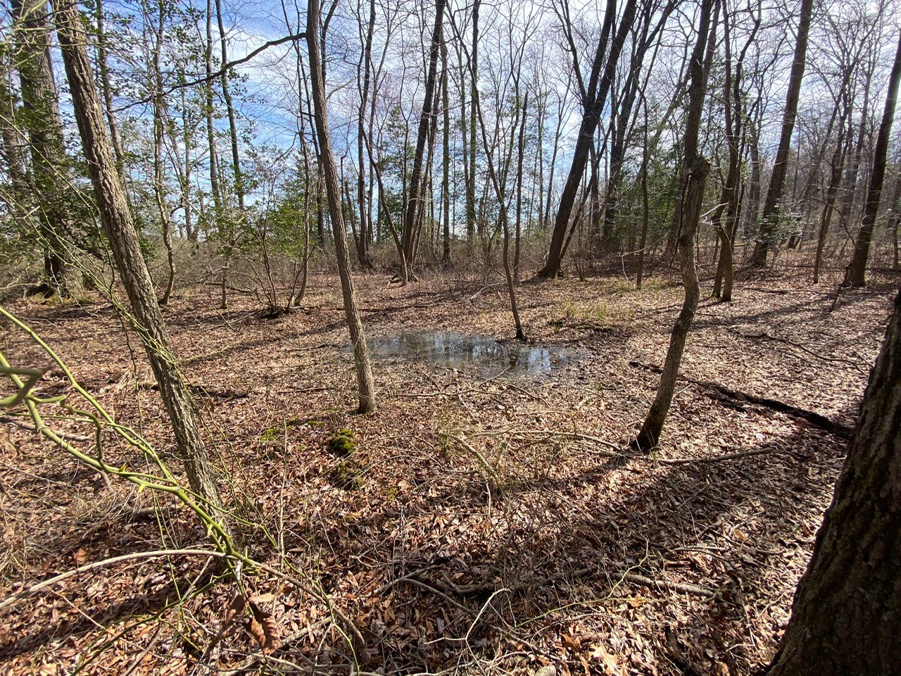
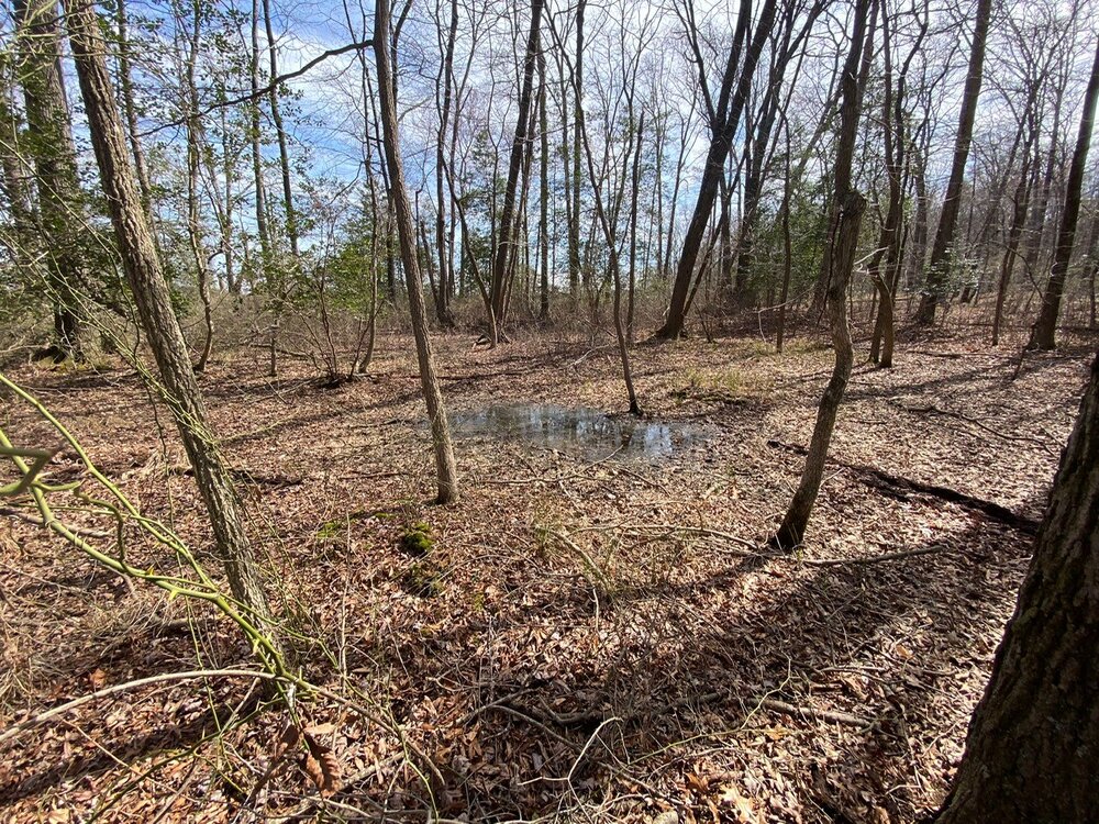
My wetland a month ago, which looked the same 10 days ago, save for more green. Very usually dry. Same area today- more typical for this time of year. Changed in a hurry since last weekend.
- 233 replies
-
- 13
-

-
That's a place I have been wanting to go. Seems to have a cool vibe and very scenic.
-
Drove to Kent island today. Remarkable to see flooded areas near creeks and major ditches, and farm fields with broad/ shallow pools of water, given how things looked just a week or so ago. Rooting for the under tomorrow.
-
Fixed it. See my post in banter. Add a little weed to that.
-
Sun breaks here too. Nice afternoon/early evening. Low 60s. Rounds of heavy rain with some thunder looks like a good bet for tomorrow.
-
Mount Holly AFD snippet- For Sunday, the second of two low pressure systems will affect the area as deepening low pressure system moves northward through the day from the Carolinas towards NE PA. This will occur in response to a strong shortwave pivoting around an upper level low over the Midwestern States. This will lead to another wet day and the difference compared with the first system is that there will be a bit more instability in play as the triple points moves over Delmarva and southern NJ with low level flow from the S/SE. Expect rain/showers to move in southwest to northeast through the morning into the early afternoon and it`s worth noting, precip could come through in several rounds with a first round moving in during the morning with heavier rain/showers moving in by late day as the system draws closer. The first system has brought a general 1-2 inches of rain so far to much of the area with 2-5+ inches over parts of Delmarva, South Jersey and the NJ coast. This second low will once again tap into rich moisture with PWATs of 1.25, and with a warm cloud layer around 10,000 feet with some instability, precipitation efficiency will be maximized, with rainfall rates potentially on the higher side, especially later in the day. The good news is the system will be a bit more progressive but still, expect another 1 to 2 inches of rain on top of increasingly saturated ground with locally higher amounts possible. For these reasons, a Flood Watch has been issued for our Delmarva, South Jersey, and NJ coastal counties.
-
Flood watch over here for tomorrow.
-
Founders KBS(the original) for HH.
-
The x axis is about spot on as a reference for the typical period of time the water table breaks and remains above the surface in that area. Late Jan through May.
-
At the peak now, just a bit of a phase shift compared to normal.
-
Much later than usual, but with 4.5" of rain over the last week, the seasonal woodland wetland has gone from a few shallow puddles to an expansive area of water a foot or more deep. Just trudged around in my knee boots and seeded it with larvicide. #droughtover
-
Hopefully we see a few breaks in the clouds today. A little sun would be nice. Likely another inch+ for tomorrow.
-
Total per my gauge is 2.9", but it may have succumbed to tree debris towards the end as it was still raining hard and it didn't move much. Looking at precip reports from NWS, several places in central DE including Dover reported 4 - 5"+.
-
Absolutely pouring here. Just missing the thunder. 2.73"
-
You are in that training band too. Up to 1.6" here.
-
1.45". Rain has been pretty impressive the last couple hours. Persistent moderate to heavy band of showers training from the SW.
-
After not doing much here for a couple hours, getting moderate to heavy rain the last hour. Closing in on an inch.
-
0.63" here so far. Winds are gusting pretty good at times. Gusts to 40 mph in the forecast for tonight.
-
I love the Flowers pick. Very much in the mold of Steve Smith. 20 pounds heavier than Hollywood Brown when he was drafted, so those making that comparison are off.
-
-
I said from the beginning the Ravens were smart to use the transition tag, so Lamar would see what the true market was. No team was ever going to give up 2 number ones and give him a fully guaranteed contract, just because the Browns were dumb and desperate enough to do so with Watson. The Ravens offer back in Sept was comparable to the Hurts deal. They just tweaked it a bit to make Lamar a slightly better deal than Hurts.