on_wx Posted August 21, 2011 Share Posted August 21, 2011 Edit: You can see the tornado at the beginning of this video: http://video.ca.msn....ebook&brand=MSN 1 mile wide tornado through the town of Goderich. 15 minute warning. Crazy photo gallery from the London Free Press: http://www.lfpress.c...f-18582706.html Just confirmed as an F3 tornado at 945pm Sunday A tornado hit the town of Goderich, Ontario on the shore of Lake Huron between 4 and 5pm this evening. Reports say people may be trapped in the salt mine and pictures verify the mine took a hit. The tornado went through downtown and heavily damaged many buildings including the courthouse. Some two or three story buildings in downtown are missing their upper floors. Reports also say numerous houses are damaged or destroyed. There were widespread gas leaks through the town but the gas has been shut off. The mayor has declared a state of emergency, media are en route but a lot of pictures are coming up on Twitter right now #Goderich. OPP have closed all the roads into town and are telling people to stay home or stay away. Shelters are being set up in the town. More details to come. A tornado warning was issued about 10 minutes before the tornado. Mixed reports right now say multiple injuries and some people missing. Others say the tornado hit a campground SE of the town. Sounds like the tornado may have been on the ground for 10-15km coming in off the Lake first hitting the salt mine then going through the heart of the town towards the hamlet of Londesborough. Link to comment Share on other sites More sharing options...
on_wx Posted August 21, 2011 Author Share Posted August 21, 2011 My family were at a BBQ in downtown Stratford, I was sleeping, but my cousins called them and told them about the tornado warning. When they left the city to come home golf ball sized hail started to fall in the city. Videos on Youtube and EC storm reports say tennis ball sized hail fell around Goderich. This was the same supercell that promoted the tornado warnings in the Gaylord MI CWA. SEVERE WEATHER BULLETIN ISSUED BY ENVIRONMENT CANADA AT 3:48 PM EDT SUNDAY 21 AUGUST 2011. --------------------------------------------------------------------- WATCHES/WARNINGS IN EFFECT FOR SOUTHERN ONTARIO... TORNADO WARNING FOR: =NEW= GODERICH - BLUEWATER - SOUTHERN HURON COUNTY =NEW= STRATFORD - MITCHELL - SOUTHERN PERTH COUNTY. AT 3:30 PM EDT A SEVERE THUNDERSTORM IS OCCURRING OVER SOUTHERN LAKE HURON. THIS THUNDERSTORM IS MOVING TO THE SOUTHEAST AT 75 KM/H AND WILL MAKE LANDFALL NEAR GODERICH ABOUT 4 PM. THIS THUNDERSTORM HAS A HISTORY OF PRODUCING TORNADOES. SEVERE THUNDERSTORMS LIKELY PRODUCING TORNADOES ARE IMMINENT OR OCCURRING IN THE AREA. LARGE HAIL, DAMAGING WINDS AND HEAVY RAINFALL MAY ALSO ACCOMPANY THESE STORMS. MONITOR WEATHER CONDITIONS AND TAKE IMMEDIATE SAFETY PRECAUTIONS IF THREATENING WEATHER APPROACHES. Link to comment Share on other sites More sharing options...
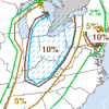
on_wx Posted August 21, 2011 Author Share Posted August 21, 2011 Link to comment Share on other sites More sharing options...
on_wx Posted August 21, 2011 Author Share Posted August 21, 2011 Looks like a big tornado, almost 1/4 mile wide http://yfrog.com/khk1bcmj Link to comment Share on other sites More sharing options...
on_wx Posted August 22, 2011 Author Share Posted August 22, 2011 Just got a call from family friends in Goderich. Houses are leveled on the east side of the town, one house just has a staircase standing. Multiple pictures on the news show a half km wide wedge tornado. OPP are having a news conference soon. They said news is downplaying the situation right now. She says air ambulances are all over town and sirens everywhere. Commercial buildings are flattened too and their business is 3/4 destroyed. They said rumours saying they are finding dead people in collapsed houses. Also a large building is blocking the highway, it's not from the immediate area. Link to comment Share on other sites More sharing options...
blackjack123 Posted August 22, 2011 Share Posted August 22, 2011 Just got a call from family friends in Goderich. Houses are leveled on the east side of the town, one house just has a staircase standing. Multiple pictures on the news show a half km wide wedge tornado. OPP are having a news conference soon. They said news is downplaying the situation right now. She says air ambulances are all over town and sirens everywhere. Commercial buildings are flattened too and their dental practice is 3/4 destroyed. Sounds like a strong/violent tornado. Does Canada still use the F-scale? Link to comment Share on other sites More sharing options...
blackjack123 Posted August 22, 2011 Share Posted August 22, 2011 I hope the people there are OK. This has been a hell of a year for tornadoes and fatalities/injuries here in the US and would hate see this happen in other places. Link to comment Share on other sites More sharing options...
baroclinic_instability Posted August 22, 2011 Share Posted August 22, 2011 Posted on twitter via Reed Timmer. Link to comment Share on other sites More sharing options...
on_wx Posted August 22, 2011 Author Share Posted August 22, 2011 OPP just delayed the news conference another hour and fifteen minutes. It's moved from 9pm to 1015pm. Link to comment Share on other sites More sharing options...
blackjack123 Posted August 22, 2011 Share Posted August 22, 2011 OPP just delayed the news conference another hour and fifteen minutes. It's moved from 9pm to 1015pm. What kind of conference? Link to comment Share on other sites More sharing options...
on_wx Posted August 22, 2011 Author Share Posted August 22, 2011 Here is the supercell coming on shore News conference in 45 minutes, no information available yet on how many casualties there are. News is still showing the same three or four pictures from the downtown square. Link to comment Share on other sites More sharing options...
andyhb Posted August 22, 2011 Share Posted August 22, 2011 Posted on twitter via Reed Timmer. Wow, that's a hefty wedge right there. Looks like the Pine Lake tornado. Link to comment Share on other sites More sharing options...
Amped Posted August 22, 2011 Share Posted August 22, 2011 Deleafed trees again. Canada still goes by the F system. Guess thats a 4 or 5. Link to comment Share on other sites More sharing options...
on_wx Posted August 22, 2011 Author Share Posted August 22, 2011 Environment Canada just confirmed it's an F3 tornado. Unknown number of fatalities and injuries. News conference at 1015pm. First fatal tornado since 2009, and only the third in the last ~18 or so years in Ontario. Also, first F3 tornado in Ontario since 1996. Environment Canada radar images: Velocity: http://twitpic.com/69qo68 Radar: http://twitpic.com/69qo6i Link to comment Share on other sites More sharing options...
Ian Posted August 22, 2011 Share Posted August 22, 2011 The vid us cool.'would like to see the torn coming off the water. Link to comment Share on other sites More sharing options...
andyhb Posted August 22, 2011 Share Posted August 22, 2011 Environment Canada just confirmed it's an F3 tornado. Unknown number of fatalities and injuries. News conference at 1015pm. First fatal tornado since 2009, and only the third in the last ~18 or so years in Ontario. Confirmed fatalities now? Link to comment Share on other sites More sharing options...
on_wx Posted August 22, 2011 Author Share Posted August 22, 2011 Confirmed fatalities now? EC knows of one fatality. The Weather Network just said it may have occurred at the Petro Canada Plant. No other word yet on casualties. Awaiting the news conference. Link to comment Share on other sites More sharing options...
Bozart Posted August 22, 2011 Share Posted August 22, 2011 The vid us cool.'would like to see the torn coming off the water. So a large tornado hits a Canadian tourist town in broad daylight with 10 minutes' warning, and no one there had a camcorder? Strange. I figured we'd have seen any number of real money shots posted up on YouTube by now -- I mean, something better than a hail core over the lake. Link to comment Share on other sites More sharing options...
Jim Marusak Posted August 22, 2011 Share Posted August 22, 2011 Looks like a big tornado, almost 1/4 mile wide http://yfrog.com/khk1bcmj you wouldn't have happened to capture the velocity shots off that exeter radar as well by chance, would you have? especially since the wunderground is now putting up the radial velocity data , thanks to EC not being so tight with it (but still tight enough that a friend of mine at TWN says they still can't budge them to get the full velocity feeds). not saying you necessarily need it on that shot, but it would be interesting to see none the less. edit: 12:05 am CT just saw the twitter pic from ON WX, when i clicked on the link originally the pic showed it wasn't available. my mistake there. impressive. last i knew king-city had a dual-doppler installed. noone would happen to be able to have maybe found that shot, would they? Link to comment Share on other sites More sharing options...
Ian Posted August 22, 2011 Share Posted August 22, 2011 Timmer called it a lake effect tornado. Lol. Link to comment Share on other sites More sharing options...
Jim Marusak Posted August 22, 2011 Share Posted August 22, 2011 Environment Canada just confirmed it's an F3 tornado. Unknown number of fatalities and injuries. News conference at 1015pm. First fatal tornado since 2009, and only the third in the last ~18 or so years in Ontario. Also, first F3 tornado in Ontario since 1996. Environment Canada radar images: Velocity: http://twitpic.com/69qo68 Radar: http://twitpic.com/69qo6i this wasn't as bad as the barrie f-4/5 back in the mid-80's. but still quite ugly damage for the downtown there on the shore of lake huron. ( edit, 1235 ct) btw, how come you're able to get the EC radar feeds but the mets at TWN can't? can't be cheap to get. Link to comment Share on other sites More sharing options...
andyhb Posted August 22, 2011 Share Posted August 22, 2011 NAM and GFS also point towards potential on Wednesday with a cold front slicing through Southern Ontario and some rather decent looking hodos. Instability on the GFS solution would be enough to support development. Link to comment Share on other sites More sharing options...
on_wx Posted August 22, 2011 Author Share Posted August 22, 2011 this wasn't as bad as the barrie f-4/5 back in the mid-80's. but still quite ugly damage for the downtown there on the shore of lake huron. ( edit, 1235 ct) btw, how come you're able to get the EC radar feeds but the mets at TWN can't? can't be cheap to get. it was posted on Twitter shared by a met a t EC. There are new pics our there of damage but I can't access them at work. Will post them in the morning. Also I'm being sent dozens of damage photos my friends took from aroud town they went to the 'good spots' wher media haven't reprorted on. Link to comment Share on other sites More sharing options...
on_wx Posted August 22, 2011 Author Share Posted August 22, 2011 The London Free Press has a crazy photo gallery including aerials: http://www.lfpress.com/news/london/2011/08/21/18582591.html#/news/london/2011/08/21/pf-18582706.html (I'd post individual images but it asks to buy each photo) Link to comment Share on other sites More sharing options...
Organizing Low Posted August 22, 2011 Share Posted August 22, 2011 couldnt believe it when i saw the news this morning when i saw the damage, i was like, WOW, thats like a real tornado! dont see that kind of destructve footage over such an area too frequently in canada. Link to comment Share on other sites More sharing options...
HoarfrostHubb Posted August 22, 2011 Share Posted August 22, 2011 Pretty cool vid. Link to comment Share on other sites More sharing options...
HoarfrostHubb Posted August 22, 2011 Share Posted August 22, 2011 What is with these cell cameras being all narrow... warning... language is aweful Link to comment Share on other sites More sharing options...
Stebo Posted August 22, 2011 Share Posted August 22, 2011 What is with these cell cameras being all narrow... warning... language is aweful People with cellphones. Link to comment Share on other sites More sharing options...
Stebo Posted August 22, 2011 Share Posted August 22, 2011 Based upon the very large hail reports in APX's CWA preceding this tornado, looks like it was a long track Supercell that went from East of Gaylord through Harrisville all the way across Lake Huron and came crashing ashore in Goderich. Really impressive track for a Supercell this far north. Link to comment Share on other sites More sharing options...
on_wx Posted August 22, 2011 Author Share Posted August 22, 2011 Based upon the very large hail reports in APX's CWA preceding this tornado, looks like it was a long track Supercell that went from East of Gaylord through Harrisville all the way across Lake Huron and came crashing ashore in Goderich. Really impressive track for a Supercell this far north. Yeah and it's crazy how it fell apart immediately after passing Goderich. It just came down hit the city, traveled a few past the city, then poof. Also, dumb luck it's like the only town for 20km along the Huron County shoreline where there was so much room for the tornado to hit without affecting much, because it's basically just a narrow strip of cottages hugging the shore then open farm fields inland, yet it managed to bomb right down in the centre of Goderich and hit the most populated areas of town and the main business districts. Also it's baffling to think we weren't even under a severe risk of storms. Where did any of this come from? I was sleeping the entire time missed the life cycle of this supercell. It's confusing to think we got a probably long track(over the lake) violent wedge tornado under minimal conditions. With the recent announcement of 19 meteorologists being cut from Environment Canada then hopefully the government will change their stance after this tornado. News was gearing up for a full blown tornado media parade for the next few days, but sadly one of our most important political figures passed away this morning -- so I guess now it's a Jack Layton media parade. The tornado will feel like last week. Who knows, Environment Canada remains in jeopardy. Just thankful there was 15 minutes warnings this time. There isn't usually lead time on our tornadoes. Link to comment Share on other sites More sharing options...

Recommended Posts
Archived
This topic is now archived and is closed to further replies.