All Activity
- Past hour
-
If there is a time for further strengthening it’s now through 18z or so. Definitely good venting helping out.
-
And it’s officially a Cat 3
-
Bad attitude. Reservoirs fill just as well on Tuesday/Wednesday rain as they do on Saturday/Sunday rain. eta: Reservoirs fill best on HECS/MECS snow melt. They just do.
-
Good catskills skiing??
-
Fully supported by recon data. That’s why NHC waited at 8 am knowing they had a plane heading straight for the money pass. Great job hurricane hunters. This might peak at cat 4
-
7:20 AM CDT Fri Oct 09 Location: 27.0°N 87.6°W Moving: NNE at 15 mph Min pressure: 959 mb Max sustained: 120 mph
-
If it weakens right before landfall and the core erodes like some models have, best winds may be found in the convection modeled on the NW side of the center. Would make it more difficult to maximize best winds in that area accounting for forward motion. You really need good mixing to maximize your best winds at the surface. That’s why it makes all the difference when a storm is intensifying as it makes landfall vs weakening. I’m not minimizing this, just stating what we know with these storms.
-
Likely near peak intensity at just over major hurricanes strength right now with pressure leveling off around 960 MB and winds catching up to pressure now supporting a major hurricane around 115-120 at the surface
-
Upgrade coming. What a pass. Might be 120
-
If Idalia didn't get retired, this one probably won't be either. Idalia got up to high end C4 speed, and this one is barely going to be a C3.
-
@WxWatcher007It was such a tough call on whether to pull the trigger on major peak or not when I issued the first stab on Wednesday...I'm happy with the forecast overall, but looks like I may have underestimated my 110mph peak a bit. I thought conditions would be hostile by dawn today, so that is the difference. Also happy with the Thursday night hedge for best deepening window.
-
Latest recon finds 117-120kt FL winds. 959.3mb pressure extrapolated. 960mb dropsonde in the center with a 6kt wind.
-
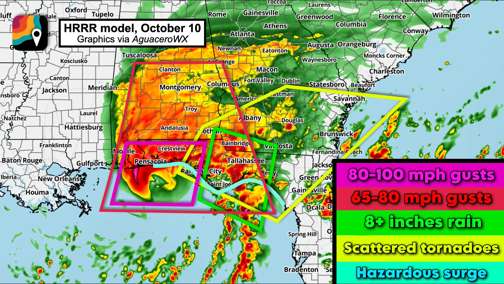
A nice way to display the impacts (I think a little over cooked on the inland gusts though)
-
Isaias is on the cusp of becoming a major hurricane this morning, and as you all know by now it is explicitly forecast to become a major shortly. Although not a pristine satellite appearance, Isaias from both satellite and recon is clearly an intensifying hurricane at this hour with an eye, deep convection continuing to wrap upshear in bursts, and rapidly falling pressure in between center fixes as a result. While the season has been defined by futility overall, with both Fay and Edouard we had systems that were able to maximize their limited geographic environment to pop, and Isaias is the best example of a system taking advantage of the narrowest of windows for development and intensification this season. If Isaias were moving in any other heading, it would be getting annihilated right now. Isaias is the beneficiary of excellent divergence and a relative heading that precludes shear so far from disrupting the increasingly strong inner core. This has also allowed the hurricane to avoid disruption from dry air entrainment. A few days ago, that was a key question for me as the core was establishing itself. Normally a northern Gulf landfall, especially this time of year, features last minute continental air disrupting things, and while that may eventually erode part of the system, that's not happening right now. The resilience of Isaias will be tested in the coming hours, and if you're still reading here's the real thrust of the post: the NHC is right to be concerned about a delay in weakening. I do still think that shear will eventually disrupt Isaias, but it may not happen until landfall is occurring. Operationally, that may mean it's difficult for the NHC to confirm weakening as the center is moving onshore. More importantly, in an expanding wind field, it could be the case that we see the intensification plateau later followed by pressure rises and then winds weakening. For folks along the coast, any lag between the impact of shear and weakening may lead to a C3 landfall. This is a razor's edge forecast. It seems clear that unlike many of the recent Gulf examples there will not be intensification up to landfall, but weakening may be blunted or delayed. The latest HAFS A & B both show more intensification before some weakening--right at landfall. Both essentially have a major landfall in the next 12 hours. Perhaps more significantly, the GDM, which I've been raving about for two years now and with good reason--it's by far the best hurricane ensemble--shows very little change in intensity until landfall is effectively occurring. Pay less attention to intensity and more to whether there's weakening evident and when. At this point, I think folks in the landfall zone should be prepared for a C3 impact. It likely won't be at its peak, which is important from an impacts standpoint (the storms intensifying at landfall tend to "feel" worse than ones weakening at the same intensity), but between surge, rainfall, and a likely significant severe weather threat, this is likely to be a highly impactful hurricane. I'm not there for this one, but stay safe to everyone down there.
-
It's a tough call because like they said in the statement, a 6-hour delay in the onset of shear could mean 20mph in LF intensity....so they are making the right call hedging more intense. They have to balance the need to disseminate as precise a forecast as possible to the public with the need to convey a sense of urgency commensurate with the worst possible outcome that can be reasonably expected.
-
Looks like recon quit transmitting data?
-
This pass will decide if it gets the upgrade. I would be shocked if it didn’t find cat 3-worthy winds
-
Andrew intensified rapidly before landfall in south florida from the east. Stick to making bad sports takes.
-
Yes they will Don. I wouldn't be surprised to see a Special Statement within the hour.
-
Yea, I’m not feeling good about this at all. Surprising mix of opinions locally. Some are just saying as “long as it isn’t Helene” but this is still a lot of rain and we haven’t been tested much since. I’m worried, especially along the escarpment.
-
HAFS-B has gone from a decapitated, essentially nor Easter, landfall to a cat 3 with eyewall intact as it crosses the coast. Buckle up coastal residents
-
With better upper air conditions than this one has. Shear and dry air are making a beeline right into this one. Will it have enough time to weaken a lot is one question but it’s almost certain this one weakens coming in.
-
If recon verifies a major before the 10:00AM update will NHC issue a special statement? .
-
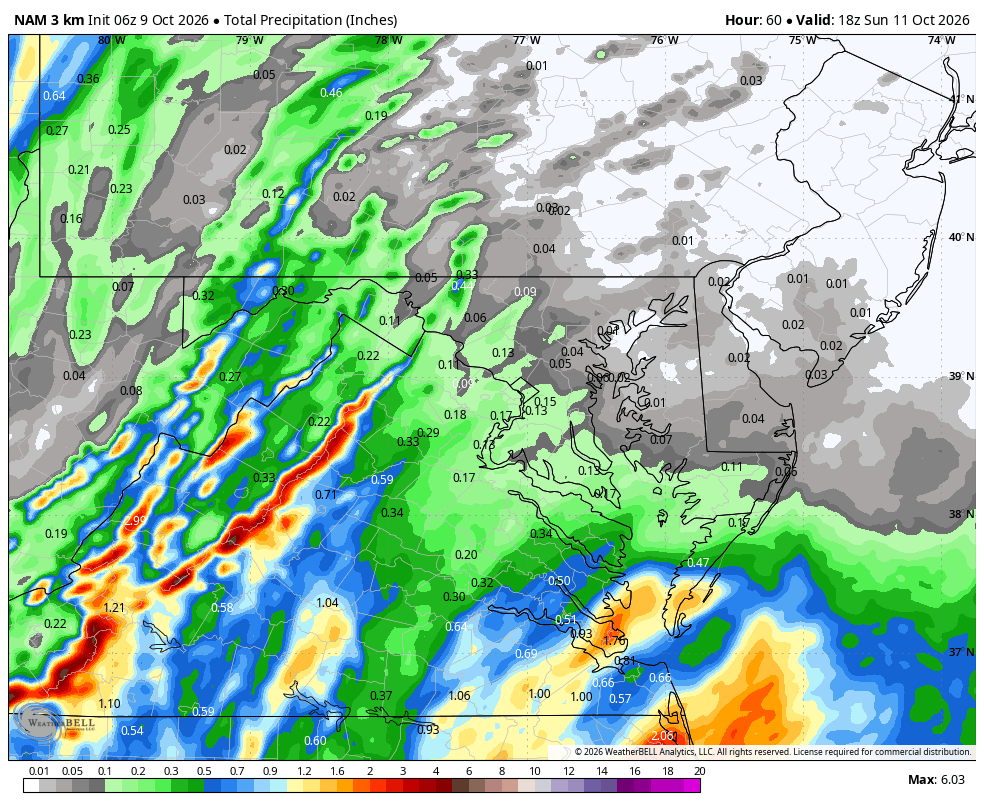
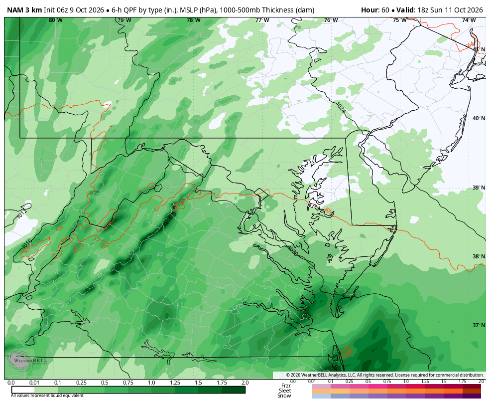
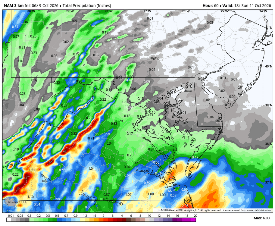
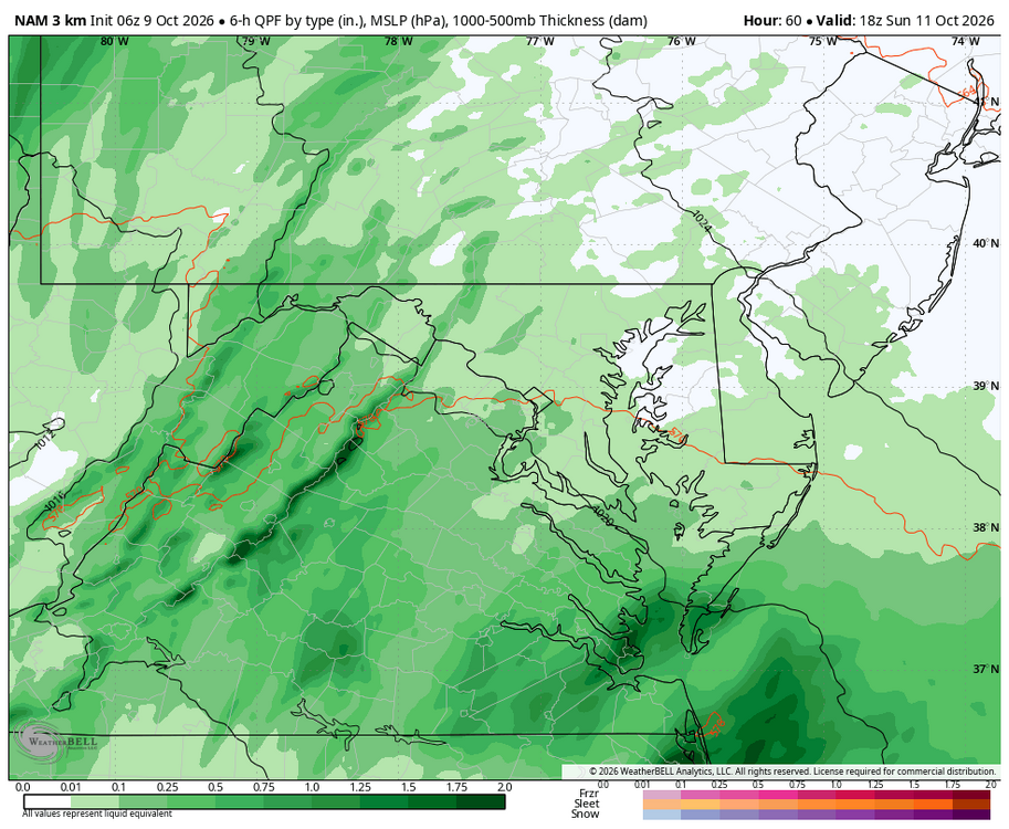
True, but WB 3K NAM is slower than EURO...more to come at hr 60.
-
Like I said to you a few days ago, always hedge east when a poleward moving tropical entity is interacting with a mid latitude system....going with the bots was a tremendously easy call. That said, there are no absolutes, so I get the conflicting thoughts by some.