All Activity
- Past hour
-
No need to keep looking. SW gets stuck out west
-
They’re struggling and need to keep the clicks going.
-

January 2026 regional war/obs/disco thread
Ginx snewx replied to Baroclinic Zone's topic in New England
It was rain starting at 9 degrees we in SW RI had a terrible ice storm. -
man---for a crap model....the GFS runs take forever. The euro finishes in 45 minutes. the GFS needs almost 2 hours to run smh. Who programmed this pos?
-
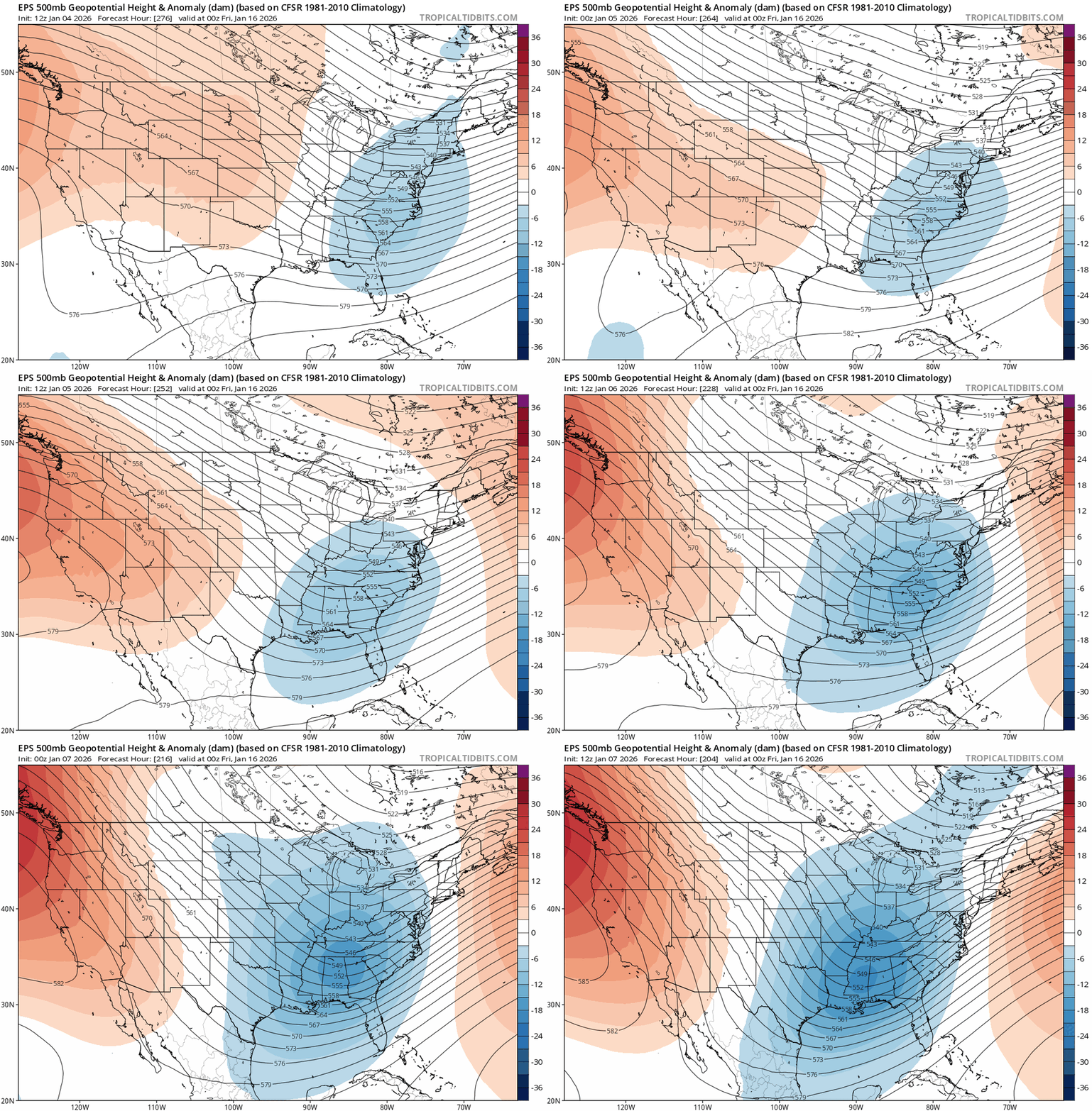
January 15th has been trending better slowly. The h5 wave is deeper and slower, exactly what we want.
-

January 2026 regional war/obs/disco thread
WinterWolf replied to Baroclinic Zone's topic in New England
Kind of like we’d never see a clipper again? We’ll see it again..bet on it. Maybe not on the 15th, but we’ll see it again. -

Winter 2025-26 Medium/Long Range Discussion
Frog Town replied to michsnowfreak's topic in Lakes/Ohio Valley
This! Whether is comes to fruition is another question but this is where we need the cold to get real action in sub.. -
i hope. this thing over NY looks awfully suppressive
-
Nah. But at least you recognize potential from what you see.
-
It's beyond 240 so doesn't matter anyway since it's going to change, but the H5 map is def way different and more interesting than 12z so far for the Cape period
-

January 2026 regional war/obs/disco thread
Ginx snewx replied to Baroclinic Zone's topic in New England
Totally understand that. We built 3 small sheds over the summer and I couldn't find the so shovels. (They were under the deck) -
-
I am ready to call the Jan 20-21 the Ji storm. The Cape storm was Jan 15-16
-
positive change from what? sounds like 3 step backs from the 6z gfs
-
January 2026 regional war/obs/disco thread
Typhoon Tip replied to Baroclinic Zone's topic in New England
Looking more and more like the Miami rule's behaving for the 15th but it's the western ridge that's that's a problem. Too far W ... It's sort causing the trough components to dangle through the Lake/OV instead of digging. So we end up with the b-c axis with paltry wave running up along it instead of the bigger woofer. It may actually work out that way - which would probably drive winter storm enthusiasts to something barely restraining apoplexy ... haha. I mean with all do empathy ... you may never see 6" of wind whipping NEster again, huh That PNA ridge was biased west much of last winter. interesting anyway. -
GFS might be trying to put some pieces into place for the period you like...let's see what she'll do
-
And we aren't in NY state at elevation downwind of Lake Ontario. Hell of a comparison lol
-
There is no way Louisiana scores for a second year in a row.
-
So the GFS is still a mess, but H5 is vastly different...seems like a positive change, but still a shitty surface
-
I haven't given up on mid month, but I just think the H5 look centered on the 20th is more impressive and conducive to a winter storm for our area- in particular the low heights in the 50-50 region vs anomalously high heights there for mid month. A 50-50 high doesnt work so well to keep surface HP in place to the north when a storm is moving in- that can work ok for places NW but even there it would probably be messy.
-

January 2026 regional war/obs/disco thread
DavisStraight replied to Baroclinic Zone's topic in New England
Pretty sure that was the year. -
We live on the coastal plain for the most part.
-
Anyway, trof looks a little sharper so far on the GFS
-
we got 1.5 inches lol. they get that in tughill in 44 seconds
-
January 2026 regional war/obs/disco thread
Typhoon Tip replied to Baroclinic Zone's topic in New England
Trick in that solution will be whether there's a pulse of sufficiently low enough DPs loading into NYS-VT-NH ... even if we can get that down to say ALB-EEN-MHT that may be close enough. There's a front coming through around 00z Saturday and between 3- 9Z overnight there's CAA albeit not aggressive. I wouldn't normally comment on a marginal set up like that for ZR, just because it's a fragile set up and it's got 60 to 72 hours to go... however, there's a distinct rising PP across upstate NY-ME and it's nosing around the terrain and bowing the isobars into a dammed look...That means like today, a sneaky ageo flow is susceptible of getting going - if/when coming out of even a -1C DP source that's good for ice at least down to the border towns. edit I see NAM cute pink paint is indeed into interior even down here. CNE obviously higher odds


.thumb.png.fa68f79383b9f1da4e6c410c19fe72b6.png)


