All Activity
- Past hour
-
Rgem much further north but still a miss. Almost there.
-
 It's a PNA/EPO issue, which I guess you could say is a PDO issue. We just had one of our coldest mid-Winter stretches on record...
 -
Icon improved
.thumb.png.8ce085237177e20f14b7195e5124269d.png)
-
 https://x.com/i/status/2022415363200446615
 -
NAM

-
It can only come so far north now. Massive amount of dry polar air sitting over New England and the Ocean east. LI might see a couple
-
-
That's what she said?
-
Its close to something bigger
-
Seeing the qpf trend over the past 5 cycles is pretty hilarious
-
Nam north It was very close to a phase
.thumb.png.dc557f461dc4126b24aedeb09075a3ed.png)
-
Just because I've been tracking it, 00z Euro is 64F for DCA 2-19, and 66F 2-20. 0z eps peaks 62F on 2-19.
-

-
-
.thumb.gif.d4d5516f1cb3b0c6460555b92a63234e.gif)
-
One more move at 12z like the 6Z NAM and
-
-
Radar https://www.jdjweatherconsulting.com/mar-4-6-2001
- Today
-
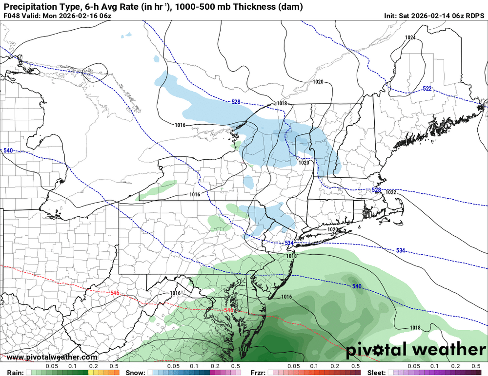
The 0z AI EPS also shows snow on both the mean & median.

-
The 0z Euro AI shows some snow by Monday am.
-
I mean it's an AFD in 2001, saying it on TV to tens of thousands of people is a very different thing. And the next AFD you can hear the disappointment and fear in drags words. Forecasts didn't change all that much but did go down a notch
-

Is we back? February discussion thread
40/70 Benchmark replied to mahk_webstah's topic in New England
No, you did.. . -
 Wait is this is a logbook fail incoming? Now see I thought this weekend was rain because the storm got here too late and the cold air had already escaped (and that if it were 12-24 hours sooner it would've been snowier) But you're saying this woulda worked before... Man I still don't get how the switch just flipped so quickly like that. This kind of setup work between 2010 & 2015? I hope this is a PDO issue and not the other.
 -
There is some phasing going on. Keep track or dont post.
-
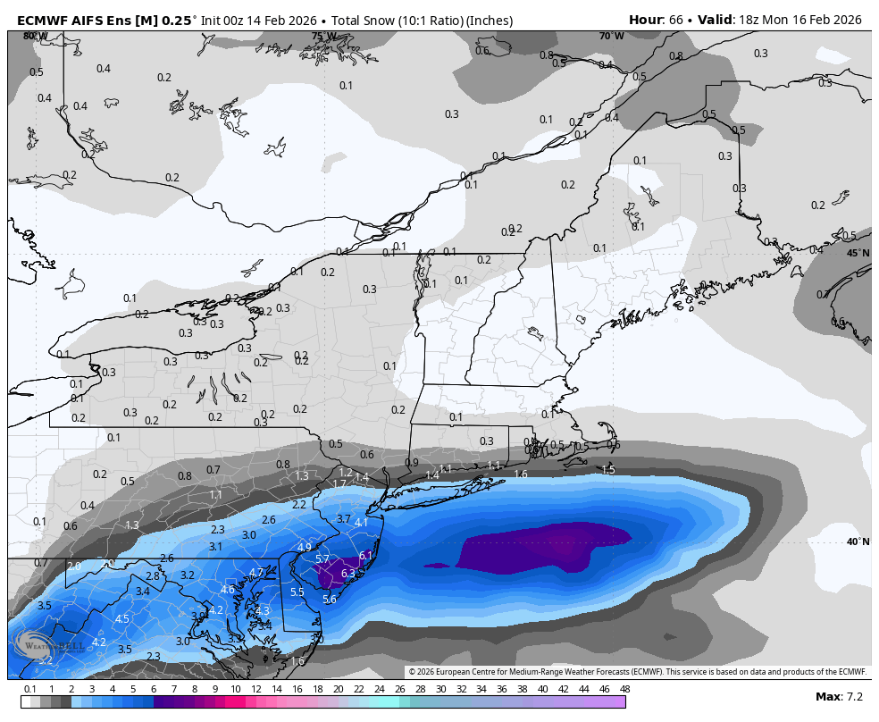
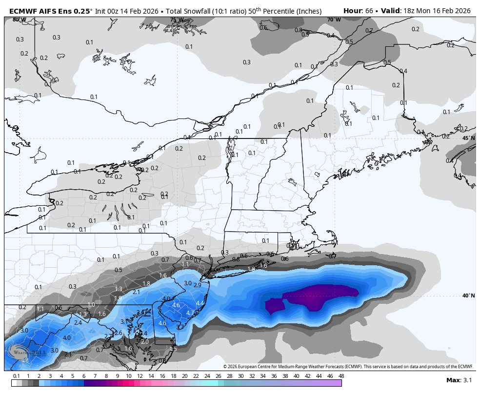
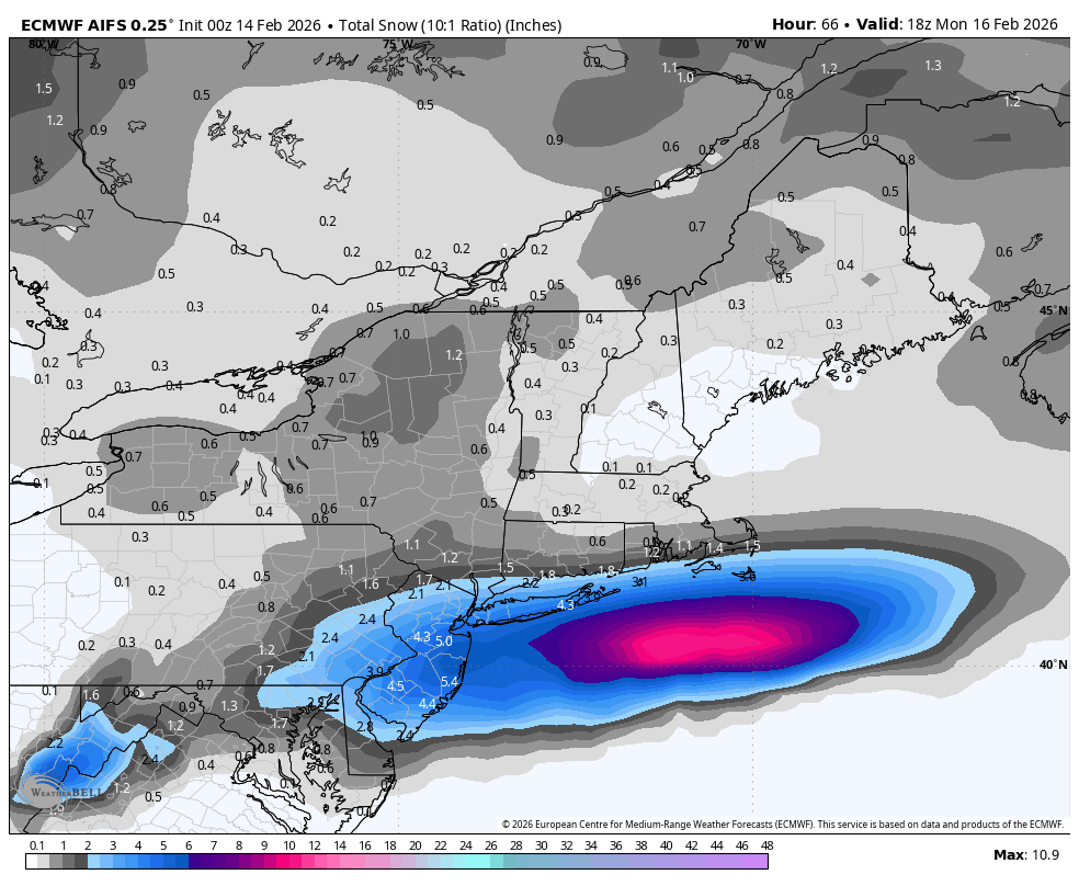
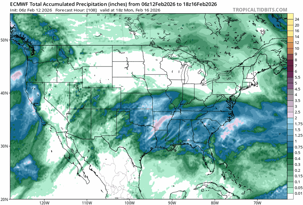
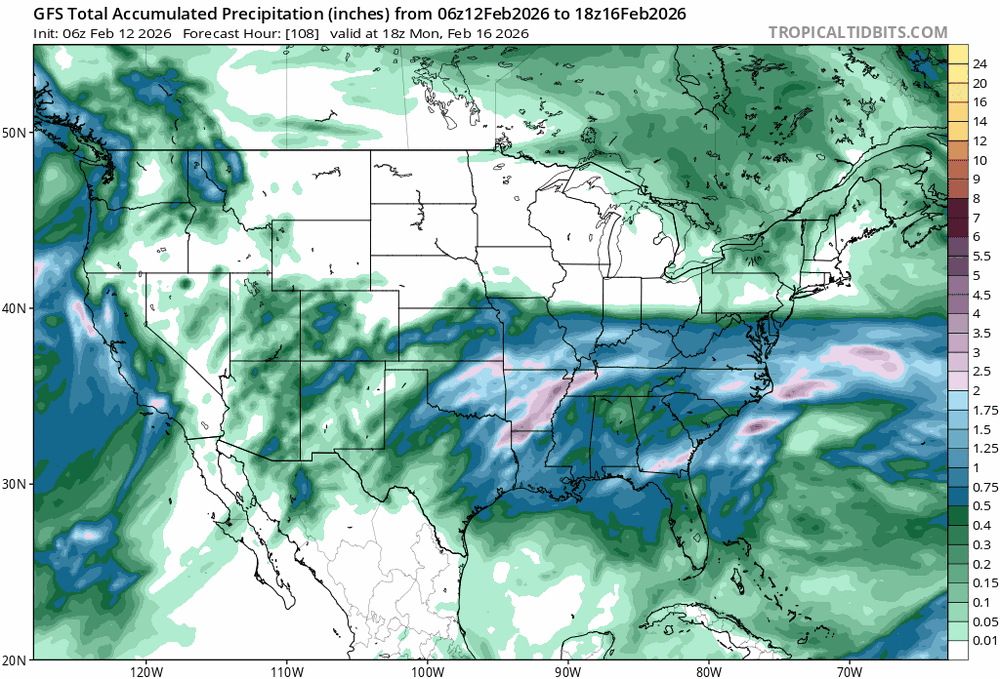
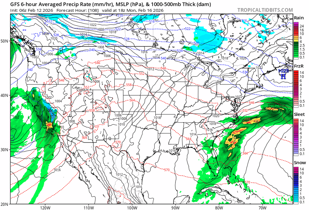
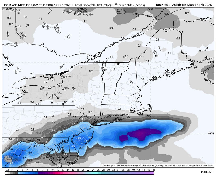
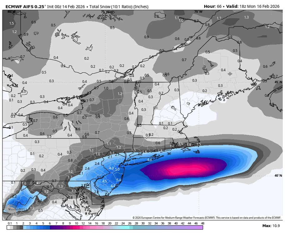
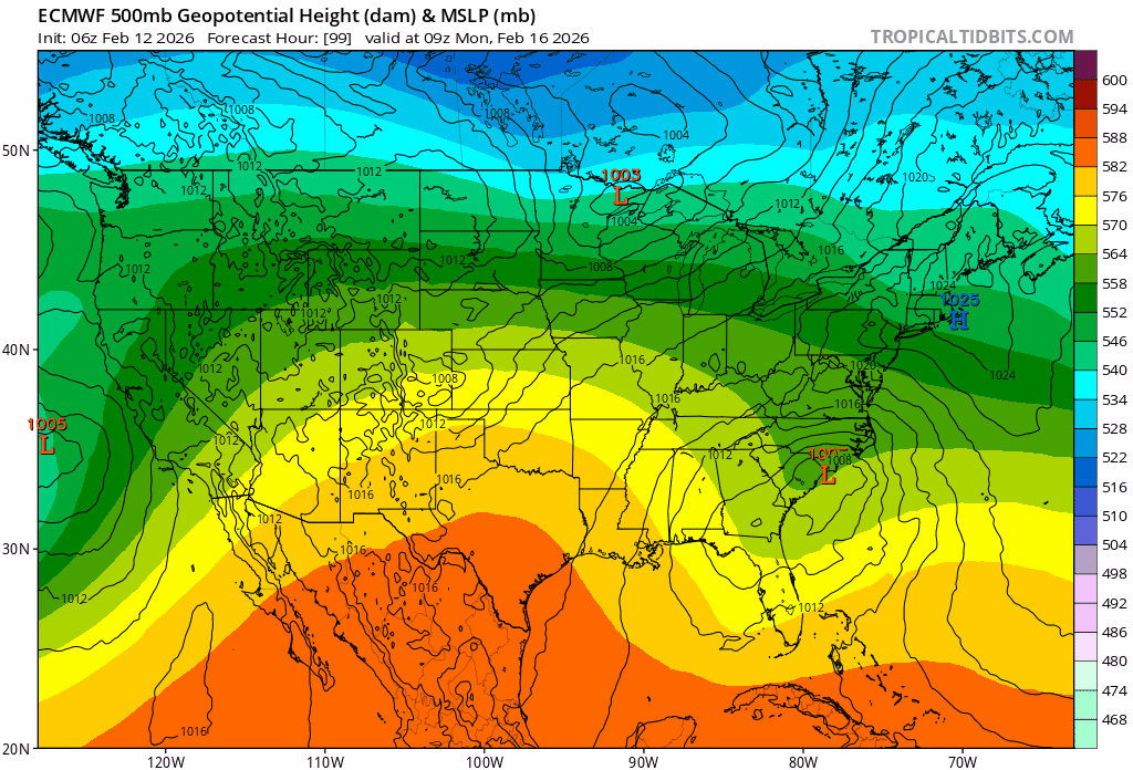
Snowy week on the euro. LFG.

.png.d9322f50d3d27da1172a4c105d675074.png)


.png.4a59773246d49750092db393e626211a.png)

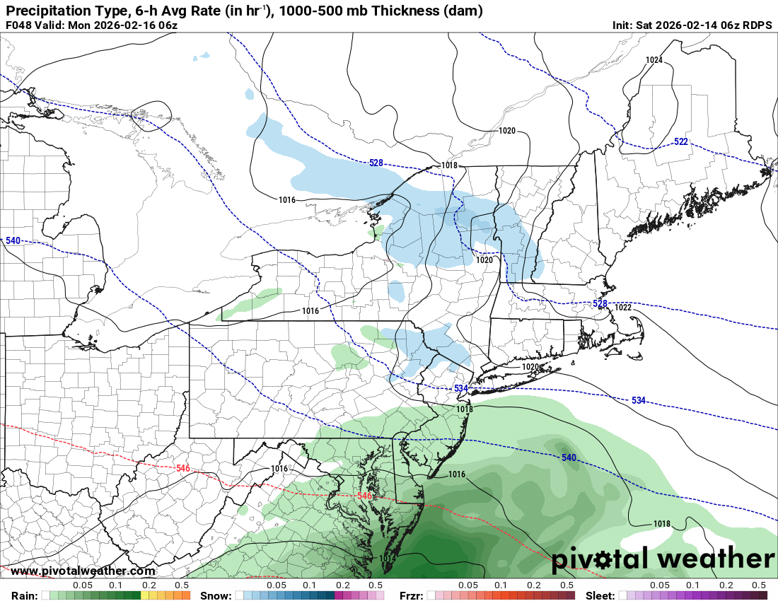
.gif.f0e2dd53913507f94694b1716c4eb4a6.gif)