All Activity
- Past hour
-
 I agree it is not as bad as 2018, but when you talking tenths of deg when it comes to exceeding records, it does matter, and the longer the period, the more this drift is a problem when talking avg temps. 1 F bias does not sound like much for a single day, but it is big over the course of a month, and keeps increasing the longer you go.
 -

2026-2027 Super El Nino
EasternLI replied to Stormchaserchuck1's topic in Weather Forecasting and Discussion
Personally, I have a sneaking suspicion that the reason for that is a long term deep multidecadal -pdo state (since 2000). Which is evident on the H300 PDO plots (image below). I'm wondering if this might mitigate the super el nino effects somewhat. As there is research out there suggesting that possibility. Sort of would explain the lack of the north Pacific low thus far... If / when one would develop. It would explain it being weaker than one would expect in a super el nino according to said research. This is also quite interesting... -
If it thick enough, it does. Put it this way on an ideal radiation cooling night, if there was a layer of thick smoke at 20,000 ft, do you really temps woild drops as low as if there was no smoke? Yes, the SW/LWIR physics are not the same as WV clouds, but it is still a cover, so to speak. Why did BOS only hit 90 on 7/14 when 97 was fcst?
-
Today it was DC's turn for thick smoke. VIS at KDCA got as low as 1.25 mi and VV restriction of only 200 ft! METAR KDCA 171252Z 00000KT 1 1/2SM FU VV020 28/17 A3007 RMK AO2 SLP183 T02780167" CoastalWx, remind you of doing TAFs for India? Every night, the VIS like clockwork would drops big time to 1/4 mi or less from smoke at so many airports, not from wildfires, but industrial pollution.
-
I need a slow moving tropical depression. Just over 7" of rain here the last 4.5 months.
-
It looks good on you. Lol
-
Hit 92° at ORD and 94° at MDW today.
-
Hit 92° at ORD and 94° at MDW today. ...2026 90°+ Day Tally... 11 - MDW 11 - ARR 10 - ORD 10 - RFD 10 - LOT 9 - PWK 9 - UGN 8 - DPA
-
We need a storm tomorrow as badly as the Wizards need a 50-win season.
-
 CAPE changed their profile photo
 -
I think I'm gonna go with it.
-
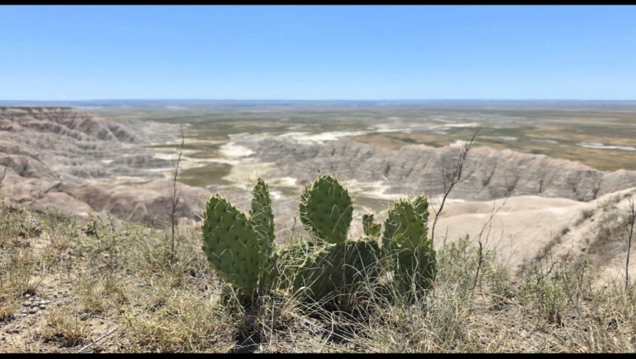
@CAPE I took this pic at the Badlands just for you. I considered making it my profile pic.
-
 69/48. Early fall like Sent from my SM-S921U using Tapatalk
 -
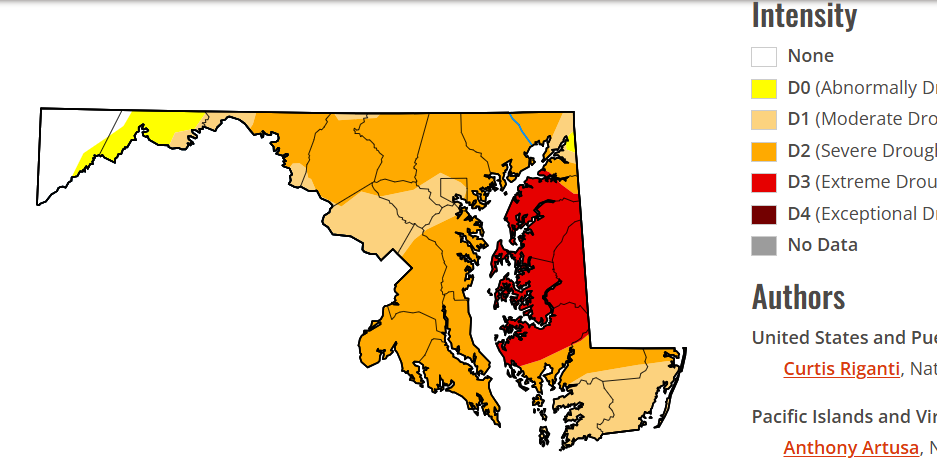
Extreme drought continues here. Updated yesterday. Areas just to my south in the same category have had 3" more than me in the past week, so this seems to be lagging. My area might actually be Exceptional, or those areas should be reduced to Severe.
-
I'll believe that actually happens when I see it. At this point I have no faith in any El-nino, pattern, or storm to produce even 1 good event here.
-
600 dm heights/ridges can and are misleading as to heat. It depends on many factors, like one's relative position to the ridge center/axis, overall moisture in and around the high pressure (not all high pressures are dry), mean wind direction, and how the surface pressure is set up/aligned and how strong it is, and time of year/location (land or ocean). And we do not live at 500 mb. And what you say above, a 600 dm ridge parked right over region is not ideal for max or record heat. Having its center located decent distance SW, S , or SE of a given location is best for an area like the East Coast. On 9/16/1989 at 00z, the Chatham MA (CHH) souring recorded a 609 dm height. That is record high for the Northeast, but there was no all-time record heat for Sep from that event on the East Coast. Aug 2, 1975 when New England has it hottest temp on record. The ridge center was to our W, and we had strong NW flow for subsidence warming. Highest 500 heights were our W. Many times when the ridge center is to the W, the downstream sfc high is strong and that promotes a cooler thickness column and onshore winds. In other words, it is not one-size-fits all, and using any one parameter or level to determine sensible wx at the sfc and how extreme it will be or not is not proper meteorology. For heat, one should be looking a lot more at the 1000-500 thickness, as that is much more correlated to temps at the sfc b/c it combines 500 heights w/ sfc pressure. Also, 850 temps, but even that has limits. Cloud cover? Precip? Lapse rates? Type of air mass? You can't treat individual parameters in a vacuum.
-
Yes, @MN Transplant posted the LWX statement this morning in his "our regions extreme run" thread
- Yesterday
-
Funny. Also contributing is that they apparently have been serving lettuce tainted by the parasite that is causing long term explosive watery diarrhea. Lovely.
-
2026-2027 Super El Nino
EasternLI replied to Stormchaserchuck1's topic in Weather Forecasting and Discussion
I wanted to make a post about this last fall, never got around to it. Watching a super nino develop now, and drinking some surfside iced tea's, I feel compelled once again to bring up something that's kind of interesting. Perhaps a clue that a super nino would have been on the horizon the following year? I thought the severely negative IOD last year was quite interesting. I had found a paper at that time discussing purely very strong negative IOD events. Diversity of strong negative Indian Ocean dipole events since 1980: characteristics and causes https://link.springer.com/article/10.1007/s00382-023-07008-x Notice the years where the strongest of negative IOD events occurred... It's really interesting to me how 3 out of 4 of those years came on the heels of very respectable el nino years. But one however did not, and that one occurred the year prior to a super el nino. That one occurred prior to 97-98. They noted that three of those events are attributed to monopole events (mainly the warmth in the east). Not surprising, these three are the ones following the respectable el nino years. The one year that was an actual dipole and featured the cooling in the west in conjunction with the warming in the east. Had the super el nino the following year (97-98). Unlike the others. The authors attribute that lone occurrence to local processes (in the IO) mainly. The other monopole cases are attributed to WWB in the IO which have links to enso. So when we look at last years case, what is the prognosis of that one? Clearly, there was no respectable el nino the year prior. Clearly, it was of the dipole variety in the sst anomaly data (image below). So it's interesting as hell to me watching this super el nino developing now. Potentially record breaking at that, following after a type of negative IOD which only really matches the year prior to 97-98. (I think the PDO is a major difference from that year specifically. May try to dig into that more later) Cheers. -
I monitor my dad's solar array and this is exactly the case.
-
Solar power was about 70-75% of what it would have been without smoke
-
Yep. My yard is as bad as yours since the beginning of March. I pay no attention to the predictions of an inch or more from NWS/WPC a couple days out, because it is not going to verify. At some point the Nino coupling to the atmosphere will take over and this awful dry pattern will shift- but not likely for another month or so.
-
IAD did get it's first 80F low yesterday - did LWX make a note about that? It's pretty insane. Yes the area has become more urbanized, but still.
-
Yeah there was that, but also some drier air moving from NE to SW. That dry line triggered the training storms over Jersey. The cell that developed and moved southeastward over your area could have been related to that, but weaker and on a a smaller scale.
-
Now...imagine if it were a large forest of cannabis plants that was burning, how would we all feel?
-

2026-2027 Super El Nino
snowman19 replied to Stormchaserchuck1's topic in Weather Forecasting and Discussion
@Gawx