All Activity
- Past hour
-

October Comes Early: Late September Multi-Hazard Hybrid Storm
vortex95 replied to WxWatcher007's topic in New England
@CoastalWx is by far lopsided and the fully versed weenie guru for winter wx. He's kinda weak in svr local storms and TCs! When we worked at WSI, he would always defer to me for those topics! And his typical reply after I would explain a situation? "WE'LL SEE!" LOL. The biggest contribution I recall I did for him that he has actually acknowledged? We we discussing the 6/1/11 TOR event and the problem/issues w/ the Springfield warnings, and I said to Scott, "no excuse to hesitate, this day was screaming big a classic spinner day for New England -- situational awareness is huge leading up to such an event!" And he liked the term "situation awareness!" -

October Comes Early: Late September Multi-Hazard Hybrid Storm
WxWatcher007 replied to WxWatcher007's topic in New England
Look at that first loop!!! That's 100% tropical. Look at that convection wrap tightly around the center. Beautiful. Riding right along the Gulf Stream. Perfect location. -
 legit canadian online pharmacy: canada rx pharmacy - canadian drug pharmacy
 -
The Oceans Calling music festival is this weekend in Ocean City. They just canceled the first day. Gonna be a huge economic hit if it all get canceled.
-
п»їindian pharmacy: buy medicines from india online - prescription medication from india
-
canadian mail order pharmacy and reputable canadian online pharmacy canadian mail order pharmacy https://images.google.com.bd/url?sa=t&url=https://canamcrosscare.shop my canadian pharmacyand http://www.xunlong.tv/en/orangepibbsen/home.php?mod=space&uid=7037580 canadian pharmacy checker [url=http://vm-01.magneticgrid.com/info.php?a[]=where+can+i+buy+viagra+online+cheap
-
October Comes Early: Late September Multi-Hazard Hybrid Storm
vortex95 replied to WxWatcher007's topic in New England
Wow, I had no idea there were STS in HURDAT2 that had winds in excess of 60 kt. Since NHC started declared ST systems regularly in the late 1990s, the has never been a "subtropical hurricane." The reasoning I heard is that if a ST system gets winds strong enough to reach hurricane-strength, it is can called fully tropical, which doesn't make any sense really. 65 kt is not some magic number that changes the structure of a storm. Many ET storms have sustained winds well over 65 kt, and there is nothing says they can't still have 65 kt when they go ST! -
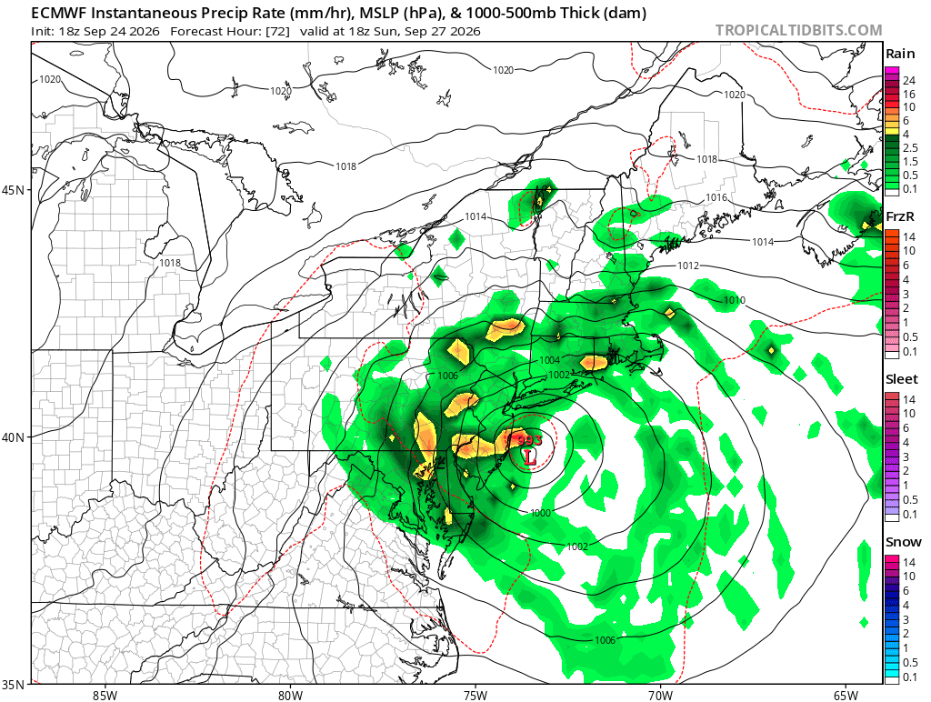
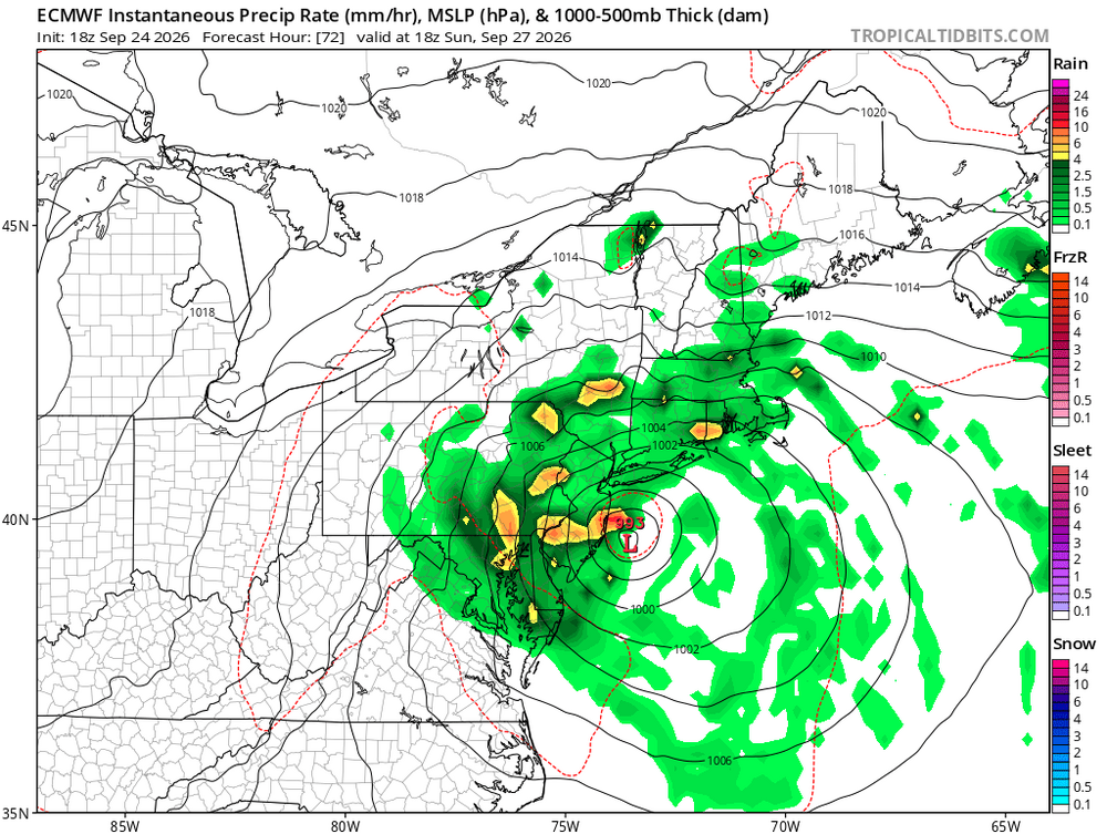
18z euro went off
-
October Comes Early: Late September Multi-Hazard Hybrid Storm
vortex95 replied to WxWatcher007's topic in New England
Concerning @CoastalWx's "garbage model" and how it handles TCs... Given the RRFS is new, I am not sure it handles TCs. I asked the modeling group if it handles TCs well. They said it should, but they said ti defer to the HAFS and the like. This event will be a good test at least when it comes to ET to ST/T transition. The RRFS is about 10 mb deeper than the other models, and shows a tight inner core pressure gradient eventually. That indicates tropical structure. -

Septorcher 2026 Discussion - Endless Summer
kdxken replied to Damage In Tolland's topic in New England
I'm saving my arrows -
October Comes Early: Late September Multi-Hazard Hybrid Storm
vortex95 replied to WxWatcher007's topic in New England
This is a much "warmer" type ET to ST/T suggested transition. The ET surface low has developed in a more tropical-type atmosphere. As noted earlier, the low is located S of the 576 dm 1000-500 thickness line, and as it develops, a pool of 576 closes off over it. Also, initial ET development to ET peak to ST/T transition can occur very quickly at times. The system off the Mid-Atlantic/New England coasts in mid-January 2023 went ET to ST rather fast (personally I think this was tropical and a hurricane), developing a distinct, persistent eye and remarkably deep convection for a winter atmosphere. See sat loops here: https://x.com/WxTca/status/1615532584016162822 https://x.com/burgwx/status/1615099242728628231 If this can occur in January, there is no reason to think this can not occur here in September over significantly warmer SSTs and a less overall sharp baroclinic environment! The point being extraordinary/outlier patterns often result in extraordinary/outlier individual wx events, so we need to adjust/adapt for that and think outside the box in such cases. -
2026 Atlantic Hurricane Season
vortex95 replied to Stormchaserchuck1's topic in Tropical Headquarters
This is a much "warmer" type ET to ST/T suggested transition. The ET surface low has developed in a more tropical-type atmosphere. As noted earlier, the low is located S of the 576 dm 1000-500 thickness line, and as it develops, a pool of 576 closes off over it. Also, initial ET development to ET peak to ST/T transition can occur very quickly at times. The system off the Mid-Atlantic/New England coasts in mid-January 2023 went ET to ST rather fast (personally I think this was tropical and a hurricane), developing a distinct, persistent eye and remarkably deep convection for a winter atmosphere. See sat loops here: https://x.com/WxTca/status/1615532584016162822 https://x.com/burgwx/status/1615099242728628231 If this can occur in January, there is no reason to think this can not occur here in September over significantly warmer SSTs and a less overall sharp baroclinic environment! The point being extraordinary/outlier patterns often result in extraordinary/outlier individual wx events, so we need to adjust/adapt for that and think outside the box in such cases. -
October Comes Early: Late September Multi-Hazard Hybrid Storm
dryslot replied to WxWatcher007's topic in New England
I should've zigged when i zagged? -

Strong Nor'Easter/Hybrid Storm Late September 2026
wthrmn654 replied to Rjay's topic in New York City Metro
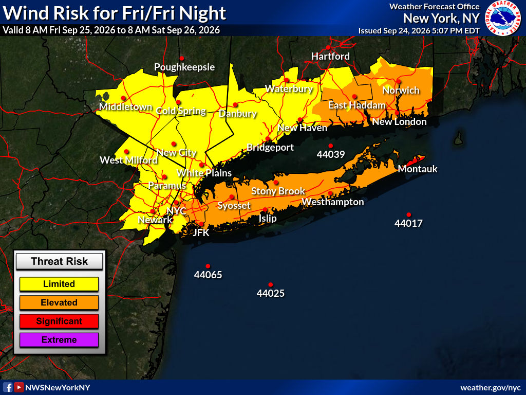
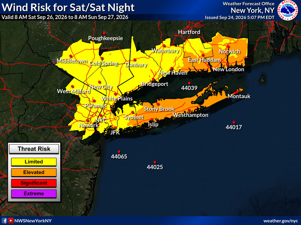
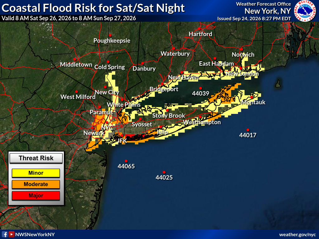
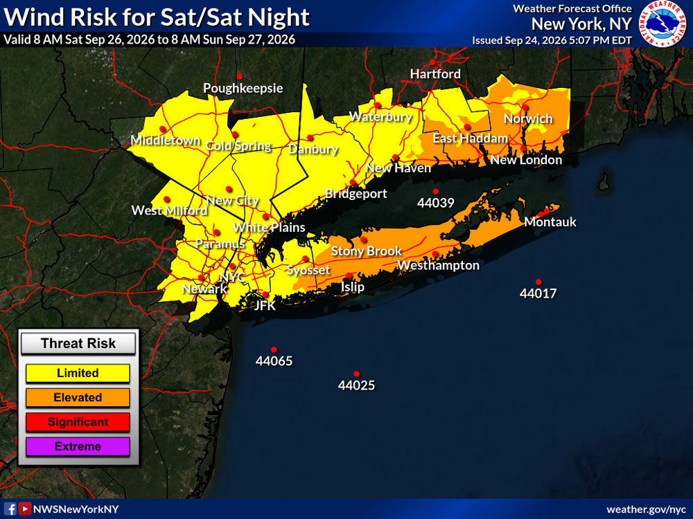
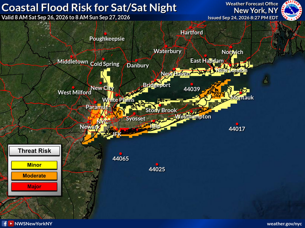
And bam there maps are showing stronger winds and worse coastal flooding finally.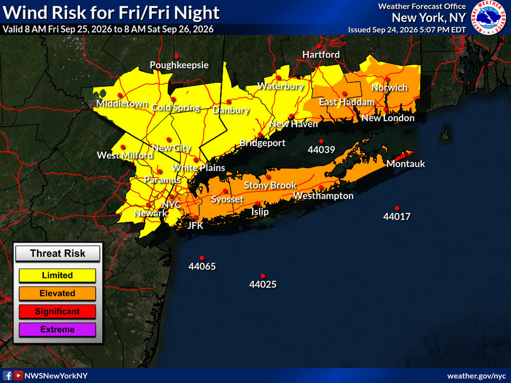
-
October Comes Early: Late September Multi-Hazard Hybrid Storm
kdxken replied to WxWatcher007's topic in New England
Book a tee time. It'll rain. Hard. -
October Comes Early: Late September Multi-Hazard Hybrid Storm
kdxken replied to WxWatcher007's topic in New England
How much for Taunton? -
2026 Atlantic Hurricane Season
vortex95 replied to Stormchaserchuck1's topic in Tropical Headquarters
Given the RRFS is new, I don't know how it handles TCs. I asked the modeling group if it handles TCs well. They said it should, but they said ti defer to the HAFS and the like. This event will be a good test ast least when it comes to ET to ST/T transition. The RRFS is about 10 mb deeper than the other models, and shows a tight inner core pressure gradient eventually. That indicates tropical structure. -
October Comes Early: Late September Multi-Hazard Hybrid Storm
kdxken replied to WxWatcher007's topic in New England
Yeah something strange is going on. Probably happened back in the 1700s too.
-
2026 Atlantic Hurricane Season
vortex95 replied to Stormchaserchuck1's topic in Tropical Headquarters
Odd sucker! Just go to shows the true vagaries of these things. -
 I mean this is a hybrid type storm in a transition season. Im sure it’ll be breezy at least, but I don’t think it’s crazy to envision lots of dry periods followed by quick downpours rotating through. Some areas will do well, but I wouldn’t expect like 2+ totals to be widespread
 -

October Comes Early: Late September Multi-Hazard Hybrid Storm
WinterWolf replied to WxWatcher007's topic in New England
There won’t be any rain there tomorrow imo. -
Strong Nor'Easter/Hybrid Storm Late September 2026
wthrmn654 replied to Rjay's topic in New York City Metro
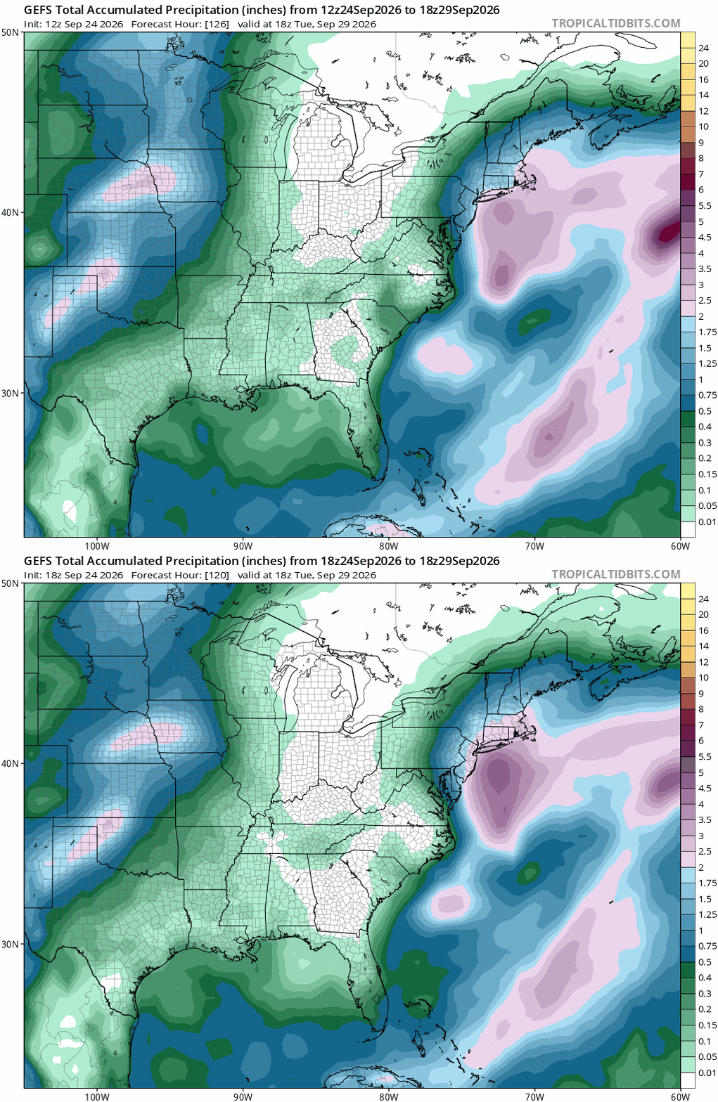
Gefs was id say a fairly big improvement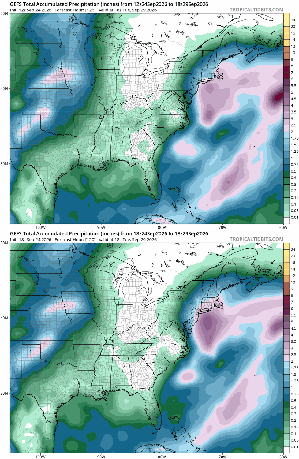
-

October Comes Early: Late September Multi-Hazard Hybrid Storm
Chrisrotary12 replied to WxWatcher007's topic in New England
God this storm is annoying from a forecast perspective. Some models bring rain in here tomorrow. Others don’t until Sunday. -
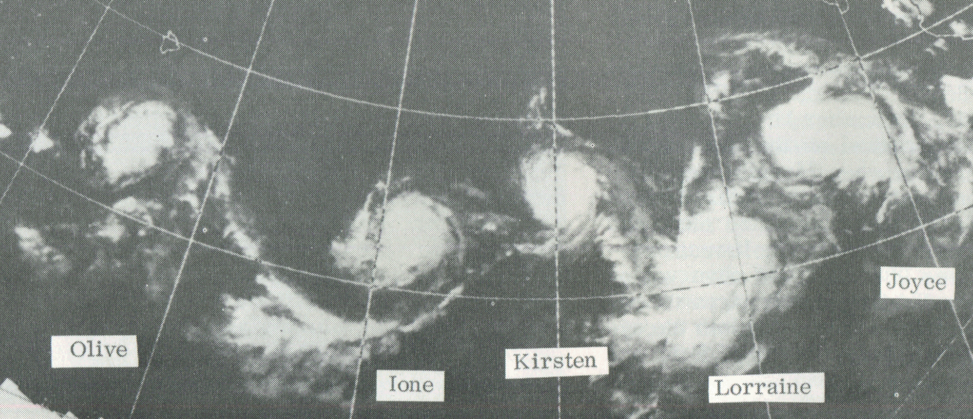
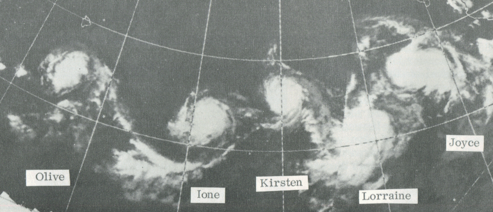
Here is a remarkable satellite image from Aug 23, 1974 from the C and EPAC! And it was weak La Nina.
-
Very warm start to october, with possible record minima.