All Activity
- Past hour
-
 rybelsus pancreatitis or how to reconstitute semaglutide microdosing semaglutide https://maps.google.com.mt/url?rct=j&sa=t&source=web&url=https://semaoraldirect.com rybelsus prisand https://mantiseye.com/community/gbeixnugiy rybelsus copay assistance [url=https://maps.google.com.au/url?sa=t&url=https://semaoraldirect.com]rybelsus empty stomach[/url] how much is rybelsus a monthor [url=http://jonnywalker.net/user/wnqadnsmum/].25 semaglutide[/url] rybelsus pill picture
 -
Some models hinting at a shaft/split-screw area between heavy rain in PA and offshore. Should be decent rain NW of us given upslope moist E flow.
-
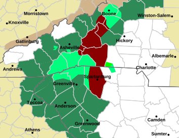
Flood warnings popping up all over Sent from my SM-G998U using Tapatalk
-

2026-2027 Fall/Winter Mountain Thread
Met1985 replied to BlueRidgeFolklore's topic in Southeastern States
Not good. Sent from my SM-G998U using Tapatalk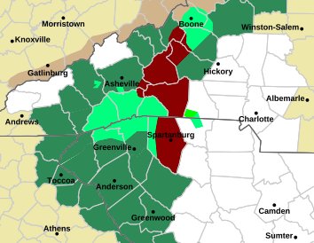
-
2026-2027 Fall/Winter Mountain Thread
Met1985 replied to BlueRidgeFolklore's topic in Southeastern States
Flash flooding warnings popping up everywhere now. -
https://metocardiorx.shop/# Lopressor side effects list
-
https://metocardiorx.shop/# Lopressor side effects list
-

Mid-Long Range Discussion 2026
WinstonSalemArlington replied to BooneWX's topic in Southeastern States
Frost possible next weekend? -

2026-2027 Fall/Winter Mountain Thread
Tyler Penland replied to BlueRidgeFolklore's topic in Southeastern States
5.5". Rates between 1/2-1" an hour consistently since I got home at 7:30. Fortunately no wind at all here. -
4.65. 1.78 in 2 hours. Bit of a lull but that next batch could be bad if it doesn't miss east
-
Yup. Got the alert call and text on that one. Good down hill. .
-
Under a flood warning now in all of Rutherford. Sitting at 3.56” here with .5” in the last 40 ish minutes. .
-
 There would have to be rapid ENSO cooling for that to happen.
 -
Flash flooding warning for McDowell county now.
-
2026-2027 Fall/Winter Mountain Thread
Met1985 replied to BlueRidgeFolklore's topic in Southeastern States
Apparently water is coming across temporary roads in the Lake Lure area. -
2026-2027 Fall/Winter Mountain Thread
Met1985 replied to BlueRidgeFolklore's topic in Southeastern States
Flash flooding warning for Chimney Rock and Lake Lure areas... -
side effects of medication gabapentin: Neuro Relief Direct - can gabapentin expire
-
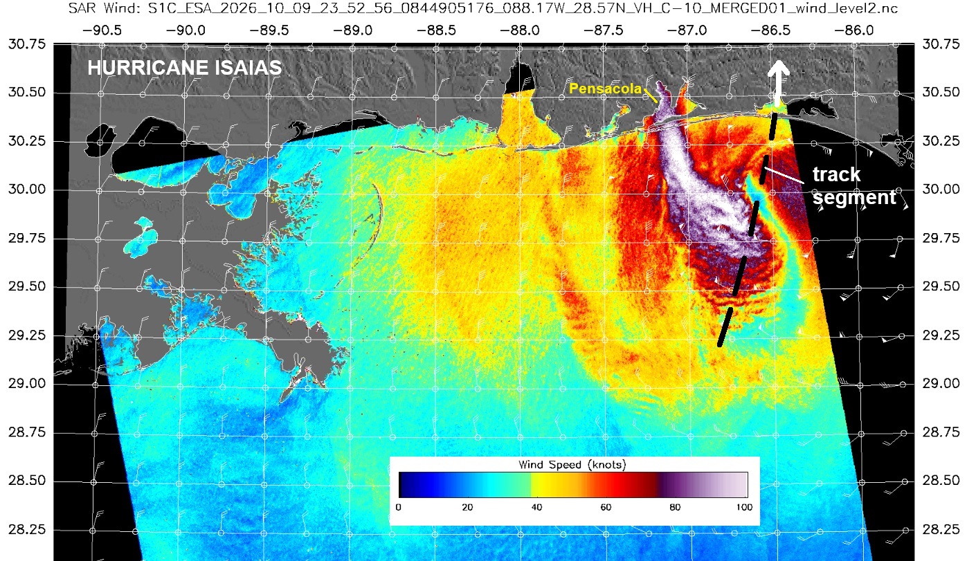
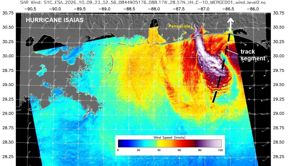
This SAR image clearly shows a sting jet, which is a characteristic of a PT/ET low pressure, not a TC. Also, prior to landfall, there was no coherent, focused wind center. It was quite elongated. So despite the satellite appearance w/ all the deep convection, structurally one could argue it had transitioned to more PT/ET than tropical prior to landfall. That sudden jump of pressure up 12 mb to 970 on recon when it has been holding steady 958-960 mb also indicates a rapid change structurally to away from tropical status. That suggested a distinct cool/dry air penetration into the core (front). Once that happens, a system is PT/ET. Note: SAR shows sustained winds max 110 kt. The SAR tends to have high bias. https://www.star.nesdis.noaa.gov/socd/mecb/sar/sarwinds_tropical.php?year=2026&storm=AL092026_ISAIAS I have always said when a system is transitions like this, there should be a ramp down to subtropical status before PT/ET status. Why not? If a system can go from ET to ST to tropical, there is absolute no reason to think it can not work the other way. This is what should have been done for Sandy for its landfall. A TC rarely goes instant PT/ET in just 6 hr. It is *process* that takes time. And I don't want to hear about the messaging issue. ST storms get names just like tropical storms, and the watches and warnings are the same ST or tropical. In fact, a few years ago, JTWC started assigning operationally ST status as systems transitioned from TC.
-
Monitor your NC mountain peeps if you have any. Confirmed landslides being broadcast. Sirens activated
-
gabapentin leg swelling [url=http://neuroreliefdirect.com/#]neuroreliefdirect[/url] gabapentin toxicity treatment
-
Confirmed landslide around 226 and Little Switzerland area. LOTS more rain still to come. Going to sketchy for you hills and mountain folks I'm afraid.
-

2026-2027 Record-breaking El Nino
LakePaste25 replied to Stormchaserchuck1's topic in Weather Forecasting and Discussion
There could be brief deviations westward, just not expecting a nearly month long deviation like we saw in 2023-2024. The fact that we shut down forcing west of the dateline already and we have a hyperactive EPac hurricane season is notable. 97-98 didn’t even do that this early. -
Sounds like things are deteriorating fast. Flood Sirens going off in Rutherford county for the Falls Creek area.
-
Just crossed over the 5" mark up here on the mountain near Seven Devils. Been absolutely pouring for the last few hours now. Hope all you folks in the foothills are staying safe.
- Today
-
People travel for beautiful scenery and what interests them. Seeing fall foliage in New England is on the bucket list for many people who enjoy traveling. It's become more and more popular. Most people wouldn't travel to experience exciting weather, but many of us here would because that's what interests us.