TellicoWx
-
Posts
2,632 -
Joined
-
Last visited
Content Type
Profiles
Blogs
Forums
American Weather
Media Demo
Store
Gallery
Everything posted by TellicoWx
-
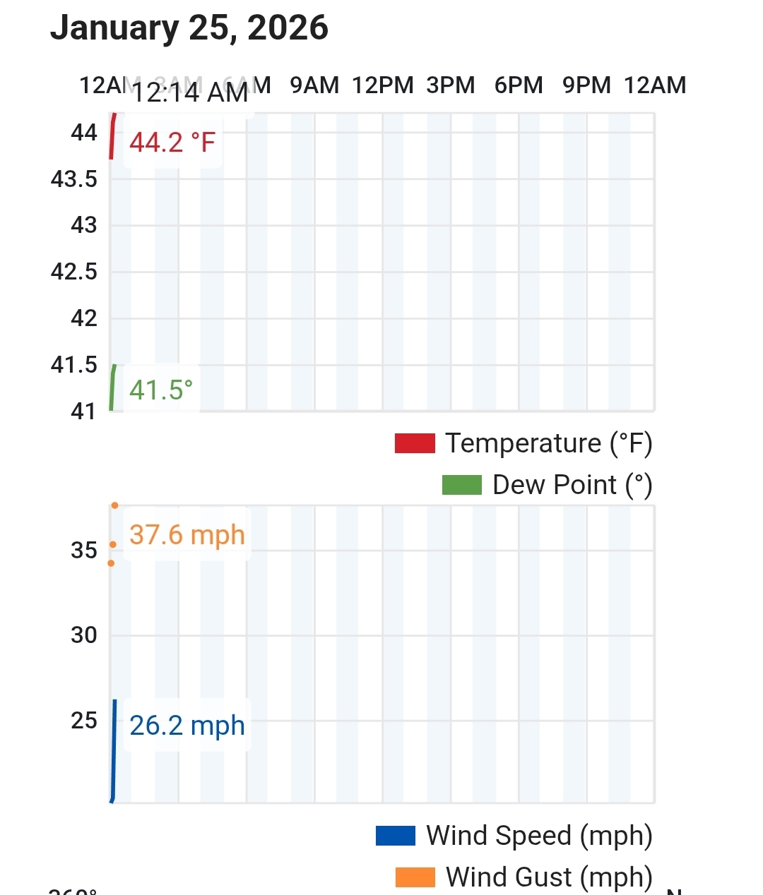
Currently a 10+ degree difference between me (31.5) and 3 or so miles up the road (low to mid 40s multiple stations)
-
For you guys that have decent accrual...really hope these winds dont make it to your part of the valley..absolutely ripping the wind on Coker Creek.
- 618 replies
-
- 1
-

-
- observations
- obs thread
- (and 1 more)
-
Definitely dodged a bullet here for ice again...temps hovering 30-31 only allowed marginal icing (.10" or less storm total). Hope everyone makes thru with power...been fun tracking even tho outcome wasn't exactly what was hoped for.
- 618 replies
-
- 1
-
-
- observations
- obs thread
- (and 1 more)
-
Agree, couple more degrees and would have been alot worse here so far. Some of the sheltered spots may not be as lucky so far.
-
This station is about where I turned around out..temp was 27 then
- 618 replies
-
- 2
-
-
- observations
- obs thread
- (and 1 more)
-
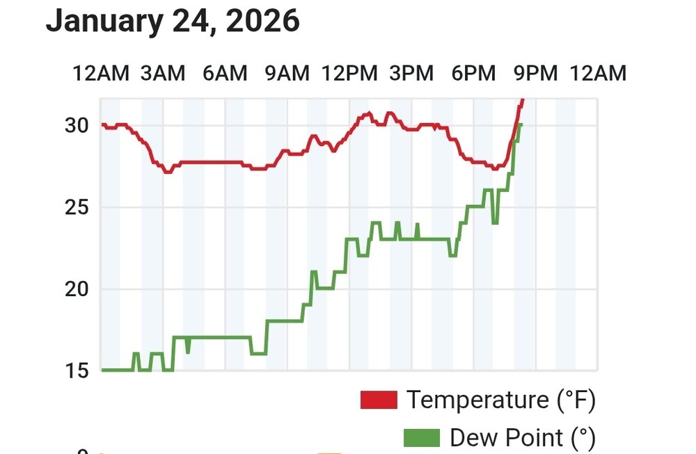
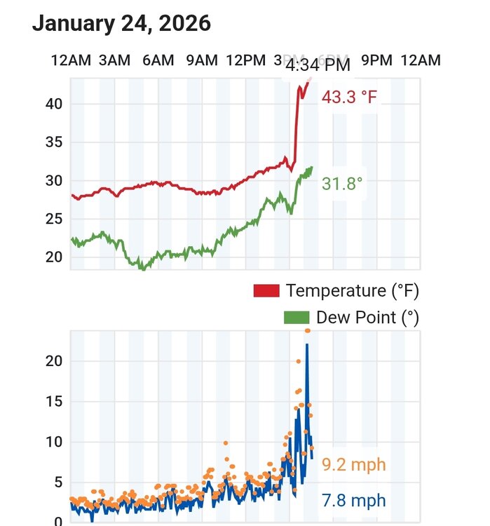
Warm air is definitely working down the mountain from the south (Coker Creek) side. Multiple stations at 1500' are now shifting winds and temps quickly rising
- 618 replies
-
- 1
-
-
- observations
- obs thread
- (and 1 more)
-
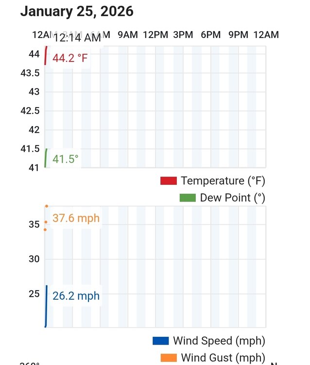
PWS station in Coker Creek recorded wind shift to SE 20mph about 10 mins ago. Temp went from 27 to 36 in about 5 mins.
- 618 replies
-
- 5
-
-

-
- observations
- obs thread
- (and 1 more)
-
About busted my tail walking back out to the truck..porch starting to ice up lol
- 618 replies
-
- 3
-
-
- observations
- obs thread
- (and 1 more)
-
Went for a drive...hwy 68 top Coker Creek beginning to ice up
- 618 replies
-
- 3
-
-
- observations
- obs thread
- (and 1 more)
-
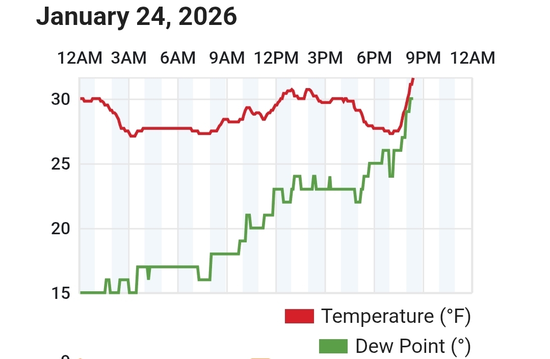
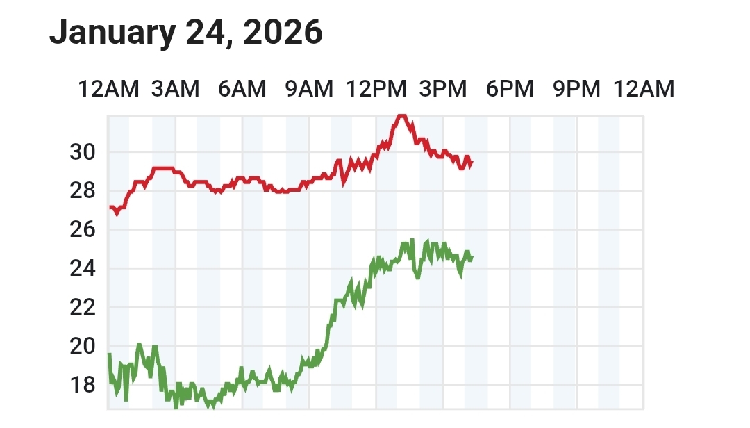
Down to 30.9...Skyway is down to 27.9 (coldest reading of the day)
- 618 replies
-
- 4
-
-
-
- observations
- obs thread
- (and 1 more)
-
During 2015 Ice Storm, while alot of places lost power. Tellico never had the first glaze of ice on anything.
- 618 replies
-
- 1
-
-
- observations
- obs thread
- (and 1 more)
-
If Tellico is seeing freezing rain, then this isn't the run of the mill ice situation lol
- 618 replies
-
- 2
-
-
-
- observations
- obs thread
- (and 1 more)
-
Yeah...each initialization is too high on CAMs, plus mountains are way colder than shown
-
I dont like where this is heading...temps not responding way being modeled and neither is the moisture imo.
- 618 replies
-
- 1
-
-
- observations
- obs thread
- (and 1 more)
-
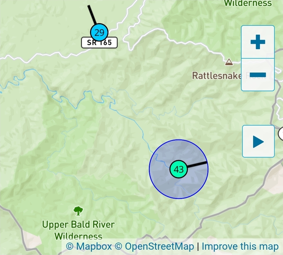
I keep saying warm nose, but that looks more like the air being squeezed downsloping both side of the Hatchery Station
-
Found the warm nose, but it's very odd. Fish Hatchery has a weather station and it sits about same elevation as other 2, I dont usually look at it cause way the ridges run it usually is the last of the 3 to pick it up...but here it is. You can see how the ridges form a dam so to speak in the topo as the River road meets the Skyway

- 618 replies
-
- 1
-
-
- observations
- obs thread
- (and 1 more)
-
Both those stations winds are still out of the NW
-
There's another station in Coker Creek (closest to Wauchisi) that will show one as well. Its chart so far is identical in temps/dp.
-
This is from the closest station to the state line on Skyway (station is next to Indian Boundary...if/when warm nose gets going, this station always picks it up first.

- 618 replies
-
- 4
-
-
- observations
- obs thread
- (and 1 more)
-
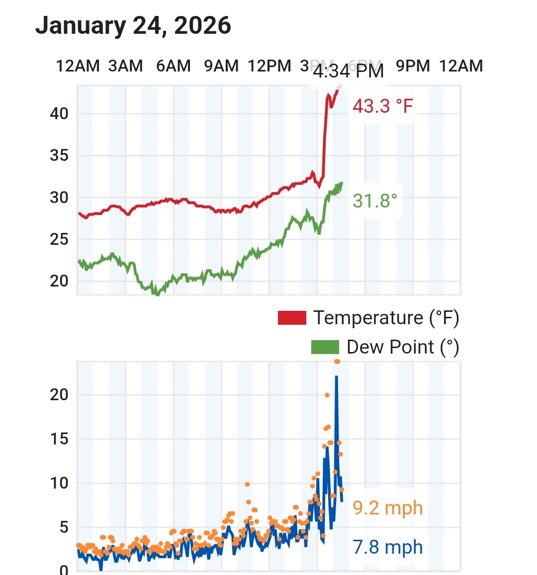
Went and took a nap, but save the modeled temp high. Never made it close. Topped out at 34.3, current 32.5 DP 23. Last couple runs of CAMs slowly increasing ice towards Madisonville, Sweetwater, with 20z RAP looking rough that way.
- 618 replies
-
- 1
-
-
- observations
- obs thread
- (and 1 more)
-
Column finally starting to saturate here...made it up to exactly 32.0....temp fell to 31.1 in last 15-30 mins
-
For anyone that may have to travel into North AL..dont. Alot of reports of cars sliding off the roads coming in.
- 618 replies
-
- 1
-
-
- observations
- obs thread
- (and 1 more)