brooklynwx99
-
Posts
6,237 -
Joined
-
Last visited
Content Type
Profiles
Blogs
Forums
American Weather
Media Demo
Store
Gallery
Everything posted by brooklynwx99
-
“trying” to flex doesn’t count. the ridge is super flat and there’s TPV vorticity in southern Canada that will make it more difficult for storms to gain latitude the gradient is largely south of us. sure, you can get a cutter, but calling it a cutter pattern is reductive. cutter patterns have deep troughs in the west and strong ridges in the east. that is not the case here
-
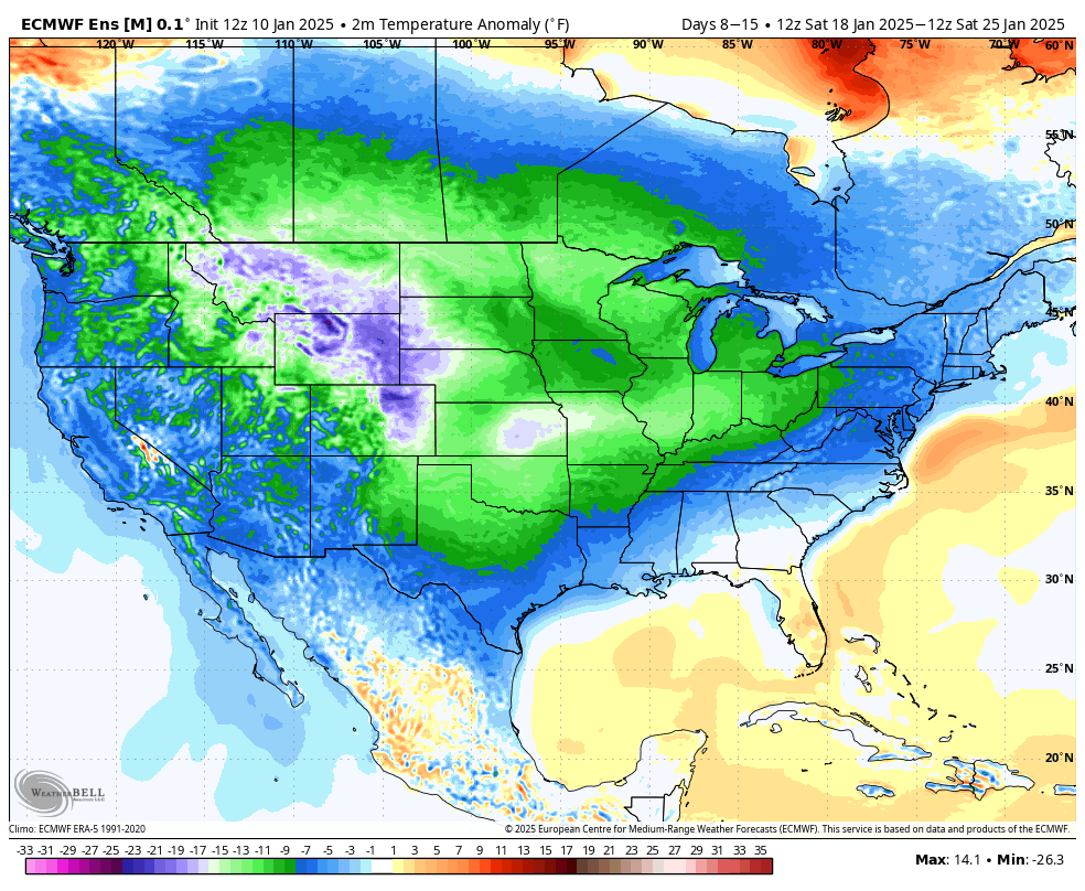
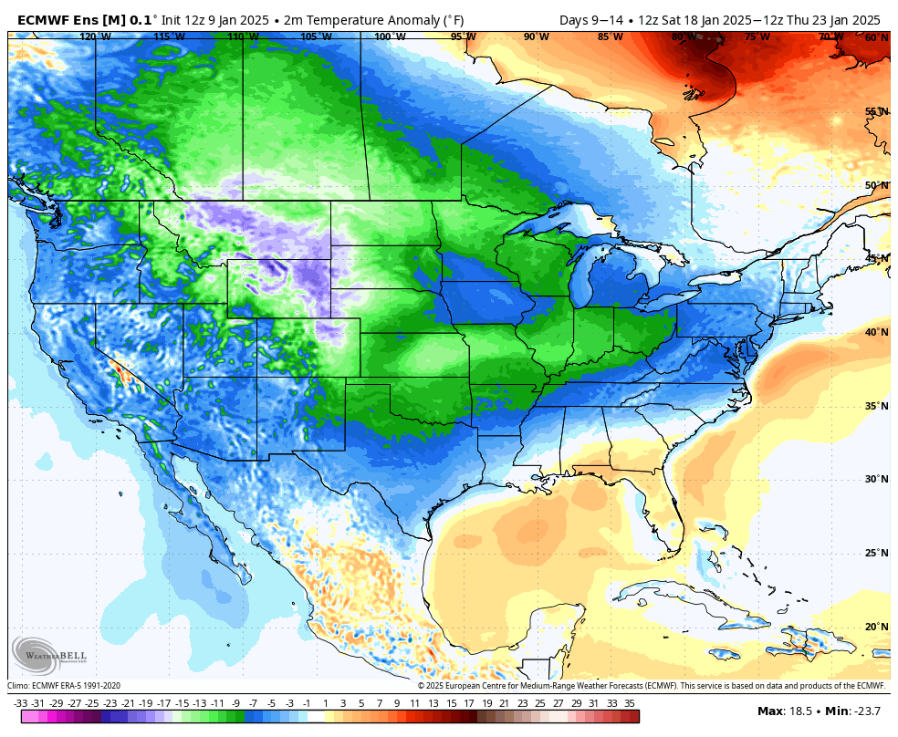
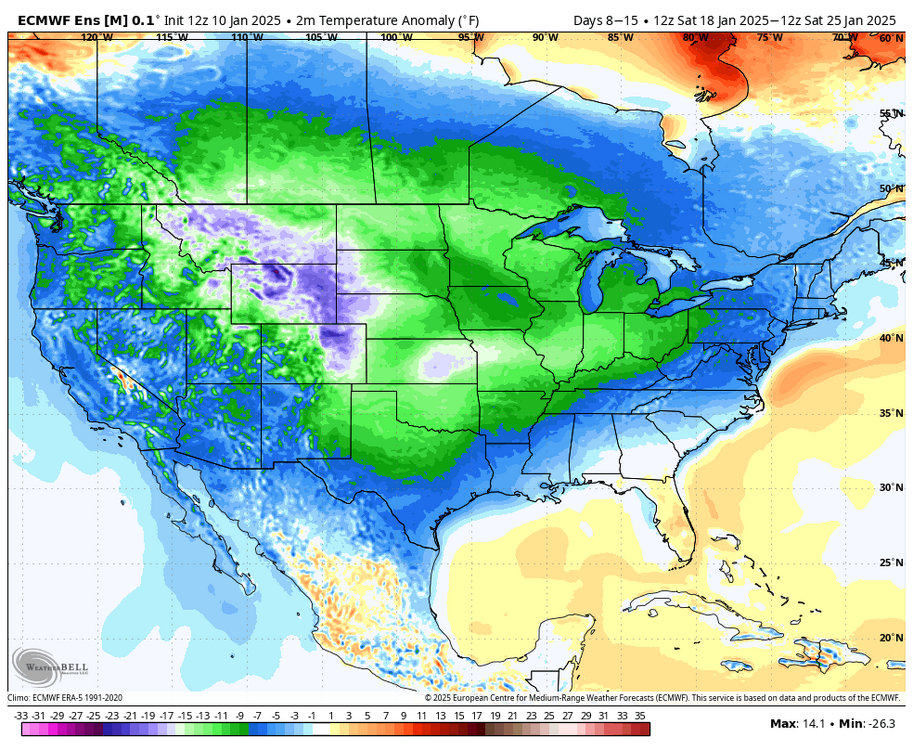
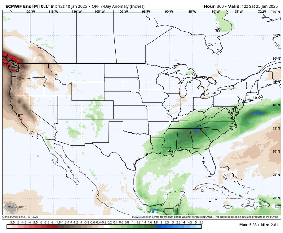
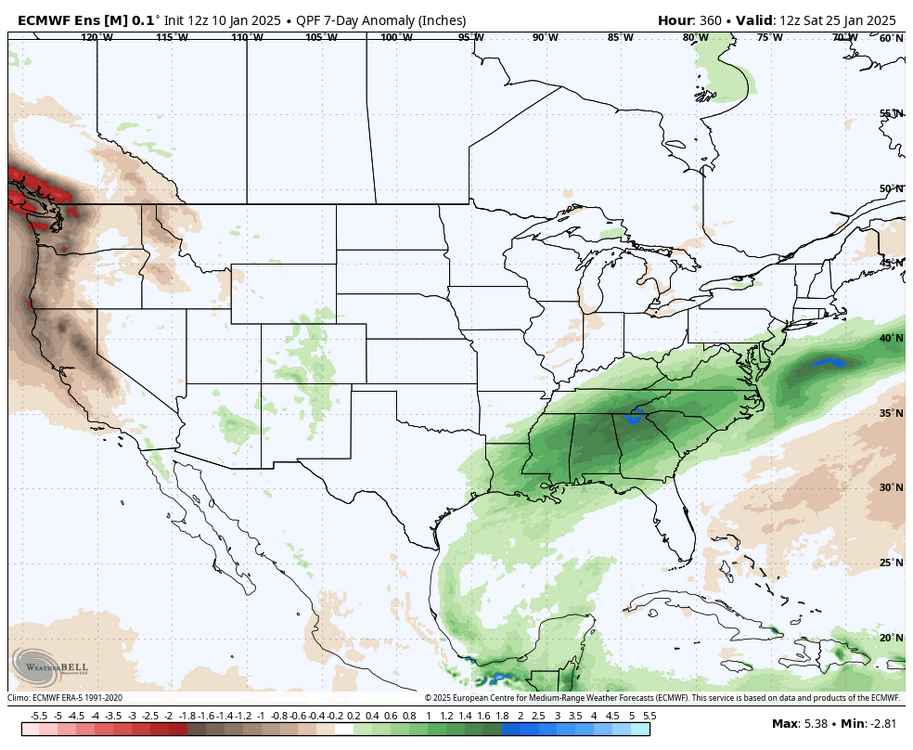
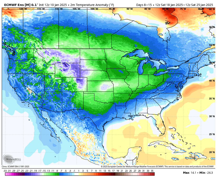
finally looks cold with precip after the 18th or so. reminiscent of the patterns we had in 13-14
-
finally looks cold with precip after the 18th or so. reminiscent of the patterns we had in 13-14
-
i mean, the angst over it is a bit much considering that the initial wave likely drags the baroclinic zone south. that’s common in these -EPO patterns. a two day warmup and a little rain before a potential colder storm isn’t an indictment on a pattern that does look cold and legitimately active who knows, that initial wave could also trend flatter. it’s 8 days out
-
acknowledging that the upcoming pattern is cold and active isn’t hype at all. maybe we have to endure a little rain. not a huge deal and it isn’t indicative of the pattern not being conducive for snow also, neither are realistic. i don’t think any of you have seen me posting long range OP runs regardless of the outcome
-
i mean DC got its 4th largest snowstorm this decade. just crappy luck that a TPV lobe moved to our north. the main threat area was NYC to RIC and it was the southern half of that envelope
-
yes, whining about rainy day 10 OP runs is grounded and realistic
-
this is the saddest internet forum on earth
-

January Medium/Long Range: A snowy January ahead?
brooklynwx99 replied to mappy's topic in Mid Atlantic
this is pretty much all you need to see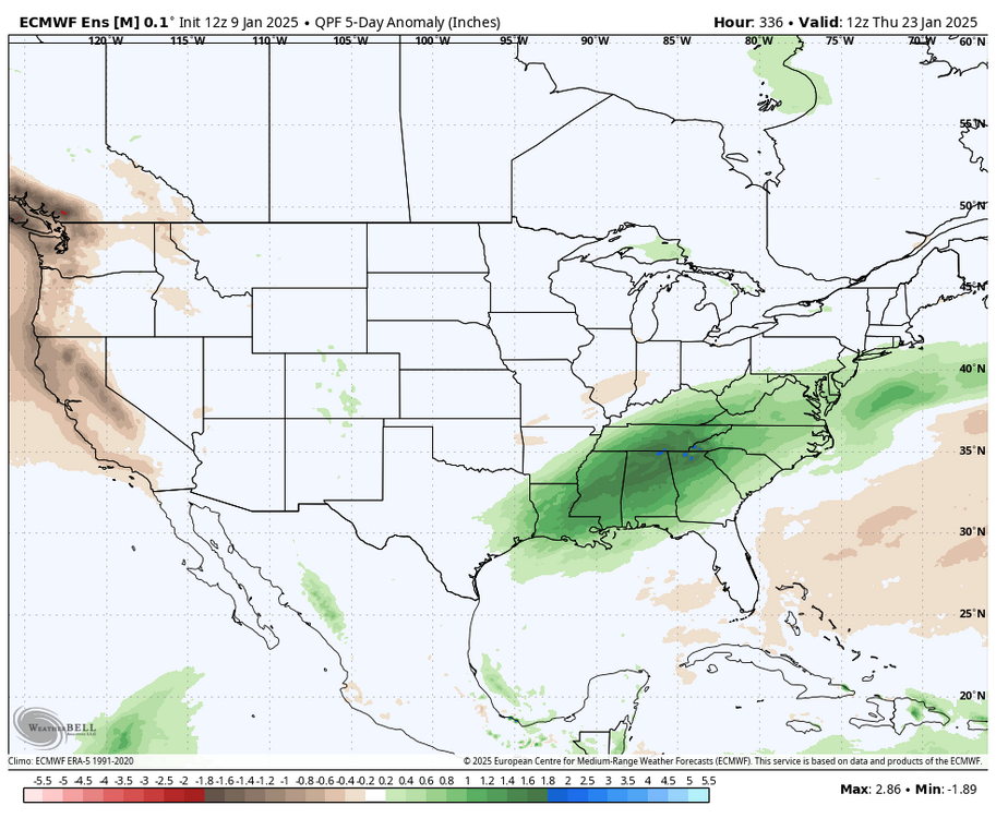
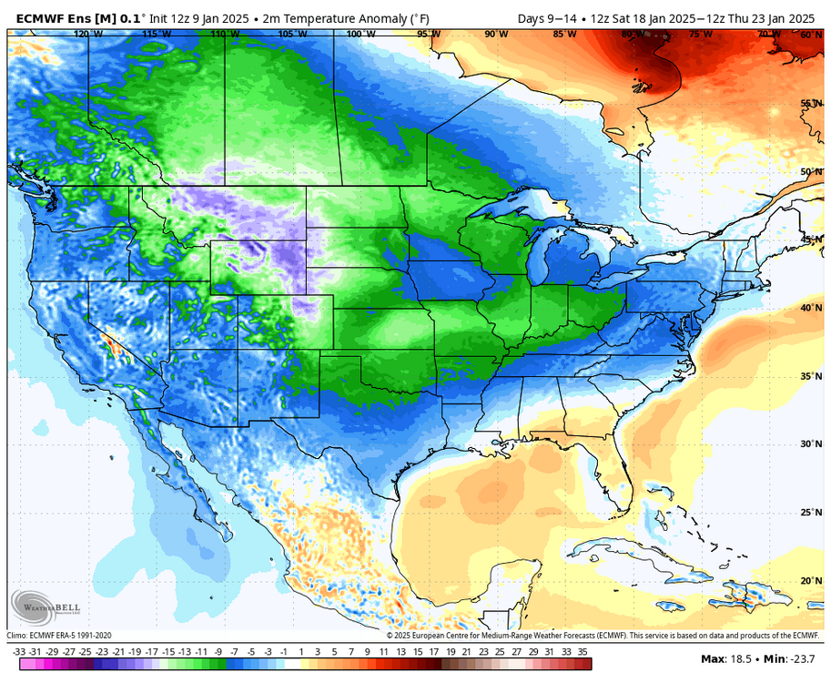
-
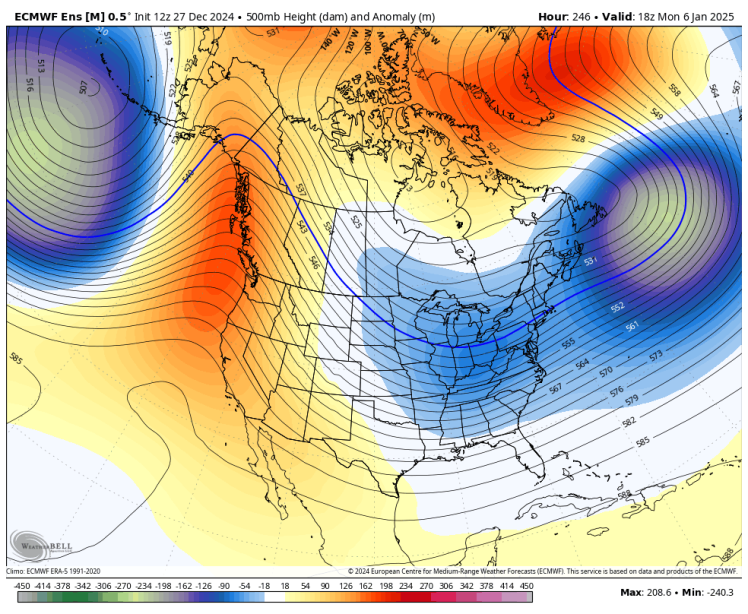
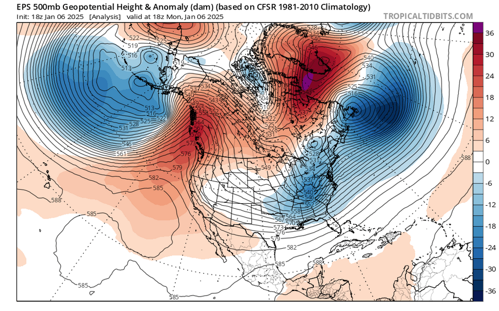
i mean, the pattern that we were supposed to have verified, and it was suppressive for up here. it's not like the pattern didn't come to fruition, it just ended up too suppressive for SNE and led to a storm that hit the mid-Atlantic. that is really impressive verification for 10 days out. the can didn't get kicked, the individual pieces didn't come together correctly for much snow north of Philly. doesn't mean the models were wrong
-
January Medium/Long Range: A snowy January ahead?
brooklynwx99 replied to mappy's topic in Mid Atlantic
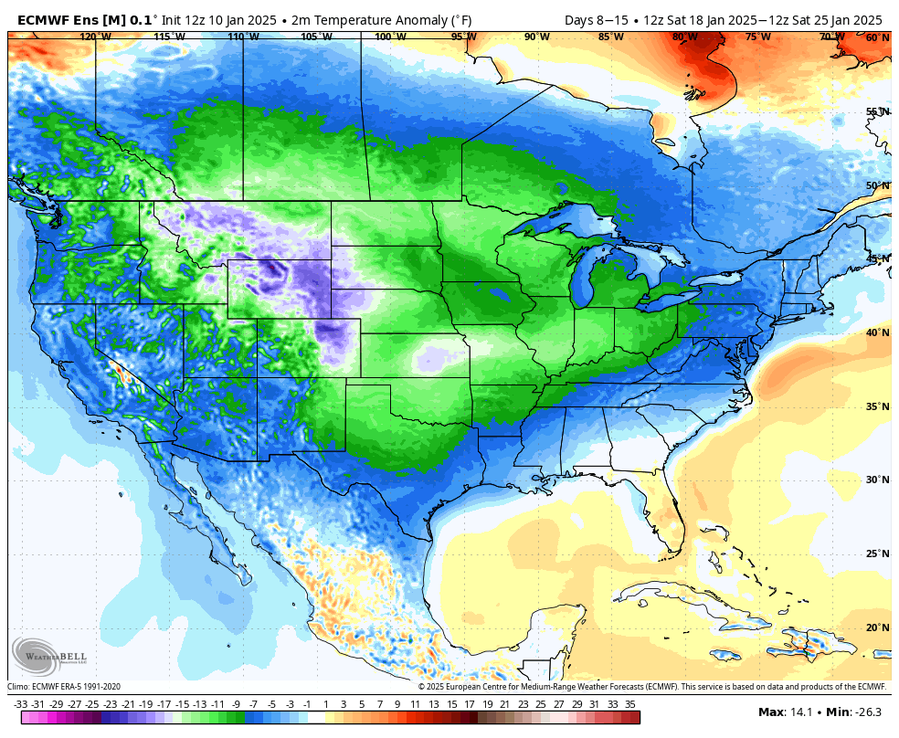
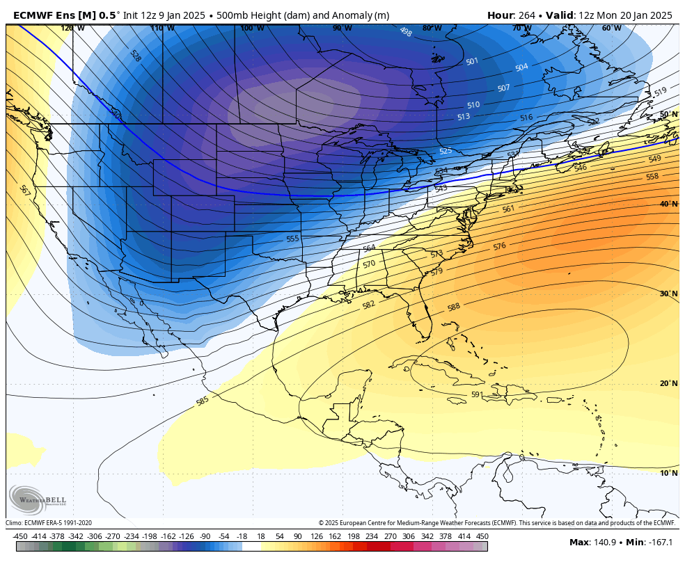
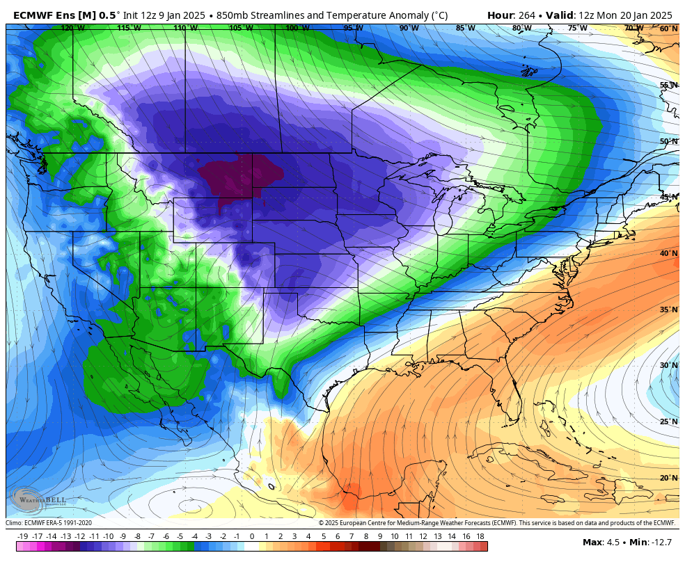
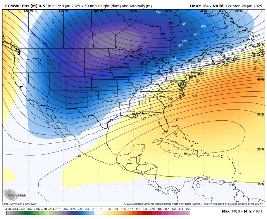
EPS is really nice looking. might be cutting it close down here but it really reminds me of 13-14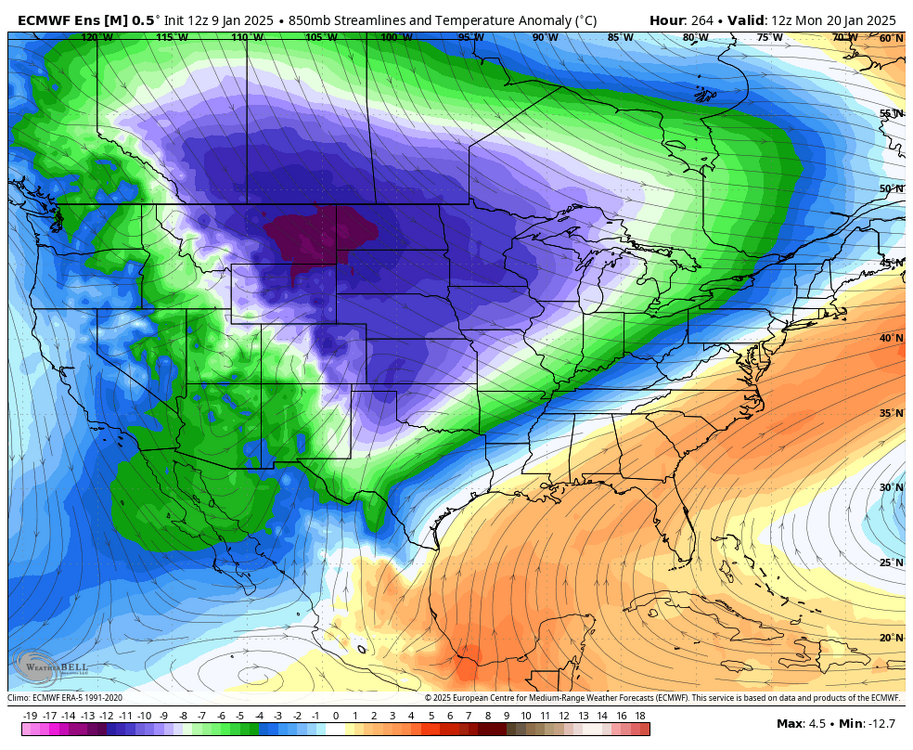
-
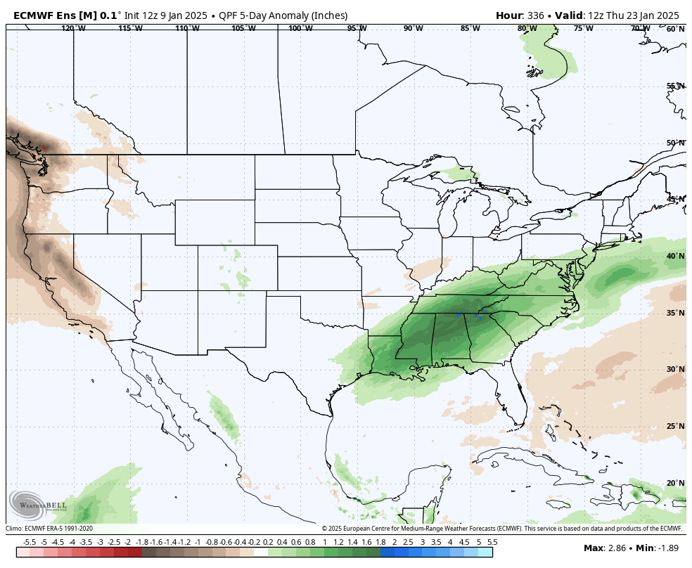
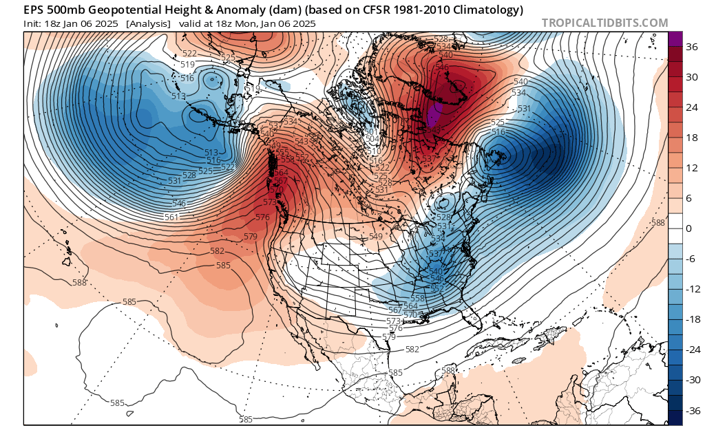
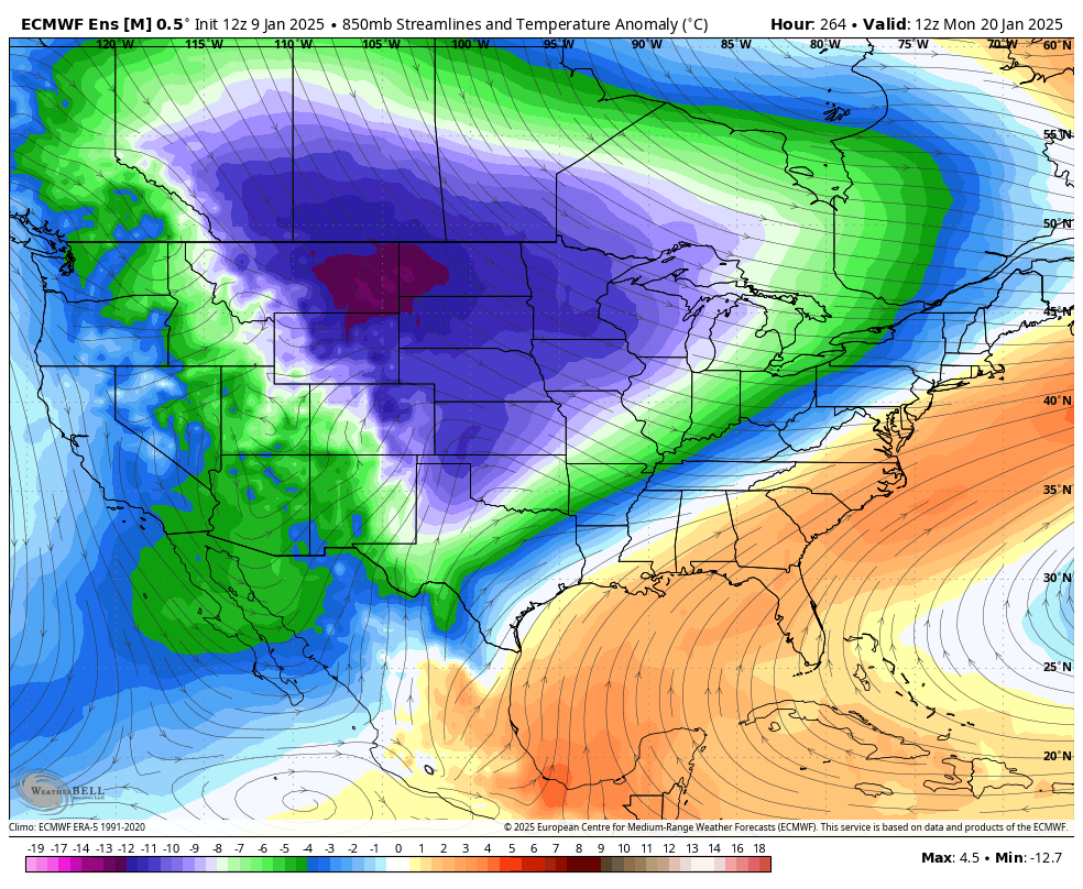
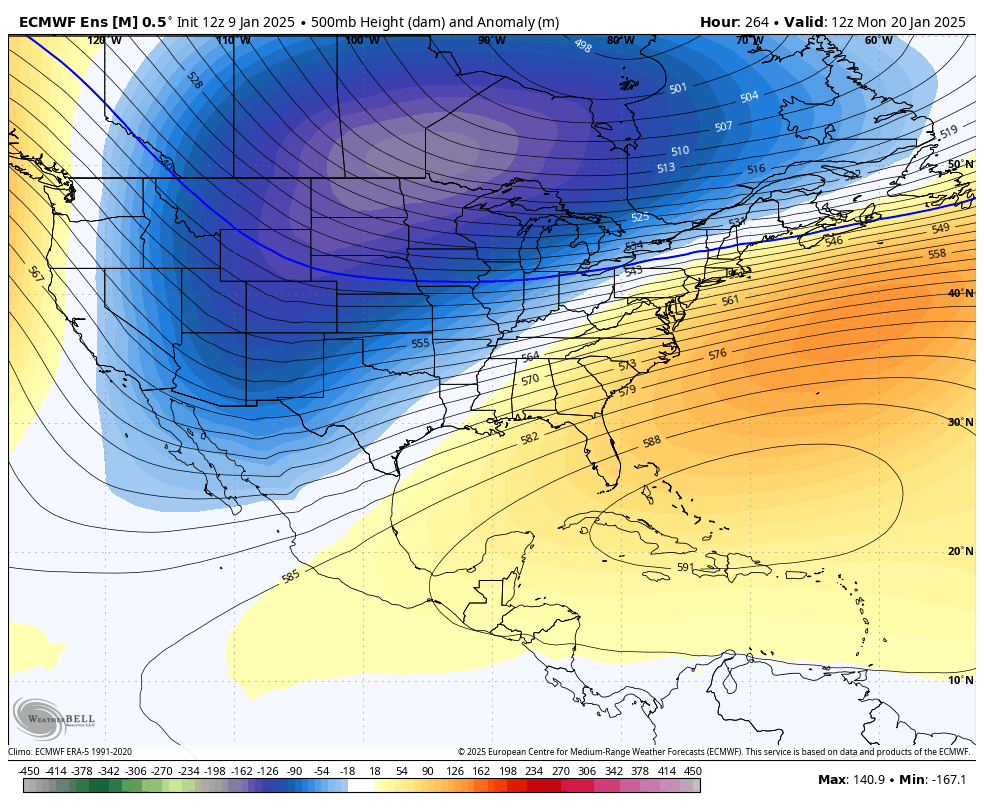
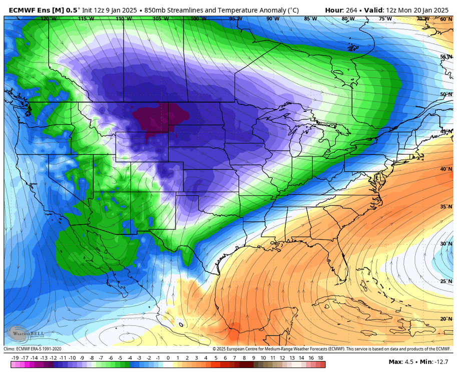
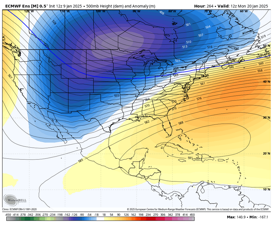
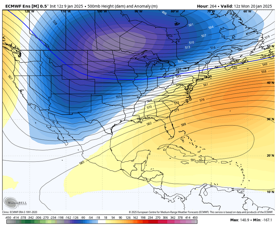
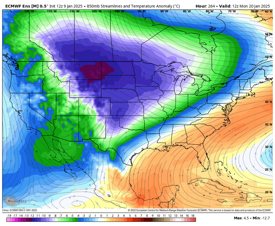
really liking the look the EPS has during that 18-22nd period. looks 13-14 esque with the displaced TPV, tons of cold in the CONUS, and a weak WAR that will help prevent suppression. sure, you can see a cutter, but it would really only tamp down the baroclinic zone for storms to ride across. give me this any day of the week over the pattern we're in now
-
no, calling it a cutter pattern is reductive and doesn't really tell you anything. my point is that the pattern leaves you open to them in the same way that a -NAO pattern leaves you open to suppression. we could see a cutter, just as other favorable patterns like 2013-14 produced. however, often times these cutters in these kinds of patterns only serve to tamp down the baroclinic zone such that a second wave can slide across the Arctic boundary the EPS, for example, is not what I would consider a "cutter pattern." there is lots of TPV vorticity sitting over SE Canada, tons of cold air in the flow, and no SE ridge... it's displaced more over the Caribbean and would just prevent suppression. of course you can get a cutter here, but storms can easily just slide to the south with Arctic air over the top. looks active with overrunning as the main storm track
-
you always risk cutters with that kind of pattern in the same way you risk suppression in blocking patterns. still doesn't take away the cold and active look. 2013-14, which this pattern reminds me of, also had cutters. usually those help to push the baroclinic zone SE for moisture to ride along
-
i think everyone would take a front end thump to rain at this point. certainly possible with the -EPO pattern. will be lots of cold nearby
-
January Medium/Long Range: A snowy January ahead?
brooklynwx99 replied to mappy's topic in Mid Atlantic
yup, didn't matter at all. the MJO isn't a silver bullet as much as some here would make you believe -
Jan 11th-12th Super Bomb or Super Bummed?
brooklynwx99 replied to Rjay's topic in New York City Metro
it’s just crappy wave spacing. all of the ingredients were there, they just didn’t come together correctly- 992 replies
-
- 4
-

-
- metsfan vs snowman
- bomb
- (and 2 more)
-
there's just too much cold air... it's a persistently wintry pattern with the EPO reloading and blocking lingering. my hunch is the 18-22nd produces some kind of event. just got screwed by a suppressive TPV lobe last week and bad wave spacing this week. the general longwave setup has been there
-
Jan 11th-12th Super Bomb or Super Bummed?
brooklynwx99 replied to Rjay's topic in New York City Metro
this looks cooked for anything more than light stuff. what a waste of a great synoptic setup. luckily there will be no shortage of cold through the end of the month- 992 replies
-
- 3
-

-
-
- metsfan vs snowman
- bomb
- (and 2 more)
-
why do you torture yourself like this
-
January Medium/Long Range: A snowy January ahead?
brooklynwx99 replied to mappy's topic in Mid Atlantic
didn’t you guys just get dumped on? lmao -
Jan 11th-12th Super Bomb or Super Bummed?
brooklynwx99 replied to Rjay's topic in New York City Metro
i’m not looking for a major storm. anything is better than nothing- 992 replies
-
- 3
-
-

-

-
- metsfan vs snowman
- bomb
- (and 2 more)
-
Jan 11th-12th Super Bomb or Super Bummed?
brooklynwx99 replied to Rjay's topic in New York City Metro
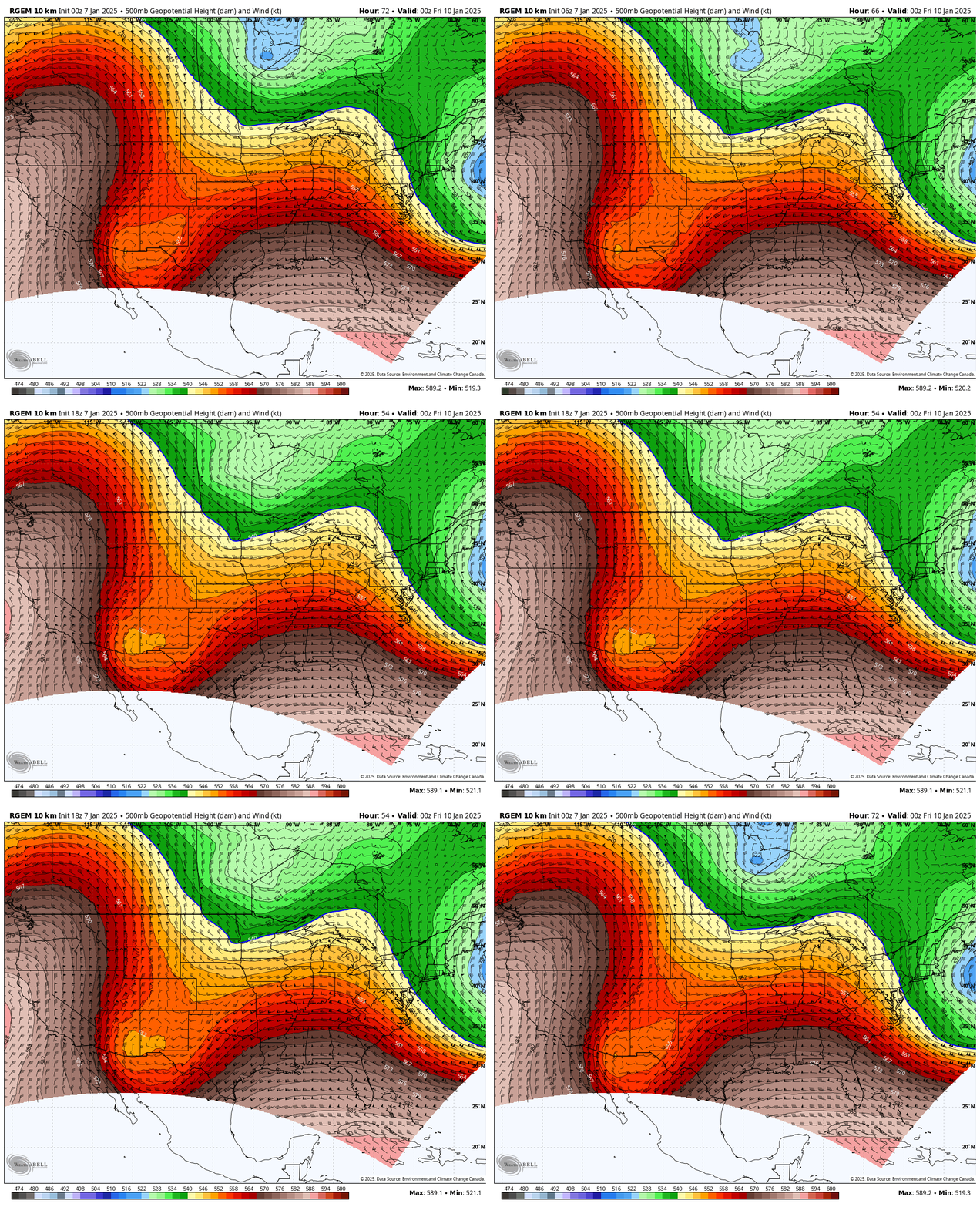
solid trend on the RGEM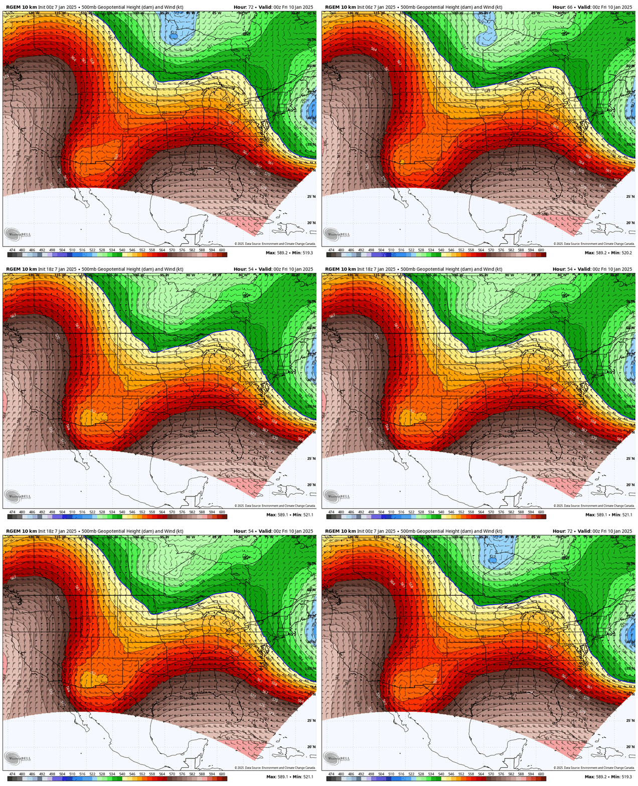
- 992 replies
-
- 7
-
-
-

-

-
- metsfan vs snowman
- bomb
- (and 2 more)
-
RGEM is phasing more too
-
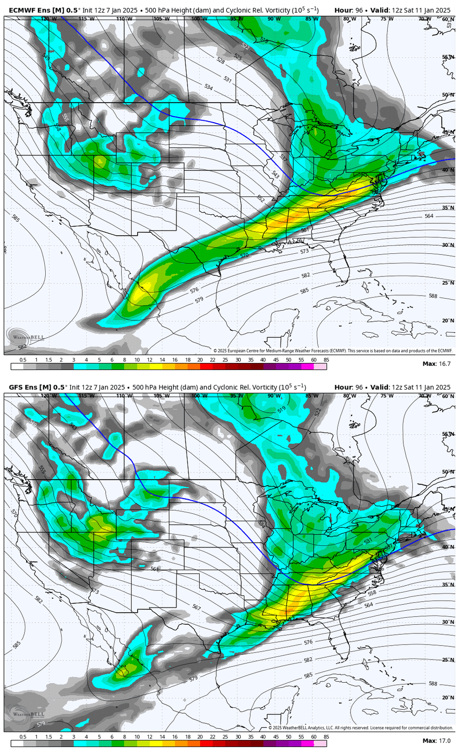
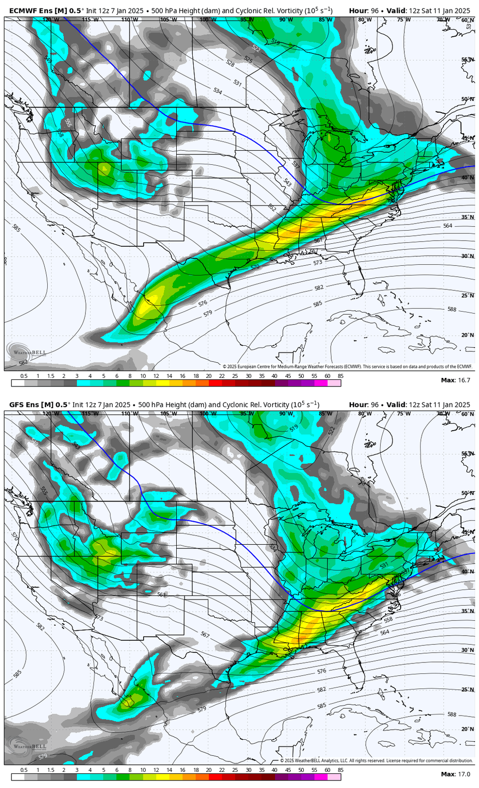
the GEFS and EPS aren't even fundamentally different, they just have different degrees of phasing. it's not a massive leap from one to the other. I would still expect a smaller event but it's not like it's that far off. all guidance this afternoon has also improved the northern stream