radarman
-
Posts
14,474 -
Joined
-
Last visited
Content Type
Profiles
Blogs
Forums
American Weather
Media Demo
Store
Gallery
Everything posted by radarman
-

March 2022 Obs/Disc: In Like a Lamb, Out Like a Butterfly
radarman replied to 40/70 Benchmark's topic in New England
Some places in SNE average more in March than in Dec, and it's at least close in most places. -
March 2022 Obs/Disc: In Like a Lamb, Out Like a Butterfly
radarman replied to 40/70 Benchmark's topic in New England
Last year even. 8.5" here on April 16th after zippo in March. Don't recall how areas further east did. Bigger than any event we had this year LOL -
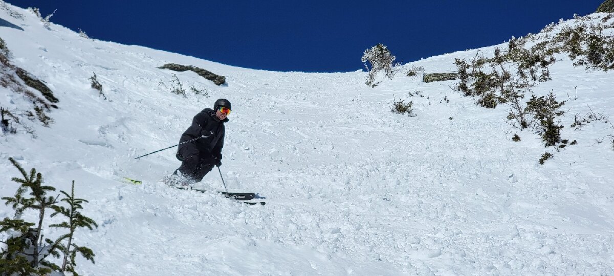
We saw 3 ski patrollers ripping up light pow in the woods off Nosedive coming out onto Rimrock. We found that it was all about the aspect. That particular one was very wintry as expected. Anything cut ESE was a different story as you noted. Anything from butter to sticky paste to heavy mashed potatoes. I will say the yellow hot wax paid serious dividends, even if in places it was still a little grabby. But we were getting through better than most.
-
Then back over to the gondy and booted up to the summit for more amazing views and awesome turns with former board member Chris M.


-
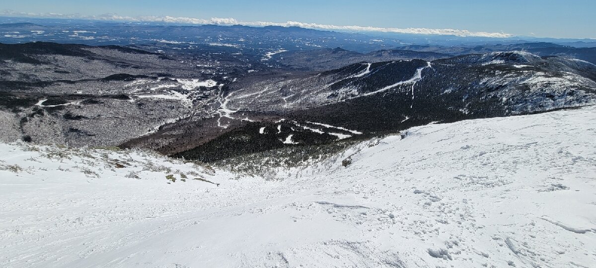
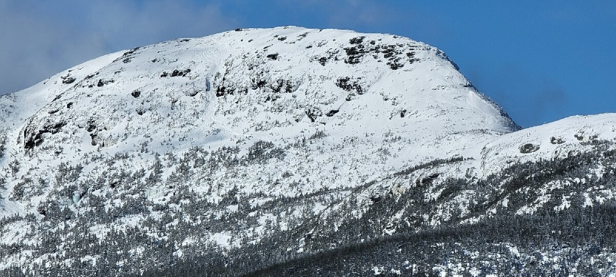
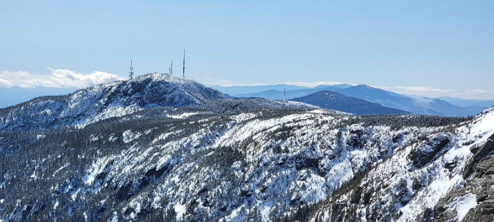
Stowe totally delivered the goods... Fast and firm everywhere from 8-945. Hit Spruce thereafter and the top turned to butter, not sticky. Wonderful. Hiked the peak and observed some cool wave features in the snow and were treated to epic views of Mansfield.

-
March 2022 Obs/Disc: In Like a Lamb, Out Like a Butterfly
radarman replied to 40/70 Benchmark's topic in New England
Whereas I'm all for ending the clock changing, this is why I am glad they picked DST and not Standard time. And probably that's the reason, because why else? -
March 2022 Obs/Disc: In Like a Lamb, Out Like a Butterfly
radarman replied to 40/70 Benchmark's topic in New England
seems simple enough really. Not sure why other aspects of society couldn't take note and implement. 23z model runs... done -
March 2022 Obs/Disc: In Like a Lamb, Out Like a Butterfly
radarman replied to 40/70 Benchmark's topic in New England
now instead of losing one hour of sleep when the clocks change, all of us here can lose an hour of sleep every night in the winter -
headed up your way tonight... seems like I should quit work early and wax em up.
-
March 2022 Obs/Disc: In Like a Lamb, Out Like a Butterfly
radarman replied to 40/70 Benchmark's topic in New England
I'm saying the map is our current snowfall climo. The moose in the Allagash can't be bothered to send in reports, Ginxy is smiling all the time, and Greenfield Chris is the new DCA. -
March 2022 Obs/Disc: In Like a Lamb, Out Like a Butterfly
radarman replied to 40/70 Benchmark's topic in New England
There is a fair amount of smoothing on that 3d topography. The hills on the east side of the valley in MA are largely over 1000', with Mt Grace up over 1600', but in a narrow strip. Meanwhile you'd think parts of SEMA and NW RI was substantially higher based on the colors. -
March 2022 Obs/Disc: In Like a Lamb, Out Like a Butterfly
radarman replied to 40/70 Benchmark's topic in New England
who doesn't like a little sugar snow to wake up to? Would be nuked in hours regardless. -
Skinned up and got a pretty good look at that busted wind turbine blade at the Beast earlier.
-
March 12 Rain to…more rain? Maybe some snow
radarman replied to HoarfrostHubb's topic in New England
if only Quabbin effect were real... I'd kill on nor'easters -
March 12 Rain to…more rain? Maybe some snow
radarman replied to HoarfrostHubb's topic in New England
I think being on the far east side of the valley in gradually rising terrain may help, with westerly wind component behind the front -
March 12 Rain to…more rain? Maybe some snow
radarman replied to HoarfrostHubb's topic in New England
2" -
March 12 Rain to…more rain? Maybe some snow
radarman replied to HoarfrostHubb's topic in New England
flipping to sleet here -
March 12 Rain to…more rain? Maybe some snow
radarman replied to HoarfrostHubb's topic in New England
I'm pretty bullish for another advy event here. We could verify it in 2hrs potentially. Lift looks great on the 3km soundings shortly after noon. -
March 12 Rain to…more rain? Maybe some snow
radarman replied to HoarfrostHubb's topic in New England
Advys hoisted for ORH, Tolland, Ct Valley -
I just have a weekday pass, so normally I skin on weekends, but might make an exception tomorrow. Debating between that and using an unrestricted KTicket voucher at Killington. I'll PM you if I'll do wind up in Charlemont.
-
Agree with all this, which is why I stopped watching on TV a long time ago and now relegate it to the radio while doing other things... cooking dinner, coding, looking at models, whatev. Makes for great background noise, and you can tell by the pitch of the announcers voice when there's something going on worth paying attention to. But don't have to rely on it to hold your full attention.
-
I think it's to get more action into the game. Hits are fun at least. Everybody striking out 150+ times a year because they're focused on launch angle to beat the shift is boring.
-
March 12 Rain to…more rain? Maybe some snow
radarman replied to HoarfrostHubb's topic in New England
I'm happy to bank the ticks east and weaker through 6z tomorrow anyway. -
Was roughly 4" at the Beast by the time lifts closed. About the same at the house. Skiing was good just don't go too hard on the edges.
-
March 2022 Obs/Disc: In Like a Lamb, Out Like a Butterfly
radarman replied to 40/70 Benchmark's topic in New England
SVR issued for Berkshire and far western Franklin Co