radarman
-
Posts
14,412 -
Joined
-
Last visited
Content Type
Profiles
Blogs
Forums
American Weather
Media Demo
Store
Gallery
Everything posted by radarman
-
As an aside, those graphs show pretty nicely the wave 2 and wave 3 action preceding this last one
-
Really we just had one... Maybe it gets some credit for the cold shot, but the overall pattern seems to have shrugged it off... I guess you keep playing the odds and hope it works out? And frankly, I'm not really sure what they're seeing that makes them bullish about another one upcoming. Wave 2 is dead. Wave 3 is meh.
-
Nice job taking advantage of the oppy. One thing I will say is that we've had two periods of good black ice, the first being in the higher elevations right after Christmas. That is no guarantee in any year. All it takes is one snow or mix event in the early formative stages of the pack and you're screwed. Granted, white ice is skateable and we'd certainly take it, but there is really nothing like smooth black ice. Anyway this was from yesterday. Not terrible.
-
Tenney Mt set to reopen on the 10th Skied there as a kid
-
We got out early too. 4" of black ice, albeit not the smoothest ice. I'd call it a B+ session. But yeah, that's a wrap.
-
Pretty classic wave 2/wave 3 induced SSW -> descent of HP over the pole -> PV displacement event. If you were gonna draw up -10 at BOS you'd probably not put low heights in AK and onshore flow into the pac NW, but at any rate we got it done in spite of it.
-
That 16F dew jump in an hour in Jan 1955 seems a bit odd
-
Same here
-
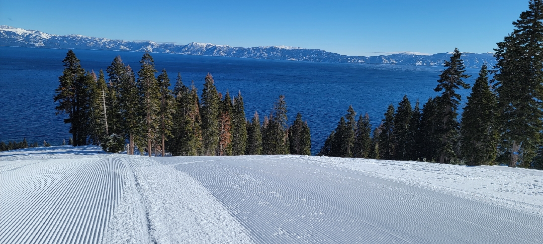
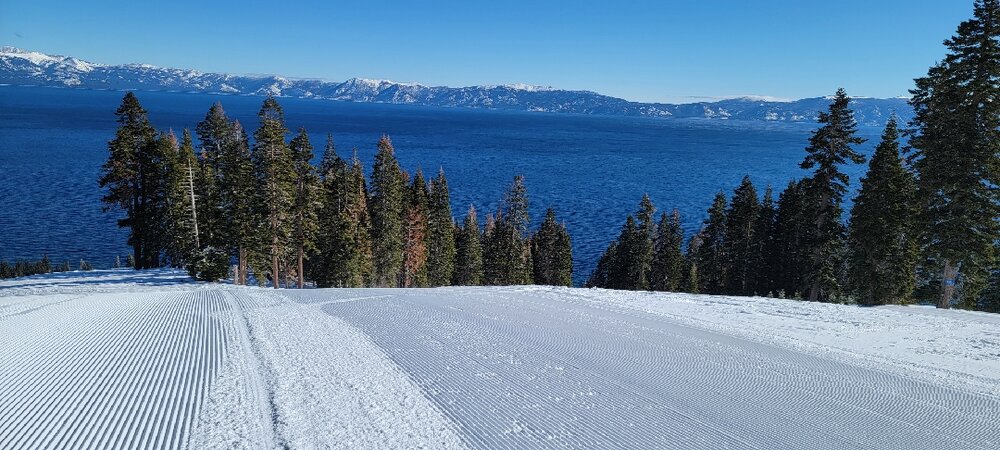
A few from Homewood today. Bucket list ski area.
-
Awesome pics
-
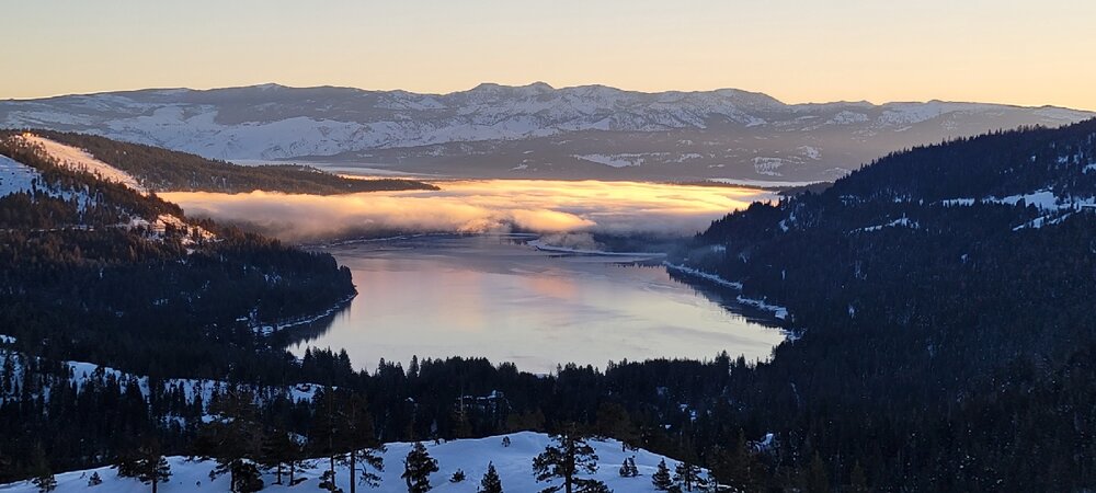
In a land of high speed chairs, shout out to the old school triple at Northstar today
-
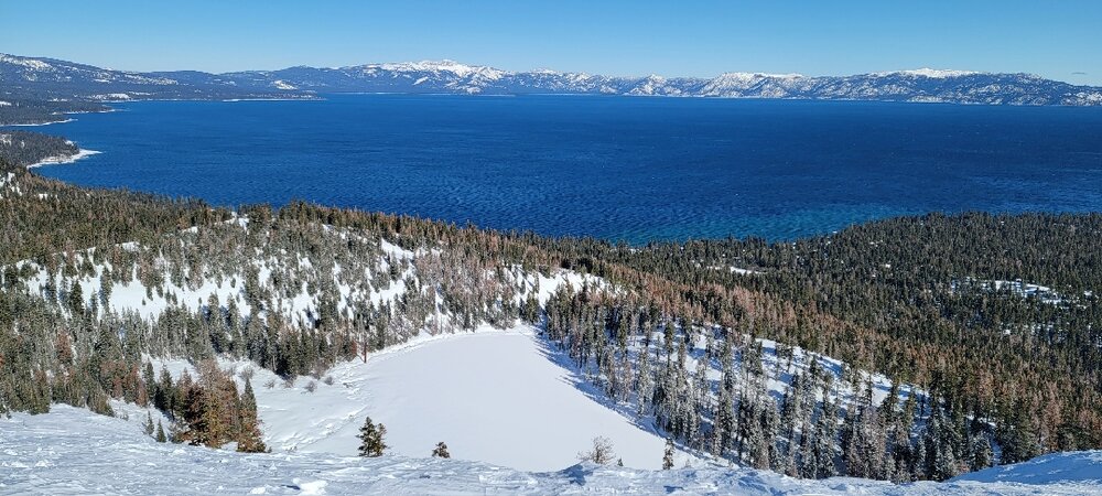
Donner Lake pretty nice too
-
Just depends on where I guess. I'm at 18.5" to date this year. I was at 4.25" through 2/5/16.
-
15/16 was brutal
-
The wheel has no memory as they say. At any rate if even odds o/u are being offered you should probably use the median snowfall not the mean. I wonder how it differs around SNE? Not sure tbh
-
Megamillions top prize was sold in Btown at the Stop and Shop 2 miles from my house. They only hit for 31M. This is like when we jackpot on anafrontal events for like 5".
-

Texas/Oklahoma Discussion & Obs Thread 2022
radarman replied to It's Always Sunny's topic in Central/Western States
I am at Alliance airport in NW Ft Worth and it is snowing hard. 35 degrees though so not accumulating much. -
...Franklin County... Leverett 2.0 in 1200 PM 01/23 Amateur Radio Sunderland 1.1 in 0700 AM 01/23 COOP ...Hampden County... 2 ESE Holyoke 1.0 in 0935 PM 01/22 Amateur Radio ...Hampshire County... Hadley 3.7 in 0858 AM 01/23 CO-OP Observer Westhampton 1.8 SW 1.3 in 0758 AM 01/23 COCORAHS Williamsburg 1.2 WSW 1.1 in 0635 AM 01/23 COCORAHS 1 ENE Easthampton 1.0 in 0945 PM 01/22 Trained Spotter Northampton 0.4 S 1.0 in 0810 AM 01/23 COCORAHS Amherst 0.6 in 0715 AM 01/23 COOP South Hadley 3.2 SSW. 0.5 in
-
Impressive. Congrats
-
Even the north side of Belchertown along 202 is over 1k', which is only a few miles away from me. And yeah, Pelham gets to 1240'.
-
My local expectations <350' T 350-500', T-1" 500-650', 1-2" 650-800', 2-4" >800' 3-5"
-
Folks can discard the nam leading a late charge north at their peril, especially after it doubled down.
-
Heavenly? I'm headed out next weekend. Hoping the ridge breaks down a bit toward the end of the month. How was it?
-
Winter Storm Watch for the east slope, advys for E Franklin/ORH county
-
that report was accurate but it did snow moderately to heavy at times throughout the morning and early afternoon. Picking up again now per ENX and the webcams.