WxWatcher007
-
Posts
36,088 -
Joined
-
Last visited
Content Type
Profiles
Blogs
Forums
American Weather
Media Demo
Store
Gallery
Everything posted by WxWatcher007
-
We’ve done enough of those around Christmas
-

Preliminarily ... a medium impact partial Miller B, Friday
WxWatcher007 replied to Typhoon Tip's topic in New England
Actually told my wife the other day that I might consider a truck because I’ve found with the new house there’s a lot more I could do with one. I’ve chased virtually all my big snow events in my car without snow tires, but I know its limits. Pushed it to the max in Buffalo but made it out fine. Elevation would be very tough. -
Preliminarily ... a medium impact partial Miller B, Friday
WxWatcher007 replied to Typhoon Tip's topic in New England
Dude -
If it doesn't produce snow, it better produce enough rain to flood my backyard, enough wind to put a tree through my deck, or enough cold to immobilize my car. Big dog or bust for next week.
-
Preliminarily ... a medium impact partial Miller B, Friday
WxWatcher007 replied to Typhoon Tip's topic in New England
Long at peace with this one. The setup is the setup. Congrats NW. Helps to have snow cover lol. -
100%
-
Good luck, everyone.
-
It's been on the guidance for a long time. Just happened across this gem on my computer
-
January ‘16 was extraordinary in DC. We kept waiting for the rug to get pulled and it never happened. I think it’s also worth noting that the Friday threat had been signaled for a while too. Models have done well highlighting potential so far imo. Placing my bets on a HH GFS run.
-
Yeah get that to the Atlantic please. My goodness.
-
Preliminarily ... a medium impact partial Miller B, Friday
WxWatcher007 replied to Typhoon Tip's topic in New England
If that did work out, most of the forum would have had at least one “wintry appeal” event. Stubborn to the end. Hopefully we get a few more ticks through tomorrow to put me in the game for a few. Tall order I know, but at the very least it’s good to see this be the second consecutive event that trends positive at short leads for parts of the forum. -
Next week looks nuclear. We don’t need to be the jackpot zone this far out, just in the game. It’s far closer at that lead time than Friday ever was.
-
Preliminarily ... a medium impact partial Miller B, Friday
WxWatcher007 replied to Typhoon Tip's topic in New England
Stubborn to the end -
Preliminarily ... a medium impact partial Miller B, Friday
WxWatcher007 replied to Typhoon Tip's topic in New England
That run was great for western CT. -
Preliminarily ... a medium impact partial Miller B, Friday
WxWatcher007 replied to Typhoon Tip's topic in New England
What a crusher in W MA. -
Preliminarily ... a medium impact partial Miller B, Friday
WxWatcher007 replied to Typhoon Tip's topic in New England
This is a tough one. Right now my first map has 6-12 for elevated northern Litchfield, 3-6 for the other part of the county into (elevated) western Hartford County, 1-3 for the interior part of the state (most in eastern hills), and a Trace for coastal and SE CT. Not sure where the rest of the team ends up, but that seems reasonable for a first call. A tick or two colder and it may be a different map. -
Brutal
-
Preliminarily ... a medium impact partial Miller B, Friday
WxWatcher007 replied to Typhoon Tip's topic in New England
GEFS look a tick SE again? -
One of my favorite all time events
-
Preliminarily ... a medium impact partial Miller B, Friday
WxWatcher007 replied to Typhoon Tip's topic in New England
-
Preliminarily ... a medium impact partial Miller B, Friday
WxWatcher007 replied to Typhoon Tip's topic in New England
Heretic? -
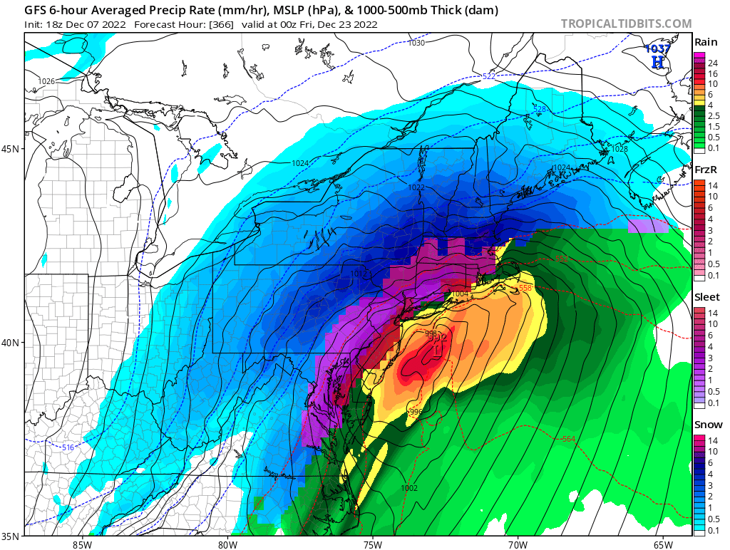
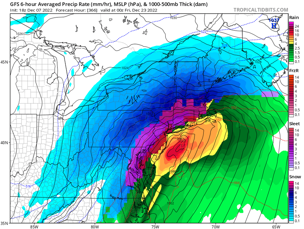
Nice signal in the days before Christmas for something. Hard not to like the active look that should continue beyond Xmas.
-
Preliminarily ... a medium impact partial Miller B, Friday
WxWatcher007 replied to Typhoon Tip's topic in New England
Anywhere close to that and we’re high fiving and popping bottles given what could have been -
Preliminarily ... a medium impact partial Miller B, Friday
WxWatcher007 replied to Typhoon Tip's topic in New England
And yes, I love the cinema -
Preliminarily ... a medium impact partial Miller B, Friday
WxWatcher007 replied to Typhoon Tip's topic in New England
I hear you and I saw those reasons, I’d just like to see more consensus, especially at this range. I’ll acknowledge again that I’m bearish on this one imby and much of CT. Still think it’ll be a significant event to my north and at elevation.