Sydney Claridge
-
Posts
537 -
Joined
-
Last visited
Content Type
Profiles
Blogs
Forums
American Weather
Media Demo
Store
Gallery
Everything posted by Sydney Claridge
-

Severe Weather 4-2-23/4-3-23
Sydney Claridge replied to weatherextreme's topic in Central/Western States
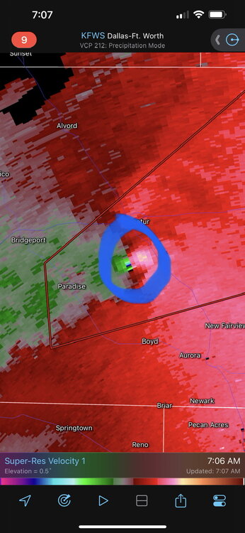
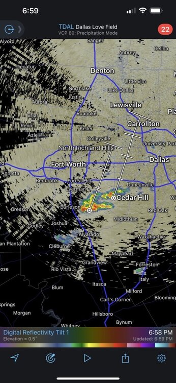
Possible rotation trying to form in the Newark and Rhome areas? Seems like the Tarrant/Denton county line needs to be watched very closely just in case.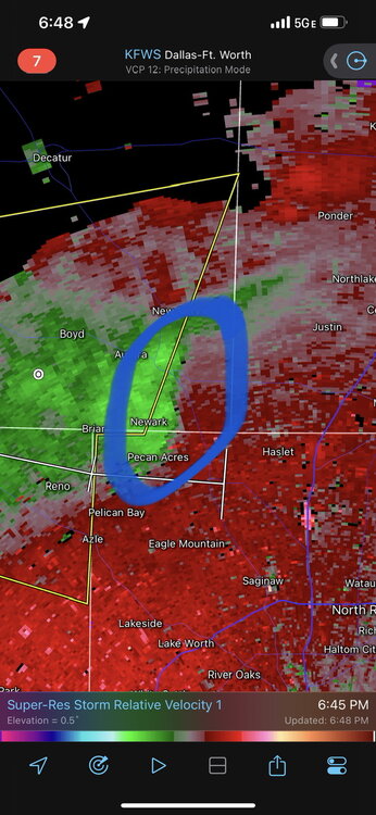
-
Texas/Oklahoma Discussion & Obs Thread 2022
Sydney Claridge replied to It's Always Sunny's topic in Central/Western States
There's a severe-warned storm along the US 59 corridor NE of Victoria and SW of Houston (near Edna) that looks ready to take advantage of the warm sector. -
January 2nd and 3rd Severe Weather Threat
Sydney Claridge replied to DanLarsen34's topic in Central/Western States
Although (obviously) I expect the greatest threat for severe thunderstorms to be east of DFW, I am starting to wonder about our risk on Monday. We are on the edge of the outlined D4 risk after all, and recent Euro (12z) and GFS (12z; waiting on the 18z) runs suggest the potential for a severe risk around noon; obviously this time frame can change! While morning severe is unusual, after the December 13th tornadoes I'm a little more alert to things like that. -
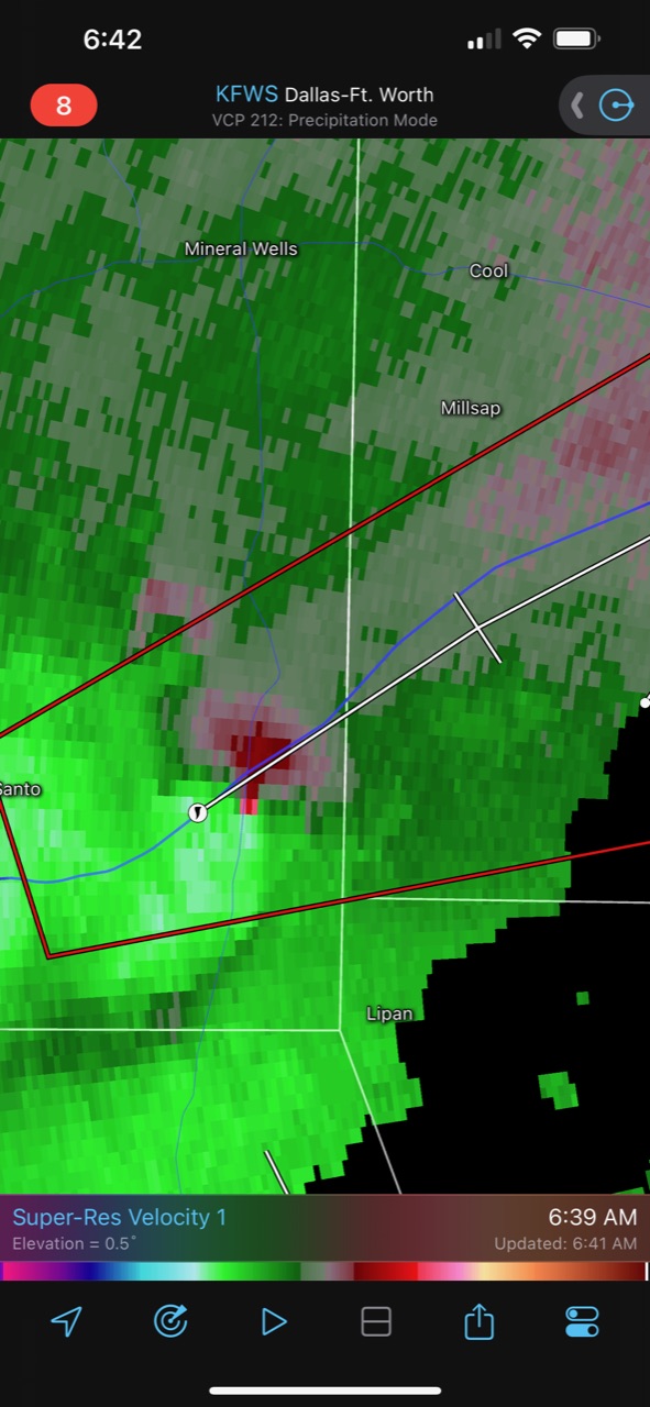
This is a concerning situation for areas in southern Decatur and south of Decatur.
-
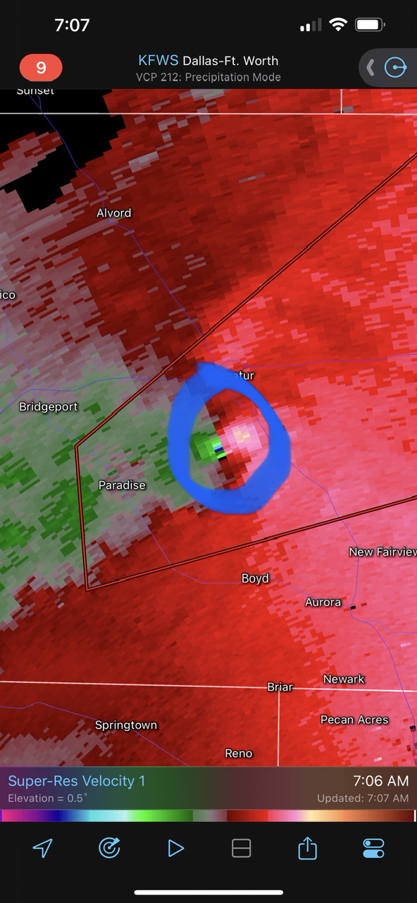
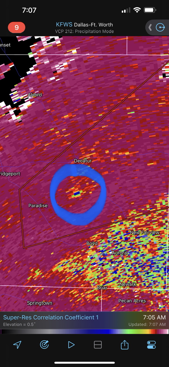
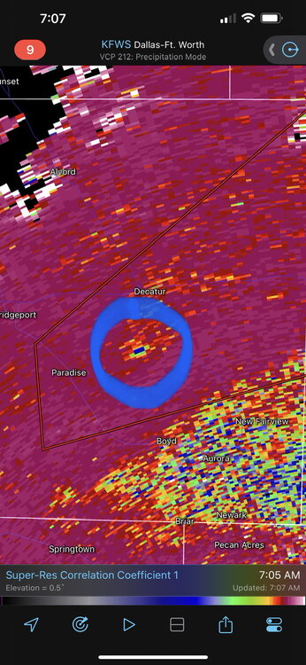
Oh boy… that’s a concerning looking rotation signature (and possible debris signature?) near the I-20/US-281 interchange. EDIT: Confirmed/observed tornado. Hopefully no one is trying to travel on I-20 in SE Palo Pinto and western Parker counties right now.


-
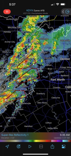
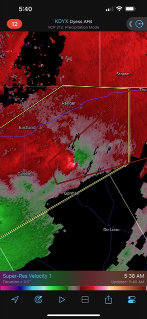
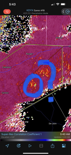
Also there’s three tornado warnings west of DFW now. I’m in central Fort Worth and I’m starting to wonder about that southernmost cell possibly becoming a problem at my location later this morning; I’m expecting the Palo Pinto (central) cell to pass to my north. EDIT: that rotational signature north of Gorman, on the southernmost cell, is looking quite concerning. EDIT 2: might this be a debris signature on the correlation coefficient? I can’t tell completely, but it wouldn’t surprise me either.
-
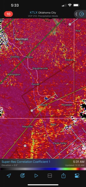
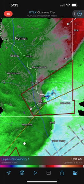
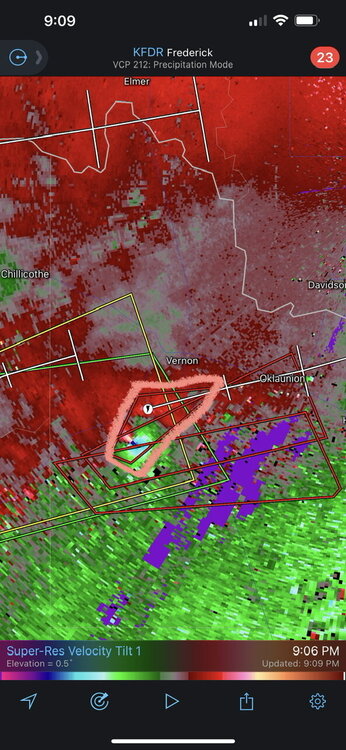
Confirmed tag on tornado warning near Wayne, OK. Correlation coefficient seems to show a possible debris signature. I’m a little surprised to see this given the marginal surface conditions (temperatures around 60) in this area.
-
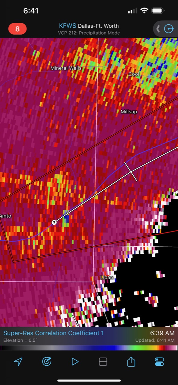
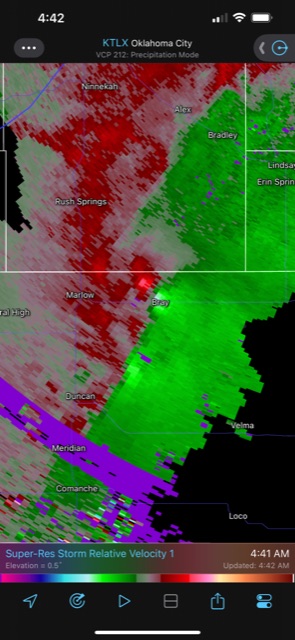
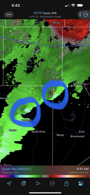
Decent circulations on tornado-warned storms near Bray, OK, Coleman, TX, and Cross Plains, TX at this early hour. If the storm around Cross Plains holds together it could become a problem for DFW a few hours from now; I’m also keeping an eye on a (non-warned) storm just north of Eastland, TX.
-
I suspect that's because they operate on Zulu/UTC time, which does not change for the switch from daylight savings time to standard time (or vice-versa).
-
Sanibel, 130 MPH.
-
We’ve had some kind of outflow boundary surge across most of Tarrant County now. I’m starting to think our severe potential just dropped. That said, it would be a different story if that boundary can come back northwest after this first round of (non-severe) storms. The boundary is surging southeast right now, so I don’t really foresee it moving back northwest, but I'll be sure to keep an eye on temperatures and dewpoints to see if they start increasing.
-
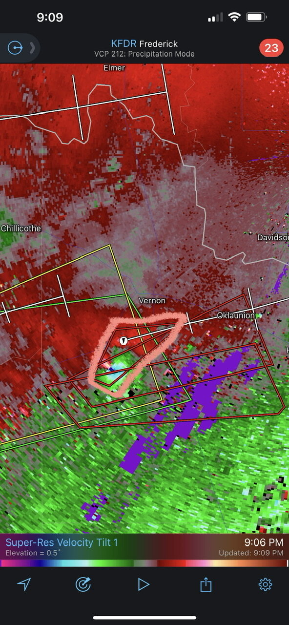
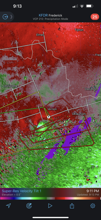
The tornado seems to be moving due north right now, but we really don’t want to get a right turn that would bring it into Vernon.
-
Wow. We have 4 warning polygons now, with Vernon now included in the newest (northernmost) polygon. I suspect the more southerly polygons are going to get canceled soon, but the storm motion is very erratic.
-
The storm motion suggested by the newest tornado warning polygon is concerning, because it suggests that the tornado could try to move towards Vernon:
-
Thank goodness. It feels like DFW dodged a bullet. Small areas of “popcorn” showers seem to be falling apart around Dublin and Hico, as well. If any of those had been able to grow into a supercell they might have posed a threat to DFW later.
-
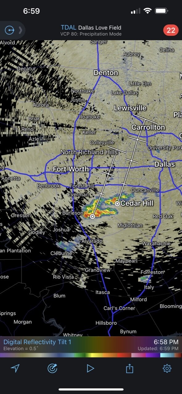
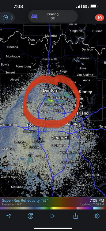
As for DFW, there's a storm initiation attempt on the Tarrant/Johnson county line, between Mansfield and Burleson. I wasn't really expecting storms in DFW, but we might need to watch out now if this storm can get going.
-
Thank goodness, because I don’t think anyone wants a damaging hailstorm over the Metroplex.
-
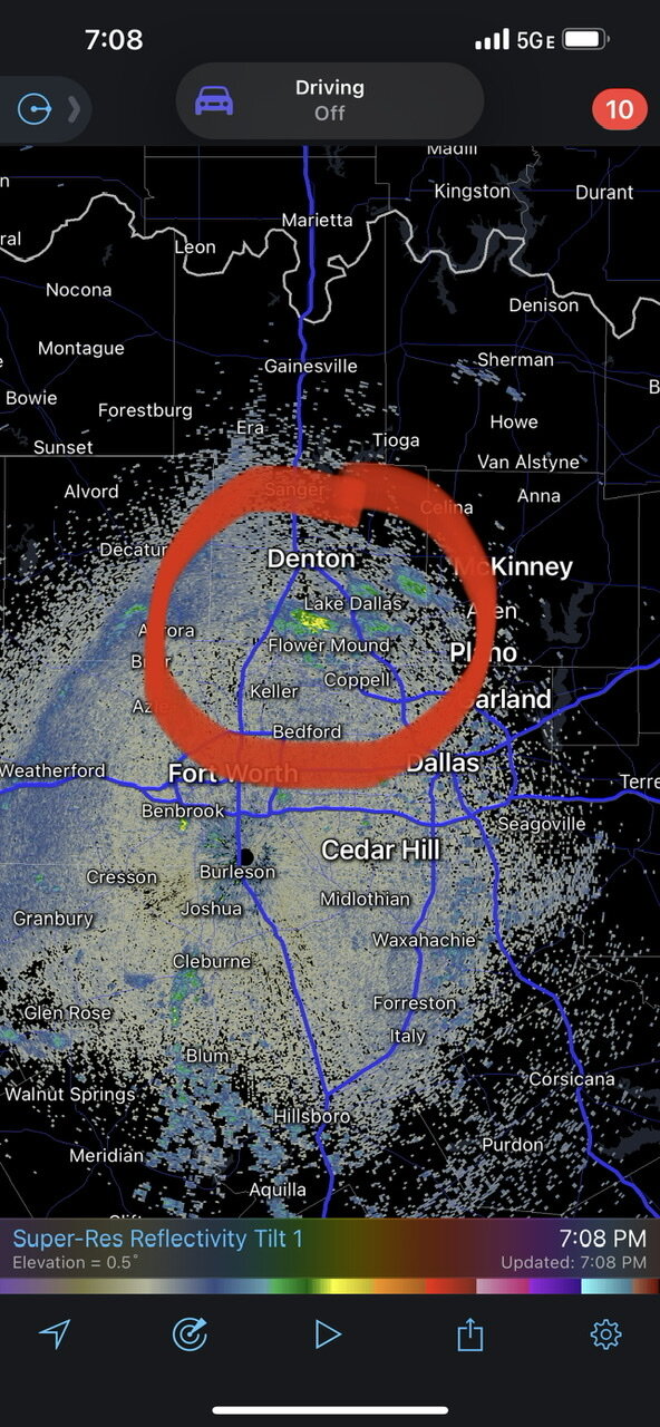
Looks like we might have some attempts at storm initiation over Denton County, TX. Nothing guaranteed though.
-
April 3-5 Severe Weather Event
Sydney Claridge replied to Powerball's topic in Central/Western States
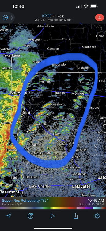
This makes me wonder if we are looking at a possible derecho tonight. That’s provided that the MCS can maintain its intensity with severe winds over a 250+ mile distance, of course. -
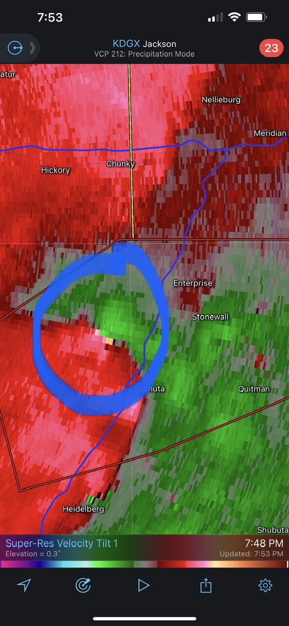
Looks like an area of stronger rotation is coming near Enterprise, MS.

-
That makes me wonder if our squall line/QLCS could line up tornado warnings along an even-longer stretch of the line. Although associated with a much stronger storm system, I recall how the squall line/QLCS on October 26, 2010 had almost-continuous tornado warnings across almost the entire north-south extent of Indiana and Ohio as it crossed eastern IN and western OH. The tornadoes that occurred that day were also embedded within the main squall line/QLCS. I do wonder if something similar could happen with our QLCS across Mississippi today (maybe not the entire north-south extent of the state). 10/26/2010 had a 15% hatched tornado risk too (albeit much further north); the high risk was only for wind. I'm not saying that 10/26/2010 is an analog for today (that was a historic storm that occurred further north); I'm rather referring to the manner in which the tornadoes occurred that day.
-
What is interesting about this setup, though, is the extent of the dry air in-between your location in South Carolina and the humid airmass in place over the Mississippi Valley. In conjunction with the strong winds, that air is dry enough to prompt SPC to issue a critical fire area across east TN, east KY, and southern OH. I know some of this is the result of downsloping winds off the Appalachians, but with such a strong storm system it is interesting that we aren't seeing more moisture transport into this region.
-
That talk about supercells makes me wonder if any of these showers and thundershowers ahead of the line, mainly in Louisiana, will try to evolve into a supercell? Even if one did, it would probably got overtaken by the squall line quite quickly (if it happened with the more developed thundershowers closer to the line).
-
2022 Short/Medium Range Severe Weather Discussion
Sydney Claridge replied to Chicago Storm's topic in Lakes/Ohio Valley
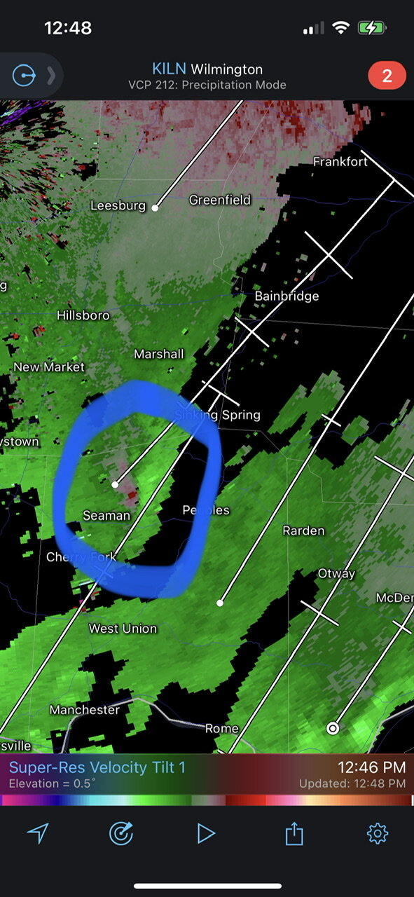
Looks like some rotation west of Peebles, OH. No tornado warning but it looks better-defined than what is on the tornado-warned storm west of Cincinnati (there’s more helicity in SE Ohio).
-
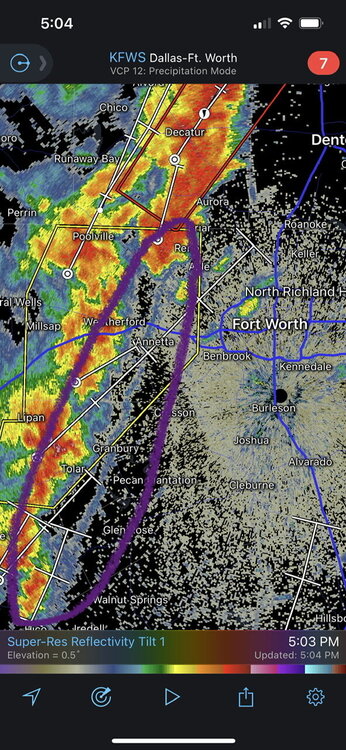
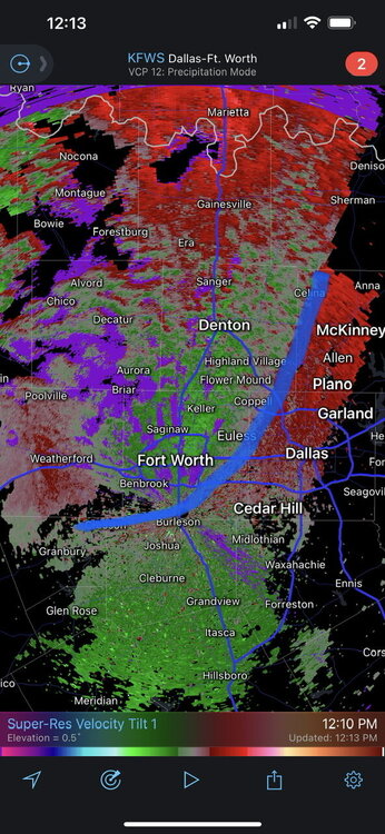
The good news for the heart of DFW is the the storms moving into the metro look to be outflow-dominant (outflow within the purple-circled line). That’s provided that something doesn’t form ahead of the line.