Sydney Claridge
-
Posts
537 -
Joined
-
Last visited
Content Type
Profiles
Blogs
Forums
American Weather
Media Demo
Store
Gallery
Everything posted by Sydney Claridge
-
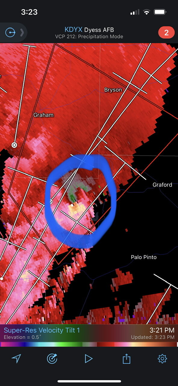
 It looked like a pretty strong-looking rotation signature west of Graford just a moment ago (it seems to have weakened slightly on the next scan).
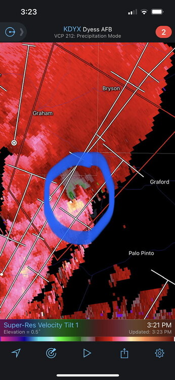
-
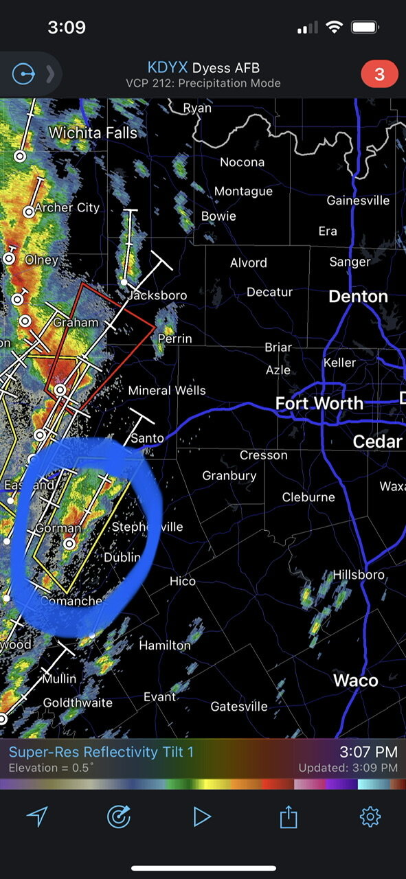
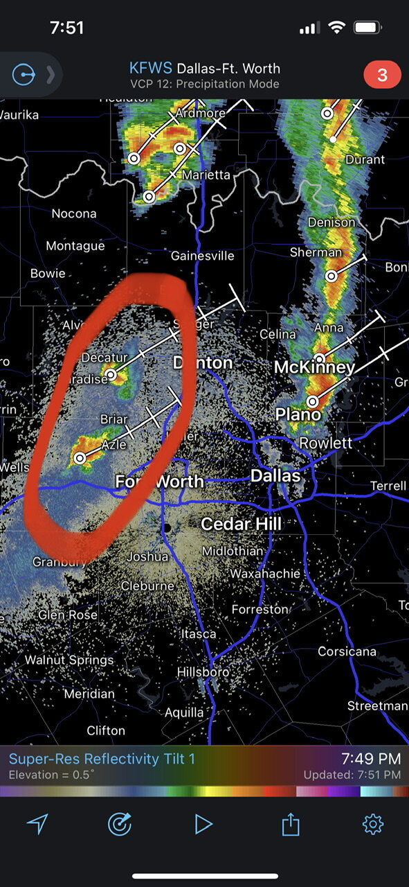
Looks like we got our first tornado warning of the day. We’ll also need to watch that (blue-circled) storm west of Stephenville too.

-
The HRRR is definitely bullish, like it almost always is. That said, this particular run (18z) does get some pretty substantial CAPE and moisture into DFW, interestingly enough. I would feel concerned about severe thunderstorm potential here if it verified, provided that a storm could take advantage of the ingredients in place.
-
For a moment there it looked like that storm around Azle was really trying to intensify, and it looks a bit weaker now.

-
Looks like DFW has a second round of storms forming.
-
That said, it seems like the radar return intensity over Irving and The Colony has increased slightly. If any storm cell in Texas is going to try to take a shot at turning severe, that tail end storm over I-35E/I-635 probably has the best shot at doing that.
-
The storms around DFW seem to be struggling to initiate into stronger cells; a local met with NBC 5 said it was because of the cap.
-
Texas/Oklahoma Discussion & Obs Thread 2022
Sydney Claridge replied to It's Always Sunny's topic in Central/Western States
I've been getting thundershowers on the west side of Fort Worth. There are other thundershowers (at the time of writing) as far west as Lipan, on what appears to be a frontal boundary along a Saint Jo-Decatur-Weatherford-Stephenville line. Given the lower dewpoints and high LCLs in that direction, I suspect these are high-based. -
Texas/Oklahoma Discussion & Obs Thread 2022
Sydney Claridge replied to It's Always Sunny's topic in Central/Western States
Getting freezing rain with some thunderstorm activity at my location in Fort Worth. We’ve also been upgraded to a Winter Storm Warning. This burst of convection looks to make things get ugly earlier than expected. -
Texas/Oklahoma Discussion & Obs Thread 2022
Sydney Claridge replied to It's Always Sunny's topic in Central/Western States
Those severe thunderstorm warnings are really starting to line up now. If I’m going to get anything in Fort Worth, the storms to the southwest (Eastland area) are probably the ones to watch.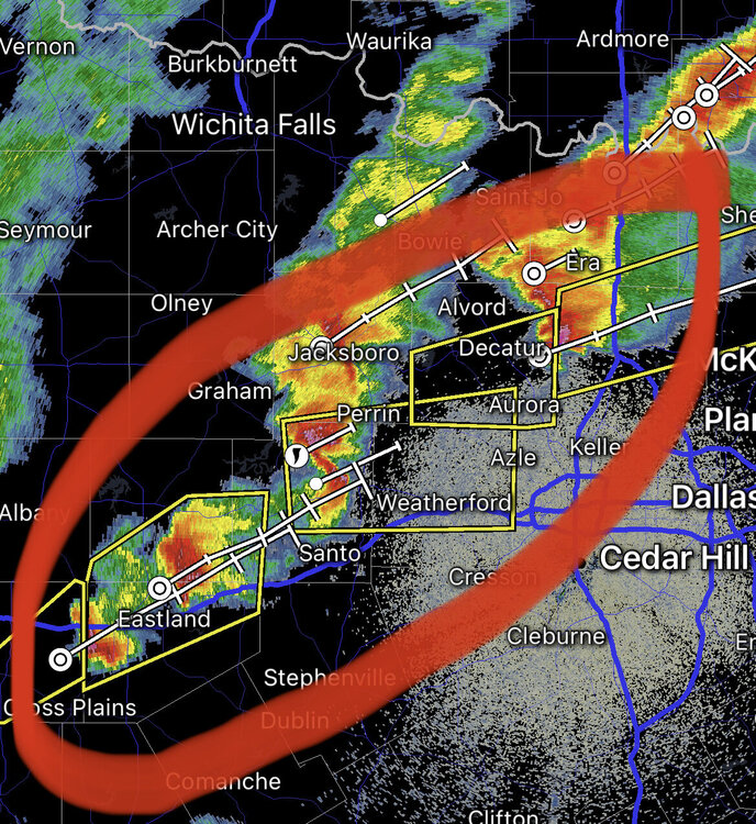
-
Texas/Oklahoma Discussion & Obs Thread 2022
Sydney Claridge replied to It's Always Sunny's topic in Central/Western States
Hail threat looks to be increasing with the intensity of that core.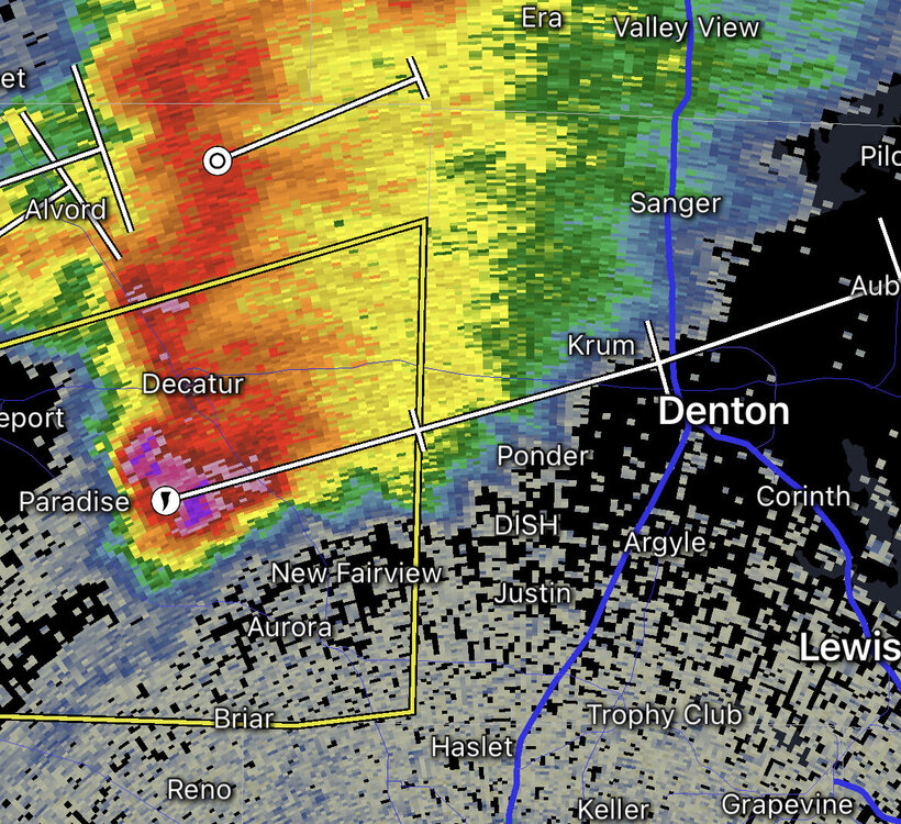
-
Texas/Oklahoma Discussion & Obs Thread 2022
Sydney Claridge replied to It's Always Sunny's topic in Central/Western States
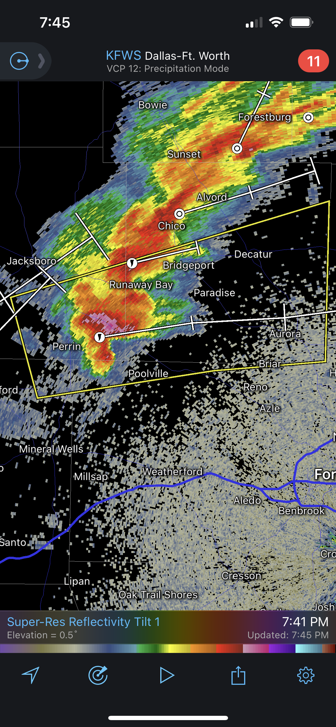
That supercell east of Perrin looks potent. I’d definitely keep an eye on any potential rotation as it approaches the higher dew points over and east of the I-35 corridor.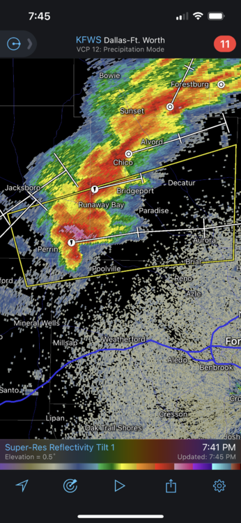
-
Severe Weather Outbreak 02/16-02/17
Sydney Claridge replied to Tallis Rockwell's topic in Central/Western States
Looks like we got our first severe thunderstorm warning over Odessa, with a risk for 70 mph wind gusts. Dew points are only in the 30s and 40s there, but there is still a little instability present. -
Enhanced Severe risk and storms Dec 31,Jan1
Sydney Claridge replied to jaxjagman's topic in Tennessee Valley
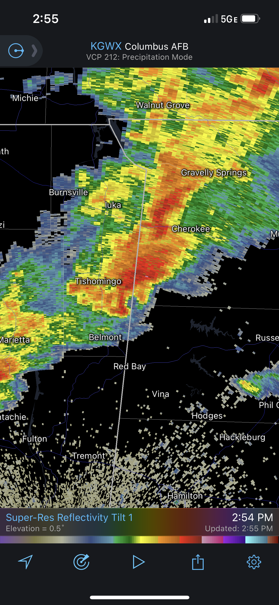
Storm on MS/AL border might have “that look” to it.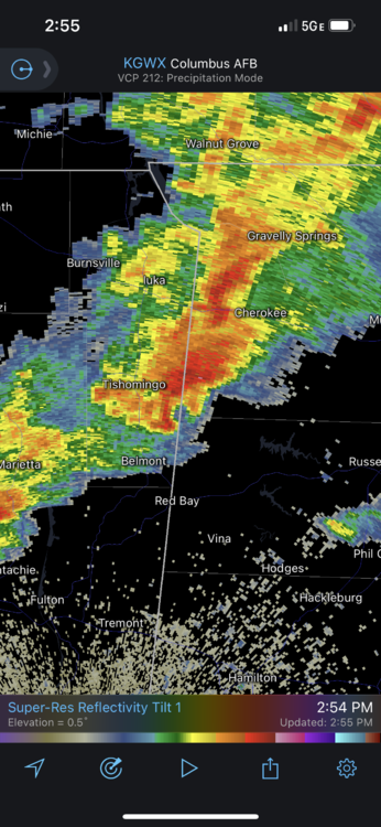
-
While well outside of this subforum (this seems to be the main thread for the event), storms are going up over the eastern DFW metroplex, much further west than expected. SPC says they are "high based" in a mesoscale discussion regarding the possibility of issuing a watch for the ArkLaTex. I do wonder what this means in terms of implications for later in the event.
-
Severe Weather event October 23rd-27th 2021
Sydney Claridge replied to weatherextreme's topic in Central/Western States
It looks like we have what appears to be an outflow-dominant squall line here.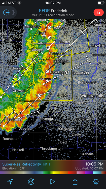
-
Severe Weather October 10th-12th 2021
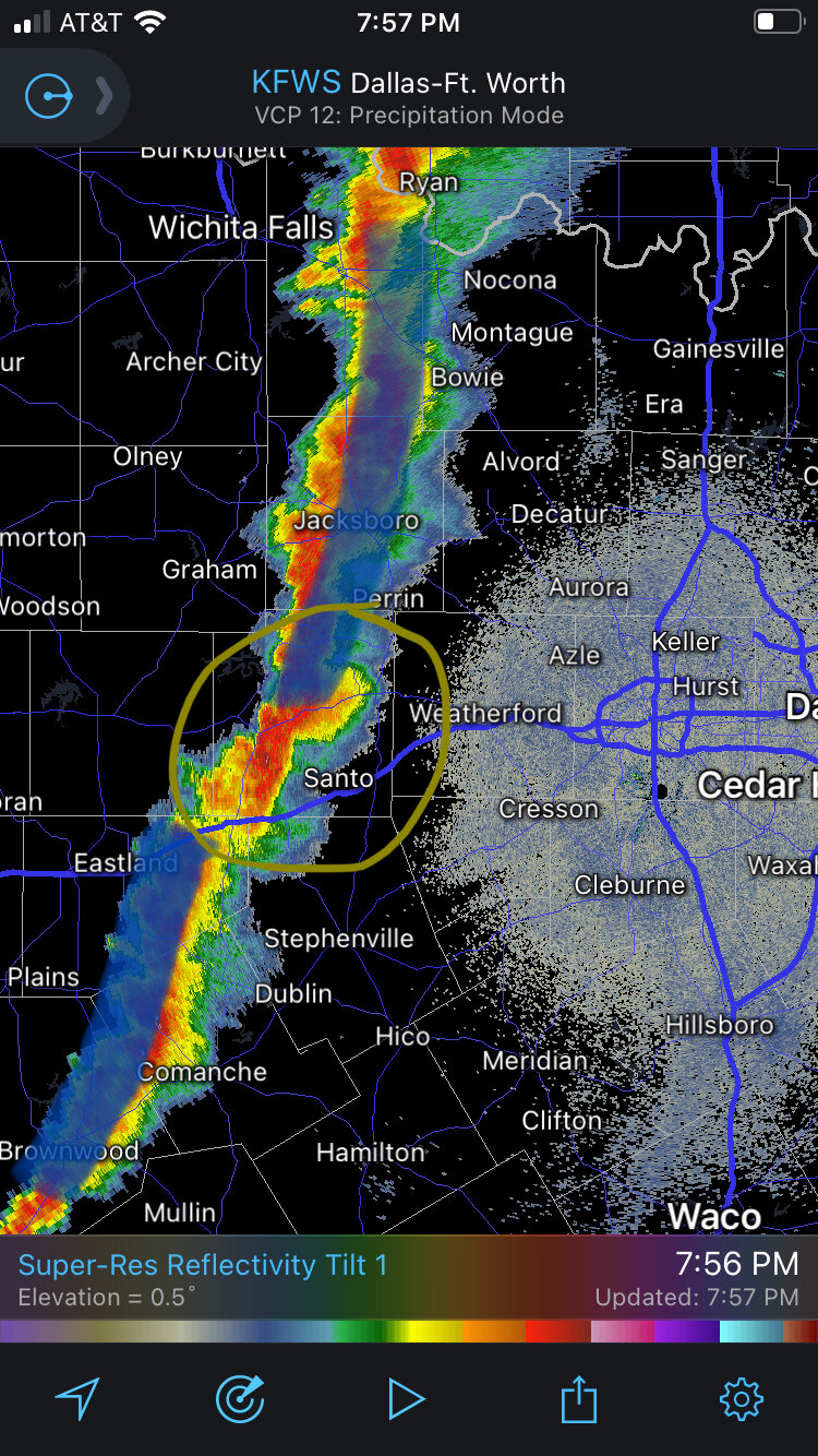
Sydney Claridge replied to Sydney Claridge's topic in Central/Western States
I wonder if this gold-circle area should be watched for potential supercell development? It looks like there is a break in the line here, or that one segment (northern) has moved ahead of the southern segment.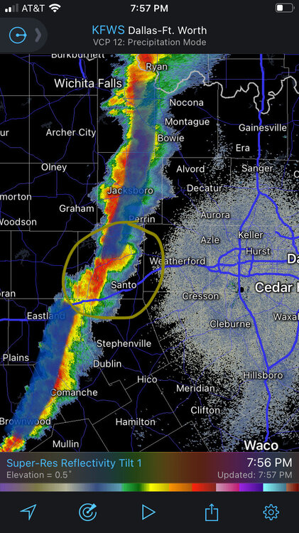
-
Severe Weather October 10th-12th 2021
Sydney Claridge replied to Sydney Claridge's topic in Central/Western States
Damaging 70-80 mph winds coming into the Mustang/Yukon area per News 9 live stream. There is a kink in the line there too, although the News 9 live stream does say it is slightly behind the cool front. -
Severe Weather October 10th-12th 2021
Sydney Claridge replied to Sydney Claridge's topic in Central/Western States
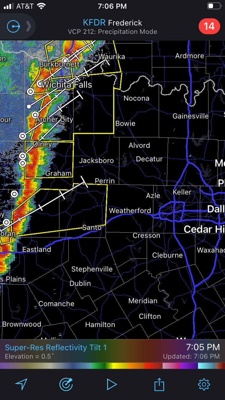
Severe-warned storm coming out of the Breckenridge area needs to be watched for the DFW Metroplex within the next few hours.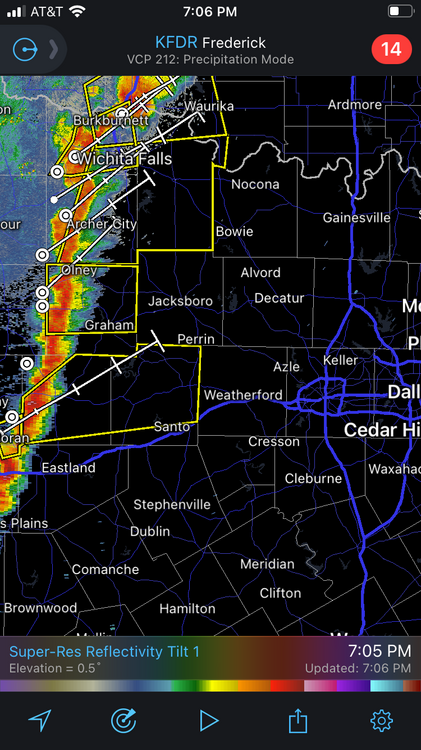
-
Severe Weather October 10th-12th 2021
Sydney Claridge replied to Sydney Claridge's topic in Central/Western States
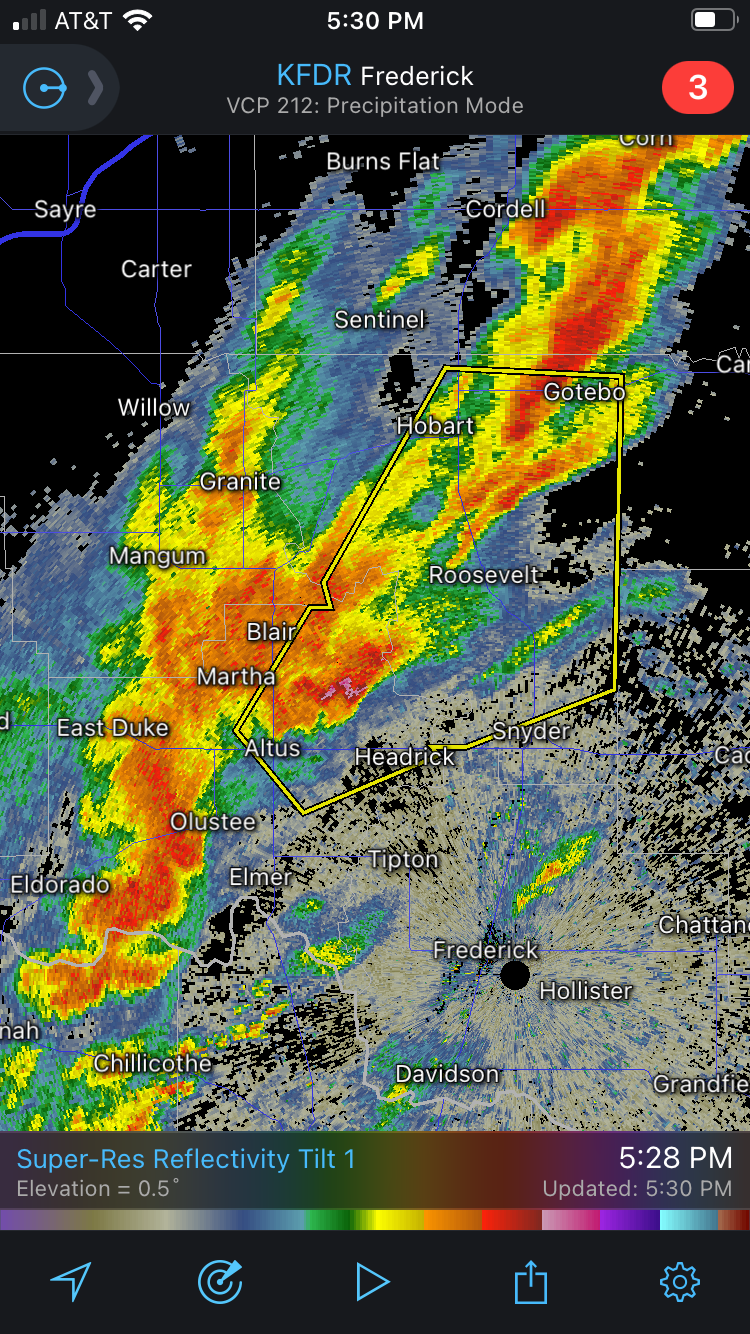
Definitely looks like this is the dominant cell right now, with a severe thunderstorm warning.
-
Severe Weather October 10th-12th 2021
Sydney Claridge replied to Sydney Claridge's topic in Central/Western States
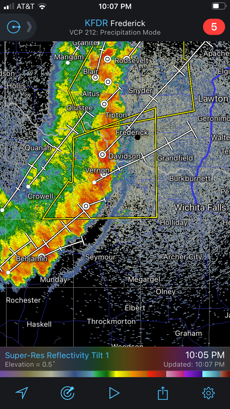
Looks like there might be some weak rotation on that cell over Altus. -
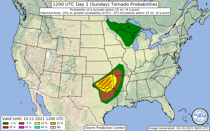
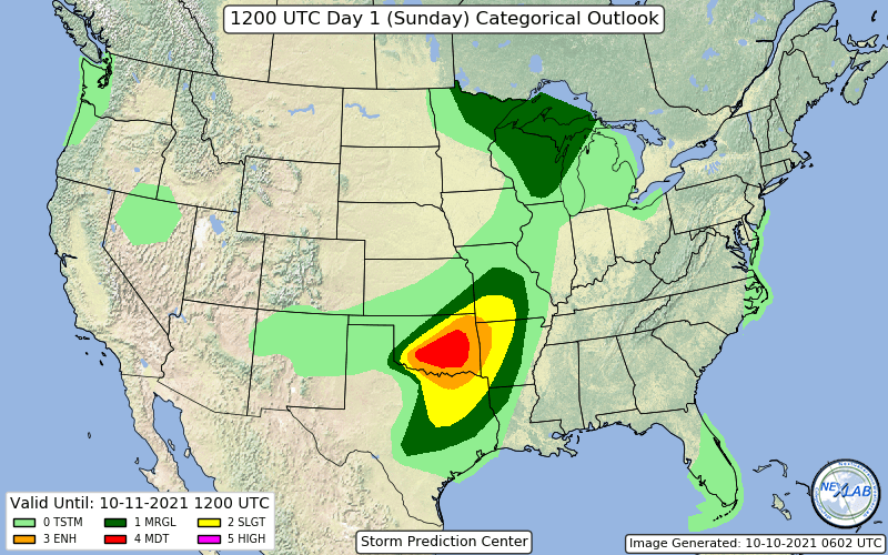
Might as well start a thread for this event. We have a moderate risk, with a 15% hatched tornado probability across central Oklahoma.
-
And there is now a TOR warning on the MN/WI border SW of Grantsburg.
-
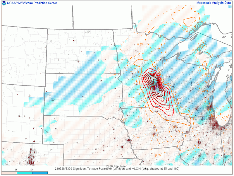
Part of me feels that SPC went with a Severe Thunderstorm Watch specifically so that they could label it as a Particularly Dangerous Situation for straight-line winds. Tornado probabilities are at the maximum (20%) for a SVR watch, while the SPC outlook has a 10% tornado probability (within 25 miles of a point); normally we would expect a Tornado Watch with a 10% on the outlook, barring some post-outlook "nowcasting" suggesting lower probabilities. Typically I've noticed that 10% contours almost always lead to Tornado Watches, while 5% contours can go in either direction (that is, either a SVR or a TOR watch).
-
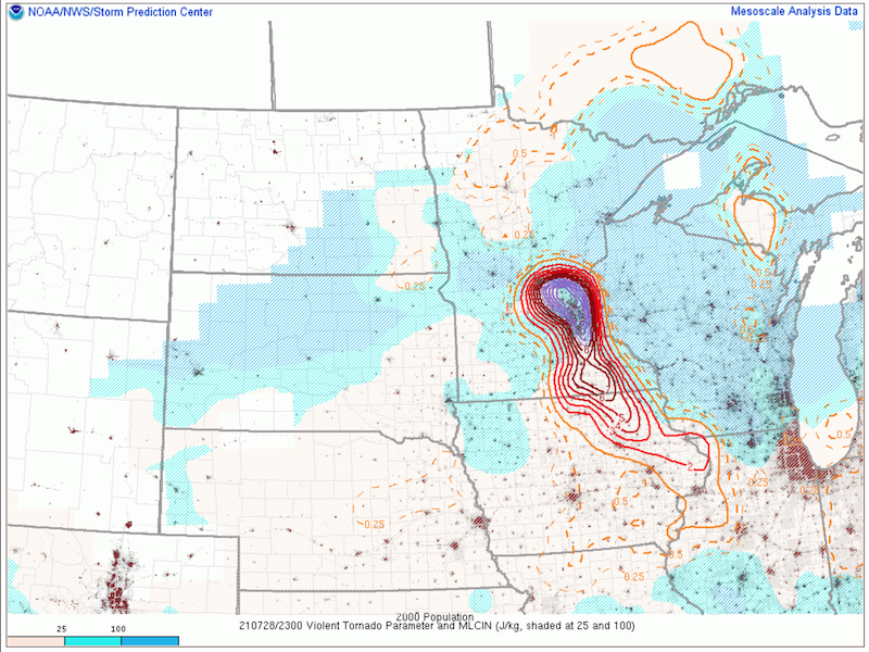
The parameters for significant tornadoes and the Violent Tornado Parameter are both very high over the Twin Cities metro area. These parameters are not everything by themselves, but still, it is not an environment you would want a supercell to form and then go on to produce a significant tornado, especially over a highly populated metropolitan area like MSP.