

olafminesaw
-
Posts
3,054 -
Joined
-
Last visited
Content Type
Profiles
Blogs
Forums
American Weather
Media Demo
Store
Gallery
Posts posted by olafminesaw
-
-
It generally has a cold bias, but the ICON looks nice. I'm not counting on that first push of moisture though.

-
 1
1
-
-
According to somone on Reddit, this is 4" short of the daily record

-
1
-
-
Extra wedgy wedge wedgie.

-
1 hour ago, PackGrad05 said:
NAM3k simulated radar shows a sharp line of heavy rain moving through central NC. Not really any show (verbatim on sim radar), but definitely the potential of black ice since the freezing temps look to set in by 11PM. That only gives about 3-4 hours of drying time prior to any standing water freezing.
I kinda doubt it, with how warm and sunny it was today.
-
I'm not too enthusiastic, seeing as we really have to thread the needle to make this work. I suppose that's usually the case in the South though.
-
6 minutes ago, Wow said:
Too lazy to research but has there ever been recorded single digit highs for the piedmont area of NC?
Greensboro: 13 (1966)
Asheboro: 17 (1994)
RDU:17 (1985)
Fayetville: 17 (1889) (Curiously, in February)
-
1
-
-
Single digit highs anyone?

-
2
-
-
1 minute ago, mclean02 said:
Whew not sure if that has happened in Greensboro before 10 degrees and snowing ! lol

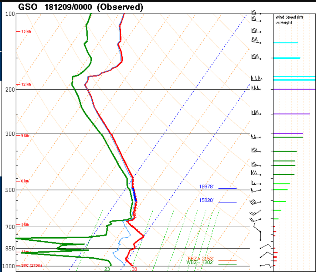
I don't understand how that can be snow, with that sounding, that's like, the opposite of saturated.
-
1
-
-
24 hours, 47" max over Dulles. Has to be one of the craziest fantasy maps I've seen for DC.

-
2
-
 2
2
-
-
33 minutes ago, ajr said:
Just for fun, the 12z FV3 has about the mother of all snowstorms out in fantasy land around hours 324-348 -- spots of 2"+ QPF and all snow through SE NC into SC.
And another on it's heels.
-
1
-
-
-
We can't even do warm days right, with the real warmth arriving after sunset. Gusty winds though to blow in the new year. I'll be driving back to NC tomorrow where snow chances are even more bleak, but no complaints given the foot we received a few weeks back.

-
Sneaky system tonight, may be able to pick up a dusting

-
4 minutes ago, Ralph Wiggum said:
Every time an epic weeklies is mentioned a unicorn loses it's horn.
At this point it would be nice just to be in puppy neck snapping range.
-
2
-
-
-
That cutoff, lol.

-
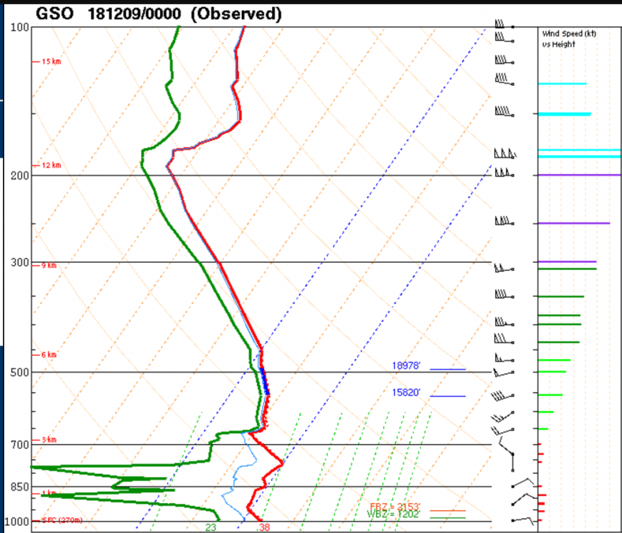
Tonight's 0z GSO sounding. Very dry.
-
1
-
 2
2
-
-
1 minute ago, Brick Tamland said:
One NAM run
One NAM run to rule them all, One NAM run to find them,
One NAM run to bring them all, and in the darkness bind them
-
1
-
3
-
 1
1
-
2
-
-
-
-
6 minutes ago, Poimen said:
For the Triad, there is more or less a consensus for snow beginning around 1 am and continuing as all snow through 11am-noon, before mixing with and changing to sleet. We'd have to pull 1" per hour rates just to get 10-11". Experience says that is unlikely. So we're probably looking more like 7-9" on the high end, with some sleet on top. That's my call, but I'm of course hoping for more.
There's that psychological factor of hitting double digits, or the one foot mark, but all and all it should be a pretty satisfying storm, as long as we can get a few impressive snow bands before the changeover. On the plus side, we don't have to worry about melty mush snow, we get the best during the daytime and it should stick around for a few days.
It looks like the latest RAP joins the consensus with sleet coming in around 11 am.
-
1
-
-
1 minute ago, Poimen said:
Got an mPing of snow in Clemmons (near Winston). I'm not expecting it, but it would be nice if we could get things started earlier than ~1am here.
I saw that too, a tad suspicious. But wouldn't surprise me to get a steady, very light snow starting at around 10 pm. It would be nice to see a dusting before I try to get some sleep.
-
2
-
-
RAH still going with all snow during the daytime Sunday. Seems pretty unlikely at this point.
-
1
-
-
Just now, mclean02 said:
Was that a Gso sounding ?
Yes.
3 hours later is a different story


February 23-25th Winter Storm
in Lakes/Ohio Valley
Posted
The hires nam legit drops 6" of snow in an hour with this band. I don't think I've ever seen that even modeled.