olafminesaw
-
Posts
4,423 -
Joined
-
Last visited
Content Type
Profiles
Blogs
Forums
American Weather
Media Demo
Store
Gallery
Everything posted by olafminesaw
-

January 30th- Feb 1st ULL and coastal storm obs
olafminesaw replied to JoshM's topic in Southeastern States
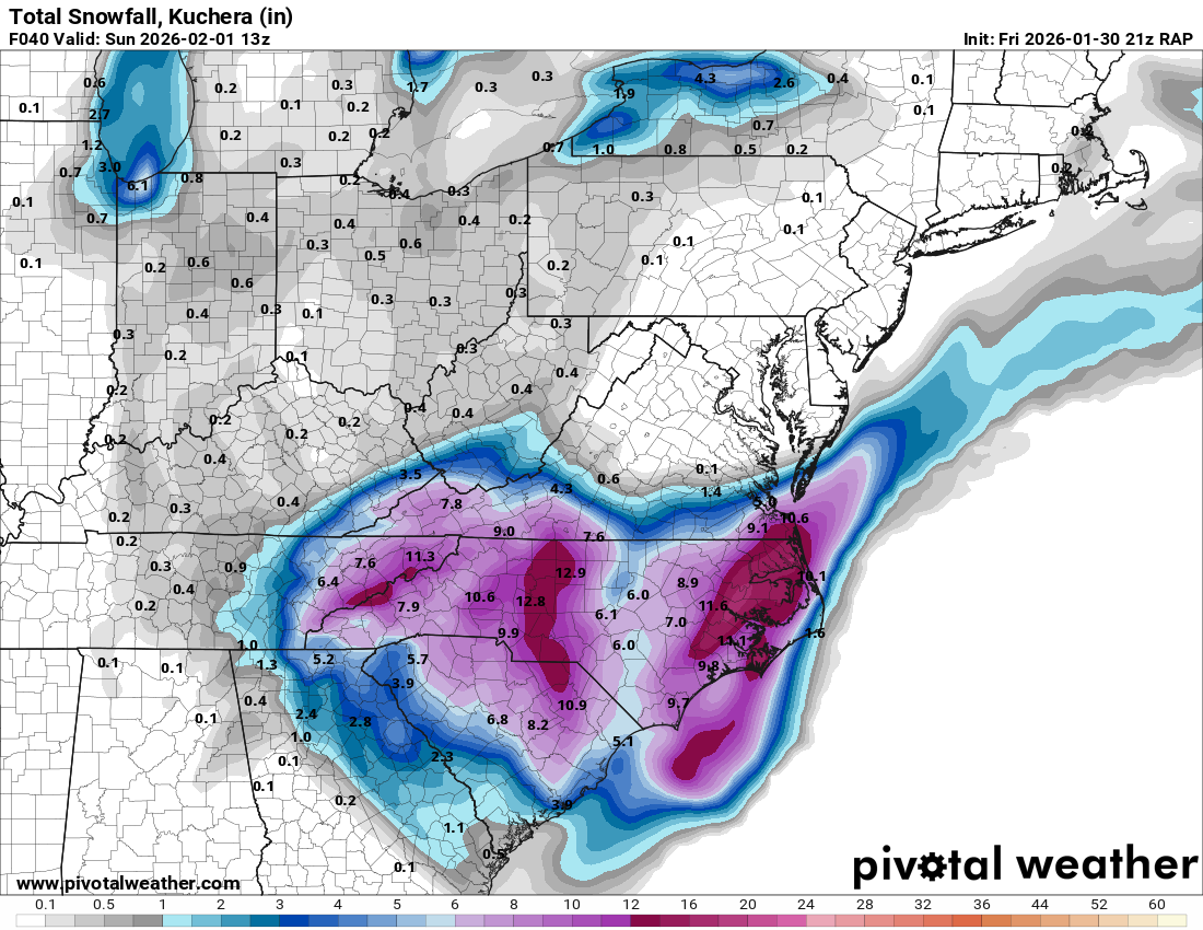
Some in that Western max had over 20:1 ratios. GSO reported .4" liquid -
January 30th- Feb 1st ULL and coastal storm obs
olafminesaw replied to JoshM's topic in Southeastern States
9", should be about wrapped up
- 937 replies
-
- 10
-

-
January 30th- Feb 1st ULL and coastal storm obs
olafminesaw replied to JoshM's topic in Southeastern States
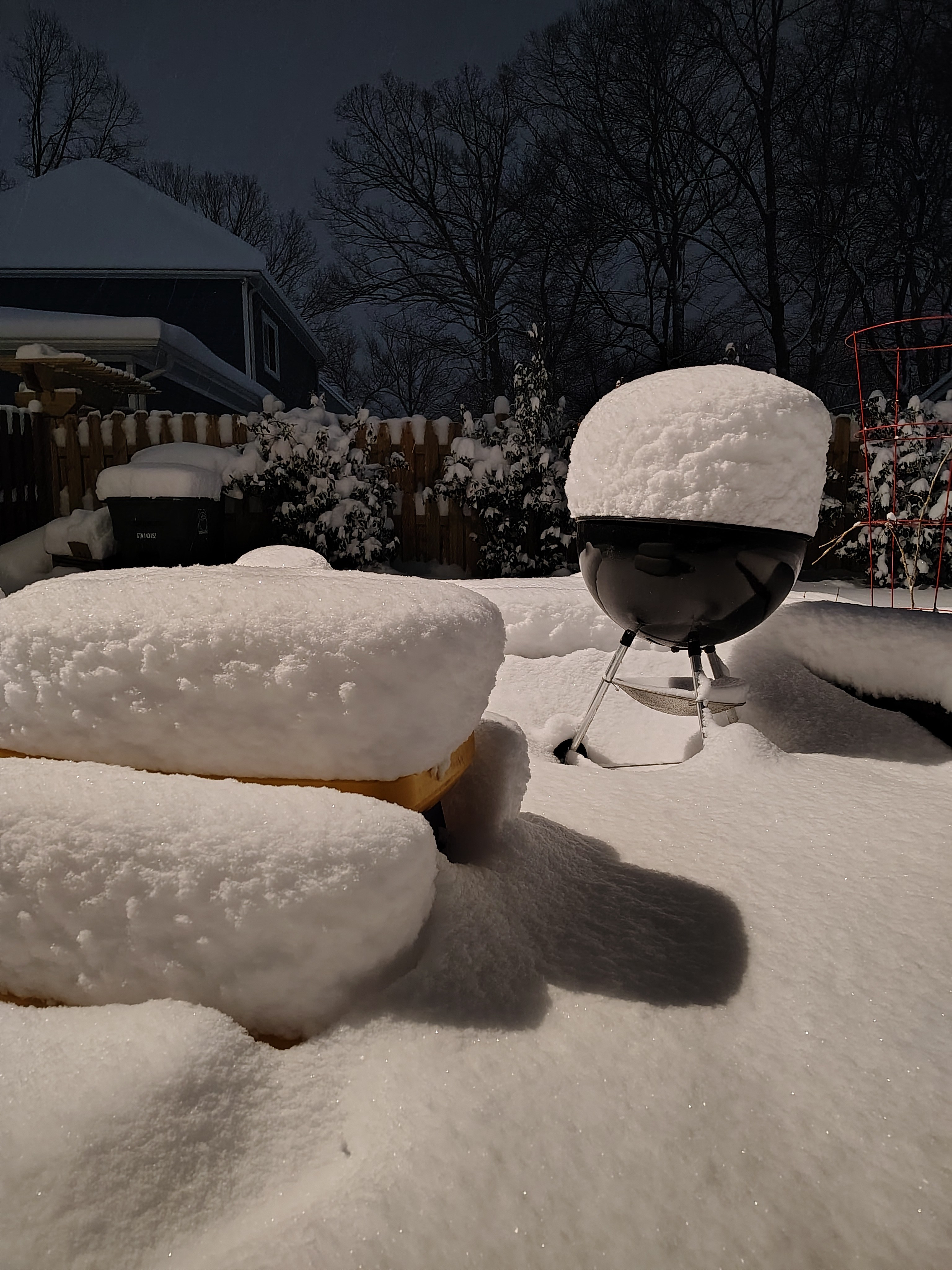
Just over 4" in South Greensboro -
The “I bring the mojo” Jan 30-Feb 1 potential winter storm
olafminesaw replied to lilj4425's topic in Southeastern States
He called it days ago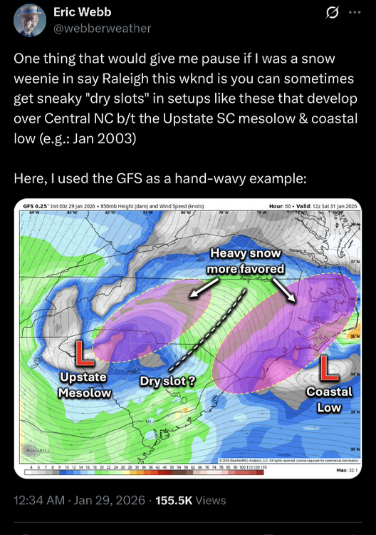
-
January 30th- Feb 1st ULL and coastal storm obs
olafminesaw replied to JoshM's topic in Southeastern States
This zone has been getting pounded all day.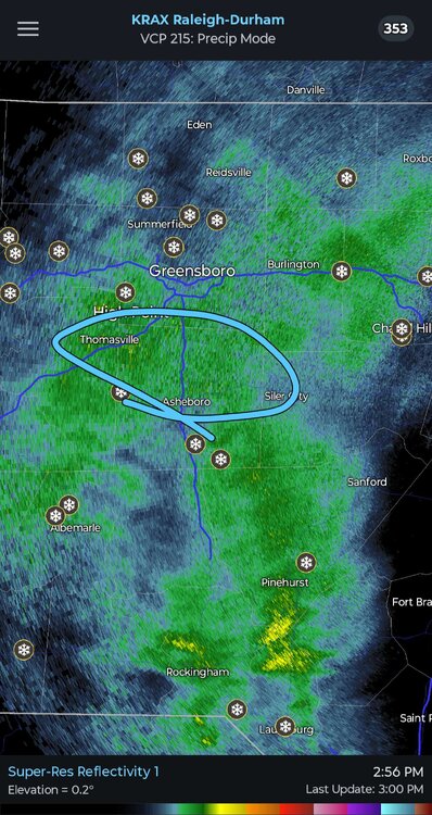
-
The “I bring the mojo” Jan 30-Feb 1 potential winter storm
olafminesaw replied to lilj4425's topic in Southeastern States
Feel pretty happy with the map I made last night based on how things are currently playing out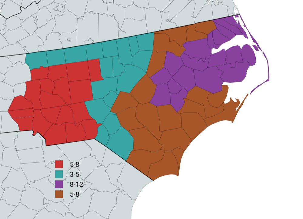
-
January 30th- Feb 1st ULL and coastal storm obs
olafminesaw replied to JoshM's topic in Southeastern States
Deformation band about to swing through too should be 1"per hour rates easy -
January 30th- Feb 1st ULL and coastal storm obs
olafminesaw replied to JoshM's topic in Southeastern States
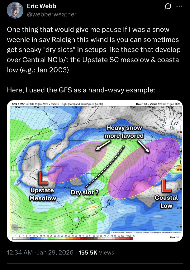
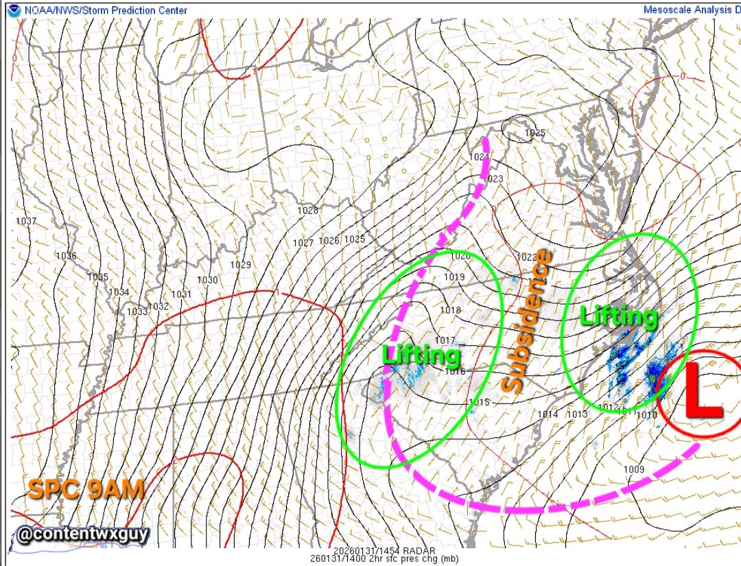
The RAP hasn't been perfect but it has easily been the best short range model for this storm so far. Consistent on showing the dry slot in the right place and the band from Charlotte extending up to the VA border. -
The “I bring the mojo” Jan 30-Feb 1 potential winter storm
olafminesaw replied to lilj4425's topic in Southeastern States
You can see the dry slot begining to shrink, I think Wake county should be getting into it in about 2-3 more hours -
January 30th- Feb 1st ULL and coastal storm obs
olafminesaw replied to JoshM's topic in Southeastern States
Sorry Raleigh friends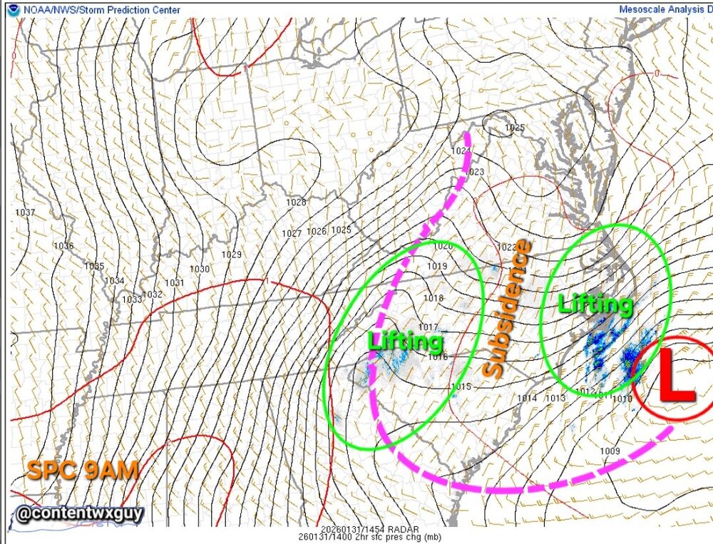
-
The “I bring the mojo” Jan 30-Feb 1 potential winter storm
olafminesaw replied to lilj4425's topic in Southeastern States
Models are notorious for under doing moisture associated with robust ULLs. I think the Western ULL piece will over perform West of 85 and the coastal generally underperform -
January 30th- Feb 1st ULL and coastal storm obs
olafminesaw replied to JoshM's topic in Southeastern States
Already a dusting at GSO, bodes well as that frontogenesis gets cranking -
The “I bring the mojo” Jan 30-Feb 1 potential winter storm
olafminesaw replied to lilj4425's topic in Southeastern States
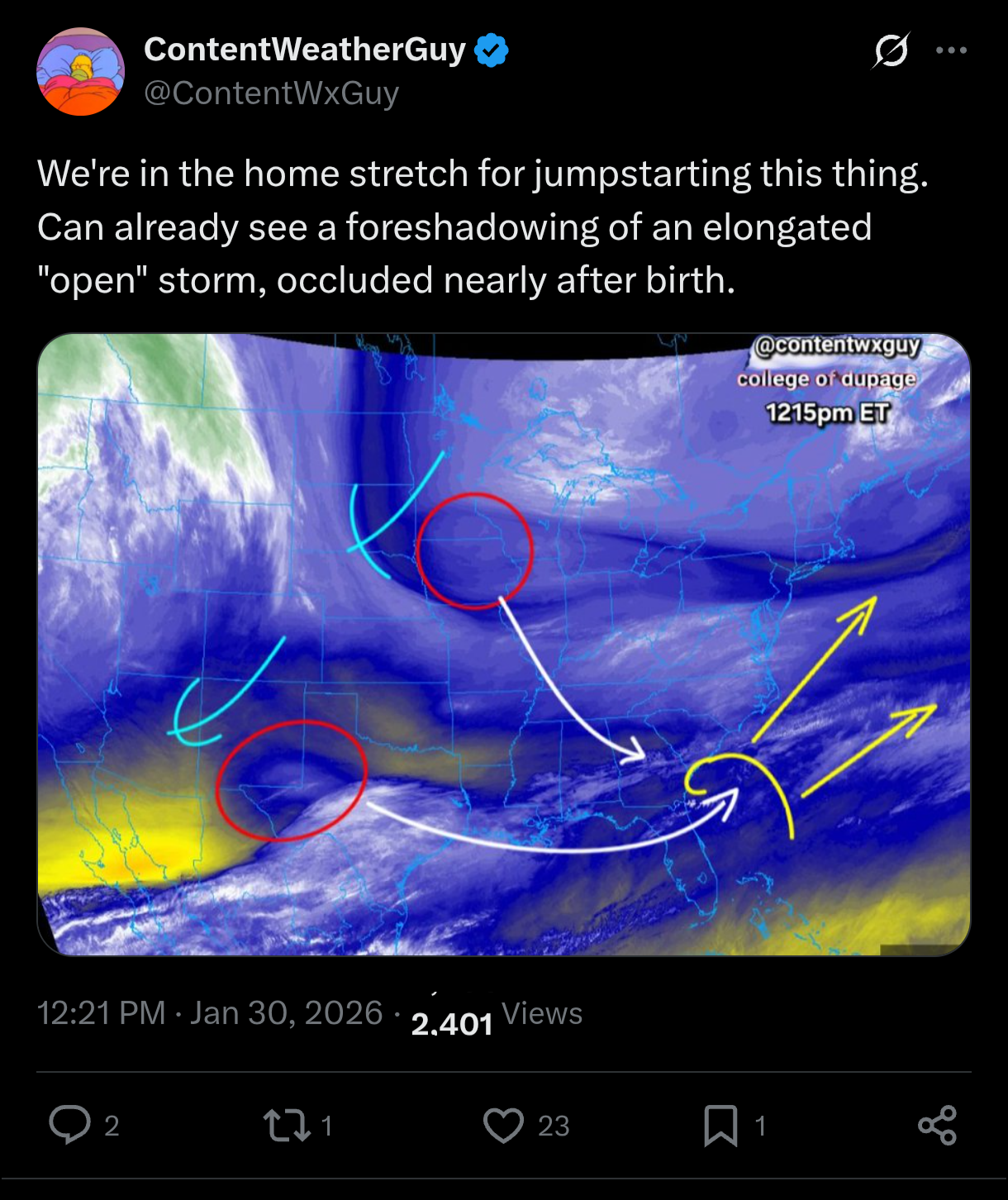
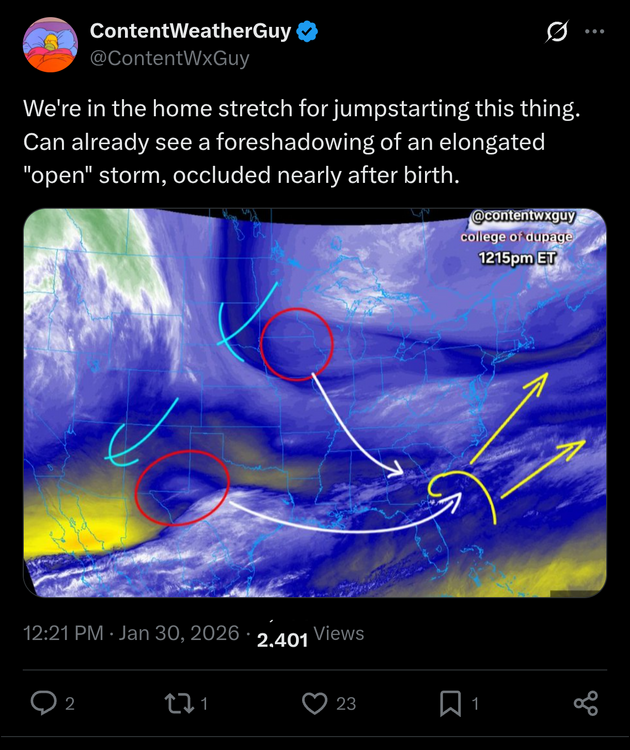
https://x.com/jackendrickwx/status/2017357675755933951?s=20 Really cool, you can see the trough diving down and starting to tilt -
The “I bring the mojo” Jan 30-Feb 1 potential winter storm
olafminesaw replied to lilj4425's topic in Southeastern States
-
The “I bring the mojo” Jan 30-Feb 1 potential winter storm
olafminesaw replied to lilj4425's topic in Southeastern States
I know the RAP sucks, but why not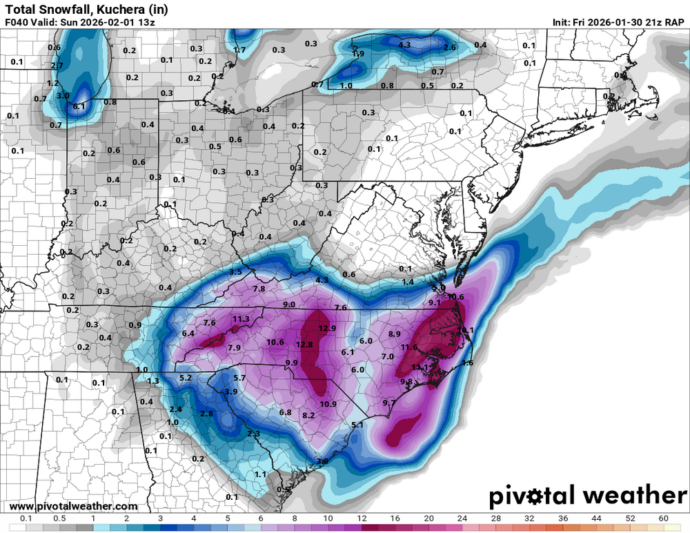
-
The “I bring the mojo” Jan 30-Feb 1 potential winter storm
olafminesaw replied to lilj4425's topic in Southeastern States
-
The “I bring the mojo” Jan 30-Feb 1 potential winter storm
olafminesaw replied to lilj4425's topic in Southeastern States
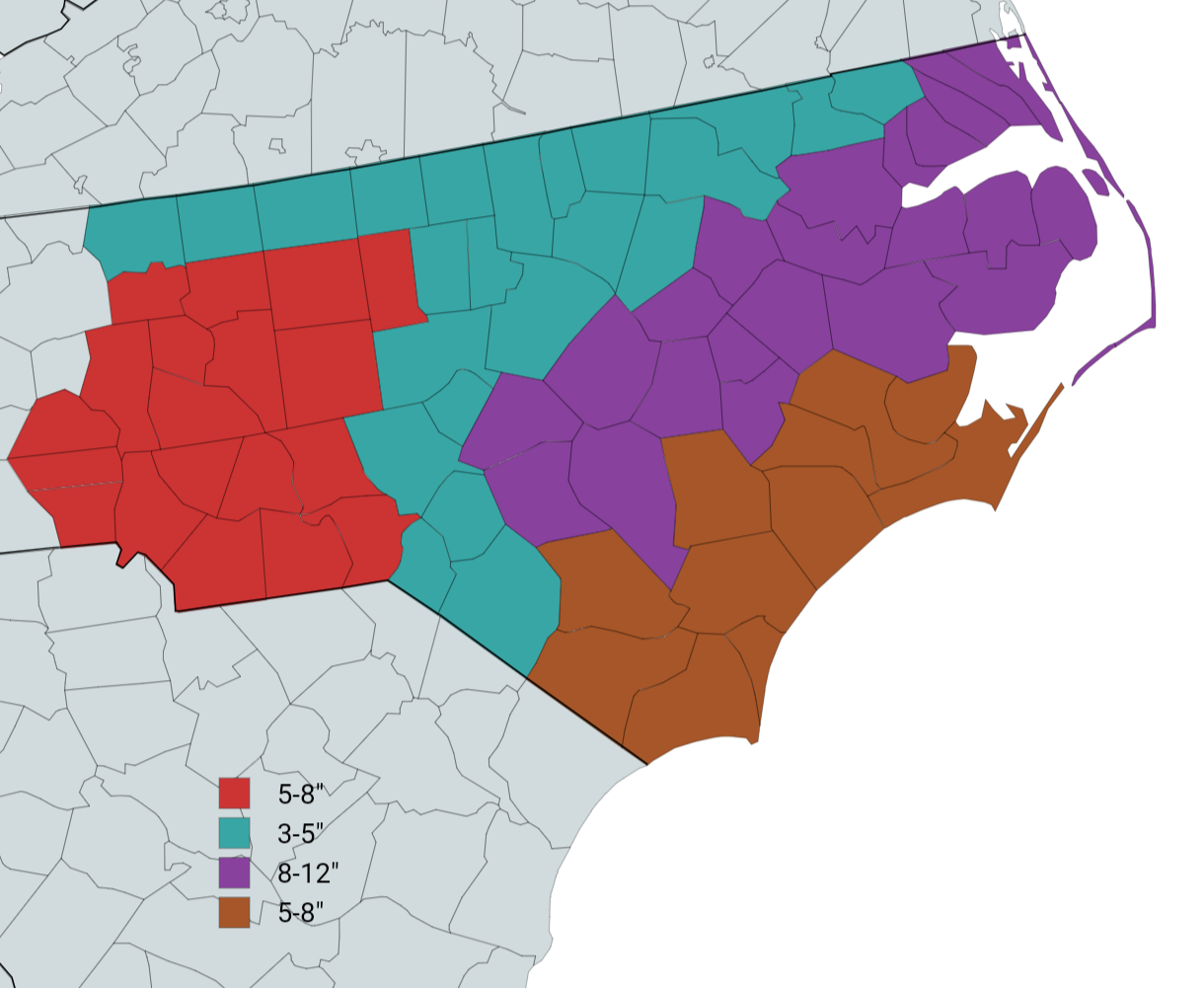
I corrected the gradients between the zones
-
The “I bring the mojo” Jan 30-Feb 1 potential winter storm
olafminesaw replied to lilj4425's topic in Southeastern States
My forecast map (first time I've done one of these I think)
-
The “I bring the mojo” Jan 30-Feb 1 potential winter storm
olafminesaw replied to lilj4425's topic in Southeastern States
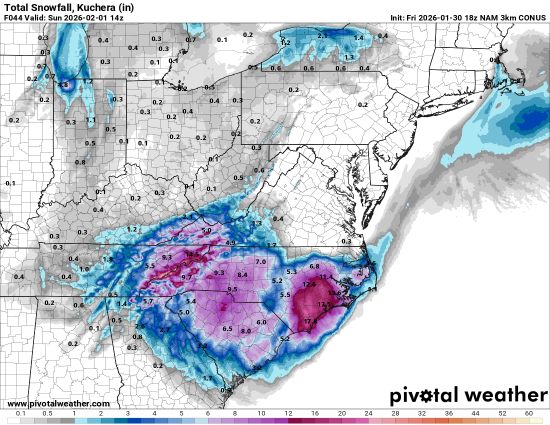
I think the hires NAM has stumbled upon a pretty realistic depiction of how this will play out. ULL max zone, coastal crush zone. Screw zone in between. Maybe cut precip totals by 25-50% overall and call it a day. Screw zone location TBD depending on timing, trough tilt etc.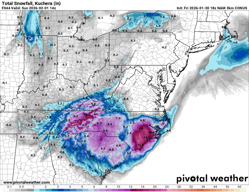
-
The “I bring the mojo” Jan 30-Feb 1 potential winter storm
olafminesaw replied to lilj4425's topic in Southeastern States
The HRRR is really only good for taking radar trends as the event unfolds (under 8 hours) and creating a kind of future radar projection. And for thermal profiles. I wish they had never made it run past 18 hours -
The “I bring the mojo” Jan 30-Feb 1 potential winter storm
olafminesaw replied to lilj4425's topic in Southeastern States
The Hires NAM looks great so far, lol. -
The “I bring the mojo” Jan 30-Feb 1 potential winter storm
olafminesaw replied to lilj4425's topic in Southeastern States
They are doing damage control for it/when the forecast busts. I get the get blowback, and especially after last week's storm they are sensitive to their viewer's response if the forecast busts. But ultimately it's bad forecasting to pick the models with the lowest amounts and find justification for why it's going to be correct -
The “I bring the mojo” Jan 30-Feb 1 potential winter storm
olafminesaw replied to lilj4425's topic in Southeastern States
Yeah I mean I would say the trend is meaningful and somewhere in the Piedmont is likely to get the dry slot. At the same time, the HRRR and 3km NAM solutions just don't quite pass the sniff test. Not sure they are handling the ULL/phase correctly. It's more concerning for the Triad. I think the Triangle gets the coastal/WAA banding and should hit 3"+ no problem -
The “I bring the mojo” Jan 30-Feb 1 potential winter storm
olafminesaw replied to lilj4425's topic in Southeastern States
For sure. Better for the Triangle and points East. May dry slot the Triad -
The “I bring the mojo” Jan 30-Feb 1 potential winter storm
olafminesaw replied to lilj4425's topic in Southeastern States
HRRR is running. Dry and a late start so far East of 77, but starting to crank by late morning