olafminesaw
-
Posts
4,431 -
Joined
-
Last visited
Content Type
Profiles
Blogs
Forums
American Weather
Media Demo
Store
Gallery
Everything posted by olafminesaw
-

-
Wet bulb temp running 4 degrees below forecast at GSO
-
We are relying on lift from the WAA to wring moisture out after the frontal passage. Since our system remains weak, it only will produce light precip
-
N and West of 85 looking pretty dry. My gut is somewhere between Raleigh/Rocky Mount/Greenville will do well as well as the northern foothills. Hires models this morning have trended in that direction as well
-
Can you spot the dry slot?
-
Around Valentine's Day features a cutter on all models. Seems like some potential for CAD/messy ice situation depending on track/ridge placement. Also could feature borderline severe if the low tracks across New England instead of PA
-
The latest GRAF is also super light with precip. I don't think that the triad is going to get more than a dusting, based on the trend on the short range models
-
Sad trombone noises
.thumb.png.6a1b7e4bcb7451665576749b6facd02b.png)
-
Speaking of which, the HRRR joins many other models in painting the southern band directly over Guilford county. Schrödinger's snow band if you will.
-
Putting all my money on wherever the HRRR doesn't have the band
-
The hires RGEM killed it on the last two storms. Especially the one two weekends ago, but here's a run from Friday that did fairly well as well
.thumb.png.859d9a8d0189e41e652f742df629a988.png)
-
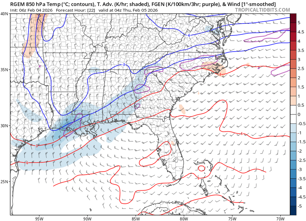
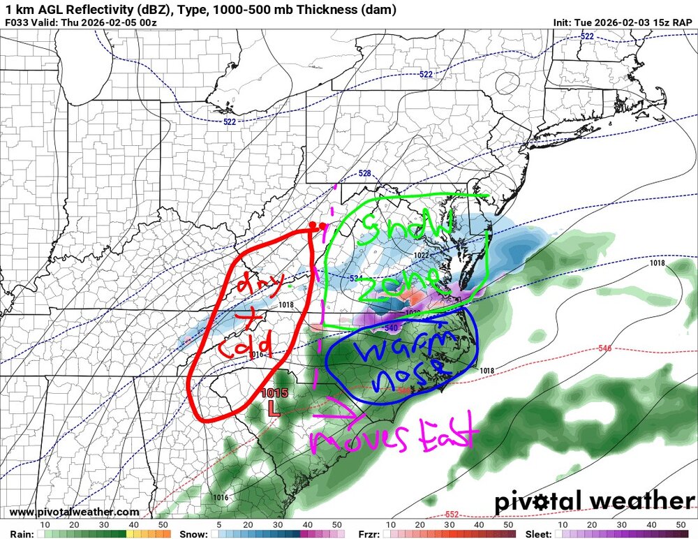
RAP illustrates my thoughts. Need to be able to get moisture and the cold to push far enough south, before cold/dry air shuts off the moisture. Moisture North of the warm front may be somewhat limited but concentrated in a band or two that may over perform. The RAP is a bit further north than the rest of guidance, so I would expect the green zone to set up right along I85
-
Some pretty insane banding showing up on the hires RGEM
.thumb.png.a28be7467e83d0763c4b51557a906694.png)
-
Actually I would say Eastern Tennessee is the King of the warm nose and North Carolina is the court Jester
-
One reason we are seeing less potential in NC is a small warm nose showing up on short range models. It was looking like a changeover to snow at around 35 yesterday but now right around freezing for the changeover with some ZR mixed in
-
Some models showing a little light ZR as well. The pavement will still be holding some of the cold we've had especially in the shade so roads could certainly be slick
-
Definitely seeing most models back off a bit this morning. Still a decent threat north of the VA border. A dusting to half an inch possible North of 85 and may include the Triangle if everything goes right
-
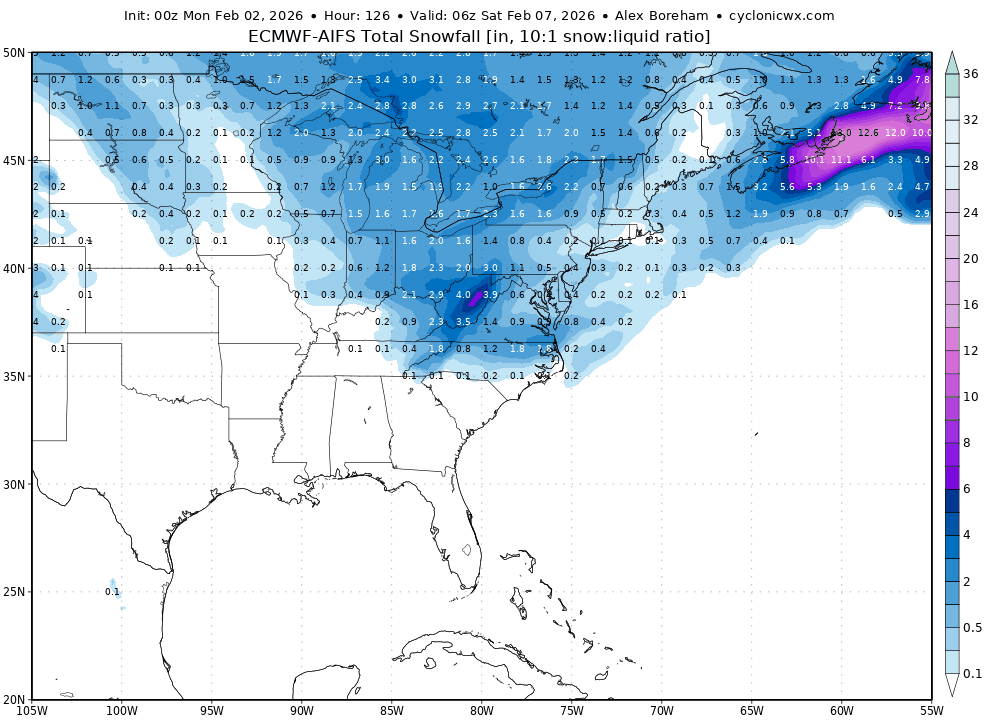
The Euro AI has been very consistent in showing a maximum along the VA border
-
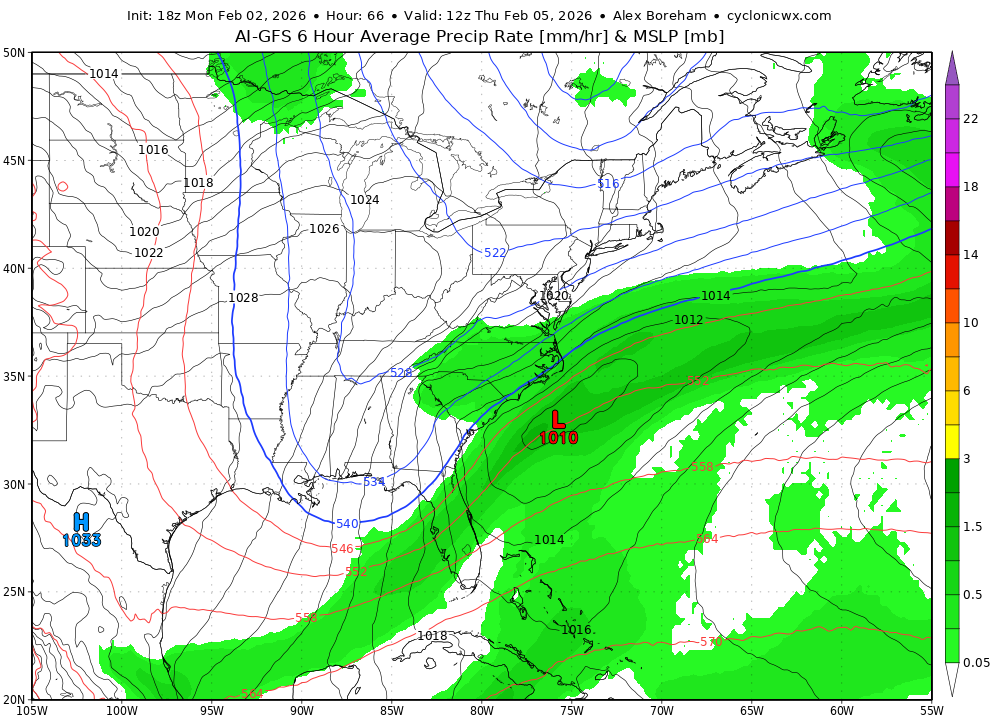
The AI GFS looks nice too
-
Yeah it's great to see that we could get accumulating snow even with the less amplified solutions knowing that a more amplified look would increase rates and crash temps even faster. That is, if the trough can stay sufficiently far south
-
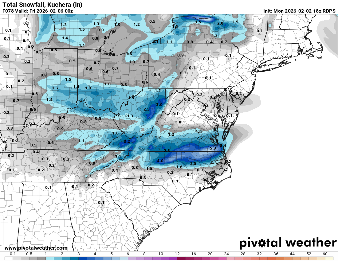
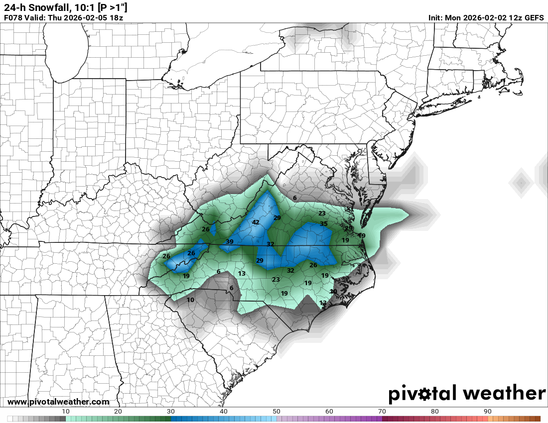
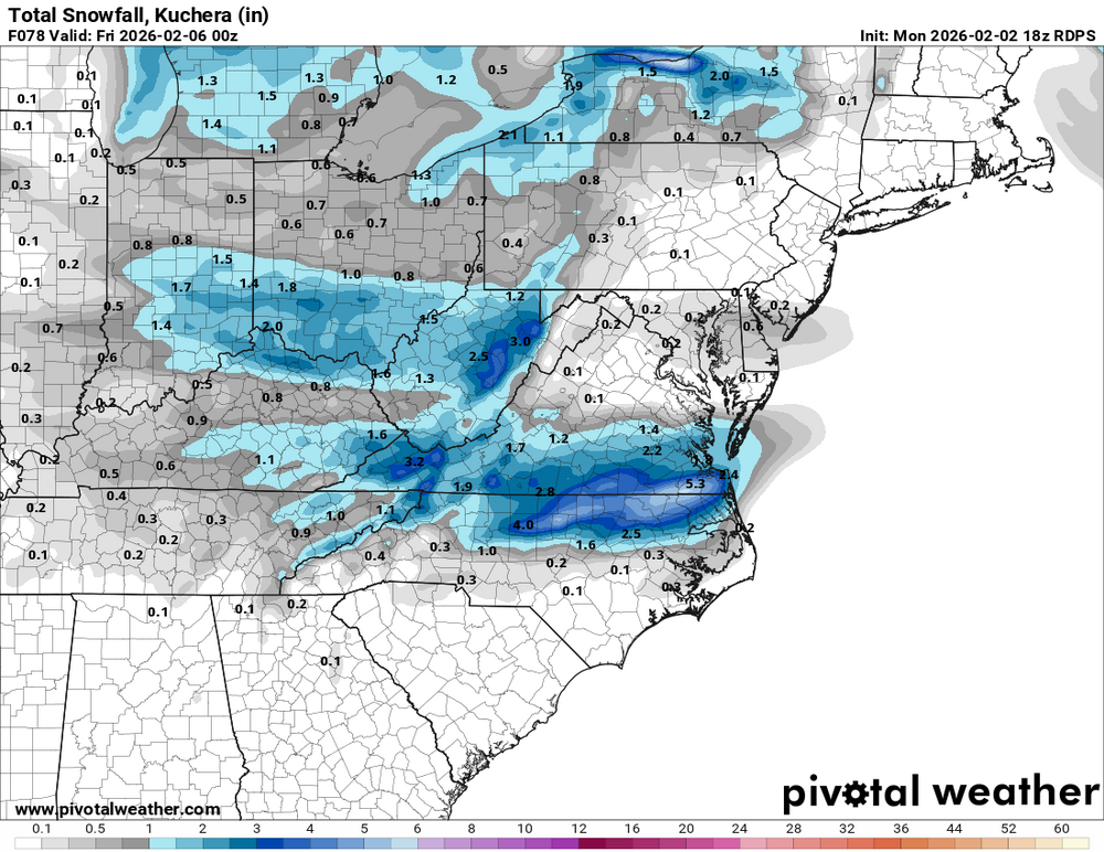
Of course, Kuchera will be more accurate, but that's still pretty sweet. I hope somehow Raleigh gets 3"+ just for the memes
-
Can you please schedule a surgery for December 25?
-
Yep! Hard to ignore the trends, going to come down to temps/rates at this point
-


.png.1ed46665647cda1ba58de881e93fc3b2.png)

.png.684068ebc1e4a5c1e998d905bf54404f.png)


.png.3ff913539c9525f85c5d7bfef032b7c5.png)