HIPPYVALLEY
-
Posts
32,932 -
Joined
-
Last visited
Content Type
Profiles
Blogs
Forums
American Weather
Media Demo
Store
Gallery
Everything posted by HIPPYVALLEY
-
Looking pretty dry moving forward.
-
I'm really looking forward to 8 weeks of posts arguing if it will be 85F or 88F. It's summertime, let's enjoy it!
-
Great, nice way to kick off the summer season. No prolonged big heat, but enough short burst big warmth to get the vibe rollin'.
-
^ we did manage to get some outdoor stuff done for the first half of the day. Still a pretty tough weekend for the last week of May. It’s chilly now with cloud cover and temps in the 50s and a slight breeze. Looking forward to some warmth this week.
-
Throwaway weekend.
-
Raining in Greenfield. At least it started while I was up on a ladder outside.
-
I'm not sure I recall, having seen this trajectory, for a legit strong low. Hopefully someone snows! I'm hoping for a dry afternoon in Greenfield.
-
Nice anomalous storm track. Hopefully someone snows just for pure entertainment.
-
Slightly below normal to normalish heat until mid-June and then maybe the ridge placement reshuffles to some bigger heat.
-
It will be like winter enthusiasts losing half of December.
-
72/56 perfect evening weather.
-
That looks awful.
-
Northern Pike?
-
It is good yardwork weather.
-
Brutal.
-
Inland temps will probably bump up a degree or two from forecast too. What's not to like?
-
Next week looks great. Upper 70's to low 80's with 50's at night is pretty good for the last week of May.
-
Maybe get some drought talk going by next weekend?
-
Next week looks like great weather. Mid to upper 70’s and dry.
-
We toughed it out with window fans. I’ll put the ACs in when a prolonged heat stretch looks imminent.
-
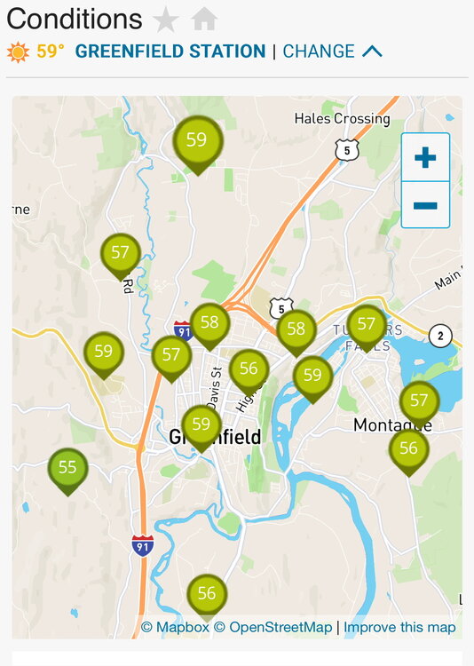
Clouds today capped us at 84° in Greenfield. Definitely more humid than Monday and Tuesday though.
-
https://www.sltrib.com/news/environment/2026/05/07/utahs-data-center-could-create/
-
Yep, the environmental impacts of that will be mind-boggling.