HIPPYVALLEY
-
Posts
32,945 -
Joined
-
Last visited
Content Type
Profiles
Blogs
Forums
American Weather
Media Demo
Store
Gallery
Everything posted by HIPPYVALLEY
-
They don't actually truly hibernate, just lazily rest until the food gets easier to forage.
-
How do those compare to March 2012 record highs?
-
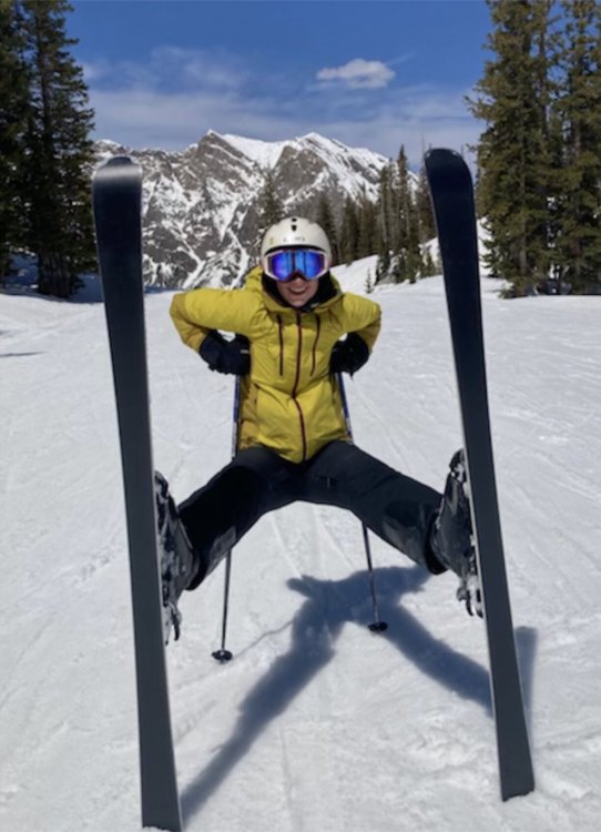
My niece at Snowbird today.
-
NAM coming in even drier at 12z
-
Well, that’s the only part of SNE that has gotten a lot of moisture since January.
-
He wants to reincarnate as a virus. Creepy. https://www.businessinsider.in/entertainment/news/prince-philip-quote-about-reincarnating-as-a-deadly-virus-to-solve-overpopulation-resurfaces/articleshow/81992882.cms
-
September on Buzzards Bay is amazing. The water is warm but the persistent southwest winds of summer are gone and the bay is often like glass. Great for buzzing around in a motorboat.
-
Weird. Bone dry here.
-
&& .LONG TERM /SUNDAY NIGHT THROUGH FRIDAY/... Big Picture... The seven-day pattern shifts around a little, showing a series of closed lows across the Northern tier of the USA. This channels the main jet corridor across the Southern USA from Srn California to the Carolinas. That concentration of jet dynamics and west-to-east water vapor transport in the South will favor heavy rain across that area. New England won`t be shut out, with low level east-northeast flow bringing some moisture into the area. But the pattern favors limited precipitation mostly concentrated on Monday and Friday as surface weather systems pass south of the region.
-
FYP
-
Hadn’t considered that but yeah.
-
I don’t mean that was the greatest, he just had one of the best home run swings.
-
One of the greatest home run swings of all time.
-
Sportsball! How’s about Prince Phillip and DMX checking out on the same day? That’s some shit to discuss!
-
Eh’ not surprising really. An endemic virus will be the final outcome.
-
Dry beget dry.
-
We tried to tell them.
-
OP Euro was meh' for many on the Sun/Mon precipitation. Pretty sharp cutoff. Congrats CT, I guess, not much different than this winter.
-
We often don't get stretches this nice all summer!
-
Boom! At least they had warning it was gonna' blow. https://www.cnn.com/2021/04/09/americas/st-vincent-volcano-eruption/index.html
-
Not looking forward to sweatshirts next week but it's been an awesome week. Hopefully WNE gets some low 60's next week if/when we get the sun to come out.
-
Yeah but throwing darts at a board to pick stocks is still the best route. https://www.google.com/amp/s/www.marketwatch.com/amp/story/random-darts-beat-hedge-fund-stars-again-2019-06-26
-
As you and I have discussed, the pandemic has further fueled the great wealth transfer from middle classes and poor to the super wealthy. https://www.businessinsider.com/pandemic-widened-millennial-wealth-gap-economic-inequality-rich-poor-henry-2021-1?op=1 Obviously it began long before Covid, https://time.com/5888024/50-trillion-income-inequality-america/ I remember reading Donald Barlett and James Steele's excellent "America What Went Wrong" the year after I graduated college. At 30 years old it is still a completely relevant read about the betrayal of America's middle class by our corporate lobbyist corrupted politicians. Bill Moyers did an excellent TV special that contains the TLDR version. Not the easiest video to find anymore.