

Typhoon Tip
-
Posts
42,311 -
Joined
-
Last visited
Content Type
Profiles
Blogs
Forums
American Weather
Media Demo
Store
Gallery
Everything posted by Typhoon Tip
-
Extrapolating the D10 Euro would offer something of siggy scenario ... with that lag back SW pinch low ... ejecting/ .. suggestive eastward, open and naked to that sudden surged -EPO hybrid ridge over the western Canada... It would set a large subsume phase ( when the N/stream comes down and takes over a S/stream that is loaded with moisture, the Earth moves and angel's weep...) type into motion thereafter... And, with large reservoir of anomalous late season cryo slabbed over S and SE Canada edging the Lakes/OV/NE ...yet, a sick baroclinic field extending roughly Indiana to Cape Cod. Everyone ends the season 120% of normal snow totals if that sets up... Unfortunately, that is D10 ... The usual suspects in this forum will be excited and should not be... If you outfitted them with an automatic genital poker that stabs a testicle whenever they get excited about a D10+12 Euro, they would get excited about the D10+12 Euro...so it is futile to caution. The GFS is also doing this - ...I'd like to see the most recent telecon layout ... The last 10 days -worth of persistence has been arguing that these operational runs, that really show no interest in moving the season on to spring - curiously enough now that we are ending the first week of March and it will rapidly be "Equinoxial" in practice here shortly, are in fact instruments of the CC denier conspiracy. ...kidding, but convention of calendar, antecedent super telecon signals, and the f'ing sun itself, are all against the operational song and dance - folks don't care so long as D10 Euro has that look I supposed. In fact, next week's warm up has finally come into a better consensus - not bad in itself considering the fragility of warmth management in guidance during a hostile time of year... 2 ... 2.5 days of warmer than normal.. Normally I'd say 70 on Thursday is a likely MOS bust with thickness over 555 and a deep layer continental warm conveyor WSW flow that is well mixed through the lower BL ...blah blah, but climo and cloud both cannot yet be discounted at D6 enough to go comfortably ... 25+ over seasonal norms just yet... Thereafter, the complexion/ .. synoptics out there .. again, it is as though the operational versions saw this warm up next week merely like an early or mid February winter warm pulse and resume winter completely oblivious to the calendar. Jokes and sardonics aside.. I'd say it is more likely we have this warm spring sort of shot across the bow next week ..then, we slip back to climatology.
-
Yeah .. sure does
-
Huh ? its March 4
-
Will it still be a piece of shit when that happens ?
-
This is kinda interesting... the AMO ... may be a fantasy index? https://phys.org/news/2021-03-apparent-atlantic-artifact-climate.html Para phrasing that article, ...it seems that external factors are to blame for the apparent oscillations of the N. Atlantic oceanic temperatures ( ~ 60 year period). Those being natural vulcanism during pre-anthropomorphic Industrial, and since the Industrial evolution... some of this apparent 'AMO' is cause by us... That means that the AMO does not have its one climate oscillation mechanism like previously thought - which means soooo many seasonal outlooks were fantastically based upon wrong factorization - usually snowy drooling ones too haha. It's kind of funny if that's true. People want snow and cold in winter, and used the AMO to forecast that ...and it has nothing to do with the atmophere in a forcing schematic at all. It has to do with whether some factory in China farts in the right direction - I'm not sure if that means there is no influence by SST/oceanic heat content. I think it is overrated for America ...more so a factor for western Europe as as stemmed discussion tho -
-
The Euro looks like Tuesday napes the hell out of 'em ... Wednesday is (nape + mild)/2 ... but very warm in Kevin's car.. Thursday is a warm day. ...Friday probably is cloud contaminating/rain... whatever...it's all D 8 by then ... But this did this again - I'm noticing this sloshing going on between 00z and 12z .. The 00z's tend to regress back toward a colder complexion... The 12z go back a bit more warm. And the posting tenor/frequency goes up and down at a negative correlation coefficients - lol ...
-
Check this ... I'm not sure it is still the case - but, the distancing MEX days are increasingly weighted to climate? ...that definitely 'used' to be the case. My experience over the years since I became more 'meteorologically sentient' as it were ...is that thicknesses over 546 dm ...particularly over 552 dm, in a deep layer continental conveyor patterns that are well mixed ... tend to make 70 F ... Obviously, clouds/rain depending ... If the MEX is still being weighted heavily toward climo, that is most likely pulling those values down? What is climo next week - 45 ..48... somewhere? If we are 10 or 13 over(under) climate on MEX for a D6/7/8 outlook, that's also about what typically happens for very warm(cool) anomalous patterns at this range, in that product. Heh...I'm sure there was a shorter way to have said this - sorry
-
Heh... Trying to say 'no politics and no covid' in this World's present dystopian ambience of vicissitudes is akin to Leslie Neilson trying to disperse a crowd of gawkers waving them off, "Nothing to see here. Go on home. Disperse. Nothing at all to see here..." while a fireworks factory is detonating behind him in the backdrop - wtf... It's a banter thread -
-
True .... but what I am saying is not in the absolute sense, either. Not saying it can't - It's a brief op ed against the presumptive attitude, a presumption that is removing the modulation curve in order to get on the far side of next week's warm up as phew, back to our drug LOL... By then, ... " 2nd half of March.." ? heh... Look, if the AO was not soaring to crucifixion heights out there, and the NAO was not in tandem also bouncing around ( albeit shallowly ...) in lower positive range, while the PNA is also tending too flop negative after this vortex interlude we suffer over the next 4 days ...I wouldn't be raising caution flags ... Oh, I might snark that the sun is a cooker. But these are bona fide clad, institutionalized methods for deterministic assessment - they are not cold and snowy. So ...yeah, it's a little odd - .. where is Larry seeing that anyway come to think about it - If I saw that layout of mass field mode/modal indicators at any time of the cold season, I would not be emphatic about any run that looks cold biased relative to that signal.
-
I dunno... What I am seeing overnight is the same shit I've seen for a week now.. . The telecon layout is warmer by numerical approach, than the operational individual and blends have tended to appeal like - Not sure which will win... I suspect the operational runs ( should anyway...) might have a special insight being the souped up front man for each family ... but that's not always true. I could see the operational runs suddenly getting more robust with raising heights south of 55 N ...given to that ginormous Swiss Alps rise in the AO curve out there mid month, while the NAO is also bouncing around between neutral to low grade positive - that offers a big gap not being used in the operational runs. You can actually see that in the SE ridge handling for the warm up next week, too... The models have this "NINO" like River coming into California with a huge planetary flux of subtropical jet mechanics riding over the SW U.S.... and the heights over the TV fan open...They don't really represent a deeper latent heat fluxed height response as much as they could - Not sure where that is going ...but the models are not really building heights that fit that mode down stream very well. That's the 00z run... the 12z yesterday seemed to fit both the west coast flow, and these polar indices above, better. So..I'm on the fence... I also think the GFS in general as a separate concern with that p.o.s. N/stream beady-eyed neurotic physics will keep it winter until the end of time if given least excuse imagined, too
-
Is he on board with : A ... sun being mid September inferno by then ... ? B ... any model run/blend or technique therein deriving pattern expectation, for that range, is historically and will likely be proven again... suspect while the hemisphere is adjusting daily to that forced +d(watt/sq*m) insolation as it increases S-N so quickly to become factor-able perturbation in the guidance. ...big words for, "the sun f*s up winter-profiled outlooks good and proper nearing the Equinoxes." I get 'why' he/others/ et al are saying this .. I'm not blind to the models - in a vacuum sure. Can't do that tho - just bear the above in mind, that's all. Those models have historically proven susceptible to these factors above. And, I'm also sensing a present lack in necessary awareness of these above ... People are treating next week's warm up as some ..intermediate thaw and then it's back to the winter hope scheme... Nahhh... get real. These 'para' phrased quotes that get bandied about in here. He might have said that ..or at least intimated that caution re A and B above - if he's a good Met he is at least thinking about that... I have seen countless delicious patterns on March 20th+ when projected from earlier in that month ... end up tasting sour when they come to pass because of rather sudden normalization of the gradients by irradiance bathing .. In fact, trying to do risk assessment/determinism in April also suffers this too. It's not every case, either - it's just increasing error tendency. We've had blizzards in May ... but we also tend to confuse/ .. or remove the sloping probability reality, replacing it with absolute interpretation when reading these skeptical posts. Don't.. I'm not say it can't ... it's getting harder, fast. I mean ..duh, 2 week intervals are always 'edubacated' guess work in the best of times, but spring? Mm...'spring modulation effect' is on, and is notoriously adding to that uncertainty even more...
-
Funny you mentioned ... I looked at that yeah -
-
I was watching Bill Maher last Friday night ... Paraphrasing one of his segment lead-ins ( because it is something that has bothered me for some time) ...there seems to be this cultural lust for dystopian realization to become of reality 'Why is the press and everyone that reads the press and all of these different agencies, the whole world, ignoring all the optimistic data. Yet, we cannot expect mask wearing to go on for ever....' etc etc... He went on to site hard numbers proving that this is getting better faster than modeled ... ( enter reason here ) Nope... death if you dare move. I mean ...wtf is going on? It's like we really are in a zombie apocalypse - as macabre zombies singularly driven to self-fulfilling prophecies of doom and gloom - I opined just yesterday about the how much time along the last million years of human evolution was spent in masks, and how that so uniquely situates us to accept this will be this way for ever, willing, so long as the CNN's thinks they can make money off gaslighting idiots that can't stop thumb swiping their phones and clicking their PC mouses through those sites' labyrinth of "Doomscrolling" Hint hint... I think that's part of what the problem is here - within seemingly "economic minutes" of this thing being declared a Pandemic late in 2019, this became Incorporated .. Ever since, people that are capable of influencing the masses that are apparent of the ginormous economic machine, don't want their cash-cow going away. I mean it may not be that coherently quantifiable as a cause but something of prefer not to see the optimism is attempting to block seeing lights at the end of this tunnel.
-
Who ever thought that ? Lol...
-
Heh, reminds me of a separate problem... too many think it does - (not you per se ) but here's the deal - when you have population of 8 billion Global inhabitants gradually supifying by modern-convenience-addling ... pretty much losing their ability for critical weighting of incoming information and data in an objective filtration, they will believe Twitter is truth. So be it - right? Except that a quarter of 8 is 2 ... 2 BILLION. Scale the down all we want... you don't need but a tiny fraction of deviancy from norms ... to seriously cause a major ripple effect leading to dreaded consequence - pick adjectives... This in terms of a National security ( Global too ) is a problem when fringe ideologies become righteously self-absolving and believing in their morality, because they've 'found one another' on the internet, and sociologically ... humans cannot avoid supremacy by numbers - we are a socially motivating species. 'Hey, ur my kind of peep' - ... emboldened, we end up with throngs of fringe lunacy storming the Capital ... and all they really have in common is hostile dysfunction needing a cause to be violent - nothing that would ever pass any kind of functionally sane litmus test.
-
Man...that's a shit pattern for California ... Almost looks like an 'atmospheric river' ... I mean, c'mon ... how many different ways can we see the pattern NOT look like La Nina before we realize La Nina ain't running the show -
-
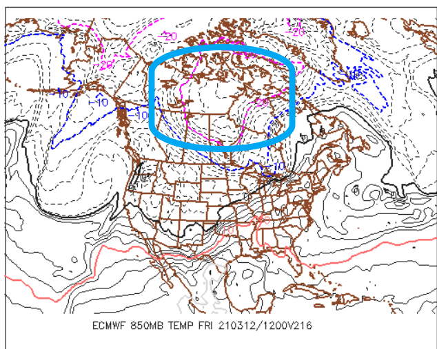
Mmm... until I see this, ... fill/ leave the Canadian shield, I don't care how utopic the synoptic backyard looks, whatever happens after next week isn't without risk afterward. That said, as the month ages obviously the sun's perpetual 'bright flash' off a hydrogen bomb becomes evermore the modulating factor- ...ever think of that? That bright flash that blinds people in nuclear bomb explosion, that's what the sun is ..... ALWAYS ... heh, kinda neat We can even lose that cold bank account up there and still go through a 'marginal' bowling ball vulnerability - although I wonder if that's less favored this year ..
-
It's a big useful factor at this time of year right there. yeah - Thing is ... parroting Scott early ...it's interesting that is not a BD look. How the hell did we wend the hemisphere into that modeled look in March... ...maybe owing to the rising NAO out there.. unknown Folks, you shouldn't get hopes up if you are spring enthusiasts until that's inside D4.5 because we've all got time-trialed experience in this part of the world - very minute synoptic construct changes can end that with a lvl cold wedge, doing so out of nowhere in sort term corrections. Yet, still overall verify the pattern recognition as a success - we are the Labrador 'Red Headed' step child, eating shit so that the rest of 'em get cake.
-
D6 Euro is insane nape on this 12z run... At least by the coarse view - if that depiction where enough, might as well be naked angles of one's carnal dreams tongue tickling beneath the ears with that look ... Actually, D7 DEFINITELY is... in fact, that would be straight warm-like
-
I've tempted the notion in my internal monologue a few times ... I don't know about that in any absolute sense, tho.. It seems already that sort of N displaced Bermuda ridge ..where by an anomalous easterly wind band has come into the M/A at higher latitudes? That seems to be a "quasi" established ... maybe even warning that that could eventual evolve. Perhaps as a more distant destiny given a few decades of continued unmitigated, relentless rise in global warming/CC - I am not personally privy to the most recent state of the art with the longer termed climate modeling - but... I wonder if a future world is so warm that we lose the Ferrel distinction altogether, and what emerges becomes ever more like a two cellular hemisphere: HC and the Polar regions... It seems these velocity soaked winters are really an early warning signal that the intrusion of the HC into the mid latitudes is underway - at an insidiously slow rate ... I say that in part sardonically, but it is happening just slowly enough to creep. But that's all speculation. I am an accomplished Sci fi author, full disclosure and I can sell this shit when not attempting to "sell" anything. I just love the pastime of open discourse and created witticism and admit to advancing more plausibility than at times is really very 'possible' - I try to make it clear which is which tho. I would prefer not driving people's opinions ...I would only wish thought provocation and then have that maybe lead to skeptical testing.
-
Yup...I was wrong .... well, 'hoping' anyway, that the clouds were not going to make it SE due to drying ( although you may be in it either way in that regard -) ... It's clouded over here. Nape over - Not so down near the Pike...
-
You and me both... it's been a crushing winter ( for me personally...) and just the change in environment - any change is good at this point for me frankly. I don't normally get affected by sensible weather stuff.. or the modeling noise, but the former personal stuff is making this experience rather unique. Seeing no white and tinting green in lawn... hell, maybe even swell a few Forsythia shrub buds - is that too much to ask? ...begging the Dickensian ward whipper ... Those might be welcoming as symbolic to better times. It really has not been a very entertaining meteorological winter, so not much hope ...none of these events left me ultimately very inspired. Although the 30" CSI band from N or ALB to mid NH was point fantastic. Otherwise, this has been a drag slog of rationalized bs to get through ... and I know I may be in the minority but I do love summer, ...tracking heat...tracking convection. These are equally as interesting to me as deep winter fair ... The last thing my personal druthers either wants nor requires at this point is protracting abysmal cold weather that only placates nostalgia threads of storms of spring yore, but won't deliver shit out the window. ... You know, in a separate texting thread a Met buddy referred to yesterday as a "bottom 10 day - only in New England can a gem sky of irradient life giving sun manage to pull off a piece of shit afternoon " Lol ..funny
-
Probably ... that's the course of least regret... I would not [ personally ] go so far as declaring mortality on winter but that's me. Obviously you/we ...all should keep in mind and do ( it is hoped..) that even an inferno spring can nest a juggernaut ...even into April's ... It is a matter of probability, year to year. This year? Probability is sloped against substantive snow occurring due to the back-ground antecedent ... ambrosia of signals that I've grown tired or reiterating and won't ... It's not "one of those 1984" spring vibes in that sense, nor in the hemispheric observable indicators... Folks should also keep in mind that even if next weeks' warm up proves just that and only that, and we are heading back into some sort of regressed cooler appeal to the N/A synoptics for a another stint, it will have to be modulating/off-setting warm just by pure increasing spring sun... Indirectly related : The models - I have noticed - tend to "forget" the seasonal migration beyond ... D6 or so.. .tending to wash it out and receded back to a colder look if the pattern leading was already cold.. It's like they fight it by data scrubbing over the processing as though it is error-checked - lol.. ..or don't have enough of a differential awareness into the super-synoptic forcing of seasonal change - interesting..
-
Ooooh ha-ho-ho-ho ... so you're adMITting it's napey now -
-
In any event... it's going to be chillier/ish the next 3 days... Chillier than today - It' interesting, but this cold plume anomaly that pinched off and zipped down across southern Canada and stung us yesterday ... isn't merely trundling away into oblivion. It's so deep in the troposphere that it's creating an "inverse west-based negative NAO" - it's depth is pulling the index negative more so than the blocking heights in the other direction. The low its self is anchoring and doing a fuji-wara around some kind of synoptic Lagrangian point over the lower Maritimes, and as that happens it will re-situate CAA/ reinvigorate it for a day...day and half, keeping us locked in a dry "super duper entertaining and soothing" cryo-flow out of the frozen tundra of eastern Canada... Aren't you all glad you pined for winter to keep going ? ....the gods of the atmosphere tried sooo hard to placate your dreams but could only get you so far - and now...this is what you get. LOL.. D6 ... for spring enthusiasts... hard to say if that's "no turning back" or if the distant range does drive a regressed appeal for while... My guess is that will happen just by common sense over where in the hell we are located in the geography...


