

Typhoon Tip
-
Posts
44,565 -
Joined
-
Last visited
Content Type
Profiles
Blogs
Forums
American Weather
Media Demo
Store
Gallery
Everything posted by Typhoon Tip
-
Monitoring a potential important TV to East Coastal storm: Jan 17
Typhoon Tip replied to Typhoon Tip's topic in New England
This is of course a fluid outlook at D6+ - of course - so, one aspect as we set here looking at the horizon .. the operational GFS appears it would is pretty stretched westerly outlier compared to the ens mean/spread product I posted above. Just sayn' -
Confidence grows for a moderate to major, low latitude transferring Miller B/ Miller A hybrid then gets foisted up the coast as a "hook low" March 2017, 1986 'zyzygy' are examples. I have seen the 12z GFS more proficiency in phasing - yes, that's possible too. **This is a fluid outlook *However* with such a high upside I feel monitoring is necessary.. I have seen this 12z GFS ... Feel the Euro cluster probably joins suit, but pending that ... confidence remains less than medium. It's an important storm - how much impact and where, TBD. Concept history: This was suggestive several days ago and I was tempted to thread for exotic early coverage but there was/is too many moving parts at the time. System's been apparently blurred by frenzied S/W management in the various guidance, ...not to mention inherent uncertainty for that long lead -duh. But now seems to be have come back at the far end of the middle range - when have we seen that sort of behavior. Too early to characterize the event... but quick stab at it, fast moving lower latitude Miller -B/Miller A hybrid. I think this has room to amplify sooner, and track further west ... and/or slow down some, but that's about as detailed as we can be for now. The base-line circulation mode is one saturated with potential; a powder-keg merely capped by wave interference. I warned this yesterday ( and the day before...) that we are essentially playing with fire having so much volatility that is being limited to exhaust due to wave-space contention. Given just a modicum of breathing room in any modeling, and any one of these waves can become an equally handsome cyclone, with very little excuse to do so. This signal had the better appeal/timing "cadence" with the super synopsis going back three days, when it was the D9-11 ( day after that last snow event).. now is D6-8, and she's more than less coming back in the GEFs... Feel we are in the early stages ( like right at zygote but ensuing -) for the 17th emergence and that other non-GFS will probably show in the future. The 00Z GGEM actually already did in principle, although it's stretching the x-corrdinate and that takes it too far E and doesn't allow the same eventual phasing of the 06z GFS solution ( using the latter as a paragon). The 06z EPS was a positive trend from 00z, and is likely also like the GGEM ...an early consensus contribution. I was nodding when I saw post mentioning the 'interesting 06z EPS mean' for the 17. This would be a different storm than the last if it works out... The 00z GEFs numerical telecons are flagging a +1 --> -1 --> 0 modulation in the NAO over the next 10 days, the range of which is rather ideal... because anything lower and it scoots seaward underneath/suppressed. Where's earlier phases/Lakes cutters are not really in the cards at all with this. Meanwhile, the PNA aspect is in a postive mode albeit modest ..but climbing through the same period. These altogether do not represent a bad scaffolding... The NAO and the PNA are in a modest teleconnector covergence here. Of 24 of the 30 GEF's 00z members, I saw have SE U.S. to west Atl cyclogenesis, 7 of which were rather deep and far enough W. This is the cluster trying to jump back on board in my opinion. I the 12z appears to maintain, with positive trend, suggesting the member count in favor is growing. When I saw this chart and compared it to the 00z, I was sold and it's time to thread. The flow over the deep S-SE is relaxed prior to the arrival of this western ridge associated with some sort of at least transient +PNAP exertion, an exertion/aspect that I wonder may be also emerging - i.e., more.
-
ICON or whatever... it's adding in the direction of expectation I outlined this morning/last page...
-
Thread likely/pending ... for low confidence, *however* with such a high upside I feel monitoring is necessary.. May wait on the 12z ens. I'll probably cut and paste content from this post and cobble some annotated charts The problem is the excessive to the extent/ saturating the base-line with potential; a powder-keg merely capped by wave interference. I warned this yesterday ( and the day before...) that we are essentially playing with fair with so much volatility, that is by convenience of wave-space contention being preventative. Given just a modicum of breathing room in any modeling, and any one of these waves can become an equally handsome cyclone with very little excuse to do so. The 00z/06z oper. GFS opened the window and let the air in for the 17th Note, this signal had the better appeal/timing "cadence" with the super synopsis going back three days, when it was the D9-11 ( day after that last snow event).. now is D6-8, and she's more than less coming back in the GEFs... Feel we are in the early stages ( like right at zygote but ensuing -) for the 17th emergence and that other non-GFS will probably show in the future. The 00Z GGEM actually already did in principle, although it's stretching the x-corrdinate and that takes it too far E and doesn't allow the same eventual phasing of the 06z GFS solution ( using the latter as a paragon). I would not have posted this post here if it were not for your mentioning the 06z EPS - which is thus a positive trend from 00z, and is likely also like the GGEM ...an early consensus. I was nodding when I saw your post. This would be a different storm than the last if it works out... The 00z GEFs numerical telecons are flagging a +1 --> -1 --> 0 modulation in the NAO over the next 10 days, the range of which is rather ideal... because anything lower and it scoots seaward underneath/suppressed. Where's earlier phases/Lakes cutters are not really in the cards at all with this. Meanwhile, the PNA aspect is in a postive mode albeit modest ..but climbing through the same period. These altogether do not represent a bad scaffolding... The NAO and the PNA are in a modest teleconnector covergence here. 24 of the 30 GEF members I saw have SE U.S. to west Atl cyclogenesis, 7 of which were rather deep and far enough W. This is the cluster trying to jump back on board in my opinion. The flow over the deep S-SE is relaxed prior to the arrival of this western ridge associated with some sort of at least transient +PNAP exertion, an exertion/aspect that I wonder may be also emerging - i.e., more.
-
Heh. Hopefully they got white paint on their pallets
-
Yeah… I’m still not really leaning, frankly because there are too many problems with the broader canvas
-
Yeah it was a weird decade man…. There was snow at times sure but the vast majority of the times it seem like the long wave axis favored being situated right over our heads, which is too far east. So they were so many ocean storms, near misses or Cape Cod maulers … usually at the expense of a two day blizzard watch all the way back to Worcester that verified with 1 to 3 inches of flurries and dim sun. Few lakes cutters …- it was unrelenting brutality for weather dweebs, and snow days? I think I experience three snow days that decade, rare enough to think there just needed The Day After Tomorrow to happen. Oh but we got the cold after every f’n miss
-
Agreed. Difference between nothin better to do vs utterly boring. Heh
-
Partial. if that spv were to capture we could start talkin whole way. But that’s not happening there - yet
-
Yeah it’s definitely got better shortwave mechanics physically delivered into that trough… Seems like that has been trending but the NAM’s known for yankin chains.
-
That is slightly amusing… For those in my generation can understand the following statement: we used to walk to school in 4° cold with 20 mph wind gusts in cold snaps in the 1980s. Thing is I’m not prepared to blame this completely on the pandemic culture that’s formulated over the last two years… Because school districts began issuing closings and delays for much much less years before the pandemic
-
Course we all know the real motivation here is that communities and townships and schools and where ever are all reeling from fear of Covid… And schools are traditionally a petri dishes anyway – it’s got to be a scary prospect for people that are paranoid about cooties risking the digression… These variances are following the epidemiological arc of novel viruses, in that they are weaker than the original. To the straw man, Society needs to get a grip and get some humility and stop feeling entitled to some kind of euphoric physical experience. Guess what ? we’re all going to get sick eventually and guess what else, we’re all gonna die eventually. in the grand scheme of things and all things considered this omicron variant is not going to cause the latter - most likely Unless we are putting up death counts like the original… It’s all needs to be accepted as part of head cold maintenance; and guess what people die from head colds too if they have pre-existing conditions
-
Really looks to me like a vast majority miss. Unless one wants to invest in the three or four outliers on the NW edge. I wouldn’t if given that spread.
-
Heh … That could be on the woman, if by election she stayed late - not checking or being aware. Did he tell her that she’s getting fired if she didn’t stay late?
-
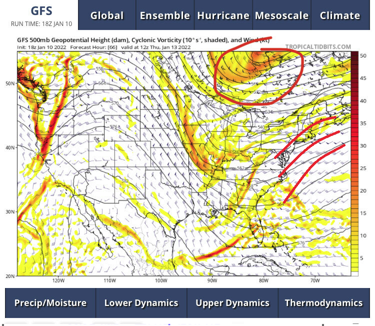
One should also look for these isohypses to take on more curved structure/flow exiting the coast, too - I'd actually suggest that is critically missing here... That "might" actually be a correction forthcoming - I was mentioning earlier in the day that the trough between the west and the formulating -NAO is was sans significant S/W input but ...seems the models had an ear to that memo because ever since, we've been trend more as your chart above shows. If it gets much stronger it'll start sending out that curvature ahead.
-
That's a bit of a specious distinction, frankly. It may seem so when looking at the previous run, but if you go back several, it's really been wandering around out there... some cycles farther SE- E and SW event. Spanning the last 4, there's really not much of a trend there. But just the last 2 cycles may appeal so
-
GEFs have, in essence, the same favorable look... Again, I've been hitting the 270-300 hr range therefrom ..etc. It's just not clear if a real event is in there, or that's just the larger scaffolding of the pattern passing through it's maximization. I've been looking at the ens PP means of the GEFs, they've also been off and on closing contours basically 240 - 330 for that matter. The numerical telecon of the PNA isn't hugely convincing but it is modestly positive. It would be better served ( confidence) if that would camel hump to go along with these graphics. That's been an interesting story that no one probably is even aware of unless they have a life like mine which is that the numerical equivalence of the graphics have not been aligning very well. The numerics/curves of the PNA should like more formidable given the graphics. I guess the only purpose for telling this is that less amazing events fit the numerical/EOF results; the graphics sell more.
-
Yeah, as far as the operational Euro goes ... this run is one perpetual negative interference scheme, ...beginning 72 hours right out to D8... In fact, it's in the process of demolishing the D7/8 event I was ( personally..) keeping track of. The 12z GEFs also blurred/backed away from that vision quite a bit, too. Sooo ... I say we blame Ray? I say we start a troll session for his making the impertinent verbal jest about rollin' snake eyes only to come up in the end knee deep in a RNA that sends us into the 80s again in February - nice goin' LOL
-
I was just gon' defend you LOL ... 'I thought he said relative to pattern - ' Although, the -PNA on roids wasn't really a favorable pattern for me. Particularly when it -NAO tried to obtrude exertion S along the EC at the same time said -PNA was attempting to raise heights. That was why 300 mb flight level velocities were 200 mph.. yikes!
-
Yeah, this is a whole new peregrination to the theme out there.. Wasn't there before - certainly nowhere near as obtrusive... Should be noted, there is a telecon drop in the NAO ... Perhaps +1 --> -1 --> neutral, over the next 10 days, and that vortex's behavior would tend fit that, particularly if the transient blocking pulses over the western limb/D. straight region. I recall some Euro runs had this 4 days ago but seem to lose it.. .But seeing as the telecon ( American ) has the NAO bounce, I dunno. More headaches ...
-
Nice coverage by y'all overnight. Concur with wdrag re the wave space contentions. The gist: we enter a pattern steeped in big potential; capped by negative interference. Longer thoughts: Should any one of these waves "correct" or open up in guidance by even a little, there's apt to be a hefty return on storm genesis - it may take the 72 hour window for the models to emerge that, as anything near -side of the mid range and beyond seems to be muddled by native model bias. I personally still like Monday... It was a D9-11 ( for those following..) notion at last event end, now D7/8. I wonder if/when the operational GFS ( and to some extent the Euro) stop tussling on the two waves the GGEM is not fighting over, and start favoring that period for just such a plausible correction mentioned above. The thing is, the 13-14th system to me almost looks fake. I'm noticing in all the guidance ( really ), there is a bit of a +PNA --> ridge assessment happening 48-84 hours off the 00z; consequentially, that is "kinking" the flow into a trough due to natural ordering of L/W forcing immediate down stream. The models than use that, but here's the thing they are using that alone, without the benefit of very convincing actual S/W input ( or at least less impressive). Given in situ the ginormous native instability where and whenever the west Atlantic thermal source meets a continental spilling polar air mass, that's all the excuse these runs need to spawn that big low. Noticing it's broad circulation with several cyclonic nodes ...It just looks like much of it is thus artificial to me. We'll see. There's likely to be something there - I'm wondering how much. If less..less interference lends to more conserved late in the weekend/early next week. Not a thread -worth idea just yet, but I'm poised should more members start looking like the GGEM. Heh...I would almost never side with the GGEM at this range, and I'm not. But, there is reason to suspect just the same. Having said all that... There is a much bigger signal in the deep range, 270-ish hrs. It's been lurking...fi we want to call that range lurking. I mentioned yesterday that it could either be just the pattern maximization, OR, ... one of those upper tier scenarios that begins showing up at unusually long-leads, due to having overwhelming physical significance in the total circulation mode. There are a few that performed this way in guidance... 1993, Sandy leap to mind, but I'm sure we could dig up others. Anyway, might be that... might just simply be the pattern getting to it's more dominate form before entering decay... I will say that the 06 z GEFs mean did manifest an impressive signal around that time, with multiple close pressure contours, and a 48 hour QPF outlook well over an inch.
-
Not that anyone should care but I don’t give a bean about snow pack at all …unless the rest base has a chance to break the snow depth record and we were so far removed from anything close to that kind of universe it really doesn’t matter to me - get rid of it As usual I just like interesting meteorology.
-
Course this 18 ZGFS solution comes up with an entirely different alternative solution which is not to have anything happen at all. Well I guess the clipper is there if anyone needs to believe it … heh
-
Sure do ... I'm wondering if that is just the pattern's apex around that, vs one of those rarities where a signal has so much physical presence in the super synopsis, that it starts showing up at exotic lead times in the dailies ( Sandy, 1993, etc...) - if so, we may begin to see it? I only suggest because looking at the GEF individual members, some of them have very large deep solutions along the EC... Like KU on roids
-
What's liable to happen here is that some run in the future over the next while will go absolutely crazy with a storm vision. What is sorta happening in the models through the mid range/extended is that wave space contention is essentially holding back a huge potential lurking in what is really a pretty extraordinary large scale. As soon as a couple of these wave open up and stop competing, any one of them could go ludicrous


