

Typhoon Tip
-
Posts
43,440 -
Joined
-
Last visited
Content Type
Profiles
Blogs
Forums
American Weather
Media Demo
Store
Gallery
Everything posted by Typhoon Tip
-
It does look like it’s trying to bias W-N yeah Tues/Tues night are getting uniquely brutal looking in the NAM’s very recent numbers. Like 91/75 prior to full mixing midday Tues … possibly to 93/68 … 78 out at Logan at 5 am for the low and likely 81 much of Tues night.
-
UK Met Office Forecasts 40C for the First Time
Typhoon Tip replied to donsutherland1's topic in Climate Change
I'm surprised it hasn't happen sooner with the blocky summer ... But then again, the AO has been positive, despite the tendency for blocking nodes in the Ferrel latitudes. Been a bizarre split hemisphere like that.. .with concurrent diametric mass fields - and it's hard to argue stability in maintaining that when it's been going on for 6 weeks. interesting -
UK Met Office Forecasts 40C for the First Time
Typhoon Tip replied to donsutherland1's topic in Climate Change
Yeah...it appears as the mid range came into this nearer/short term the heat's eased some. As far as records.. 38.7C vs 38C can come down to waft perturbations near the thermometer housing. Probably not 40.. I don't follow the dailies with model performance over western Europe... My experience with doing so over the N/A continent is that all models tend to have an amplitude bias in the late mid range that corrects toward less crossing over the D4 .. 5 range. I'm sure they have godly experienced forecasters in the UK Met office doing analysis - they know. But I wonder what nicked this since Thursday when the news broke that it looked historic at first. It may still be ...not saying it won't. 38 is certainly notable even if it falls short. But 104 over the cobblestone streets of London would've been amazing. -
I got bunned above for daring others.. .heh. yeah, like the shear profiles and the low LCL thing/overlay
-
This 'was' the heat wave toward the end of the month...
-
I'll have to find it.. but I recently read a summarized paper that gave the watered -down version (n'yuk n'yuk) of a why there is a "bounce" mechanism in the arctic wrt to sea ice, that is caused by accelerating periods of ice out. The arctic is warming faster in CC as of last check, than any other planetary domain space. Concomitant with that ...we've seen dramatic recession in integrated ice so far this century. Clearly ... that should represent an "accelarated" geologic period. I wonder whether any currently observed "slowing" and/or modest date-relative gains, may be related to those studies' causalities. It also seems intuitive given all the complexity in the moving parts of the total planetary system, that deltas would tend to be polynomial - there would likely be irregularities ('serrate') along numerical curves.
-
Same down here... Crisipies with some elevated opaque regions hanging beneath alto-strata height anvils. No glaciation ... yet looks like some must be taking place in that cell.
-
FIT's hygrometer needs calibration ...or at minimum a check. Today is a good righteous reason to check that station.. There is no wind appreciable enough to argue mixing idiosyncrasies/ and geography, yet EEN, ASH to BED... ORH ...pretty much everyone in the triangulum that surrounds FIT has a DP of 64, while FIT is 57. I am located 10 miles as the ruler line goes from that station site, and all home stations are 68 to 72 ... and it feels more sultry than 57 by a goodly margin. Now even owing to the local garden/rural effect and accounting for that, FIT seems to me to be a modest to at time egregious negative outlier.
-
UK Met Office Forecasts 40C for the First Time
Typhoon Tip replied to donsutherland1's topic in Climate Change
This may have already been accessed by the forum users .. .but, it pertains to the June period ( recent ) in general, which I find to be too plausibly link-able to the whole aspect re attribution and/how it pertains to what is happening now. https://www.metoffice.gov.uk/binaries/content/assets/metofficegovuk/pdf/research/climate-science/attribution/western_europe_attribution_june_2022.pdf It's probably becoming entirely academic that these "rogue heatwaves" are attributable... As an aside ... I have found there to be an increasing frequency in "teleconnector correlation" failures, both air to air and air-oceanic ( the latter of which are more related to seasonal forcing). This has been been evidenced in recent winters where/whence ENSO biases have shown increasing tendencies to decouple from the circulation modes. There is a little known western Europe/eastern N/A positive correlation, when inference uses the "previous climate" That correlation argued June to have been hotter over the M/A and N/E regions than it was, if/when using the previous statistical model. It was not. Much of the region, albeit local if even possibly outlying compared to the total continental space ..was in fact modestly negative. I am not sure what the monthly means for UK vs the former, spanning the whole month of June. But there were not any heating events requiring any sort of attribution analysis over eastern N/A, either way. I believe the reason for this apparent increase in lower correlation observations, is due to CC forcing circulation structural changes. It's been observable/suspicious for over a decade for me personally .. but, these evidences keep emerging. There are other more empirically measured values that are likely related .. Such as, record breaking commercial air liner air-land-speed records being set across the Pac and Atl flight routes, W-->E occurring with increased frequency in the same time span. The appearance of unusually steep hemispheric gradients during cold season, with unusually strong/progressive pattern biases ... These are related to disrupting R-wave distribution/footprints as a plausible conclusion - The above serving as a hypothetic premise, "I" think it is worth it to paper that. It is time the scientific community takes this CC --> 'synoptic base-line' forcing more seriously, because these statistical derived means were all created during a time of relative climate stability - prior to 2000. Where as since ... the 'hockey-stick' climate changing should immediately conjure ( intuitive objectivity ) skepticism of ENSO to seasons, as much as shorter intra-seasonal correlation disruption among the purer atmospheric domain-to-domain regions . -
12z NAM likes the idea a little better ... An important factor's going to come down to how much we can add to CAPE via insolation. The T1 at Logan is 23C at 18z tomorrow... That's a bump over previous runs...and suggests there's some correction potential to warm more. It's looking real real gunky though... Even without that, where activity still manages to ignite I suspect the rain rates proliferate tomorrow afternoon and evening. About the only aspect I use the NAM for ( ...other than gawking at winter QPF numbers when it's yankin' people's chains with it's NW coastal storm bias...) is convection initial conditioning. It's always had a sneaking decent job in that one area.
-
Meh... clouds look hopelessly slammed shut from 15z onward ...but still, with DPs 73-ish and deep in the bottom of the sounding ( something we haven't seen much of this season btw -), it's still interesting with those modest hgt falls meandering over top in the afternoon. Damn...just a little more sun.
-
I'm wondering if short duration/ small scale areal coverage FF warns for excessive rare-rates Monday afternoon and evening should be considered? Low amplitude, but sufficiently lowering heights aloft evolving over the top of guidance blended 67 to 74 DP ...along and S of a RUT-PWM ...west to east through New England. May even be milk sun/modest heating in the morning. Looks like slow moving heavier results relative to DBZ. Any cores over 45 are likely to lower visibility to < 1/3 of mile with rapid ponding on roadways and/or low collecting points. Lesser considered factor ... erstwhile desiccated top soil types are actually primed for rapid run-off/responding low areas to 'fill' before absorption. I mean... these kind of events hit the evening news some how some times - may as well try to identify the framework ahead. Primary risk for that would be along White Plains NY to Concord NH with less SE and variable in the over-arcing mountainous terrain. I could see cells moving lower to moderate speed with rate rates exceeding rad returns given that ginormous PWAT air. More sfc heating than modeled? ...if a doable now cast, things might be interesting.
-
Thursday looks about as close to ideal synoptic parametrics for supercell propagation through New England that I can recall observing in guidance. The Higher res Euro even has a right turning cluster of dense QPF nodes moving S of the environmental steering, from S VT to NW RI... GFS has the synoptic layout, but lacks the discrete resolution ..otherwise, they're identical. Not likely to survive the next 84 hours modeling perturbation but that's a helluva set up - for now.
-
I dunno... I'd call that pretty hot for us actually. Two reasons: One, that area of Nebraska/Kansas and SD are already sitting at a minimum of 925 mb as their surface sigma, and probably closer to 900 or 875 in the western half. Those anomalies over us mean more for a projected sfc temperature because being 1000 mb down to sea level, east of the Berk's/Mts means the adiabats are extended farther. d(t)/dp is a shallower differential out there compared to here... I mean it'll be hotter than here, because moreover to all that, the lowest 25 mb will also slope harder to the right due to superior land/air radiative transfer space.. but when I see +4.5 over climo at 850 mb, for PHL-LGA-BOS-PWM ...which are near sea level, that's really a huge signal. If climate is 16 to 13, were talking 21 to 18 which is 90+ from an ensemble mean in an aggregate spanning 30 days... that's actually pretty massive. Two, that being a mean ... also means that a few members are probably bizonker hot. The other aspect to the average is that it provides a general arena of enhanced probability for local time scaled extremes that lurch above(below) the longer term mean. Conclusion: You probably don't want to see that above if you are a temperate loving, heat hating sort. Which means it'll be too warm - most likely ... - if anything.
-
You know ... last year, prior to the Pac NW bread baker event, I'm pretty sure the models began signaling absurdities, too. Just sayn' These models ( you know this but for the average reader ) don't prog physically impossible solutions. They may prog solutions harder to realize for other 'emergent' offsetting factors that are not really predetermine-able.. .but, something peculiar is going on out there because that 5-7d aspect you mention, where the physics and inputs they are working with are flagging that we're 'playing with fire' - you gotta wonder if we're counting on the unforeseeable emerging offset as protection. Meanwhile, SE of Wales is objectively forecast to breach 40C this week... so, the era of the "syntergistic heat waves" is clearly upon us ...not having to wait to 2040 for the climate models to be right about that... get me started -
-
Brian check out that 2 am temps in that area... Like a hundred degrees... oy
-
Best to think of next week as entering a new regime - not that you're not...just sayn'. Plan on the sensible and empirical weather as being pretty discernibly different than pretty much anything we've experience, across New England since the end of May. Vestiges of that 6 week pattern persistence appear to remain ..in the form of a flat nadir over SE Canada. It's hard to know whether that is a pattern relaxation aspect, or if it is just the perennial North American pattern ( PNAP ) occurring in the absence of any other large scale forcing, ...but, in either reality ...we bleed in high DPs and occasional hot days, with [probably] noticeably muggy conditions in the in between days. That'll probably take us into the end of the months as a character. A time during which - imho - the region will probably go some distance in recovering any perceived or measurable hydro deficits. I mean ..we're looking at a bath of +PWAT anomalies stacked in the sky below 700 mb itching for triggers that the models don't pull beyond 30 or so hour very well. That comes down to butterflies f'n' ... who knows when they're horny. If there anything like Weatherwiz, we'll be building Arks though. If they're Kevin and his bestest BFFy, Epstein, ... we'll get healthy convective rain recovery while fielding diametric realism posts about the ongoing cracked Earth.
-
The 101 at 2am in southern MN on this 12 GFS totally happens all the time so yeah ...
-
Lol no warmer
-
‘Nother toastier looking run of the GFS.
-
UK Met Office Forecasts 40C for the First Time
Typhoon Tip replied to donsutherland1's topic in Climate Change
Interesting word ordering there ...the 'synergistic heat wave' -
Yeah..mentioned earlier, while no direct W/SW heat plume assaults down stream, there are these kind of non-committal ejecta that offer more of a indirect/mixing with continental cook. It's hot...but 'how much so' The 850 mb heat isn't also associated with a deep EML either but ...that 'side swiping' is similar in this context.
-
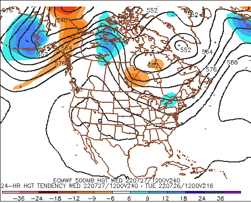
Check out this GFS surface synopsis ...18z Wed, 974 years from now... Note, 582 hydrostatic heights over such a large envelopment. That's f something to behold ...even if it is likely the GFS daydreaming. By the way, ...for the first time ever the UK office has officiated a forecast for London taking the higher temperature to 40 C, purely as a metrical/objective forecast projection. There's a little known global wave spacing -related telecon that when it is cold(hot) in NW Europe, it tends to be that way over the eastern U.S. Not sure if that works in the summer, though. But it "might" not be a coincidence that we are heating up this next week at least in "some" fashion, as it fits the 104 on Tuesday. But man... 101 then 104 for London, Mon and Tue? wow..
-
I wouldn't be surprised if that's an 83..87/ 68...73 type of week. I'm not getting a whole helluva lot of solar insolation vibe out of that synoptic appeal. Looks like morning debris ..then hazed sultriness with distant booms capping high potential. Definitely Mon/Tue... Thur/Frid ( for now ) look like the best chances for fart on the neck days.
-
That's actually a good question 'implicit' in there, as to "weather" ( heh ..) that perceived/modeled circulation changes are pattern migration versus seasonal forcing ? I don't know..I've been trying to find pattern markers up stream ( Pac and Pac relay into N/A ...) and there are some -but not convincing. It's very difficult to do that analysis at this time of year, with wave functions seemingly more 2ndary/emergent than propagating. I am noticing that WPC is also reacting to the Pac changes though by intensifying the cool anomalies over Alaska heading into the 2nd week. That does fit the stretching flow along 50 N from the Berring Sea across the Continent. At the same time, ...yeah, the erstwhile seasonal bias has been an unusually fast polar jet lingering R-wave structures into the summer. It's why the persistency in SE Canada was so anchored. God let that happen in November please - I love me some front loaded winters... What? 2010 since the last one? They fit better with my own preferences - I hate winter after about Feb 10th every year - but am happy to play the hypocrisy card when a rare March bomb is in the betting pool. I digress... Anyway, that anomaly with the westerlies really should be seasonally forced out at some point. Maybe the two aspects are not mutually exclusive events. Lord am I a nerd


