Typhoon Tip
-
Posts
44,835 -
Joined
-
Last visited
Content Type
Profiles
Blogs
Forums
American Weather
Media Demo
Store
Gallery
Everything posted by Typhoon Tip
-
Significant Miller B Nor'easter watch, Apr 3rd-4th
Typhoon Tip replied to Typhoon Tip's topic in New England
2ndary takes over it’ll truncate the elevated warm tongue. -
Significant Miller B Nor'easter watch, Apr 3rd-4th
Typhoon Tip replied to Typhoon Tip's topic in New England
Prolly should go with the JMA... 2-3" of liq equiv over 24 hrs of rampaging Nor'easter -
Significant Miller B Nor'easter watch, Apr 3rd-4th
Typhoon Tip replied to Typhoon Tip's topic in New England
Steve ... I don't really care to get involved in that hair pullin' match but just for morbid curiosity .. why do you care so much what Scott's attitude is? LOL -
Significant Miller B Nor'easter watch, Apr 3rd-4th
Typhoon Tip replied to Typhoon Tip's topic in New England
Yeah... Kevin was mentioning this earlier this morning -
Significant Miller B Nor'easter watch, Apr 3rd-4th
Typhoon Tip replied to Typhoon Tip's topic in New England
It's probably hard to parse this out of the general model noise at this time, but the NAM at this range has a NW bias -
Significant Miller B Nor'easter watch, Apr 3rd-4th
Typhoon Tip replied to Typhoon Tip's topic in New England
Little leery of that -NAO perhaps showing up to a party where everyone's more than less gotten lost in cutter thinking. We're in a kind of fun-house modeling era. NW should really be less favored. Yet, our canonical storm is plagued with nuances to press the statistics... squeezing harder and harder NW into statistical domain that is lesser and lesser correlated with these western -NAOs. Mm, some part of my inner voice keeps whispering red flag ...but I also acknowledge the lateness of the year. Its taking on a bowling ball structure so early. We could actually correct some of this south closing in, while also weakening the total storm profile - both aspects would satisfy these oddities. It's a bit ironic... the NAO handling has been the most consistently immutable presence on the charts going back over a week. The NAO is traditionally a lower performance skill beyond short range, regardless of guidance source. I guess even the runt on the team hits the game winning shot some time. I tell you, the RGEM beat out all the guidance in the storm in early January. Granted there is a big fat 0 analog to this, but in so far as behavior ... it just reminds us to be cautious. I've always been more impressed with the Canadian suite during stronger blocking eras. -
Kevin's exuberance aside for moment ... There has been a very abrupt changing of the guard signaled for quite some time amid all guidance, that sets in as this storm in the nearer term is exiting. Really quite abrupt as it is leaving. It's readily identifiable just looking at the actualized/operational model paintings from April 7/8 ... 11th. Not always but uuuusuauly, when the extended range operational models turn the paint brush with the colors provided by the teleconnection, that's higher than normal confidence for given extended range - There's literally about a day's worth of transition between the storm and the arrival of 60+ air. By the 9th 70+ F air would thermodynamic supported in the EPS layout with +7 to +10C 850 mb air mass sprawling across the lower Lakes and NE. It's ways out out so these synoptic metrics will be tinkered with ... but the general continental synoptic evolution through that period has been unusually stable in the guidance, suggesting a few days of d-slope/W wind transporting anomalous 850 mb thermal layout. I mentioned this a several days ago that the 2nd week of April appeared to be big green-up acceleration week ... I mean it's been in the advanced telecon, and since .. .the emergent model layouts with just as much consistency really as this storm in the foreground. interesting... it's like a wholesale 'climate couplet' and we emerge even for the first 10 days of the month.
-
Significant Miller B Nor'easter watch, Apr 3rd-4th
Typhoon Tip replied to Typhoon Tip's topic in New England
and I'll add ... the position 'over the thumb' is stressing this type of -NAO correlation, too. I'm not sure if seasonality may somehow transitively allow that? It's stressing but I suppose not impossible. I kind of like mid range 'path of least resistance' to correct things. The "correction vector" is pointing toward less penetration to those latitudes, though. The other thing that makes that odd is that this block, albeit in the process of breaking down as this event is unfolding ...is retrograding S-SW. -
Significant Miller B Nor'easter watch, Apr 3rd-4th
Typhoon Tip replied to Typhoon Tip's topic in New England
That's interesting ...that's not the same as the 06z source I've seen, that places that cluster a little E of that toward the arm of the Cape. This above suggests the low probably stalling for 6 hrs over Providence. ha -
Significant Miller B Nor'easter watch, Apr 3rd-4th
Typhoon Tip replied to Typhoon Tip's topic in New England
It was ... but the point was that it hasn't deviated. I hunch that it'll be the same at 12z today - but we'll see. I don't particularly trust that guidance source ( lol ). It is what it is. I really just posted that as a tongue-in-cheeker. -
Significant Miller B Nor'easter watch, Apr 3rd-4th
Typhoon Tip replied to Typhoon Tip's topic in New England
Few pages behind in this thing, but I like the GGEM's blocking influence, during -AO and/or -NAOs, more so than the GFS Euro (for positioning aspects in space) and always have. Maybe it's something to do with that index being more important/urgent in every day means up there, but just anecdotally they seem to do well with that aspect. A blend in the ens means may be more useful. I haven't looked at jack squat since very early yesterday morning and that was a just a cursory pass thru. Fwiw, yesterday's Euro and GGEM solutions from 00z ( now 36 hrs old) vs last night's, other than essentially meaningless differences were remarkably similar. This looks like to historic storm on Jan 31st, but since it is March 31, we are getting some geriatric diminishing returns due to seasonal aspects that cannot be avoided. Again, this system is unique relative to anything we've seen this last season. It is anchored by the index rate of change, which is why it is moving so slow. It's driven by sub-PNA --> +PNA with a well timed NE Pac S/W diving in. This latter wave space gets caught underneath a very potent albeit -NAO burst over the western limb of the domain space. That is dense statistical correlation for just carving over the Del Marva ...yet the GFS once this over Worcester. Anyway, the wholesale event is some 30 hrs in some of these model because it is straight up index driven event... Unfortunate that it is happening on March 31 and now January 31. Shave 3 deg for winter climate off that thermal plumb and this thing would easily be a top 10 event. Not only would the ptypes be settled, but the more intense baroclinic axis throughout the entire domain would positively feed-back in consolidation and higher storm productivity results from that. So a few realistic aspect that cannot be avoided in this from what I am looking at. The JMA has never deviated from a blockbuster blue bomb, btw. If for cartoon value alone, this is a pretty ominous look -
Significant Miller B Nor'easter watch, Apr 3rd-4th
Typhoon Tip replied to Typhoon Tip's topic in New England
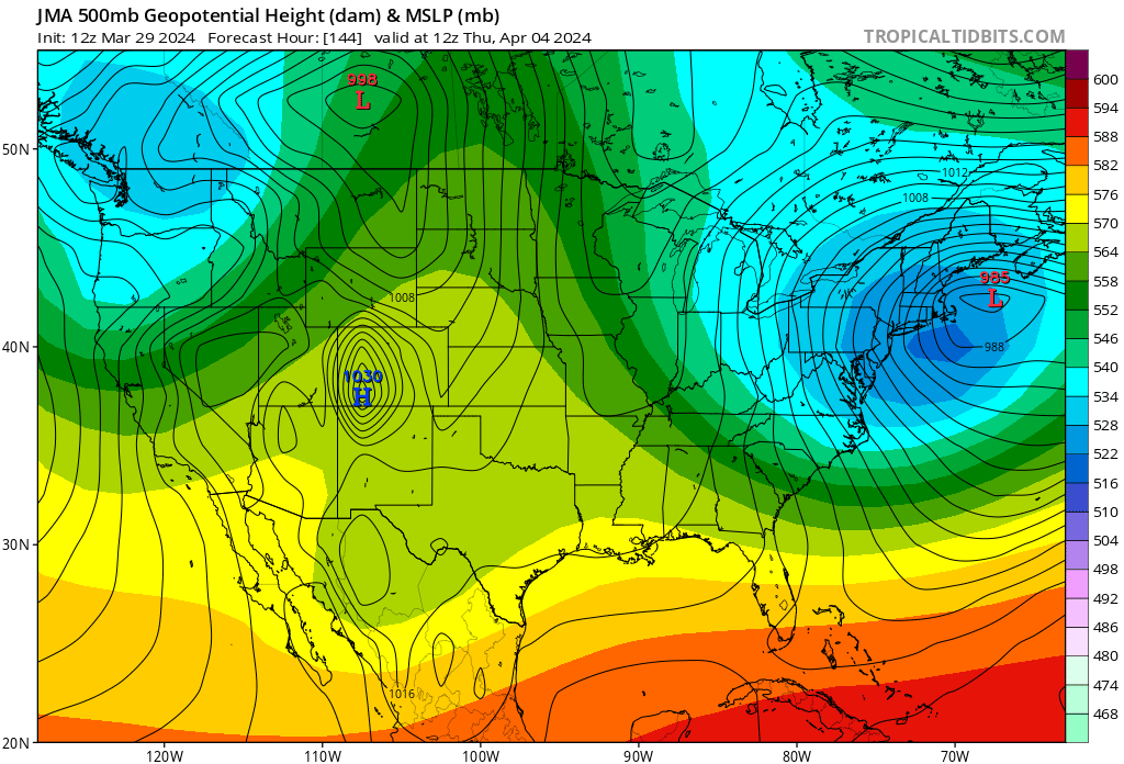
It’s a coarse model that probably isn’t very good… but the JMA’s 12z took 24 hrs to get to this arrangement below, a time span in which everyone remains below 0C at 850mb the whole way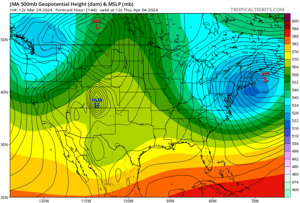
-
It really is remarkable how quickly at least in the operational GFS, is transitive … Tries to go from the substantial snowstorm in New England all the way to the mid 70s just three or four days later.
-
Significant Miller B Nor'easter watch, Apr 3rd-4th
Typhoon Tip replied to Typhoon Tip's topic in New England
Lol dont play with my junk … I meant that as a headline like, “severe thunderstorm watch” fwiw -
Significant Miller B Nor'easter watch, Apr 3rd-4th
Typhoon Tip replied to Typhoon Tip's topic in New England
This ending up more central NE and N is also on the table. Duh... but just pointing out that NYC/CT and RI peeps need to be aware of this in the evolving totality of it -
Brooklyn' or Drag perhaps consider a thread for this for early awareness. pushing -3 ( perhaps - 4! ) SD anomaly ... trending under Long Island in recent guidance; this is historic/inference quite significant, and here there is enough cold. Primarily this is an interior CT and points NE emerging threat, but the wholesale manifold of synoptic metrics are not excluding this reaching back SW as a major blue snow player, either. Super synoptic considerations have shown remarkable continuity ( -NAO over the western limb) with apparent highly coupled trough. These REX couplets tend to operate within themselves and often disconnected from the telecon tapestry of the surrounding hemisphere where they set up this coherently.
-
Significant Miller B Nor'easter watch, Apr 3rd-4th
Typhoon Tip replied to Typhoon Tip's topic in New England
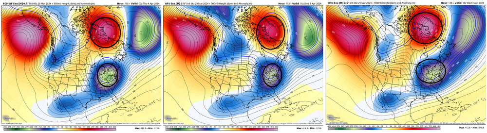
I made this same comparison over another system a week ago ... ha! thing is, most spring events probably carry this kind of genetic likeness in the 500 mb pieces. But this is multi metrical/layering. You can really make out how the shortened wave lengths are working in conjunction with the cold anomaly situated GL-NE over top and how all that creates these rare late deals. Folks should bear in mind that whatever has happened between October 2023 and March 2024 bears 0 indicator significance for what's being set up by the model. It's particular type of exclusive seasonal predicament that causes these that is unique to the spring season. -
Significant Miller B Nor'easter watch, Apr 3rd-4th
Typhoon Tip replied to Typhoon Tip's topic in New England
Yup -
Significant Miller B Nor'easter watch, Apr 3rd-4th
Typhoon Tip replied to Typhoon Tip's topic in New England
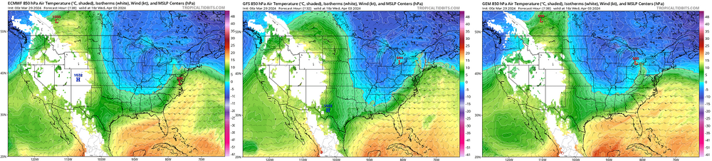
On that run/model? yeah... Haven't seen anything but a glance at the GFS which appeared at to at least not argue. I noticed that the 500 mb in the leading time intervals on this GGEM run ends up some 3 deg latitude deeper along the M/A, before the cyclogenesis dynamic feedback repositions the whole structure to what amounts to the idealized position/climate reference for absolute maximization. Yikes. Very deep while at that location, too. Cold is is NOT in short supply, either ... as I heavily demonstrated in the thread opener, there is a big sprawling cold lower tropospheric anomaly in situ, prior to all this unfolding. Considering the seasonal warming signals is still alive and well S of NJ... that sets the domain table with am acutely explosive potential. That's probably why we're seeing some upper 960s mb low results coming out ( 00z Euro and this ICON ..etc) This goes form a significant season ending/blue bomb snow, to a historic suggestion should this continue - won't pull that trigger yet at this range ahead. But I will caution, big events in history almost always have an usually long lead with more coherent than normal actualized charting. I'd say this system has a lot of upshot potential in general though. It has a ceiling that is very high. It's anchored by the index mode rate of change, which is also in constructive interference with the wave mechanical movement through the field - we've observed good index signaling in the past but the flow itself being so fast detracts from realized physics. The models have gone and set up a big one here at the time of the year when the speed of the flow is stepping off the accelerator - that means the physics can be tapped. So we'll see -
Significant Miller B Nor'easter watch, Apr 3rd-4th
Typhoon Tip replied to Typhoon Tip's topic in New England
Yeah...these individual runs are producing some love at first sight eye babe solutions .. that GGEM is a ceiling storm -
Fwiw - the CCB has been trending S though the last three cycles. It's hard to quantitatively assess that because the system is really sort of two events in a 'contact binary' The other models show a lead wave triggering steady cat paw if not wet snows for 9 or so hour prior to the hog balls mid level amplitude then spinning up a main low. That lead 9 or so hours is a coin toss because of a marginal thermal layout. The GGEM and operational Euro (standard) are cold enough at 850 mb through the lead, and the 2nd more potent near bombogen deepening rates underneath is no question we all flash to snow. The AI version is sort of blurring the distinction of the two pulse scenario by just having a weird CCB that presses S with limited associated 2nd cyclone depth associated, underneath. Busted ravioli low with CCB over top is a red flag for piece of shit model handling - something more significant is liable to be there
-
It'll be interesting to see how fast 15-20" of blue bomb high h20 content snow disappears. As persistent as this signal has become in recent days ... so too is the handsome mild to warm signal for the 7-10th of the month. But obviously ... long range blah blah not withstanding. The Euro and GFS both implicate a middling to major snow potential, followed by a real shot at 70 F by the afternoon of the Eclipse.
-
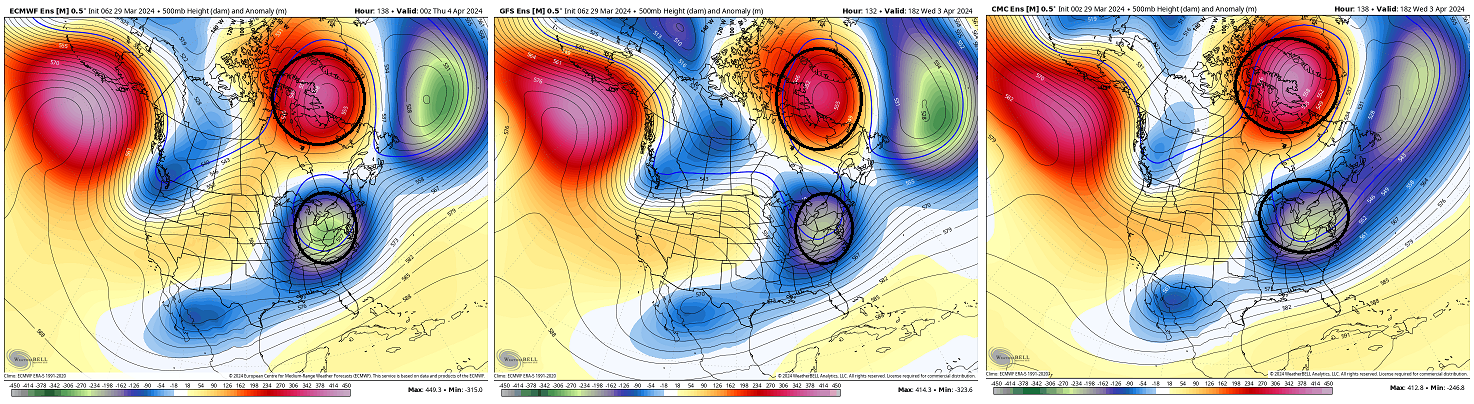
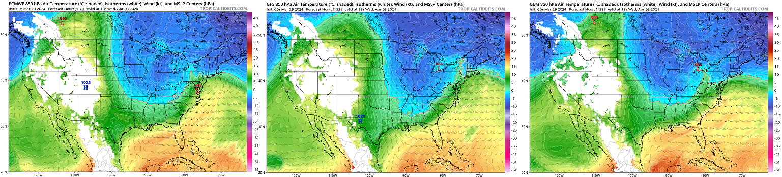
Significant Miller B Nor'easter potential is signaled across Apr 3rd-4th ... A chilly 850 mb anomaly is in position over SE Canada ...infiltrated throughout the eastern GL and NE England regions, prior to a strong -NAO maxing over the western limb of the domain. This aspect is situated while there is an undercutting trough of significant amplitude. Any kind of emergent trough is highly statistically correlated with this particular kind of -NAO expression, but below we see what really amounts to a phenomenally exquisite expression of that. Given to the high correlation, notwithstanding the "stable look" to this synoptic evolution ... confidence is quite high for at least the general set up. Anomalously high baroclinic instability in situ despite the lateness of the date/spring season. As the above mid and upper level events unfold over top that lower level temperature gradient ( see the 850 mb charts from the operational Euro/GFS/GGEM further above) ... strong cyclogenesis is well within the realm of possibilities, and the only limitation on this as far as I can see given these rather elegantly, yet glaringly obvious precursor metrics is the fact that this above is about 144 to 156 hours away. Unfortunately ... confidence is only very high for an event. What that event's particulars will mean as far as specific impacts is still pending. But sufficed it is to say ...this is a classic leading layout for late season snow impact. What is also interesting about this - from a personal anecdotal/experience perspective, these spring storms tend to actually be modeled more marginal/warmer than this, at this sort of time range - only to tick colder as the time nears to a 'blue timber bender' storm. This already has the look from all sources, and has been a recurrent theme over the past week. Dynamic height falls and just wholesale evolution of common winter metrics that are involved, snow would be a slam dunk. It's worth it to follow this ...lest the new April thread has a 100 pages by the 5th of the month... I also am aware that interest in winter -related subject matter may be diminishing at this point. Seasonal awareness, along with just issue fatigue for having been abused so mercilessly over the last 4 months ( LOL )... but it is what it. It is noted that the 00z Euro CCB's the hell out of interior and eastern SNE out of this ordeal. It is also something that we haven't seen much of in recent years, a slower moving event.
-
Racked up another positive temperature day despite feeling miserably cold and gloomy ... this is how we contribute to CC here.
-
12z Euro's another flooder ...but does bring goodies to the winter hold-out types from Brian-like and points N. Also has the balmy bubble air mass formulating after that from 7th on spanning SE Canada/NE and the OV, too.