

Typhoon Tip
-
Posts
44,539 -
Joined
-
Last visited
Content Type
Profiles
Blogs
Forums
American Weather
Media Demo
Store
Gallery
Everything posted by Typhoon Tip
-
Yeah .. agreed. Was tracking the possibility that a more substantial 'heat burst' synoptic interval might nest in there but that appears to be shrinking pretty obviously at this point. One aspect that is still out there for me is a regression beyond the 10th regardless of what happens in the foreground. In fact, there's already telecon support - granted it is out at the edge of the "probability horizon," the NAO appears prone to tanking by both experience at this time of year and blah blah. For winter enthusiasts ... pump the breaks. 'Have to keep in mind that July is still coming, and in order to get there, the sun is climbing ...and it does so at a particularly fast rate during March. It does begin to diabatically force the hemisphere, detectably so even between March 1st and the 10th. BUT, if overcome, look out! Some of the biggest bombs in history have takin' place in that window for good reason. If there is an anomalous wave in the flow that entangles a pocket of cold ...the whole thing can get a kind of diabatic "steroid injection" ... etc. Not saying that's happening... but the NAO is unanimously sloping toward -1.5 SD, and it's not a "spike" ( which is dubious behavior for that particular index), but takes place over a week's time and is descending along a non-perturbed trajectory - gives it more credence. Meanwhile, the PNA rises from -3 SD this week, toward neutral. It's not exactly positive? The +delta is likely more telling with that. It's just the way the 'experimental' extended range has continued to look.
-
I've been pretty vocal myself that I thought mid March may regress some after an early balm period (maybe that's a twitter thing? ). Not sure of a regressed month, no ... I'm just basing it on the last 30 years of "existential climate" during both autumns and springs - it's pretty clear in my own memory that large scale driven warm surges have faded into often enough -NAOs. To wit, that has some basic synoptic arguments to back it up I remember the October snow storm back in 2011 - can you believe that will be 13 years this fall ? whole decade, poof ... Anyway, it was near 80 F in mid early to Mid October, than we had cold nor-easter with cat paws, followed a week later by that event. That's an extreme case, granted. Having said all that.. sure, March 2012's probably have a return rate. I got to say ...it's hard to 'standardize' any of this though, because springs over the last 10 years have been wildly warm and cold at both ends.
-
I don't doubt it. hey what were those dates on that?
-
After a decent attempt yesterday ...the operational runs regressed to finding any plausible physics they can find to abase their own ensemble means. All of which actually are either the same or even more so amplified with the ridging we've been tracking.
-
We'll see how things materialize in the runs going forward but I'd remind that we are tracking the 80+ phenomenon as a new spring "threat"... It is a harmful influence too. Orchard crops will respond and that's a problem for obvious reasons, when onward in time the warm troposphere migrates into a -NAO phase and we risk freezing
-
I kinda wanna start a thread for what could be a historic heat burst - conjectural +15+ diurnal means for 3 days ? ... We don't get ours in July's like they do in Eurasia, probably do to converging continental with subtropical meridian flows. It's hard to extend BL when the DPs 78 degrees when there's whole country's aerosol anus pointing right at us, while we're so close to sea level/air density. I suspect that's why we've been getting so many 92/77 days under 590 hgts. They're doing 104 in Iowa with that where their sigma starts at 700 feet. Anyway, we get our synergy heat in springs it seems. Can't wait until BTV is 100 on May 8th while HFD is 82 with a S wind.
-
It was a Flop... February 2024 Disco. Thread
Typhoon Tip replied to Prismshine Productions's topic in New England
Definitely must have been some regional variance there... It's anecdotal but it was horrible down here. You'd pull into your driveway, park the car, and in broad daylight sometimes even with the sun shining, the mosquitoes would immediately be bouncing off the windows of the car. Closer to dusk you ran to the front door and hoped you didn't drop your keys fumbling around in haste because there'd already be several of them landing on your forearms, while the atonal chorus hummed around your ears. Ticks were everywhere, too. -
I didn't know this thread started. I'm sure it's been covered but... the 12z GFS oper continues to trend toward a more cohesive/less perforated eastern continent ridge in the first week of March. 3-6th may even have a synergistic warm burst in there. 582 dm non-hydrostatic hgts near-by our latitude that early ceilings the anomaly products. For now the modeled hydrostats are held up toward 552. It's as though the models don't integrate diabatic modulation of the tropospheric sounding because that does that every year/early spring when a warm up is in the 8-12 range - they edge the 850's on the cool side, and limit 2-m results. Given that surface pressure pattern everywhere E of the Rockies and S of 55 N across the conus under said burgeoning ridge, in a world that has a decadal history of warmth explosions ...that seems like an overall candidate period for warmth to exceed present guidance.
-
It was a Flop... February 2024 Disco. Thread
Typhoon Tip replied to Prismshine Productions's topic in New England
Two days later ...this is a hinting at synoptic feed-back synergistic warming ...582 dm height to nearly western NS that early is impressive -
It was a Flop... February 2024 Disco. Thread
Typhoon Tip replied to Prismshine Productions's topic in New England
Cleaner, much less perforated ridge has trended toward coherence over these last immediate 3 cycles of the operational GFS. Each one was a little improved over the last. -
It was a Flop... February 2024 Disco. Thread
Typhoon Tip replied to Prismshine Productions's topic in New England
It seems to be the last of the -EPO's cold loading from last week's dive. Can trace the air mass back... And it does appear to be the last as this week the transition into an entirely new paradigm gets underway. Who's to say if it sets the table for the whole spring (we may regress mid month), but at least that first week of March, the overnight op versions looking more concerted with the ens telecon projection. Lawns tinting green with forsythias -
It was a Flop... February 2024 Disco. Thread
Typhoon Tip replied to Prismshine Productions's topic in New England
It's probably not entirely true but I've read they don't move slowly. They can run ... and run at you. -
Occasional Thoughts on Climate Change
Typhoon Tip replied to donsutherland1's topic in Climate Change
It's nice to see some data ... (if the above proves veracious enough - ) that corroborates what I wrote about a few posts ago. Paraphrasing ... the transition to green power ( at least in our society ...) is so far completely wrongly incentivized. Really, these are just greedy, morally questionable at best venture enterprises. They are "gray-area sociopath" outfits, only seeing opportunity there that presupposes any kind of connection to why it is actually needed. These "solar programs" are a complete waste of time and only adding to the problem. There has to be a broadly sweeping, cost-controlled social program that diverts humanity's extinction pathway. I have a friend that is about to pull the trigger for a 58K installation cost, up on the roof-top of his sub-colonial sized suburban home. He's trying to argue that rebate programs will offset the coast... and how that and monthly loan repayment is less than paying for NGRID over the long haul. Okay, buuut... rebate programs (government) come from tax payers ultimately ... It's just redistributing the huckerstism, white-washing the background truth of how the econ mathematics works. He says as long as his monthly bills go down. This is stupid... sorry. It's wrong on both ends. He's not worried about GW in that arithmetic - he wants his monthly power bills to come down. The purveyors of Solar PV and so forth, aren't interested in offsetting GW ... they're seeing a profit wagon. They're not doing it for the right reason in other words. -
It was a Flop... February 2024 Disco. Thread
Typhoon Tip replied to Prismshine Productions's topic in New England
ticks I imagine will be at an all-time bad this warm season. Lack of sustained cold seems to be correlated to all these increasing numbers of critters. Not just that ... but the whole invading southern species thing. Either taking advantage of a retreating frost line that no one in here admits while claiming they don't deny climate change ( snark intended - ), or even climate refugee diaspora in the animal kingdom in general, there's weird colored bugs with poky parts everywhere now that I don't recall ever seeing having lived my life along 40 N. The week after this last Thanks Giving, I pulled a tick off my person. I'm like Dec 2nd?! We're pullin' f'n ticks off in the winter now I guess. Not idea where that I picked up that vampire. I don't see how the last 10 years of statistical changes in the insect population was alleviated by this particular winter's shirking. -
It was a Flop... February 2024 Disco. Thread
Typhoon Tip replied to Prismshine Productions's topic in New England
Operational models ran a bit milder overall for the latter mid/ext range. -
It was a Flop... February 2024 Disco. Thread
Typhoon Tip replied to Prismshine Productions's topic in New England
To me ...that frontal whole thing reminds me of one of those early December S gale deals. Like, we don't typically see those this late in winter. weird. Really, think back - steeply kinked baroclinic axis with gradient compression on the warms side is so November.. Only in this case, it doesn't herald in the first cold change ... -
It was a Flop... February 2024 Disco. Thread
Typhoon Tip replied to Prismshine Productions's topic in New England
Nice GFS -enhanced hallucination off the EC in the chaos range. That whole entangled train wreck out there is completely fabricated by the physical processing emergence - there's no identifiable feed into that sytem, and given the total envelope of environmental, and modeled synoptic parameters, there's very little credence to a spontaneous cyclone driven by oceanic heat, either. This model just cannot leave ridges alone. This run exposes big brother constantly flicking ears. -
It was a Flop... February 2024 Disco. Thread
Typhoon Tip replied to Prismshine Productions's topic in New England
We've had some weird cold shots in these recent Mays, people. I've seen and/or heard of snow being reported across multiple Mays since the year 2000, waay vastly more often than I ever did growing up in the 1970s and 1980s. That's not gaslight-able otherwise. -
It was a Flop... February 2024 Disco. Thread
Typhoon Tip replied to Prismshine Productions's topic in New England
This is the related to the mantra I've been raging about for 15 or more years... The problem with Global Warming is that it does not have enough 'natural advocates' ... by that I mean, it does not appeal to the nature senses, which is what all biological organism use to judge their environments. Humans are capable of connecting discomfort to the abstraction of CC, but discomfort has yet to be truly registered. The majority population needs to actually be in fucking pain before they admit anything... Until then, just about everything and every sense of reality in how humanity carries on with their worldly and not so worldly realities, all of it, is dependent about a ways and means that has to change: we're asking them to change all that ... based upon something that is not registering. Failing that...5% of the general population is capable of projecting a dire end result and actually willing, therefrom, to response an appropriate action that prevents harm. 95% are instead waiting for the report to be obvious, at which time it is too late. Weeeeee! Simply put, people deny CC because they can, and are running with it .. because the combination of understanding CC ( how and implications ) is too vastly complex to readily understand, combined with not registering ( anyway) gives them a false/reinforced sense of abstinence to the crisis. But that's a digression... You're absolutely right about the system changes taking place before the registry of the 95% doomed - -
I've noticed this will all storm logistics in recent years ( another new aspect ) that they come down to relative error management. Like, the extended range is too amplified almost always. But, then as the storm nears, the correction they did to attenuate was correct, buuut because PWAT is a burgeoning parametric due to you know what ...the storm than over-achieve relative to the weaker profile. I see this kind of two-step dance with other aspects in synoptic handling too. You get some back, or lost ( in either direction ) at relative scales.
-
It was a Flop... February 2024 Disco. Thread
Typhoon Tip replied to Prismshine Productions's topic in New England
Exactly what I just said, too. Yup. It's a 'cold purgatory' that doesn't mean snow. Take a seat at the table and eat your New England spring dog shit cursed cake - Re the ensembles... yeah, all three ens mean sources have been routinely warmer than their operational versions. The GFS ( as is typical for that model) has been the worst offender. The GGEM has had one or two runs that came close to 'filling in' the potential...but last night it Charlie Browned with a particularly big serving of said dog shit. Euro's essentially the same as the GGEM. It's that duping song and dance where these solutions are cold despite the warm heights -
It was a Flop... February 2024 Disco. Thread
Typhoon Tip replied to Prismshine Productions's topic in New England
Maybe not, see the post I just made - -
It was a Flop... February 2024 Disco. Thread
Typhoon Tip replied to Prismshine Productions's topic in New England
Yeah ... but subtle signs that -NAO may crop up are in play ... we need a longitude flow structure. The GGEM shows how to muck up warm outlook by buckling the flow as it's leaving the continent N/NE/E of Quebec into the Maritime. Result is strong confluence generating big fat wrap around high pressure and no warm air is getting in here if that happens. The other operational models are also doing something similar. GFS can't wait to abolish warm air as native bias about that particular model anyway, but the Euro too. Not a warm surface chart implied by this These operational runs are trying to enter a pattern ( if not seasonal ) transition. That requires evacuating the semi permanent SPV out of Canada ... It's a classroom in how these seasonal move intervals actually can cause us here in New England ... particularly eastern New England, to get cold relative to the pattern look. As the SPV ( or any trough for that matter) attempts to exit, there is an interval of confluence where the arriving continental changes impinges on the backs side ( confluence) and that sets off our idiosyncratic "atmospheric Labrador" conveyor. Everyone else east of 100W across CONUS balms... except here, we sometimes get stuck in a cold purgatory (no, not a snowy one - just hell). We have to watch for that. It's possible these runs are going too far with the trough amplitude through eastern Canada. If that alleviates in future cycles, there'll be less of that big cold elephant's ass looming over top with it's chilly marine rhea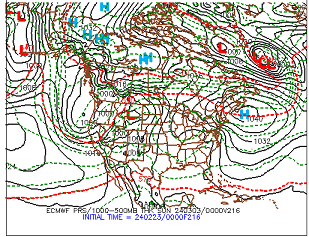
-
It was a Flop... February 2024 Disco. Thread
Typhoon Tip replied to Prismshine Productions's topic in New England
In this group of clearly socially aware non-spectrum users ? I'm guessin' that's likely -
It was a Flop... February 2024 Disco. Thread
Typhoon Tip replied to Prismshine Productions's topic in New England
Did I use the word "impossible" ? I said wondered off the ranch, unconstrained by chaos. less likely to verify given all possible outcomes.


