

Typhoon Tip
-
Posts
43,386 -
Joined
-
Last visited
Content Type
Profiles
Blogs
Forums
American Weather
Media Demo
Store
Gallery
Everything posted by Typhoon Tip
-
mm that's exactly the problem when I was whining above. There doesn't appear to be much large scale mechanism to bring it east. But you're right - these -AO/-NAO coupled aspects "might" offer winter enthusiast salvation.
-
It's been a specter growing more suspiciously obvious for 10 to 12 years, actually. I'm not saying winter(s) are out of reach - but we happened to be in a competing signals so ... I don't have any qualms about discussing the possibility that we've gone and moved climate to where we are on the plus side marginal scenarios. Could be wrong.. .but the evidence in both modeling tonalities and verification trends are tough to ignore.
-
None of these fuggin sources were .. jesus - cancel January if these first couple of opportunities fail. It's a wind blown -PNA/Chinook look in the 500 mb with positive hgt N-NE of Hawaii and a broad open trough through the west. Not sure I see how that ends well for the E. And it's not just that spatial version of it, either. The numerical telecons have -PNA/+EPO, which makes it difficult to argue against. The only thing that would save that is the -AO/-NAO. I would say 30 years ago ... not so sure with the climate now. It's just one in many nuanced ways in which these circulation modes are being modulated by CC that I personally cannot ignore any longer. However subtle or gross notwithstanding, it more than merely seems that when in a dilemma of diametric signals ( cold vs hot ) ... hot wins. It's just a matter of by how much of a margin. I'm looking at the 06z GFS and feeling satisfied eating shit (so to speak..). Because yeah, made the call that there should be systems in place around those time intervals last week. Wee... but the jokes on us because, has anyone noticed that the 0 C 850 mb isotherm is always on the NW periphery of system structures? It's never really IN the storm. It's like the storms are oil and cold side is water
-
My favorite winter promptly ends on Feb 15 followed by 70s and an eery absentia of BDs. Since that’s never happened my favorite winter is still out there… In the meantime … I’ll settle for anything other than this forced stuffing of shit down throat of a winter so far
-
Environmental Canada used to provide a really awesome product. It was the 2 m 10 day temperature anomaly. That thing was remarkably accurate at depicting cold loading post -EPO bursts or just in general. For some reason they divided the standard deviation in .4s or 4/10. So -3 SD was really -1.2 so a little annoying. Not sure where that went but when they swept their public access/web some 10 years ago, I haven’t been able to find it very readily. I think that would be really useful now considering -
-
The 2-m temp distribution is necessary there. Yeah. Pretty colors at 500mb over those latitudes can still be quite cold below. …very cold particularly if it’s taking place over a cryosphere - DVM caused ideal low mixed/ high decoupling potential at this time of year … etc I’m not sure what the state of the cryo is up there, just in principle.
-
I was speaking specifically to the GFS operational… Least that’s what I had in mind lol
-
I cannot even identify any of the entities that were previously on the charts. It's like something's come along and completely scrambled everything oblivion. Nothing is there that was there two days, absolutely. strange -
-
the aroma of bargaining psychology in here today is as fragrant as lilac wafts on a warm May day. And the irony is ... winter's not actually dead. It just hasn't yet shown up to the funeral to shock the shit out of everybody.
-
wait until it gets bad for those with sensitivity to tick borne deadly pathogens and brain eating amoebas
-
What if it doesn't snow an inch until March ...then we get 70 inches - what then
-
It's a 'flaw in the design' of social media. How does moderation ( which frankly in here ... doesn't seem to care or actually monitor - different discussion) determine the difference ? Plus, you and I troll each other ( for example) but we're sincerely busting balls for laughs. You can't allow that, and but then not allow the others. Yeah, the "intent" of others may be nauseatingly obviously and an insult-to-intelligence cloaked in careful phrasing - but it's not like it's okay to hijack a car if your just joking around? I'm kind of with JD. I just ignore 'em. But ... I don't even 'block' Uuusually I just can tell within the first sentence where the poster's intent most likely lies ( and "lies" ) and scroll on by. I mean it's not hard to do so. Usually good intentions qualify their remarks. When that never happens, just spewing ... immediately suspect. Other times? Ha, I may actually agree with them. Even when they are "really" trying to poke balls from the back, the joke may even be on them. They're unwittingly agreeing. Anyway yeah, there's a difference between objective criticism and/or objective forecasts that don't agree, vs those that attempt to 'sound' like they are in that group but are disingenuous about their intentions - the solution is to grant them no audience.
-
mm Teleconnection spread looked contentious for mid month, though. We have a -EPO early on, and there's ample suggestion among the operational runs ... materializing cold into the Canadian shield as a result of that. It's gonna set up volatility and potential for time as that happens - no question. But beyond the 5th, the EPO fades and actually flips positive in the index projections from all three ens sources. If the PNA were to stay positive we'd be okay - but the PNA projection beyond that is negative. So a +EPO/-PNA for mid month? It's a little bit of a head scratch though because the -AO/-NAO phase state is also in the outlooks/agreed upon. If these grander scaled telecon work out, it's going to be a merry-go-round badly performing operational model run era. I imagine the flow would have to be fast - wtf's new there, huh ... - because the Pac is a warm signal over the downstream continent, whilst the -AO/-NAO is not. So competing larger scale mass-field indicators makes for a mid latitude gradient rich environment with cold over hot. Seems the last several years ...one f'n way or the other we end up in mid winter with some kind of rage of velocity issues - so how's that for "persistence" ? we'll see
-
no argument from me. this seemed evident by late August or September frankly.
-
I don't necessarily structure my outlooks around analog method/philosophies, buuuut ... the overnight ensemble means appear to be leaning more Jan 7 as opposed to the Jan 5 . You might recall yesterday the trend was the other way/we discussed it. Then we have these la la range runs occasionally creating black hole quasar storms near the 10-11-12 ... I think above all else, we're seeing some of the most elevated potential power we've seen in quite some time painted on the longer range model canvas' As the next cold loading into the continent is very prolific, and down to perhaps 50 N, meanwhile this maddening warm belt lingers along the ~ San Francisco to VA Beach latitude. Pretty much a baroclinic particle accelerator between it and said 50 N. ha. That's probably why anything the model physics generate beyond D10 is exceptionally intense - any cumulus cloud that wonders through ends up being an Andromeda Galaxy. sorry babbling
-
The cold loading into Canada ( particularly evidenced in the 00z GGEM and Euro operational runs) appears classic -EPO related. Couple of plumes up there to -30 C at 850 mb. The fact that it's not really coming south of the border? that appears related to the collapse of +PNA toward neutral or even going negative. The vastness of the PNA allows for less tightly constrained results. What we need to consider when juggling teleconnectors (particularly when they are in flux), is that there can be idiosyncratic anomalies relative to what is the canonical correlated/text book layout. Some -PNA's appear instrumental in driving 60 F to Chicago and eventually Boston, while others hit a cold wall and a stationary polar boundary aligns just S of that axis. Mixing/snows on one side, and a tornado event south. These variances occurring at the same numerical index values. The PNA domain is truly huge. It covers such a vast geometric area that events over the Pacific may ballast the total index into a negative value, while the eastern limb of the domain (over N/A) may actually be structured more like the positive mode. And vice versa.. Granted comparatively less likely. The D8-9-10 of the Euro and GGEM have some syrupy cold right down to the border of Lakes/NE with Canada. That's awful close for the deep mid range model performance to expect that it's impossible for that to come south.
-
Those stem-wound bombs have been recurring in both the GFS and Euro beyond 300 hours. ( not intending to lecture you here ...) It's likely a factor of background volatility in a potential saturated hemisphere, more so than having a "real" system. I think when there is this behavior in the guidance, there might be some value in monitoring the period in question as the time ranges shorten. The idea there being ... as the time nears and any real entities emerge, they may be doing so in said higher dynamics environment. Maybe D9 ? ... usually by 7 if the system in question is destined to be a humdinger it start to pin to the charts as run-to-run identity.
-
serious Q' where did you find this ?
-
I still have not seen a lot of evidence that this El Niño is strongly coupled to the hemisphere to be honest. … there are aspects that appear to be so but enough that don’t that I almost wonder if the former are just coincidences
-
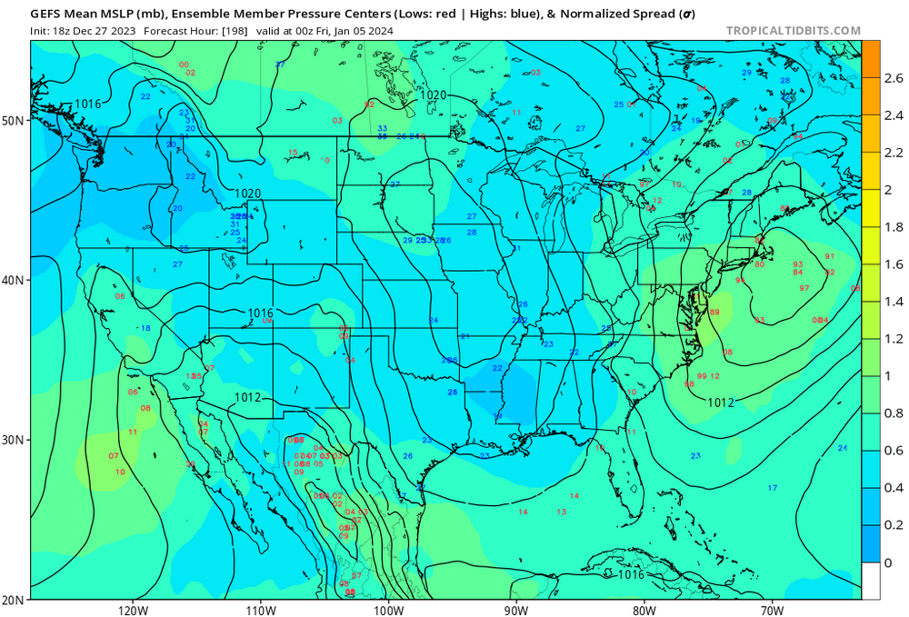
Fwiw the 4-6th a bit more coherent in the 18z GEFS
-
Does look like a slow moving spring cold front doesn’t it ha ha
-
Kevin, I realize you’re just busting balls - or at least I hope you are… – but just in case, no one promised jack shit.
-
Put down the beer. It’s past your bedtime.
-
… Basically, the normally inconsolable crowd in here is downright apoplectic, and cannot be penetrated with any form of rational thinking
-
Would still be a false assessment approach


