

Kevin Reilly
-
Posts
3,401 -
Joined
-
Last visited
Content Type
Profiles
Blogs
Forums
American Weather
Media Demo
Store
Gallery
Everything posted by Kevin Reilly
-

E PA/NJ/DE Summer 2025 Obs/Discussion
Kevin Reilly replied to Hurricane Agnes's topic in Philadelphia Region
No power still 35 hours and counting no restoration time estimated. -
E PA/NJ/DE Summer 2025 Obs/Discussion
Kevin Reilly replied to Hurricane Agnes's topic in Philadelphia Region
Enhanced risk of severe thunderstorms today I guess it’s possible for a tornado watch today starting around 1-2 pm. Looks like we have a difluent split in the flow which also probably means isolated to scattered strong activity rather than a squall line.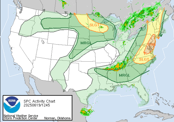
-
E PA/NJ/DE Spring 2025 Obs/Discussion
Kevin Reilly replied to PhiEaglesfan712's topic in Philadelphia Region
Over here just lifted north Low right on top of Media heading NNE winds clouds switched around to the NW a few minutes ago. Ended with exactly 1.00” since 8:30 pm. witnessed a tree on fire and telephone pole on fire from tree falling Barren Road and Painter Road Middletown Twp Delaware County. I called 911 fire police on scene in minutes. Great job!!! -
E PA/NJ/DE Spring 2025 Obs/Discussion
Kevin Reilly replied to PhiEaglesfan712's topic in Philadelphia Region
Oh, it is coming a wall of rain, wind, and embedded thunderstorms with isolated tornadoes marching NNE. My under over is 2.27" -
E PA/NJ/DE Spring 2025 Obs/Discussion
Kevin Reilly replied to PhiEaglesfan712's topic in Philadelphia Region
64f got nailed pretty good at peak SW winds gusted to 40-45 mph picked up 1.07” in 30 minutes long duration lightning and thunder all elevated no strikes. -
E PA/NJ/DE Spring 2025 Obs/Discussion
Kevin Reilly replied to PhiEaglesfan712's topic in Philadelphia Region
Mostly Cloudy breezy SSW wind 15-25 Pressure 29.76 steady 79f heat index 80 humidity 58% dew point 63 high so far 82f -
E PA/NJ/DE Spring 2025 Obs/Discussion
Kevin Reilly replied to PhiEaglesfan712's topic in Philadelphia Region
So…. Euro had 10” a few days ago and what I’m seeing the percent starts at 90% then drops to 80% the drops to 60% then drops to 40% then drops to 30% then zippo. This has become tracking a winter storm like looking for a needle in a haystack. NWS last night had heavy rain here for 3 days see about that! Guess it depends where the front and storm get stuck. Think someone said a few pages back hope the rain stops by next Saturday! Can’t stop if it doesn’t start. also nice to see the Southeast Ridge Bermuda high in place like it’s mid summer damm lightning bugs brought it I’m sure. -
E PA/NJ/DE Spring 2025 Obs/Discussion
Kevin Reilly replied to PhiEaglesfan712's topic in Philadelphia Region
71 f humidity 86% dew point 67f Cloudy, breezy West-southwest winds gusting to 27 mph. Total rainfall so far: 0.02" -
E PA/NJ/DE Spring 2025 Obs/Discussion
Kevin Reilly replied to PhiEaglesfan712's topic in Philadelphia Region
56f humidity 28% dewpoint 26f NE wind 7 mph The La Niña dry has returned -
E PA/NJ/DE Spring 2025 Obs/Discussion
Kevin Reilly replied to PhiEaglesfan712's topic in Philadelphia Region
Local elevation anomaly. -
E PA/NJ/DE Spring 2025 Obs/Discussion
Kevin Reilly replied to PhiEaglesfan712's topic in Philadelphia Region
Any reports for up towards like Mount Pocono / Hawley Pa Bushkills Fall -
E PA/NJ/DE Spring 2025 Obs/Discussion
Kevin Reilly replied to PhiEaglesfan712's topic in Philadelphia Region
Here in Media sleet with darting snow flakes we are west southwest of Philly so yes no joke 35f sleet and snow some sleet accumulation on the cars. It probably won’t last long once the sun works that 1-2 degrees of radiation will quickly put an end to any sleet and snow warm the surface just enough to change everything back to rain most areas except very highest elevations up north. In addition the intensity of the precipitation is lightening up now so cold air transport to the surface is starting to break down now here. Currently light rain and sleet mixed now lost the darting snow flakes. Total Rain: 1.80” -
E PA/NJ/DE Spring 2025 Obs/Discussion
Kevin Reilly replied to PhiEaglesfan712's topic in Philadelphia Region
Sleet and snow accumulation on the cars 36f -
E PA/NJ/DE Spring 2025 Obs/Discussion
Kevin Reilly replied to PhiEaglesfan712's topic in Philadelphia Region
Moderate to Heavy Rain 43f dewpoint 42f humidity 99% wind NNE 14 gusts to 26 Total Rain thus far: 0.88" I am guessing we would be snow now if this were January, February, or early March and we would have about 3-5" of snow on the ground and coming down an inch or two an hour. -
E PA/NJ/DE Spring 2025 Obs/Discussion
Kevin Reilly replied to PhiEaglesfan712's topic in Philadelphia Region
Cloudy 41f light drizzle rain awful out there! If only it was January or February. I have my new rain gauge out and ready to go let’s do this!! Snow north and west I’ll have my snow board ready just in case lol who am I kidding. I will just enjoy the rain. -
E PA/NJ/DE Spring 2025 Obs/Discussion
Kevin Reilly replied to PhiEaglesfan712's topic in Philadelphia Region
Media Low clouds fog drizzle 48f ENE wind at 8 mph Overnight low clouds / fog / drizzle Rainfall amounts: trace to 0.02 I did drive by Springton Reservoir yesterday it is up about 10% since early March when I last saw it. -
E PA/NJ/DE Spring 2025 Obs/Discussion
Kevin Reilly replied to PhiEaglesfan712's topic in Philadelphia Region
Funny you said this because that’s exactly what happened here in Media at 4:45 am this morning. -
E PA/NJ/DE Spring 2025 Obs/Discussion
Kevin Reilly replied to PhiEaglesfan712's topic in Philadelphia Region
Patience is needed. -
E PA/NJ/DE Spring 2025 Obs/Discussion
Kevin Reilly replied to PhiEaglesfan712's topic in Philadelphia Region
Not one drop of rain here today to this point here windy cloudy and temps 63f to 70f High today here 70f Currently 63f winds South 26 mph gusting to 37 mph. Rain today: 0.00 -
E PA/NJ/DE Spring 2025 Obs/Discussion
Kevin Reilly replied to PhiEaglesfan712's topic in Philadelphia Region
Oh it's trash night here so wind on!! -
E PA/NJ/DE Spring 2025 Obs/Discussion
Kevin Reilly replied to PhiEaglesfan712's topic in Philadelphia Region
Completely socked in here with ocean clouds. A wall of clouds rolled in from the sky east at 7 pm. you can see it on the visible satellite right into SE Pa over this guy! -
E PA/NJ/DE Spring 2025 Obs/Discussion
Kevin Reilly replied to PhiEaglesfan712's topic in Philadelphia Region
Any idea how Bushkill Falls are fairing up north may take a look and do some hiking up there in April. -
That matches the winter of 2024-2025 perfectly it's on!!
-
65 and sunny next run or maybe it shows this for three more runs then has the storm down in Jacksonville heading due east.
-
E PA/NJ/DE Winter 2024/25 Obs/Discussion
Kevin Reilly replied to JTA66's topic in Philadelphia Region
Yea I am watching the clouds ripping east southeast by the moon and temps rising from 40 to 45 in the last hour. Humidity 35-40% right.


