

wasnow215
-
Posts
875 -
Joined
-
Last visited
Content Type
Profiles
Blogs
Forums
American Weather
Media Demo
Store
Gallery
Posts posted by wasnow215
-
-
8 minutes ago, RVASnowLover said:
Yikes. Hopefully that’s overdone
Total precip is over an inch. Surface temps well below freezing. Again it’s one model and one run. But yeah.
-
 1
1
-
-
9 minutes ago, wasnow215 said:
Gfs a nasty ice storm Thursday night so far
Oof

-
1 minute ago, clskinsfan said:

Oof-that’s “generator ice”. TY
-
1
-
-
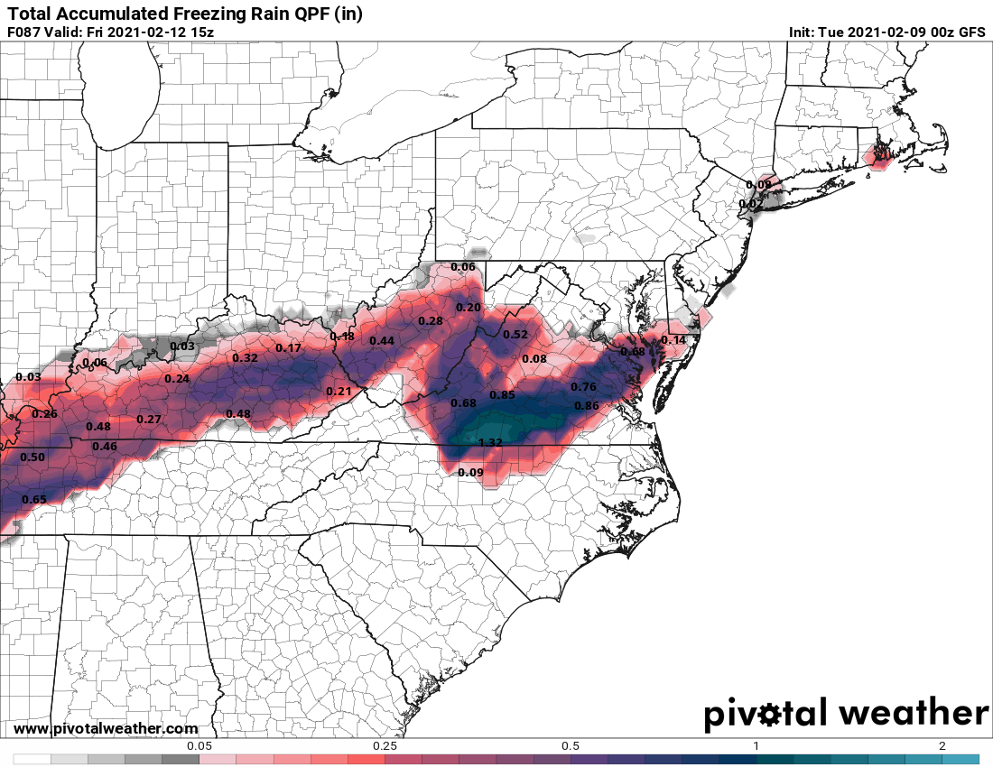
Looks like ice storm for Centtal Va on GFS. Any ice maps? Plz.
-
Gfs a nasty ice storm Thursday night so far
-
-
I saw that. Ty. Also saw someone say that the Icon looked like the European model but it looked nothing like it at all LOL
-
Does anyone have RGEM? It’s stuck on 24 hours on Tropical Tidbits.
-
Can someone show ice accumulation for Central, Va from this 0z Nam run plz?
-
3 minutes ago, Wetbulbs88 said:
I don’t think this will resemble the final outcome.
NAM at this range rarely does.
-
NAM north. Not in range until at least 0z tomorrow anyway, but has the ingredients.
-
1
-
-
As depicted with the euro at 12 Z it was a half an inch of ice starting very late Wednesday or early Thursday, and ending up as 5 to 10 inches of snow from south east to Northwest in the Richmond metro area. One reason I think it’s possible is because we are so close to the event it’s not like it’s 7-8 days out.
-
1
-
-
2 hours ago, RVASnowLover said:
Think euro ensembles are pretty decent for us. Several members out there with nice hits. The mean gives us 4-5
18z GFS cuts big time part 2. I don’t buy it. Onto 18z Euro n 0z runs.
-
1
-
-
4 minutes ago, Wetbulbs88 said:
How do people still take him seriously? Honestly I’m not bashing him but he is so irresponsibly early/bullish with his calls. Every. Single. Time. His record is appalling if you take him for his word 3-5 days out.
Agreed but besides the wording this time he simply attached today’s 12z Euro.
-
Ummmmm no mention of the 12z Euro? Everyone okay? Lol
-
 1
1
-
-
21 minutes ago, RVASnowLover said:
Saw that which I honestly would gladly take. Some of the weenies on the main thread make me laugh. They want storms to go south just so it can go north. They think every storm is going to go north when it’s south of them. Sometimes that does happen but not always
In my early days of this hobby would actually put stock in that silliness haha. One thing real interesting is seems like temps won’t be an issue especially late Thursday into Friday.
-
 1
1
-
-
4 minutes ago, RVASnowLover said:
There’s a little trend going on on the euro. Tick south and a little colder each run. Could just be a temporary thing. Well see
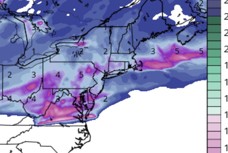
Was just gonna post about it. Looks like by looking at 850’s and then surface temps, this thing starts late WEDNESDAY as light ice and then 4-6” of snow by noon Friday. Most of the snow falling overnight Thursday into Friday morning. Again by 12z Euro only I’m talking.
-
2
-
-
39 minutes ago, RVASnowLover said:
GFS now showing ice as well Thursday night-Friday morning. Between .10-.25
And GFS says “I’ll double your ice storm” Sat into Sun
-
 1
1
-
-
The morning commute tomorrow could be a problem with low temperatures in the low 20s overnight tonight.
-
1
-
-
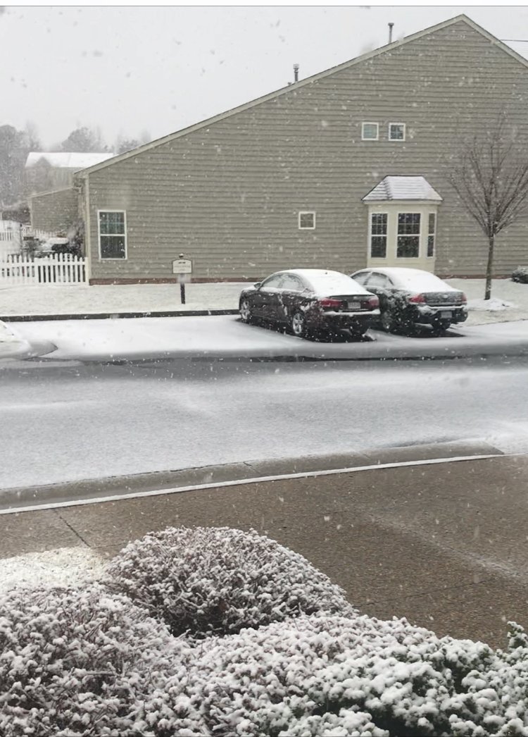
8 minutes ago, eaglesin2011 said:
Prob about an 1/2 to and inch depending on what surfaces you measure here NJ now
 in Glen Allen
At least an inch here now
-
-
2 minutes ago, benjammin said:
I'm afraid it's almost over for you all with the snow from the radar I can see. I hope I'm wrong though.
Sent from my motorola edge plus using Tapatalk
I’m glad you have radar because I don’t think any of us on here do lol.
-
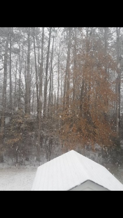
Same- heavy wet snow in Glen Allen. 32°
-

Richmond Metro/Hampton Roads Discussion
in Mid Atlantic
Posted
0z Canadian is all snow pretty much. 6-8”