-
Posts
4,734 -
Joined
-
Last visited
Content Type
Profiles
Blogs
Forums
American Weather
Media Demo
Store
Gallery
Everything posted by Windspeed
-
We won't have recon until mid-day tomorrow. John will be very near the shoreline and most likely a major hurricane by then. Given the slow crawl inland into mountainous terrain, the flooding potential with this is out the roof. 1. HURRICANE JOHN FLIGHT ONE - TEAL 77 A. 24/1730Z B. AFXXX 0110E JOHN C. 24/1330Z D. 15.8N 97.8W E. 24/1700Z TO 24/2030Z F. SFC TO 10,000 FT G. FIX H. NO WRA ACTIVATION
-
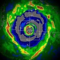
TS John may not be a TS for long. Obvious cyan ring centrally aligned within very deep convection. Clearly, the mid and low level vortex is stacked and this TC is taking off. This is going to be a hurricane prior to landfall, and unless shear gets in the way to disrupt the current structure, it may be a significant one. Plenty of time for rapid intensification to occur when it's slowly moving towards the coast.
-
-
Use the global OPs for pattern and track, less so for intensity. The ECMWF is excellent for overall track guidance. Obviously, if the globals are significantly intensifying a system, it's worth noting. But it is better to use the TC models for intensity once we have an established tropical cyclone. Even still, err on the side of caution because TC models can way overdo the intensity on an invest that has yet to form a proper vorticity maximum. That's a bit of a tangent, so to just be clear, focus less on the global OPs for exact intensity and more for track of system. I'd stress even further that the ensembles means are much better at determining overall track three-to-four days out, especially prior to TCG, as it's still unclear where exactly that will occur for initial origin of track.
-
Summer-Fall 2024 Weather Disco Med/Long Range
Windspeed replied to John1122's topic in Tennessee Valley
Going to have to start focusing on the tropics for the TN Valley. Multiple OPs and the ensembles are starting to converge on our region regardless of the exact landfall point and timing in the eastern GOM. Intensity would matter somewhat, but even a weaker system would bring heavy rain potential to the eastern Valley with mid-to-upper level interaction over the Ridge and Valley and Blue Ridge provinces. ETA sometime this weekend through early next week. Edit: If you will notice the ensemble mean tracks of the TC's surface low. However, the mid-level circulation and flow of the heaviest precipitation shield will likely move NE over the southern and central Appalachians while the remnant surface circulation bends back NW and even west. With the ULL setup and block, the entire region may get a good drenching. Hopefully, this will be a beneficial event without severe flooding, but I am getting concerned for eastern areas.- 688 replies
-
- 5
-

-
- heat
- thunderstorms
- (and 7 more)
-
9PM CST update from the NHC with regards to TD 10-E
-
Yeah, this might even reach hurricane intensity before land interaction. The strong convention looks aligned. Would be nice to have recon.
-
SSTs are plenty warm for high MPI. As has been reiterated, size and timing for the broader surface circulation to spawn a tighter vortex in the NW Caribbean/NE Yucatán/Channel/WCuba and placement of mid-to-upper trough/ULL are the biggest factors on intensity. A few hundred miles could be a huge factor on the shear axis ranging from a sheared TC to a well-ventilated one. Obviously, the uptick in intensity ranges on the OPs and ensemble suites are troubling, but in this time-frame, pretty much anything is still on the table. There are still uncertainties on ridge vs upper trough placement as well; therefore, residents in the western Peninsula still need to watch closely regardless if there has been more focus resolved on the Panhandle region.
-

2024 Atlantic Hurricane Season
Windspeed replied to Stormchaserchuck1's topic in Tropical Headquarters
Nice breakdown by Hazelton. -

2024 Atlantic Hurricane Season
Windspeed replied to Stormchaserchuck1's topic in Tropical Headquarters
Low background pressures and intense convective bursting throughout central America this afternoon. The broad surface trough slowly organizing and should resemble a CAG over the next 24-36 hours. At that point, we'll have to start focusing on the NW Caribbean for any potential vorticity that may spin off NE of the monsoonal surface flow. Heavy rains and flooding have already been an issue in Guatemala, Nicaragua, and Costa Rica today. -

2024 Atlantic Hurricane Season
Windspeed replied to Stormchaserchuck1's topic in Tropical Headquarters
-
I should clarify that the RSMCs in the Pacific did stop issuing advisories on Yagi when the remnants crossed into Myanmar. Though the surface low never dissipated. So technically, the TC did lose TC classification. But the low reorganized into a deep depression over the NIO and Ganges River delta region.
-
Unfortunately, it looks like the number of fatalities from Yagi will surpass 1k. Estimates as high as 10k are still missing and over 250k displaced. The aftermath to central Myanmar may have been the worst; some of the most severe flooding in decades has occurred there. Believe it or not, Yagi has never fully dissipated. The remnants regained some organization in the upper North Indian Ocean and brought torrential rains to Bangladesh and India. In fact, the circulation and convective envelope still looks like an organized tropical cyclone despite the center being far inland into NE India. Yagi will be retired. It is now the deadliest Pacific TC since Haiyan.
-

Potential Tropical Cyclone Eight—50mph/1006mb
Windspeed replied to WxWatcher007's topic in Tropical Headquarters
It looks like low-level vorticity is detaching from the front. Indeed, the intense training of supercells into SE North Carolina looks more like a feeder band versus the warm boundary layer further north. You can see the surface circulation right over North Myrtle with offshore flow now SW of tilted closed circulation. Low banding clouds are becoming more evident on the backside of the warm core surface vortex. However, the timing may just be too late here. It appears the surface low is going to make landfall before TCG can complete, and this system will not get named. I'm not sure how that will affect insurance claims with it not being a classified tropical cyclone. Unfortunately, the flash flooding that is ongoing looks to continue into the evening, as the dominate intense band north if the surface low does not appear to be waning. The 15+ inch totals are pushing inland now to communities like Bolivia. This area just got hit hard by an unclassified tropical low a few months ago. The inland flooding potential looks worse here than that former event. -

Potential Tropical Cyclone Eight—50mph/1006mb
Windspeed replied to WxWatcher007's topic in Tropical Headquarters
The system remains non-tropical. All you need to do is look at the motion of the low-level cloud field on visible. The surface low still has frontal characteristics. Regardless, Carolina Beach is getting smashed with extremely high rain rates right now. Hopefully, the core of this firehose doesn't pivot over Wilmington. -
Wrong thread, sir.
-

Potential Tropical Cyclone Eight—50mph/1006mb
Windspeed replied to WxWatcher007's topic in Tropical Headquarters
This scenario is why the PTC designation is great. Allows advisory packages and watches/warnings while also allowing meteorological transitions to complete. NHC is essentially waiting for the loss of frontal attachment here. It is very close and most likely goes straight to Helene. -

2024 Atlantic Hurricane Season
Windspeed replied to Stormchaserchuck1's topic in Tropical Headquarters
-

Potential Tropical Cyclone Eight—50mph/1006mb
Windspeed replied to WxWatcher007's topic in Tropical Headquarters
It does not mean they won't simulate them for tracking purposes, but they don't simulate ocean coupling the same way as TC models and do not handle intensification realistically. The NAM, HRRR and RAP code simulate them as assymetric or baroclinic warm core surface lows. They do not simulate intensification accurately, which is why their handling of intensity is usually overdone. I'm going to add to this a lot more. The NAM, HRRR and RAP are designed to simulate development and intensification of convection (precipitation, thunderstorms, etc.) within the confines of diabetic processes (heat exchange) between vapor and air parcel associated with diffluence (spreading wind vectors), frontal boundaries, surface troughs versus ridges, upper lows, surface lows, etc., for atmospheric lift/instability. Tropical lows are surface lows just like baroclinic surface warm core, but they are powered by latent heat release off of SST evaporation, which is not the same as latent heat release from air parcel and dew point derrived instability over land. Why am I explaining this? Simply put, the convection models mentioned above, by their design, cannot handle the latent heat release of SSTs correctly, so they overdo convection, which starts a feedbak loop. This inflates convection, driving down simulated pressures, which in turn over-intensifies the tropical surface low. This feedbak loop is kept in check over land where, again, dew points and diabetic processes drive convection. The feedbak loop is why the NAM, for example, will show hurricane over water bottoming out way lower in pressure than what is realistic. Convection over land is, of course, what those models were designed to correctly simulate in mesoscale and baroclinic processes. That is their purpose and also why we may switch to them after a hurricane makes landfall, as they then become excellent for simulating what the surface low will do over land for land-derrived convection. Hope this helps. Year after year we always scream not to use the high resolution convection models in the tropical threads, but perhaps an explanation as to why we don't use them will deter people from posting them? Meh, who am I kidding? Long story short, do not use the NAM, HRRR or RAP products for tropical lows over water. After they make landfall? Sure... -

2024 Atlantic Hurricane Season
Windspeed replied to Stormchaserchuck1's topic in Tropical Headquarters
94L has been a pestering nuisance. I kept waving it off. But it kept pulsing convection just enough. Glad it's finally squashed. Gordon is an excellent example of the continued unusual stable state of the MDR during peak ASO. Typically, by mid-September, we see higher latitude CV systems that go through TCG eventually go on to thrive in the central Atlantic to reach hurricane intensity. But Gordon isn't impressing me much. Interesting comments/thread by Webb on reinforced stability across the MDR by a strengthening Summer +NAO here: -

2024 Atlantic Hurricane Season
Windspeed replied to Stormchaserchuck1's topic in Tropical Headquarters
Hrmm... 94L is looking quite interesting this morning. Against low odds, the previous light convective bursting has finally given way to deeper persistent convection overnight. This invest already had a small vortex. The disturbance had just failed to maintain any prolonged convection with a notable west wind at the surface on ASCAT. That may be changing, however. Could this be a real player now? Modeling support has remained abysmal. -
Surge is starting to move into Dulac per chaser Aaron Jayjack. Hope he didn't make a bad decision by going too far south. He's normally pretty savvy. But if he gets cutoff south of Dulac, he'll have to ride out the surge in place as it continues to rise.
-
I should have prefaced that it's also a bit early. Let the eyewall come ashore and give the datasets time to update. Hope that the surge is mitigated, but these are unknowns. We'll just have to hope for the best and wait and see.
-
[mention=2227]wthrmn654[/mention] The onshore flow is going to be a problem for areas east of the eye. Those places you posted are experiencing offshore flow. I'd focus on eastern Terrebonne Parish, Montegut, Chauvin, especially Coco Marina at the end of Little Caillou Rd, and points further east, for worst surge presently based on current motion.

