calm_days
-
Posts
284 -
Joined
-
Last visited
Content Type
Profiles
Blogs
Forums
American Weather
Media Demo
Store
Gallery
Everything posted by calm_days
-
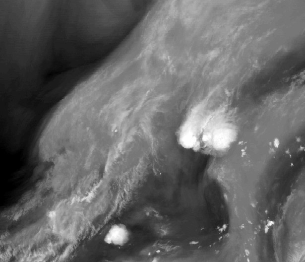
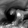
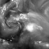
https://imgpile.com/images/NHlX7L.gif i've finally found a hosting option for downloaded loops from the College of Dupage suite This depicts the most recent several hours of INVEST 90 (July 2021) The thunderstorms that appear along the far southeast coast were uniquely satisfying to experience in the early morning hours, going in and out of sleep, due to the lightning and thunder off to the east!
-
Hopefully at this point of the future there is some protection from stronger storms due to the proximity of Sunny Point, as well as the nuclear power station! https://en.wikipedia.org/wiki/Military_Ocean_Terminal_Sunny_Point I am not sure what type of mitigation of hurricane strength is possible in 2021, but, it is doubtful that there has not been a safe and non-disruptive method discovered.
-
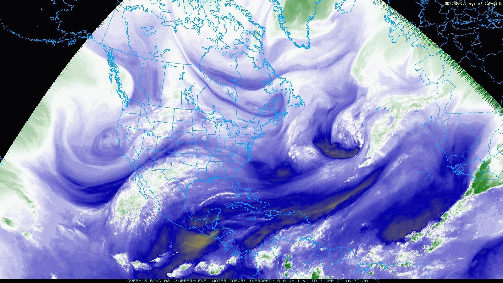
College of DuPage is really good i would say! They have site specific NEXRAD https://weather.cod.edu/satrad/nexrad/index.php?parms=GSP-N0Q-0-24-100-usa-rad and many different sizes of regional views that also offers full satellite imagery among other display options! https://weather.cod.edu/satrad/?parms=local-NC_VA-comp_radar-48-1-100-1&checked=map&colorbar=undefined
-
The updated NWS radar is terrible
calm_days replied to Heisy's topic in Weather Forecasting and Discussion
https://weather.cod.edu/satrad/nexrad/index.php ^^ For this one you do need to mouse over the topmost icon on the left that is overlaying the map, and click Radar Selection to choose from all of the locations! https://weather.cod.edu/satrad/?parms=continental-conus-comp_radar-48-0-100-1&checked=map&colorbar=data College of Dupage's sites thankfully are quite awesome, very configurable too, and very easy to download both animating loops and single images!! And, available through the second link are the options to show only every x number of frames which can allow a longer time period to view, here is an example! https://weather.cod.edu/satrad/?parms=continental-conus-comp_radar-200-1-100-4&checked=map&colorbar=undefined -
more is on the way!! The image being courtesy of gatorcane from storm2k
-
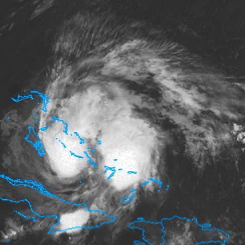
I was reading some posts on storm2k that refer to the large area of convection forming to the east of Isaias and remembered these images i had posted in 2015 of a similar phenomenon happening with ULLs! They are surprised it is as large as the main area of convection of Isaias. In watching the animated infrared and water vapor loops it is interesting that the shape of the storm did develop a more hybrid appearance, maybe it is a specific structure of any type of low pressure based system that results in enhanced convection to the east. /// Here is what they are saying! #3586 Postby tarheelprogrammer » Fri Jul 31, 2020 10:44 pm eastcoastFL wrote: Javlin wrote: hipshot wrote: Eric, I would still like to know what is the deal with Izzy's evil twin to the east? I appears to have some fierce convection and seems to pulse up and down in sync on IR with the twin to the west? That's what I am wondering also? Ya the thing to the east looks almost identical to Isa On IR It looks very similar to the blob that hurricane Matthew had attached to it:

-
The discussion is like that from GSP as well! It will hopefully not stick with confusing patterns for the models for the remainder of the springtime. Looking at the current overview, the additional layers of complexity are evident! .LONG TERM /THURSDAY THROUGH SUNDAY/... As of 306 AM EDT Monday: You would be hard-pressed to find a fcst with bigger differences between the model guidance out on days 5-7 than what we are presented with this morning. Before we get to that, we still have decent agreement for Thursday with a cold front running up against the mtns early in the day, warranting a chance over the mtns for the first half of the day. The guidance agrees the front will weaken and cross the rest of the fcst area dry in the afternoon, but not early enough to keep temps from making it back into the lower 80s over the Piedmont regions. The cooler air will finally make it into the region for Friday, with temps returning to normal, or maybe slightly below normal. From that point onward, though, the operational models diverge wildly and significantly as we get into next weekend, with both models sticking to their guns. In the near corner we have the GFS which has dry sfc high pressure moving slowly over the southeast and Carolinas with zonal flow aloft and a srn stream system hanging back over nrn Mexico. In the far corner we have the ECMWF with a progressive srn stream system that appears to feed on a tropical connection to develop widespread heavy rain and possible flash flooding associated with low pressure moving up the spine of the Appalachians. Wow. Needless to say, confidence is low. In this situation, we prefer to stick close to the previous fcst, the guidance from WPC, and the model blends until a consensus starts to form, so we will keep a chance of rain with temps near normal, which may seem unpalatable, but right now there are no good, safe bets. We look forward to a resolution.

-
It is possible to make bookmarks that directly lead to an animated GIF of the wunderground radar!! Basically, you can configure the settings through this page, including changing to a different radar site. https://www.wunderground.com/weather-radar/united-states/nc/raleigh-durham/rdu/ Mainly I would recommend setting the number of frames to 10 unless you prefer fewer! At the very bottom of the dark gray panel is the Save Image button. You can also right click the Save Image button and open a new tab if that is possible in your browser! Either way it will hopefully open a GIF all by itself, and you will be able to make it a bookmark! Visiting the bookmark on another day is somehow able to run all of the same settings that you initially selected and produce an up to date new radar image!! And of course, you can set up different zoom levels and radar angles, then, use the Save Image option again and you can bookmark those too!
-
Yes; Brick and others have been mentioning over the past few years that the once certain seasons for severe, especially autumn, have changed in that regard. I feel like it is at least a guaranteed interesting spring in terms of unusual weather systems, although I'm not sure if any would be severe, maybe just different enough to be noteworthy! I do think that there is at least a chance of a few to several colder wedge days during March and April.
-
The December to Remember 7th-8th blue turd winter threat thread.
calm_days replied to lilj4425's topic in Southeastern States
I think this has already been a very enjoyable/fulfilling system to watch in forecasts, and hopefully, most likely, it will turn out to be intriguing as it happens and as the thread title mentions, good to remember into the future! -
Are there links available to track Gulf of Mexico methane? I can't tell if changes I have noticed in water vapor behavior in relation to the Gulf of Mexico are from integration of comet dust (ISON & LINEAR) or from possible increased release from underwater that have been theorized to be possible since 2010 and earlier.