

marsman
-
Posts
723 -
Joined
-
Last visited
Content Type
Profiles
Blogs
Forums
American Weather
Media Demo
Store
Gallery
Everything posted by marsman
-
.65” so far.
-
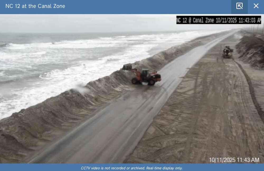
NC 12 as of 11:43. High tide around 2pm for this location.
-
0.00” from the front. Opposite of washouts, I’m calling these “dryouts”.
-
The gods demand more sacrificial houses. Apparently 8 wasn’t enough.
-
Low of 50 at 7:32am, high of 77 at 3:38pm.
-
.11" overnight, "storm" total of .42".
-
High of 88 at 4:55pm. No rain so far in the past two days. Last measurable rain was on 9/11, .45". .69" for the month.
-
Schools closed Monday in Brunswick County NC (most southern county)

-
Brunswick County NC schools closed Monday.

-
95 at 3:10. Go away, I can't have Oktoberfest with this weather! Eyeing that possible low of ~49 next week.
-
93 yesterday at 4:10pm.
-
Pushes it south after this if I’m looking at the right one. We could use the rain, but please not another Florence.
-
High of 91 at 1:45pm.
-
Impressive 94 at 4pm. Definitely a late summer 94, humidity was 34%.
-
.45" overnight. Impressive, since next to none was forecast. We hit 75F yesterday at 3:10pm.
-
Low of 55 at 6:45am, high of 87 at 4:45pm. I was able to keep the A/C off today, but it'll be on tomorrow. Leaves are coming off the trees, I'm sure the lack of precip is accelerating their demise.
-
62 for a low this morning at 8:27.
-
Low of 59 at 6:22. High of 84 at 4:14pm.
-
Hit 93 at 2:30pm.
-
I lost my no 90's streak. 91 at 3:55pm yesterday, will probably see it again today. Currently 88 at 1:35pm. edit: 91 today at 2:22pm.
-
High of 90F at 3:57pm. May not see another 90+ for some time and no complaints here.
-
There's this Dunkin Donuts on Western Blvd by NCSU that has a "pond" in it's drive thru after rain. I can affirm it was there this morning. I could swear the thing is nearly 1' deep sometimes.
-
1.88" overnight, most of which came down in under 30 minutes.
-
.82" yesterday and .47" today. Dew currently at 79. High of an awful 88.1 at 6:30pm.
-
Old Davis still ticking. 1.41" yesterday, high of 89.9. 7.65" for the month, passing July's total of 7.24".


