
marsman
-
Posts
716 -
Joined
-
Last visited
Content Type
Profiles
Blogs
Forums
American Weather
Media Demo
Store
Gallery
Everything posted by marsman
-
1.03" WRAL saying it's the wettest day since August.
-
27 at 6:54am, 46 at 3:03pm.
-
High of 75 at 4:39pm. .29" from the front.
-
.85" yesterday. A much needed soaking. High of 58 at 3:37pm today.
-
49F at 1155am. 0.00" in the bucket. Dew is climbing.
-
35 at 7am, 53 at 4:30pm
-
Low of 26 at 5:57am, high of 71 at 4:21pm. The north-side shadow sleet remains..for now. I'm really hoping for a good wash of the roads tomorrow, but chances of that are diminishing.
-
30F / -1 DP.
-
39/36, .12" in the bucket.
-
Yep. 15 minutes of snow after hours of rain.
-
LOL here's what they went with: More snow possible Wednesday. It will be a WRAL Weather Alert Day https://www.wral.com/weather/forecast-raleigh-durham-fayetteville/
-
16 at 6:56am. Higher than expected.
-
Happy Groundhog Day!

-
Hit 35F at 4pm, higher than expected, good melting on the southern sides. Low of 18 at 7:41am. Even with the plows coming through, streets are soon to be a sheet of ice.
-

January 30th- Feb 1st ULL and coastal storm obs
marsman replied to JoshM's topic in Southeastern States
Relatives and friends reporting 8-9" in Onslow County, some drifts up to 5' in Carteret County on the coast. -
January 30th- Feb 1st ULL and coastal storm obs
marsman replied to JoshM's topic in Southeastern States
I'm not sure if i'm looking at the snow cutoff, the fall line, or both.
-
January 30th- Feb 1st ULL and coastal storm obs
marsman replied to JoshM's topic in Southeastern States
1.5” light and fluffy, leaf blower will handle cleaning off the cars. Gotta get to it before the sun though. -
Well good thing I didn't winterize the leaf blower, because I'll be using it to dust off the dandruff on the car tomorrow morning.

-
January 30th- Feb 1st ULL and coastal storm obs
marsman replied to JoshM's topic in Southeastern States
I'm still in this hole. -
January 30th- Feb 1st ULL and coastal storm obs
marsman replied to JoshM's topic in Southeastern States
Maybe 1/2".... but y'all got some nice Blackstone grilles/ griddles on here. -
January 30th- Feb 1st ULL and coastal storm obs
marsman replied to JoshM's topic in Southeastern States
Calling it light snow now in Cary. Dusting on the ground including roads. -
Make sure you're Ft. Myers or south. Safer bet is Dade County or the Keys.
-
January 30th- Feb 1st ULL and coastal storm obs
marsman replied to JoshM's topic in Southeastern States
20F / 6DP. Still dry. Maybe 10 flakes on an earlier walk. -
The “I bring the mojo” Jan 30-Feb 1 potential winter storm
marsman replied to lilj4425's topic in Southeastern States
Brandon is headed towards MHC just coming off the Havelock bypass: -
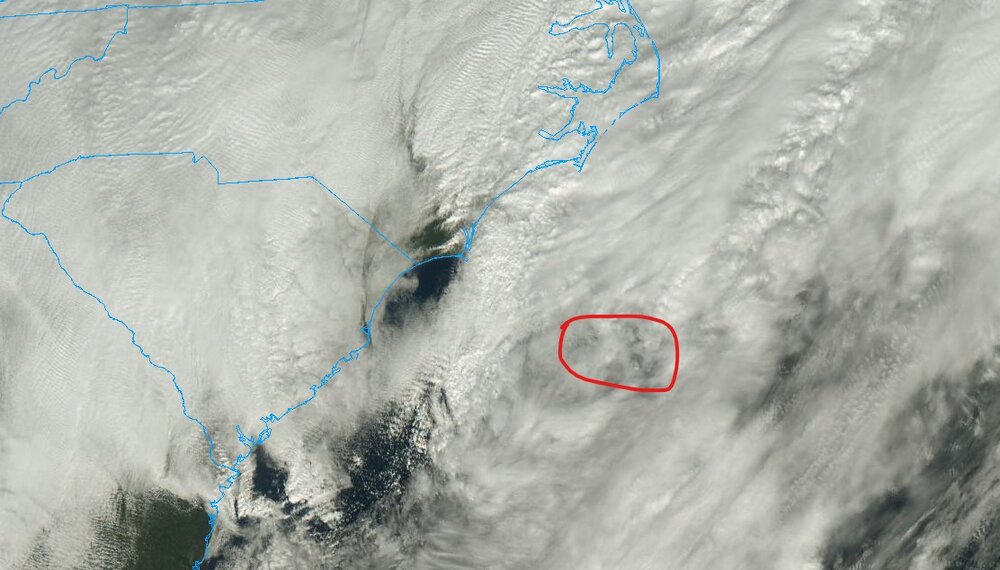
January 30th- Feb 1st ULL and coastal storm obs
marsman replied to JoshM's topic in Southeastern States
Coastal low ramping up on sat: