frostfern
-
Posts
2,204 -
Joined
-
Last visited
Content Type
Profiles
Blogs
Forums
American Weather
Media Demo
Store
Gallery
Everything posted by frostfern
-

Winter 2020-21 Medium/Long Range Discussion
frostfern replied to Hoosier's topic in Lakes/Ohio Valley
GFS with two weenies in a row. -
All it takes is one warm sector with convection.
-
Time for me to fold.
-
It seems like most the models agree that energy will transfer to the coast. That's the major problem. I don't know if the GFS handles precip placement as well as other models though. It seems to miss bands that occur away from the low back in the cold air. At least that's a bias I have noticed in the past. A few people may get lucky with a defo-band hanging back overhead for a while even as the surface low transfers to the coast. Maybe wishful thinking.
-
If the NW trend is possible this year.
-
As typical, the next system is another long-range tease on the euro. Could it trend NW without the PV? And no other system riding it's ass too close? If none of these produce it's time to punt.
-
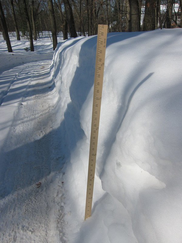
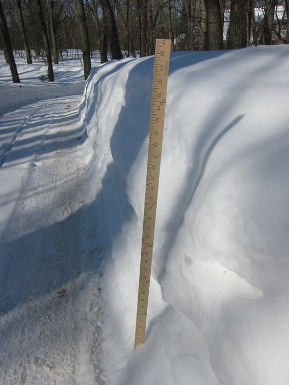
Late February 2014 looked like this here... even after some melting and compression. I was out west during peak depth though. The problem is this year hasn't had the lake effect with the cold. Lake enhancement has all been in Wisconsin and Illinois.
-
That was a problem briefly in 2014. 3-5" of snowpack water didn't cause any major flooding later on because the thaw was very dry. 2013 didn't have as much snowpack, but there were a few major early spring rainstorms and April was bad. It seems like it only takes one widespread 2-3" rainstorm to cause significant flooding if the ground still has frost after snowmelt. When the frost and snow is gone but little green-up has occurred it seems to only happen with two or three of those widespread 2-3" rain events in close succession. Soil is somewhat sandy here though so that helps a little when the ground isn't frozen.
-
Feb 12-14th V-Day Weekend Potential Stuff
frostfern replied to Chicago Storm's topic in Lakes/Ohio Valley
This year Lake Michigan is upping snow totals on the Wisconsin side more than the Michigan side. -
Seems like something will happen. It's just a matter of what and where.
-
Suppression is better for the southeastern forum. You'll have the possibility of a better low to dump in the OV, maybe as far northeast as DTX. Just Alek and me will get whiffed.
-
An occluded mess with a big-ass dry slot shutting things off early. Most of the moisture is shunted east.
-
I this case the farther NW solutions are weaker, quicker, and less phased. The optimal big dog phase location is a whiff southeast for me. Just can't win.
-
Feb 12-14th V-Day Weekend Potential Stuff
frostfern replied to Chicago Storm's topic in Lakes/Ohio Valley
We're seeing a trend to a nothingburger. -
Oh boy. I'm as excited about spring flooding as I am about getting covid-19. Cursed thread. If it's a side effect of a good spring t-storm outbreak fine. Snow melt flooding is about as exciting as hemorrhoids.
-
Winter 2020-21 Medium/Long Range Discussion
frostfern replied to Hoosier's topic in Lakes/Ohio Valley
Southern zones do better with the long strings of weak waves... a big system will change it over to mixed garbage. Being way north of the average storm-track in this pattern I'd prefer a big-dog event to getting repeated fringe dry 1" accumulations. Being greedy though. -
Feb 12-14th V-Day Weekend Potential Stuff
frostfern replied to Chicago Storm's topic in Lakes/Ohio Valley
Very high ratios become possible with temps in the teens, but it depends on way more variables than just surface temperature. Lake influence almost always fluffs up totals. Pure synoptic events tend to be denser most of the time, but sometimes really good dendrite growth conditions happen in a band and you get something like last night. -
Winter 2020-21 Medium/Long Range Discussion
frostfern replied to Hoosier's topic in Lakes/Ohio Valley
Euro has trended a little more west on tracks 16th and beyond... but at this point I'm just jonesing. There's too many waves to know which one will really cut. -
Winter 2020-21 Medium/Long Range Discussion
frostfern replied to Hoosier's topic in Lakes/Ohio Valley
Long range has been looking good forever, then they become nothing as time approaches. It was the 12th, then the 14th, then the 16th, now the 18th or later. Rather just be surprised by something. -
Feb 12-14th V-Day Weekend Potential Stuff
frostfern replied to Chicago Storm's topic in Lakes/Ohio Valley
Narrow FGEN bands can sometimes squeeze out what limited deeper moisture there is, but it will be 50% shallow lake moisture. -
Feb 12-14th V-Day Weekend Potential Stuff
frostfern replied to Chicago Storm's topic in Lakes/Ohio Valley
Chicago stealing all the lake enhancement this year. ZZZZZ.... IMBY. -
Winter 2020-21 Medium/Long Range Discussion
frostfern replied to Hoosier's topic in Lakes/Ohio Valley
I can see places like Gary, Indiana getting dumped with a deformation-band / lake-effect combo. Widespread snows look meh. Boring on this side of the lake except far southwest corner maybe. -
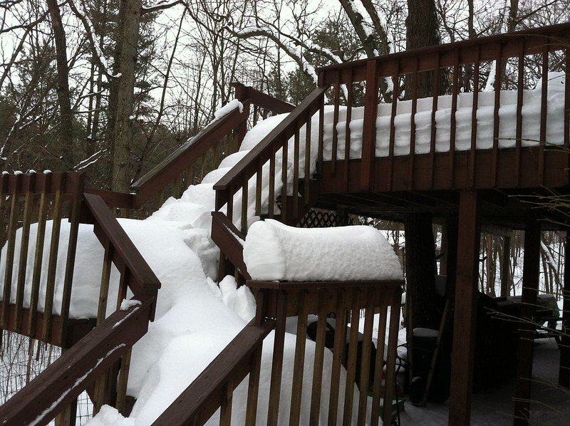
That dendrite aggregate stuff has a knack for sticking to things despite being dry. Also piles up perfectly on benches and deck railings, provided the wind isn't too strong.
-
Winter 2020-21 Medium/Long Range Discussion
frostfern replied to Hoosier's topic in Lakes/Ohio Valley
Don't know if mother nature is more offended by premature storm threads or you calling her a b..... -
New southern meso has developed a nice eye. Coolest thing ever.