-
Posts
2,267 -
Joined
-
Last visited
Content Type
Profiles
Blogs
Forums
American Weather
Media Demo
Store
Gallery
Everything posted by frostfern
-
The problem with only looking at deaths to estimate the true infection rate is it ignores changes in behavior. In general older people are being more cautious. It's mainly 20 and 30 somethings going to bars and parties. These are the main super-spreading type events. In Lansing close to 100 cases were linked to a single freaking bar!!! While the initial infected are mostly mild cases involving young people, when the amount of community spread reaches a certain threshold, older people will be involved again and death rates will climb again. Many vulnerable people still have to work and shop and they will come in contact with careless spreaders. Also not that not all non-deadly cases are "mild". Even people in their 20s who never required hospitalization say it was the worst illness in their life and nobody even knows how long certain problems last. Many people still have symptoms after 2 months!!! Even people who were never hospitalized!!! Many people never know they had it, but others become ill for a protracted period of time. It isn't a brief illness like the flu.
-
The sad thing is some places in the world have managed to keep numbers low without hanging a threat of destitution on millions. The barrier to management in the US is ideological.
-
You better believe lots of people will place blame and not have a lot of sympathy for the selfish.
-
Could also load up on Lysol. Take a long ass needle and inject it into the lungs as a preventive measure.
-
If people were willing to fight a virus like they fight a war against an invading army things would be different. Worship of individualism and capitalism is the undoing of the US. Nice for the people who can afford to stock shit and hide in bunkers. People who've been living paycheck to paycheck will come for your ass regardless.
-
The downward trend in Michigan is over :(.
-
For western zones maybe. It's hard to say how long it takes for the ridge to build east with the new east coast cutoff clogging things up. Backdoor easterly flow knocking down the ridge looks possible at times. Looks like a warm dry pattern, but intense heat confined to the plains for a while. I just hope Friday night delivers some rain here because after that things get real dry.
-
It's all relative, but in mid-summer generally the farther west you go the better. This looks like a repeat of 2018, warm but blocky with no ring-of-fire setup until late August. Probably something to do with arctic warming. Stratiform tropical system will be the only drought buster for the lake shadow.
-
After Friday it's back to the boring blocky pattern.
-
It became a big MCV / QLCS while crossing Lake Michigan. Wisconsin always gets the peak severe, but sometimes the late night leftovers here in Michigan are still good. Most times the Wisconsin evening MCS just dies completely, then afternoon stuff pops way to the east the next day. Annoying aspect of summer climatology here. The severe stuff often survives through west Michigan though. It's just when there aren't severe setups with good shear and/or low-level-jet the lake shadow dominates.
-
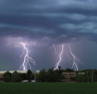
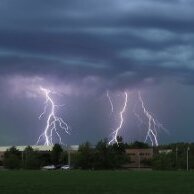
I remember the MCV coming through around 2 AM on the 22nd being incredible in terms of constant lightning bolts.
-
June 21-22 2010 was wild. I don't think I'll ever experience that again.
-
Usually mature multicell clusters and concave-type structures produce good CG barrages. Bow echo's are often tilted back towards the stratiform region so a lot of the CGs land on the back side under the rain. It's often hard to find a lot of CGs out in front of a bow. QLCS type storm will produce lots of CGs in rain-free zone where there is a concave kink or curve to the line. The convex/bowing segments don't tend to have a lot of CGs out front. They tend to be on the back side instead. Having a big anvil also seems to play a role too. Very new/isolated storms that haven't produced much of an anvil yet can be kind of lightning-sparce even when they have intense updrafts (even hail and such). I mean, they often do have a lot of lighting but it's usually predominately IC and not noticeable during the day.
-
I've seen a lot more IC activity compared to CGs. I think the big MCS with a large anvil and stratiform region produce more frequent CGs. Afternoon pop-up stuff doesn't always perform in terms of photogenic CGs, and that's what it's been this year. I think low cloud bases and heavy warm-process precip can be a problem for lightning photography. You often can't see the lighting until the storm is practically over you, then it's hard to photograph. If you don't get a strong MCS that produces lots of bolts-from-the-blue ahead of the rain shafts, the window for getting lighting is really brief. It's so much easier to film big bolts out west where you have high bases and much less precip. The Arizona monsoon can be amazing.
-
West Michigan seems to miss out on most general afternoon thunder. Hopefully Friday will feature a more organized MCS. Will really need the rain by then. Who knows if it will be evenly distributed though. So often it's a 40 mile wide E-W ribbon of 2-3" with almost nothing north or south.
-
At least Chicago doesn't get lake shadowed. This weak diurnal stuff always skips over my area. Storms make it 2/3 the way over the lake then die.
-
I wonder how much time spent in re-circulating AC air contributes to spread. I the north people open their windows and get fresh air. Arizona and Texas mid-summer is the other cabin fever season. Similar for Florida with the humidity if you're not right on the beach where you might be able to catch a breeze.
-
What is "mild" anyways? I had one of the worst fevers in my life back in early March, but since I was only bedridden for 3 days and never felt so bad I might die if I don't go to the hospital I couldn't get tested. For COVID-19 it wasn't that bad, but I'm having a lot of trouble believing it was something else because I'm 40 and haven't had influenza since childhood. The symptoms were either influenza or a short COVID-19 case. A positive antibody test would make me feel better. It's still worth it even if false positives are possible. Whatever it was my wife got it exactly a week after me. Both my parents were exposed to us before I realized it might not have been influenza, so I was nervous for a while. My father has heart disease.
-
The destabilization will be driven by cold air advection aloft more than surface heating. The upper low moving in was producing thundersnow showers over the southwestern US. These will be very low-topped cells. Less instability is needed. The bigger problem will be whether there's enough upward forcing to overcome dry air entertainment with such a big shear-to-instability ratio. I don't think CAMS really know how to handle these kind of small-scale details. Chasing small fast-moving cells that can poop out at any moment will be frustrating. It also gets dark early this time of year. If it's a late-evening event it will be mostly in the dark.
-
Yea. There might be an outbreak of low-topped supercell storms coming out of Iowa as the dry slot and upper low sweeps in from the west. Not a lot of CAPE needed because the tropopause/EL will be low. It's hard to predict if there will be any really persistent cells though. Updrafts might have a lot of spin but are usually kind of small and can be snuffed out pretty easily in the dry slot.
-
I had a bad cough and 102 F fever a couple nights in a row about 2 weeks ago. I get colds and bad intestinal stuff a couple times a year but I don't recall the last time I had full-blown flu symptoms like that. I'd probably have to go back to childhood. Thankfully I was only really sick for about 3 days. I want to the doctor but there was no test. They said 90% likelihood it was influenze B or H1N1 (even though I had a normal flu shot last October). It would have been nice to know for sure what it was and why the flu shot didn't prevent it. I didn't travel anywhere but now it's a little concerning that random celebrity cases are turning up. It's a worry if non-severe cases are slipping through untested.

-
Yea. I think sometimes intense sunshine is unhelpful because it produces a deep dry adiabatic layer. Supercell tornadoes tend to like areas where there the low-level lapse rate isn't too steep. Downdrafts don't become too dominant then. You also get more backing near the ground when the first 1000 feet is a little more stable because there aren't as many dry thermals mixing westerly momentum down from above. The most likely place for big tornadoes usually isn't in the middle of a bubble of high SBCAPE. It's usually around the edge of the SBCAPE bubble (i.e. where there's a sharp SBCAPE gradient). I think tornadic supercells are often pulling in the most unstable air from a slightly elevated layer, but the meso is able to "dig" down and pull in surfaced based air as well. For example, you might have a MUCAPE of 1400 j/kg for a layer rooted around 900 hPa on the "cool" side of an old outflow boundary, but the storm is also pulling in surface parcels with CAPE around 700 j/kg. The surface parcels probably have a fairly high LFC, but the vacuum effect of the meso can get them up there. These parcels have a lot more "backed" momentum profile than those entering the storm from the 900 hPa level, so they can contribute a lot of extra spin to the meso, helping to reinforce the upward vacuum effect. On the warm side of the outflow boundary you might have SBCAPE of 2500 j/kg, but meso's are all weak and elevated due to strong cold pools and lack of near-surface backed flow.
-
Yea. Tornado outbreaks in March and April are usually going to coincide with abnormal warmth and humidity for the time of year. That doesn't mean you need summer-like temperatures though. Shear is far more important, and low cloud bases / high relative humidity is very beneficial because evaporative cooling from nearby precip won't completely stabilize surface-based storm-inflow. I think Dr. Leigh Orf's work provided some pretty strong evidence that violent tornadoes ingest a lot of surface-based parcels that are more stable than average, yet still realize some positive buoyancy once lifted into the middle levels of the storm by the upward vacuum-suction force of the rotating meso. Hot weather brings you the highest surface based CAPE, but that CAPE can be completely neutralized by just a little bit of precip if the boundary layer is characterized by low relative humidity. The result is many hot-day summer supercells have elevated inflow, and thus never produce tornadoes. Early spring supercells are very good at producing tornadoes because they often form in an environment where instability is more than adequate for strong convection despite high boundary layer relative humidity.