frostfern
-
Posts
2,267 -
Joined
-
Last visited
Content Type
Profiles
Blogs
Forums
American Weather
Media Demo
Store
Gallery
Everything posted by frostfern
-
I think there will be thunder nearby the week of the 8th. Might just be cold rain given it's only March, but the current split-flow pattern will be over so there's at least a chance of a warm sector with mild temps and considerable gulf moisture.
-
This right now is a very weak clipper-like system. It's just not a very deep system. Cloud tops at 8k feet max doesn't really do it, unless you're in a location where a band can park over you (which I'm not). The better clipper fronts push the cloud layer up to 15-20k feet.
-
Where I live there just isn't enough fetch to get an extreme event like what happened in Chicago. Normal years have a lot of very light lake effect during cold periods. It will snow 1" per day for a few days straight. The better events are clippers that get bumped from a 3" event on the Wisconsin side to an 8" event here. It happened repeatedly in 2014, but not this year.
-
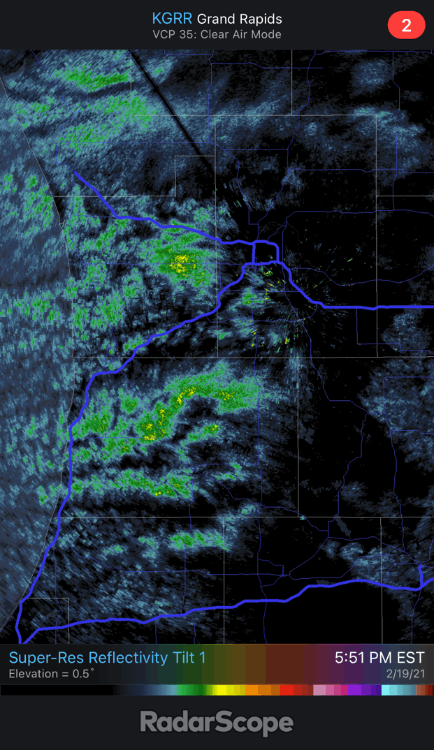
30 dbz "cell" is missing just to my NW. Stuck in the gap between bands. Happens more than not this year. Don't know why. Hopefully it fills in at some point. Any single one of these showers could drop an inch of fluff in 20 minutes.

-
Nice big dendrite fluff coming down. Finally some lake enhancement on this side of the lake.
-
It's been very light snow with filtered sunshine here.
-
-13 officially last night at GRR. This is 2 degrees colder than the coldest night of the PV event in 2019. That one had way worse wind-chills and was a colder airmass overall though. Pure radiative cooling isn't nearly as bad as a super-cold airmass that is below zero despite passing over Lake Michigan on a 15 mph breeze. Also decent rebound with days getting longer.
-

Winter 2020-21 Medium/Long Range Discussion
frostfern replied to Hoosier's topic in Lakes/Ohio Valley
You mean May. -
To win you just move to Paradise Ranger Station, WA and gloat. Or just be a Yooper in this sub. Or are we talking individual storm totals?
-
Wow. People get really raw over missing a snowstorm here. It's worse than pro-sports. Like people are literally freezing to death in their homes in Texas because of corporate corner-cutting and greed. So much corruption and incompetence and gross injustice everywhere... so much to be angry about... but we're angry about missing a big snowstorm.
-
Winter 2020-21 Medium/Long Range Discussion
frostfern replied to Hoosier's topic in Lakes/Ohio Valley
Would rather have winter continue into March here. Highs in the 30s is fine, but please no torch that melts all the snow at once. Brown mud season is depressing. Outside whacky years like 2012, nothing really starts growing until the first week of May here anyways. -
Snow came down harder than I expected last night. Difficult to measure though as the wind whipped not only the new snow but older layers as well. Only measured about 5" new on average, but it's probably like 12:1 ratio since the wind did such a number on it. That's on top of the 2" from the night before, so at least 7" total. Definitely not fluff anymore though. Drifts were hard to shovel. Total depth on the ground is now around 17" IMBY, including the hard packed stuff at the bottom. It's over 20" in some places though, both due drifting and old crust from January that didn't melt completely everywhere.
-
Virga touchdown.... 5... 4.... 3.... 2.... 1....
-
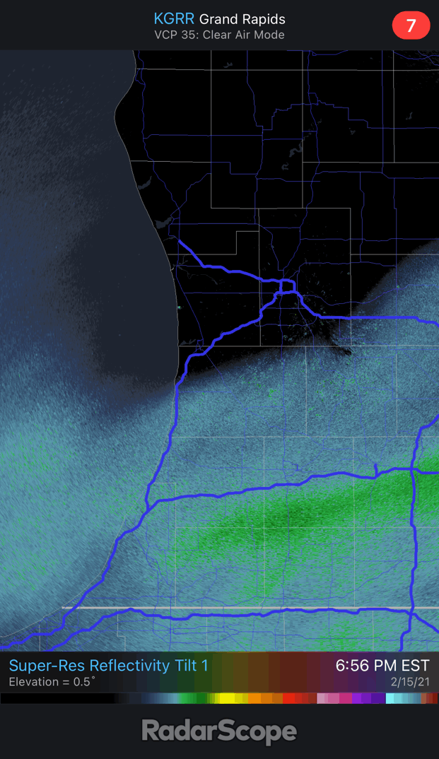
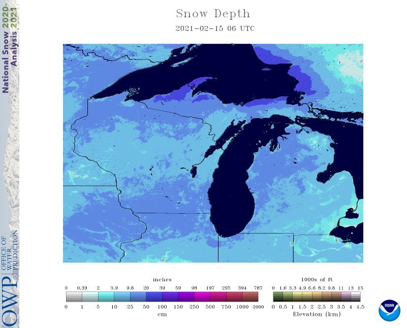
While it isn't a bullseye IMBY, this storm has the perfect distribution to spread the 1 foot or more snow depth across almost all of the Lower Peninsula.
-
It's pretty common here IMBY to miss both t-storms and major lake-effect events by 40 miles or less... over and over again. Often close to the action, but have to chase to actually get to it.
-
Don't know if this current one being so big is going to suppress the next though.
-
It's like spring-summer frustration with the t-storms. Missing the bullseye by 10 miles and getting a nothingburger doesn't usually happen in the winter.
-
-
It's nerve-wracking being right on the northern edge of this thing. Sharp cutoff somewhere between MKG and GRR. Already got 2" of new powder from light snows last night. I'll be happy if this next batch can drop a quick 6 inches. Depends on how fluffy it is. DGZ is plenty deep if a nice back-edge band sets up as the system wraps up tonight.
-
Finally.
-
About 2" from yesterday evening through last night. Long duration light dust. Not overly fluffly like the last snowfall. More just powder. The main back-edge defo-band tonight should have bigger flakes... hopefully. Bright sunshine now in the break between waves. Weird that the other side of the lake is stealing all the lake effect this year.
-
I can see the thumb getting good totals despite being further north. Lake Huron influence will amp up the flake size.
-
Well, long range now is more than 24 hours lol.
-
That it's a long-duration event with two periods of light snow might pump up the numbers. If they clear the snowboard after every inch you might end up with a sum of 4", even though it's only 3" additional on the ground at the end.
-
I'm calling 3" here total in GRR on 0.2" liquid. Hope I bust low. I just don't buy that it will be super high ratio. Will probably be mostly small flake dust as fringe synoptic events tend to be under cold conditions. Lake influence areas will get better flake size and fluff.