frostfern
-
Posts
2,267 -
Joined
-
Last visited
Content Type
Profiles
Blogs
Forums
American Weather
Media Demo
Store
Gallery
Everything posted by frostfern
-
Just had the heaviest rain bomb I've seen in a while. Not severe, but it looked like the trees were being pushed straight down when it came. 1/8 mile visibility, probably even less than that for a brief moment.
-
Are those troughs not just the negative image of the Rockies/Plains death ridge that is now pretty much a climate feature? The areas of "troughing" have simply been "average" as compared to the "much above" most other places.
-
I went on a trip to Alberta. I saw some supercells way off in the distance on the road, but missed the (most likely) best storm of the season at home. It happened last year too.
-

Summer 2022 Medium/Long Range Discussion
frostfern replied to Chicago Storm's topic in Lakes/Ohio Valley
Booooring -
Summer 2022 Medium/Long Range Discussion
frostfern replied to Chicago Storm's topic in Lakes/Ohio Valley
I'm just keeping my fingers crossed for next Wednesday's low to track across northern lower MI like the 18z GFS now shows. Really really need a solid squall line or training MCS, though it will probably be non-drought-busting hit-and-miss severe cells yet again given its summer 2022. -
6+ hours of cloudy misty "rainy day" feel, yet only 0.05" to show for it.
-
Ohio doesn't need rain anymore. How about sharing?
-
2022 Short/Medium Range Severe Weather Discussion
frostfern replied to Chicago Storm's topic in Lakes/Ohio Valley
Given trends this year it will probably be isolated discrete supercells again. Would rather have a solid squall line or, better yet, backbuilding cluster overhead. -
0.03 What a joke
-
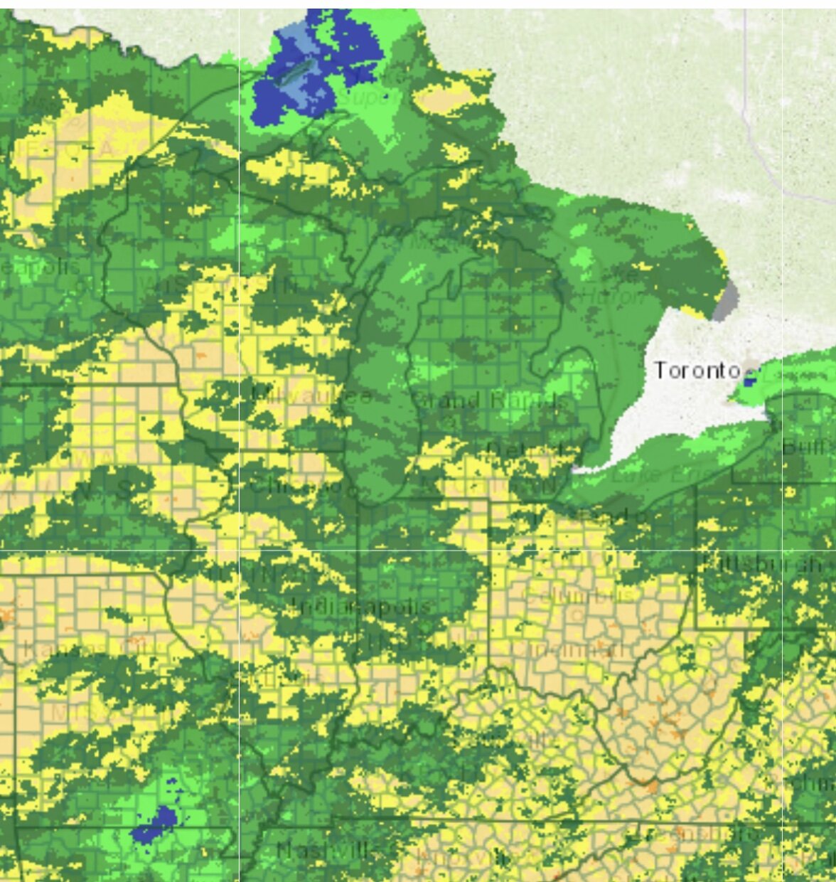
Actual 2 month rainfall. Notice all the moderate to severe drought areas in Illinnois and Indiana have had about the same or more rainfall than the dry areas of Michigan. Drought is only worse there due to more heat and slightly wetter climatology (thus bigger departures). As far as boring thunderless weather, its pretty bad here this year.
-
I didn’t get anything. Actually the most annoying thing is the gradient being so close with areas just to my SW being actually WET. And it looks like the next MCS goes over the SAME area yet again. From just north of Madison, the streak dives SE and smashes the SW corner while GRR north and east gets a few stratiform sprinkles. It would be less aggravating if the rain was missing by hundreds of miles instead of being constantly close.
-
Not liking the continued whiff SW lake shadow / lake deflection pattern this weekend. Just can’t get a break from the dryness this summer. Amped bad climo continues.
-
So of course I get dry gapped with the ultra-skinny line, sans stratiform sprinkles adding a few hundredths. No drought relief with this nonsense. Weird to see the micro-cell that popped nearby become tornado-warned north of Lansing though. I didn't see that coming. Going to bed.
-
If the south part of this line doesn't fill in you'll have your wish. Missing 0.2" from a 10 minute shower will put me in suicide mode.
-
It was never wet up here, and now more f*ckery.
-
Summer 2022 Medium/Long Range Discussion
frostfern replied to Chicago Storm's topic in Lakes/Ohio Valley
More turdy dry NW flow. Becoming a desert here. -
Summer 2022 Medium/Long Range Discussion
frostfern replied to Chicago Storm's topic in Lakes/Ohio Valley
zzzzzz…. Need the heat and humidity or it doesn’t ever rain here. -
Most summer severe events are associated with heat somewhere nearby. You just have to be on the perimeter. If the perimeter of the heat dome is up in Canada that's where the severe is. Troughing is the least conducive, at least north of the OV. If you aren't right next to the GOM (aka spring dixie outbreaks), you can't really built up enough CAPE without a cap to the south or west.
-
Cold stratiform borefest in March/April sure. We are missing out on a lot of thunderstorms lately compared to other years.
-
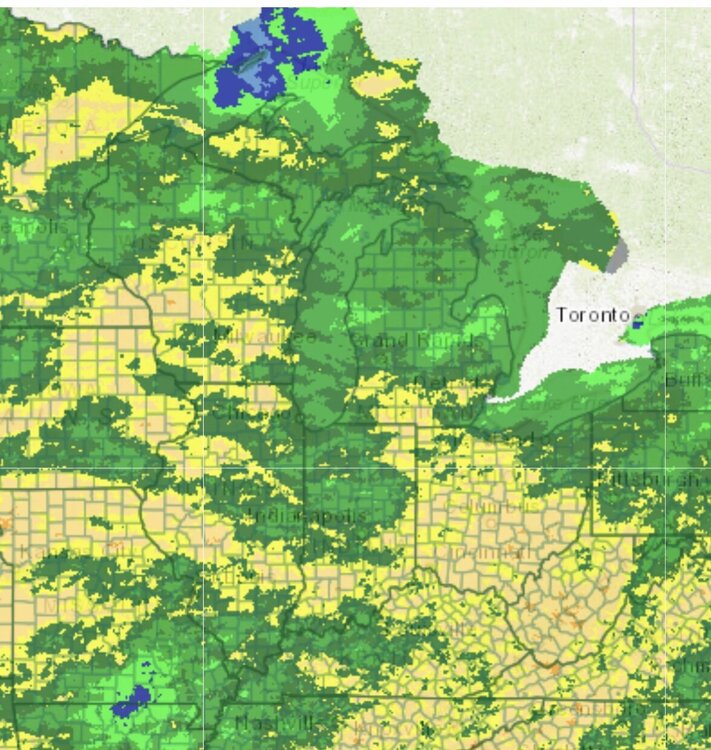
That map is missing a lot if local details. One county south there’s been more rain. Same north and east. They smooth it out. Plus the heat hasn’t been as extreme here, but actual rain is still low.
-
Im in the white but locally dryer than areas in yellow. Maybe less heat. Still dry is dry. Gardens are not doing well.
-
Actually, though I chased, the June 13 event was also a miss south for MBY. Big stuff either missed north or south for the whole year so far. The only events that produced over an inch of rain at once were boring stratiform events in may. It's more aggravating that the long term looks like continued NW flow with transient fronts pushing through quickly and convection dying as it approaches from the NW at night, lake shadowed, etc.... Same old same old. At least you have a good chance of heavy rain tomorrow. Here it's just nothing for weeks on end.
-
Big whiff south here. Very typical.
-
zzzzzzz.......... forever.
-
.82" but not even close to a drought buster. Best rainfall whiffed just barely southwest as is typical here.