-
Posts
2,234 -
Joined
-
Last visited
Content Type
Profiles
Blogs
Forums
American Weather
Media Demo
Store
Gallery
Everything posted by frostfern
-
Winter 2022/23 Lake Effect Snow Thread
frostfern replied to Chicago Storm's topic in Lakes/Ohio Valley
The problem is you need a stationary stacked low somewhere near the south end of Lake Huron. That just doesn’t happen. If there is a low there it tends to be on its way north towards Quebec or Hudson Bay. You can get northerly flow for a while with an arctic high, but then the inversion heights are too low and winds too light to get the deep dominant band you need to really dump. -

Winter 2022/23 Lake Effect Snow Thread
frostfern replied to Chicago Storm's topic in Lakes/Ohio Valley
8” depth on the ground here. -

Winter 2022/23 Lake Effect Snow Thread
frostfern replied to Chicago Storm's topic in Lakes/Ohio Valley
Not too surprised. I didn’t hear or see anything but that band was intense for 45 minutes before it shifted more to the south. Hopefully the Saturday event will be more solid coverage. The monster sized flakes today were cool, but it hasn’t been persistent and its a little sloppy and heavy compared to a normal LES event. Its not super dense, but its not that really light 20:1 ratio we sometimes get either. More like 12:1. The next one is supposed to be colder. -
Yea. Eastern Allegan and western Barry have had more persistent coverage. There has been a cutoff where to the north its very scattered with a lack of good banding, especially very close to the lake. I think maybe the dendrite growth zone is a little high and being squeezed up against the inversion layer. There is a fairly deep liquid cloud layer and I think that can produce a cellular pattern with dry gaps wherever there isn’t enough upward motion to feed the DGZ, despite ample moisture. It is more W than WSW at this point as well.
-
I notice it's very cellular like we sometimes get in the afternoon during March/April cold unstable spells.
-
I don't think anyone has better insight at fantasy range. Sometimes models keep clowning right up into 12 hours before the event.
-
It's really hit/miss showery and ratios are not high, but when it comes it absolutely rips. There is about 4" here on the grass, 2" on the driveway, and 5" on parked cars that haven't been brushed off. The super heavy band that was over me a few minutes ago seems to be shifting south now though.
-
Absolutely ripping right now and its getting more steady as opposed to the on-off squalls earlier today. I notice more accumulation on the roof of the car than on the ground. If the ratio was classic LES this would be 4” per hour stuff. Its just somewhat wet and the ground is a bit warm…. thus compacting a lot.
-
Impressive silver dollar flakes on and off today. Its not the heaviest in terms of visibility reduction or rapid accumulation, but the flakes are magnificent dendrites.
-

What is your favorite weather day of all-time?
frostfern replied to Hoosier's topic in Lakes/Ohio Valley
It was terrible. But it was exciting for me. -

What is your favorite weather day of all-time?
frostfern replied to Hoosier's topic in Lakes/Ohio Valley
https://www.spc.noaa.gov/misc/AbtDerechos/casepages/jul7-81991page.htm I was 11 years old when I witnessed this storm. In my parent's yard there were at least three 50' tall 2' thick oak trees that bent over so far they snapped off 20 feet off the ground. There were trees down everywhere you looked. Couldn't get out for 24 hours due to so many trees having to be cleared off the road, and the power wasn't restored until 5 days later. It's funny with derocho there are always pockets that get hit way worse than areas around and we were right in a really bad pocket. It looked as bad as some of the worst pictures from the 2020 Iowa derecho. I really think it was around 90 mph. It was actually kind of miserable, but of course I was excited. -
Same. Scattered non-sticking mood flakes, but otherwise CAD. I jinxed it with my dumb wishful weenie post yesterday. Wind direction is wrong for LES as usual.
-
First 1"+ snow at GRR tonight? It's a tough call with warm ground and being on the northeastern fringe of the QPF. 1-2" on non-paved surfaces seems doable. If the band can come inland at some point.
-
Wetlands aren't looking great here either. A lot of dirt/mud/grass in places where there'd normally be water. December and January are not particularly wet months. Even months with large snowfalls typically don't add up to more than 3.0" of water, and heavy rain isn't common in winter. Really need a few 5"+ months, but that usually only happens in the spring or early Summer, if at all. September and October are normally wet months as well, but they ended up being on the dry side. Could have used a tropical system at some point.
-
Missed the rain last night here, just sprinkles and distant rumbles. Had some decent lake effect rains over the past few weeks though. The east side of the Lower Peninsula that missed out on the LE moisture is parched though. Growing season mostly is over, but newly planted trees aren't going to do well in the spring if winter remains dry.
-
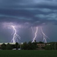
Non-severe storms have less lightning within the cloud overall, but what lighting there is tends to be visible and dramatic. Higher-based elevated storms have a knack for big bold CG strikes. Monsoon storms in the desert SW are similar. Nice big CGs from a high base.
-
I heard one very low pitched rumble in the far distance. The more active stuff will probably miss NW of here though. These high-based cells can make for nice CG photos.
-
I thought there was one or two very warm days early November 2020, upper 70s even here in Michigan.
-
So. Did anyone take the day off to go surfing in southern Lake Michigan?
-
Snowfall helps me, and I don't think it's just the weenie factor. All that reflected white light adds a lot of light. I just really don't care for solid overcast tacked on to the rapidly shortening days. It's a shock after such a sunny summer. I remember those kinds of rains in the PAC NW when the Pineapple Express got going in October/November. Near the mountains it can rain 0.25-0.5" per hour for 12+ hours.
-
Kind of annoyed the more interesting weather is missing to my southwest, but I still get the dark clouds and dreary cold of course.
-
It's getting to me here too. SAD is already starting. I will be happy when it snows, but this dark dreary drippy s*** is useless.
-
Here's a series of questions to gauge preferences. Thought about just putting this in poll format, but doing it this way encourages more discussion. Do you prefer..... A snowstorm in winter or something out of season? If it's the latter, early or late? Best is with a good 6" base already present... so deep winter is best. January or February. I love a deep snowpack. No pre-storm thaw or slushy/icy changeover. Wet snow, dry/fluffy snow, or something in between? It's all good. Just no changing to rain or sleet. Also, lake effect is often too fluffy and totals always feel artificially inflated to me. Light/calm winds, or windy conditions while it's snowing? It's all good. Blizzard conditions are cool, but I'll take calm snow falling straight down too. Continuous snow, or do lulls not matter as long as amounts end up as expected? 12" in 12 hours, or 18" occurring over 36 hours? 12" in 12 hours is more impressive. 18" in 36 hours isn't impressive when the net water content is only 0.7" because it's all lake effect. Bitter temperatures, or just cold enough to stick well during the storm? Bitter cold onset usually means a dry east wind and virga problems, and small crystal sizes even when the snow does reach the ground. If there's an arctic airmass involved, it should wrap in from behind. The front end should not be too cold or totals are impacted by the dryness. Storms on holidays/your birthday/some other meaningful day, or are dates irrelevant? Don't really care. If living in a lake effect area, would you rather have a synoptic or lake effect storm of the same amount? Synoptic all the way, though I do appreciated lake effect on the back end that adds to the totals. 100% lake effect totals always feel artificially inflated to me, especially when they occur over many 12 hour measurement intervals. It can easily snow 4" every 12 hours, but only be 0.12 water content for every 4" that falls. When another 4" falls on top of that first 4" fluff, it contracts to 6", but another full 4" is recorded from the board. Then the next 4" only adds another 2" to the depth, because even more settling occurs with all the air space to fill. The end result is the official storm total snow measurement is way over the final depth on the ground. Lake effect snowfalls are the most beautiful in light wind conditions though. The snow has a tendency to stick to trees, railings, roofs, etc... in a very uniform way, creating a classic pristine winter look. The totals just feel inflated in comparison to synoptic big dog storms with actual water content.
-
GHD 2011 was awesome. Other storms have had larger totals, but it's the only storm in my lifetime where the accumulation occurred in a short period ( well over a foot in a 12 hour period ) accompanied by true blizzard conditions. Most storms the "blizzard force" wind only comes on the back end when the snow is winding down, or the snow accumulates over several periods stretching well over 24 hours. With that storm everything happened at once, mostly in a 12 hour period. It was a good storm, even with *only* 14-17 inch totals here as opposed to the 20" in Chicago. Getting 20"+ lake effect fluff over 72hours just isn't the same as a genuine synoptic storm.
-

2022 Short/Medium Range Severe Weather Discussion
frostfern replied to Chicago Storm's topic in Lakes/Ohio Valley
I guess there was a wind gust or two. The stronger lake instability never materialized. Cold aloft was kinda marginal even for thunder.


