

frostfern
-
Posts
2,206 -
Joined
-
Last visited
Content Type
Profiles
Blogs
Forums
American Weather
Media Demo
Store
Gallery
Everything posted by frostfern
-
Its pothole season. I narrowly avoided a pretty deep one today. I hate how Michigan roads are so fragile. Is it like this everywhere?
-

Winter 2023/24 Medium/Long Range Discussion
frostfern replied to Chicago Storm's topic in Lakes/Ohio Valley
-
PNW heat can be muggy, but it’s never “tropical”. Evapotranspiration from all the conifer forests can push the dewpoint up to the low 60s, but I don’t think it ever reaches 70. Triple digits usually happen when the wind blows downhill from the Cascades, and from that direction it dries out some. When it gets muggy (60 degree dewpoints) it’s typically much weaker offshore flow with temperatures in the upper 80s vs near 100. When it really torches the airmass comes from the east side of the Cascades, and then the dewpoint falls into the low 50s.
-
Yea. Lake Michigan definitely takes the edge off a bit in both winter and summer. Still distinct seasons, but 100F and -20F are more rare here compared to Northern Illinois. You don’t have to travel far to see those more extreme readings though. The interior north gets a lot colder and Chicago gets a lot hotter.
-
I don’t think interior BC gets 80 degree dewpoints though. I have experienced some PNW heatwaves, and they can be very hot and also humid enough to be uncomfortable, but you never get that steamy tropical feel. It also seems like the most extreme temperatures happen in localized downslope areas. I noticed Olympia Washington hit 110 while Seattle only got to 101. It has something to do with the terrain. There are plenty of extreme places on earth, especially when you consider micro-climates, but the combo of tropical summers and brutal cold winters seems kinda unique to the Midwest US IMO.
-
Most other places in the world that experience extreme seasonal variation are more arid. The upper Mississippi Valley is kind of unique in how tropical it can get in the summer while still having very harsh winters. I think the only other place similar is the northeastern part of China. I think China is a bit more mountainous though and mountains will shelter some areas. There is no real mountain range anywhere separating the arctic and Siberia from the Midwest US. Same for humidity from the Gulf / Caribbean.
-
The temperature in GRR has been a bit below what forecast grids have been indicating for the past 24 hours. It was below zero for quite some time last night and earlier this morning. There’s been a pretty sharp gradient through here.
-
Its crazy to me that the same place that has triple digit hear and 80 degree dewpoints in July and August is this cold in the winter.
-
Winter 2023/24 Medium/Long Range Discussion
frostfern replied to Chicago Storm's topic in Lakes/Ohio Valley
Can it be as bad as seamless blocking and smoke the entire months of May and June? -
Winter 2023/24 Medium/Long Range Discussion
frostfern replied to Chicago Storm's topic in Lakes/Ohio Valley
I hate brutal near zero temps with a nasty wind, but I also hate 40s and melting all my beautiful snowpack. Upper 20s is the best, but it never stays there. -
-
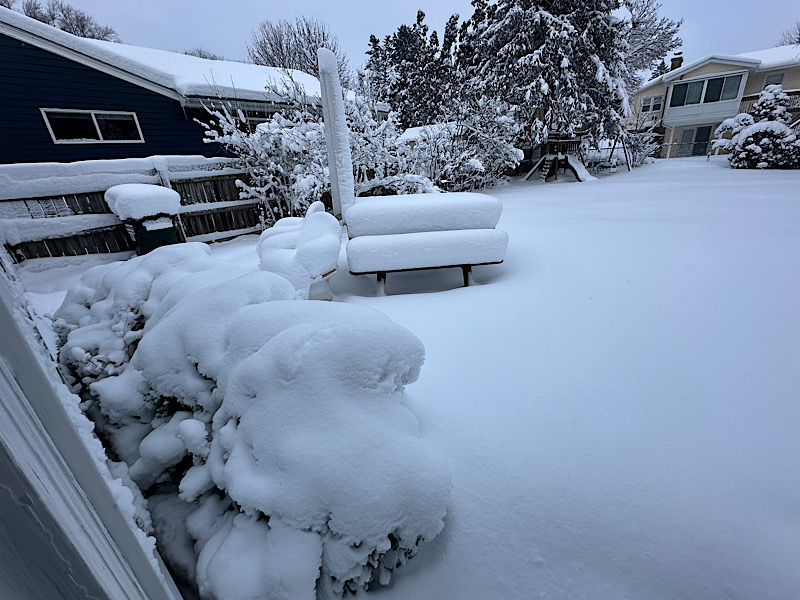
Picked up an additional 7” last night with strongest lake effect band I have ever seen locally. I think most of it fell in a 4 hour period between 10pm and 2am. It was a bit lower ratio than normal lake effect. Definitely not 20:1. It came down so hard the flakes were riming. I could hear it hitting the window. Surprised there was no thunder. The weekly total is now over 20” and the ground depth average is now around 14.5” IMBY. Lots of drift variability though.
-
You don’t need to be anywhere near frostbite to feel that burning. Blood vessels in the extremities always constrict in response to cold and dilate in response to heat. The problem is very fast dilation from a constricted state is painful. Lots of immune response signalers collect in the cold extremities because low blood flow makes them vulnerable. Sudden return of blood activates all the accumulated immune signalers causing lots of burning, swelling, itching, and tingling. A problem I have is finding boots sized to not cut off circulation in my toes. I have super wide feet with a high arch and I’ve had problems with cold toes. Sometimes thicker socks make the problem worse by squeezing my toes even tighter. They also get very itchy after being numb for too long.
-
The grid forecast for GRR was 8-12 and only ended up with 8” at the very max. Still did fairly well given the duration of significant snow was really only 6 hours verses the 12 hours forecasted. The onset was delayed 2 hours by 850-700 dryness, the dry slot came early, then the lake-enhanced wraparound defo-band that was forecast for this morning never really materialized. Bummed I didn’t get double digits, but the lake effect fluff tonight will add plenty of depth. 15”+ depth seems very possible on top of the super solid 10” base I already have. It’s been a while since we’ve had that kind of depth. GRR is still advertising a convergence band near I-96 with up to a foot. Will see how it goes. It will be much lighter to shovel thankfully.
-
Exactly. Being directly under the surface low when it hasn’t fully occluded is never great. Maybe a clipper, bit a major southern stream system is going to be warm in the middle if the warm sector hasn’t fully occluded, which was the problem.
-
You know its coming down when it makes that soft hissing sound. Wish it would last all night.
-
Some proper rippage.
-
Getting ready for heavy band. Will get video.
-
I really doubt lake temperature has any significant impact on the track of winter storms. The lake only becomes an issue when temperatures are marginal to begin with. If the air coming over the lake was in the middle 20s, the warmth would boost snowfall. Milwaukee got a boost from the warmer lake temps. If the air is 32 to begin with, then raising the temp 3-4 degrees is a problem.
-
Nice heavy band overhead now with big flakes. Finally just barely starting to stick to the pavement. There is about .5” (and growing) on the cold surfaces.
-
5” from Tuesday settled and melted to around 3.5”. Tuesday was an overperfomer, just super wet and dense.
-
Moderate snow here, but accumulating very slowly because its a degree above freezing.
-
Its finally coming down at a decent rate here. Its a little granular though. Not really sleet but small grainy flakes.
-
This is frustrating. Doubts creeping in.
-
That confirms what the radar was showing. I noticed watching snowstorms over the years that changes between sleet and snow often go in cycles. New returns begin as sleet, then transition to heavy snow as the warm layer that temporarily moved in aloft gets lifted and cooled.


