

cbmclean
-
Posts
3,053 -
Joined
-
Last visited
Content Type
Profiles
Blogs
Forums
American Weather
Media Demo
Store
Gallery
Posts posted by cbmclean
-
-
Well, with the close of Met winter I will say that it could have been much much much worse. The 4" of snow and the repeated (if brief) cool snaps really helped me to make piece with this winter. On to spring.
-
1 hour ago, psuhoffman said:
Gfs has my big rainstorm from a storm that would have been snow a week earlier. Lol
You hear that sound, it's the sound of inevitability.
-
 1
1
-
-
17 hours ago, Maestrobjwa said:
Uh...dude? Nobody here would want that result--not just me! After the 2016/17 and 2017/18, I'm not sure why you're acting like my dislike of ninas isn't logical (check the stats and see how well we do in ninas here).
Oh it's completely rational, in just funnin'ya
-
1
-
-
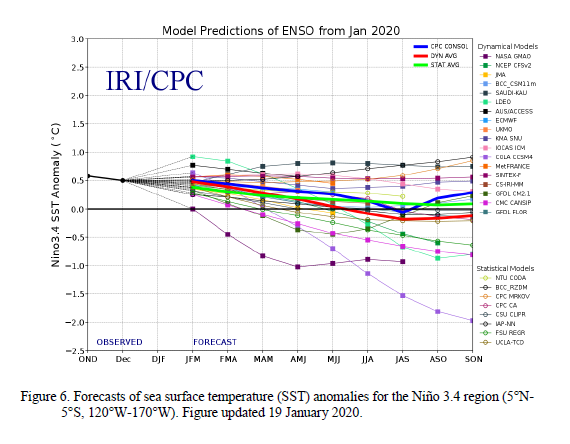
LONG LONG LONG term but I'll just leave this here. Somebody make sure that Maestrobjwa doesn't see this.
https://www.cpc.ncep.noaa.gov/products/analysis_monitoring/enso_advisory/ensodisc.pdf
-
I blame PSU personally. If he hadn't have made that infamous post back in late December, this never would have happened.
-
 1
1
-
 5
5
-
-
As much as I love snow, cold and the outdoors, I would like to get into skiing. But there are several factors against me
1. I hate looking like an idiot.
2. I hate getting in other people's way.
3. I really hating looking like an idiot and getting in other people's way and paying a small fortune to do it.
4. My wife despises cold.
So I would need a to find a place with facilities dedicated to teaching adults who have absolutely no knowledge/experience. I'm sure they exist but it is probably 10x more expensive than even the already expensive normal places. And even if I could find an affordable one, I wouldn't be able to go because the boss would just laugh at my suggestion.

-
Warning: the person who runs this site that I am linking to appears to be dedicated to AGW skepticism/denial. I post it because it has some interesting discussion of the hypothesis that I have alluded to previously about reduced latitudinal temp gradients causing more blocking. Apparently the hypothesis is being questioned by new studies.
Just ignore the constant carping at the "stupidity" of climate scientists.
-
Wow, I hadn't heard anything about this. But apparently the Summit station in Greenland may have hit an all time record low this winter. I guess the fruits of our friend the PV.
-
3 hours ago, psuhoffman said:
And there it is
The sequel to the BobChill storm is the PSU rainstorm.
-
2 hours ago, WarmNose said:
I’ve seen snow thrice in February with a record AO! Icon says #4 is on the way!

I will gladly take some extra snow, but I am really rooting for our comrades in the MA to score something.
-
1
-
-
6 hours ago, psuhoffman said:
That would help but there is a strong correlation between the unfavorable RNA pac pattern and a +AO so I think there is some connection beteeen the 2. There are some examples of a -AO with this pac but it’s very rare and most of those examples were during the extreme blocking regime that dominated between 1956-1972. Outside that period almost every example of this pac pattern featured a very +AO also.
Things are getting out of hand. I just saw reports on the news that the +AO was sighted mugging little old ladies in Philly and stealing ice out of people's freezers.
-
6 minutes ago, cbmclean said:
Just started learning about GLAAM. What is GWO?
I found it: Global Wind Oscillation.
-
6 minutes ago, psuhoffman said:
gwo
Just started learning about GLAAM. What is GWO?
-
I'm also really curious what driving force the seasonal dynamic models were seeing to make their +AO/NAO predictions.
On a larger note, a few years ago I saw some speculation that AGW would lead to a weaker polar jet thus more -NAO/AO episodes. The idea was that the strength of the polar jet is strongly affected by the latitudinal temperature gradient. As that gradient goes down with polar warming, the mean strength of the polar jet would also go down. It made sense to me. But obviously it didn't work out that way this year. Perhaps there is another forcing which is overwhelming it (maritime continent warm pool perhaps) or maybe it was just pure random chance. But the fact that the seasonal models picked up on it implies there is a non-random forcing element involved.
-
34 minutes ago, George BM said:
You know, it is very frustrating that the second half of December was mostly negative, but it was completely ruined by the AK vortex.
-
1 hour ago, poolz1 said:
Thanks...Now I'll waste the 2 hours!

That's interesting, I don;t think I have ever heard of a TRIPLE phase. So there's the SS, NS and what's the third stream?
-
1 hour ago, psuhoffman said:
Good. Obviously the rest of us were put on this earth just to make you feel better...so that’s all that matters.
Its good to find a purpose in life.
-
42 minutes ago, C.A.P.E. said:
Its here-
That was the winter Boston had over 100", much of it coming in Feb.
Wow, I have a hard time believing that is the same Jebman
By the way, didn't the cold and moisture finally line up for you guys later in February?
-
4 minutes ago, C.A.P.E. said:
It wasn't your typical rant. It was ROFL stuff.
I would love to read it. Any idea which month it was?
-
15 minutes ago, C.A.P.E. said:
No post by anyone here will ever match Jebman's epic Boston snow rant from 2015. A true classic.
He's been so relentlessly positive in the posts I have seen I have a hard time imagining him ranting.
-
2 hours ago, psuhoffman said:
I’ve suspected the unfavorable forcing this year is too hostile for the chaos of shorter wavelengths alone to overcome.
It works sometimes. But it’s not like this pattern often morphs into a suddenly long term great pattern in March. This isn’t like some years 2017/2018 come to mind) where I had hope for a more meaningful late season pattern change. Those years while hostile featured a much colder overall profile and weaker hostile forcing. Years like that do often flip late. Years like this usually don’t.
What did happen in some similar years was the chaos of shorter wavelengths created an opening and we got lucky with one fluke. But the forcing this year has been so strong and consistent (as evidenced by the measurable effects of the pac ridge and AO) that I’ve been skeptical even March will offer much. Not too late to be wrong on that but hope is fading fast.
When you look at the pool of really bad years do you note any pattern for the next year. I remember us discussing a few multi-year stretches. Given the relative rarity of years this bad, I was wondering if there wasn't an elevated chance of another really bad year following.
-
55 minutes ago, Ji said:
Carolinas got snow with a severe positive ao and nao
Why know so little lolI am assuming you meant "We know so little"? I think we know quite a bit. We know that snow is extremely hard to come by in a pattern like this, but obviously not impossible. My area just got lucky today, that is all. I feel grateful and a bit refreshed. Still looking forward to next year (unless its a nina).
-
19 minutes ago, mackerel_sky said:
Robert (WxSouth) just posted about the coldest air of the season coming in March! So, that’s not going to happen
Its a pretty low bar, but I'll take it.
-
Still holding at 33 F. If I could have had one degree, I could have had 6 inches.
March Observations
in Southeastern States
Posted
Got down to 22.8 °F last night. I will say that the brief yet repeated cool snaps in February seem to have gone a long way to keeping the more annoying bugs in check, and also slowed the grass a good bit. They are still way ahead of schedule, but less disgustingly so.