hawkeye_wx
-
Posts
6,311 -
Joined
-
Last visited
Content Type
Profiles
Blogs
Forums
American Weather
Media Demo
Store
Gallery
Everything posted by hawkeye_wx
-
The next six hours is when the Euro continues to insist Milton will make a left hook, moving almost straight north for a few hours. It'll be interesting to see if that is actually correct.
-
The latest center dropsonde shows the pressure is up to 914 mb.
-
924 mb, per the latest dropsonde.
-
The latest dropsonde is back down to 926 mb.
-
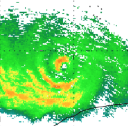
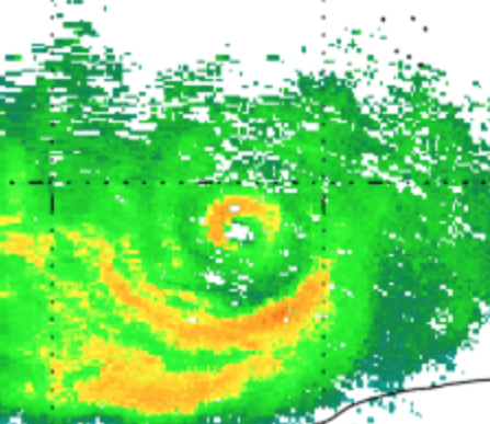
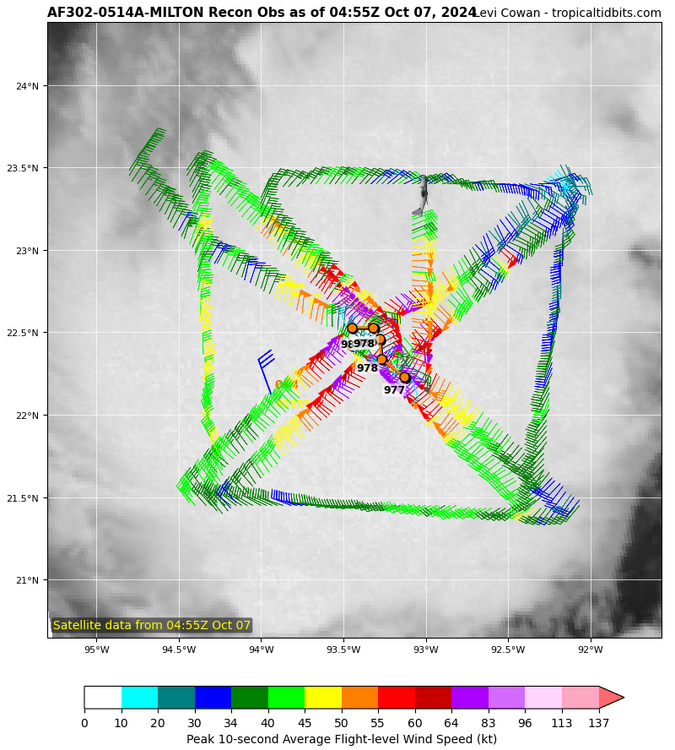
Latest radar
-
And now it's 911 mb. Such an extreme low pressure requires incredible inner core structure. Any disruption will send the pressure back up pretty quickly.
-
New dropsonde pressure is 908 mb.
-
The pressure is rising now (latest extrap pressure is 909 mb), and this is why. The inner eyewall is finally beginning to break up a bit.
-
901 mb and 902 mb per the latest dropsondes from the two planes that just went through the eye.
-
Recon is going to make one more pass before it has to fly home.
-
The CDO was still a hair ragged in the nw quadrant first thing this morning, but just over the last couple hours it has become significantly more circular and uniform.
-
The newest dropsonde says about 947 mb.
-
A few spots in northeast Iowa and also western Iowa have bottomed out in the low 30s this morning.
-
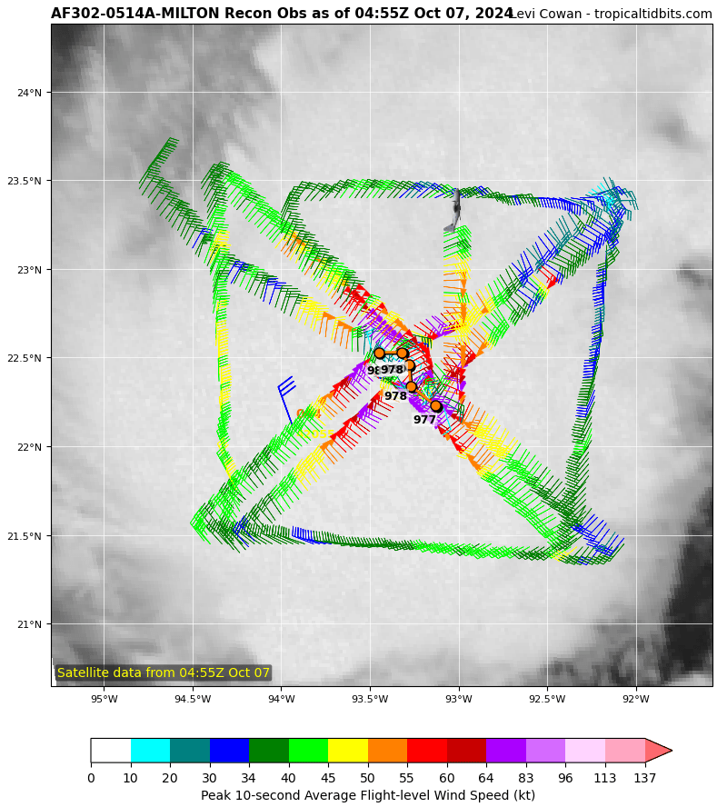
The recon plane went in one more time and found 976 mb. The track of the center has been south of east during this plane's flight.
-
Recon has found no pressure drop over the last 1 hr, 16 min..... still 977 mb. This plane is now done.
-
Two separate dropsondes show a pressure drop of 1 mb in the last ten minutes, now 978 mb w/ 12 kt wind.
-
New dropsonde says 979 mb w/ 13 kt wind.
-
The newest dropsonde says 980 mb.
-
We are only getting two passes from this recon plane. The next plane should be in there this evening.
-
985 mb per recon dropsonde..... 3 mb drop between passes.
-
The 12z gfs track is interesting. Initially, it is farther south, close to the Yucatan like the latest Euro. However, then it doesn't just turn northeast, but north-northeast, and ends up farther north than previous runs.
-
The visible loop looks very good. A nice ring of bubbly convection continues to surround the center. The next recon is on its way and should be in the eye in a couple hours. We need a moderator to clean out some of the garbage posts polluting this topic this morning.
-
The 06z Euro took a big jump south, shows Milton's center almost scraping the coast of the Yucatan.
-
I'm simply referring to the structural change that leads to much of the precip shifting to the northern half of the circulation.
-
All models show the south half of Milton clearing out as it approaches Florida.