vortex
-
Posts
500 -
Joined
-
Last visited
Content Type
Profiles
Blogs
Forums
American Weather
Media Demo
Store
Gallery
Everything posted by vortex
-
NWS rated this EF1. Never really hit anything directly. Grazed some farmsteads and a business. We had debris falling on us about a mile away. Biggest EF1 I’ve seen, lol. Yes I know that’s not how it’s rated.

-
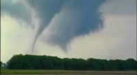
Still of video from tornado near Reddick tonight. Other pic is Sup before going tornadic.
-

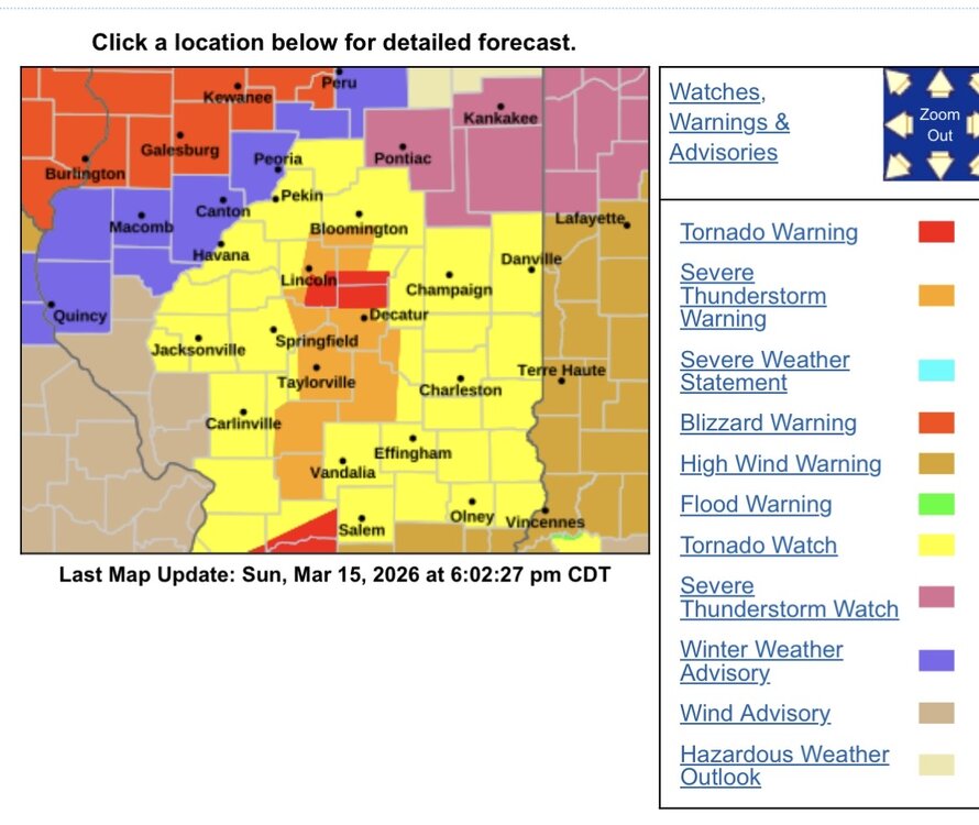
Potential Sever Weather Outbreak 4/27/2026
vortex replied to pen_artist's topic in Lakes/Ohio Valley
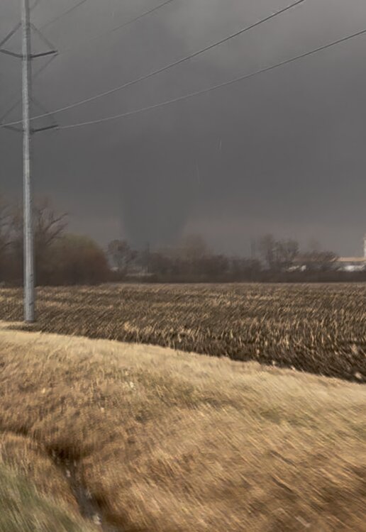
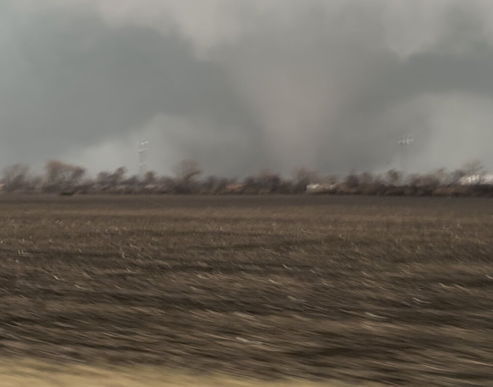
Tornado warned cell near Dewitt, about 40 minutes ago. Looking north. Messy af.
- 68 replies
-
- 12
-

-
My son captured this lightning strike from his front door.

- 99 replies
-
- 15
-
-

-
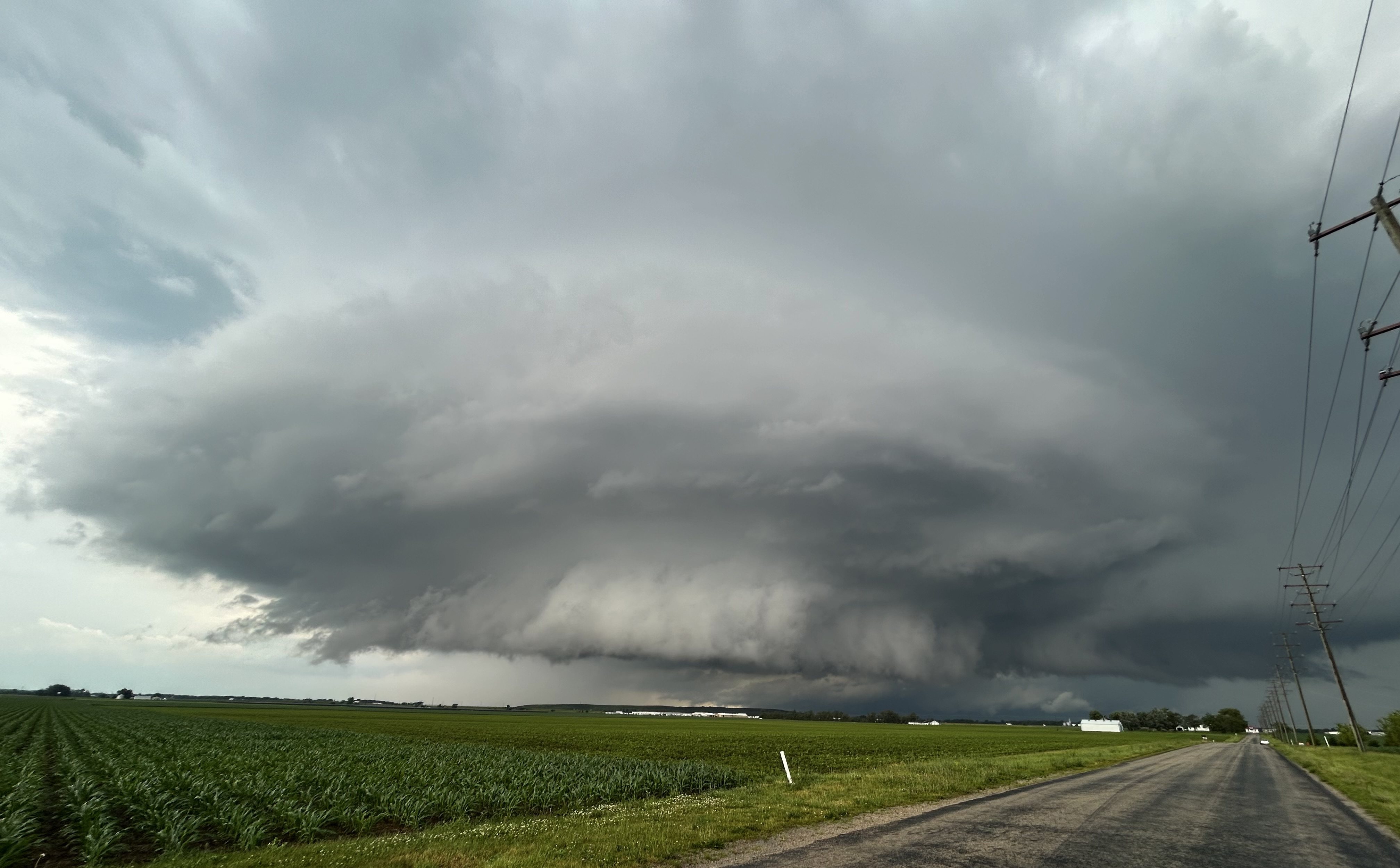
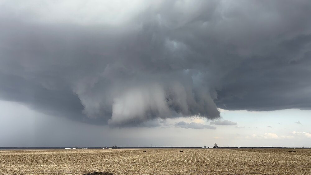
Couple pics from our brief chase near Wenona, IL. Nothing exciting but wasn’t a bad looking storm.

-
Don’t see this very often
-


-
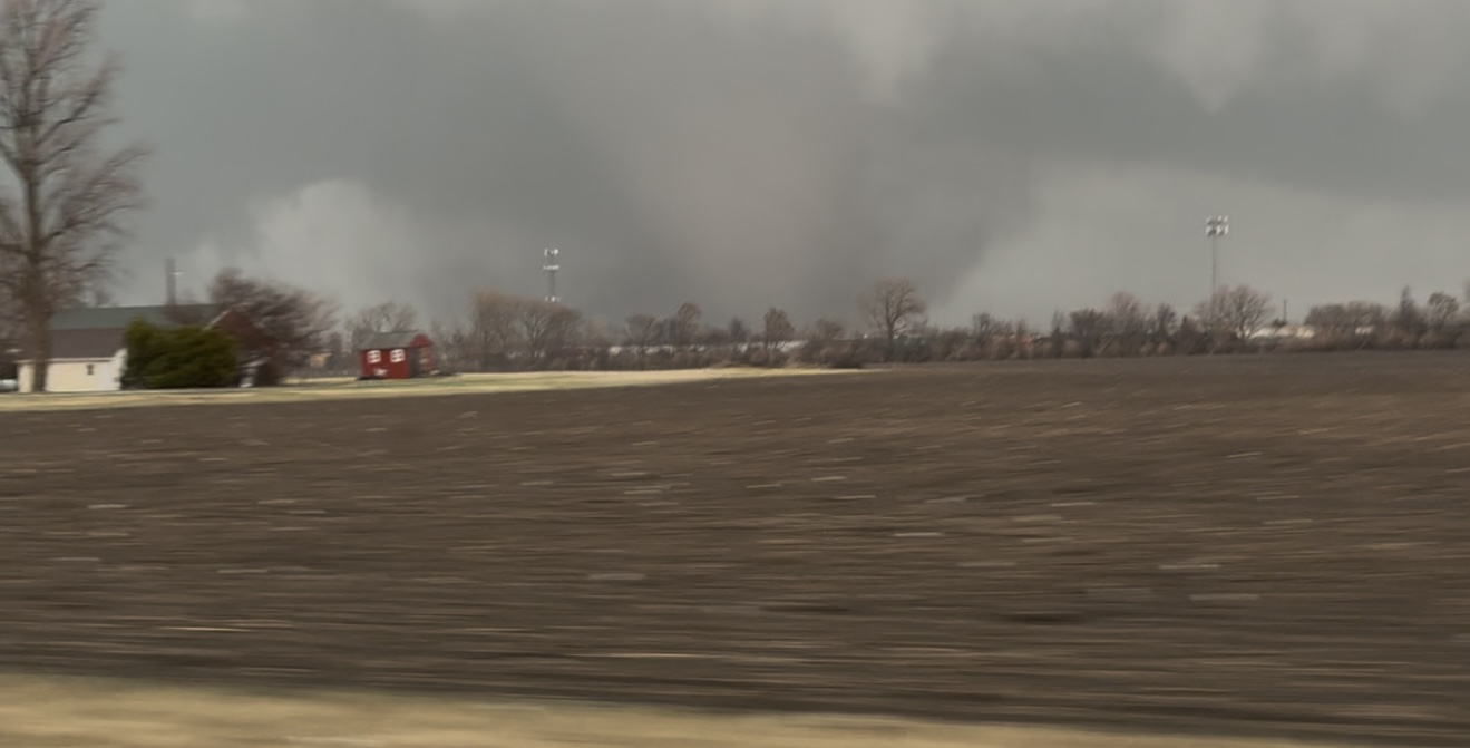
EF3 rating in the Aroma Park area. Traveled 36.6 miles. https://x.com/nwschicago/status/2031906106218356917?s=46&t=3wSgoAIsN5JjPoTPQ9Bzcg
-
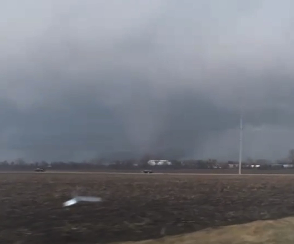
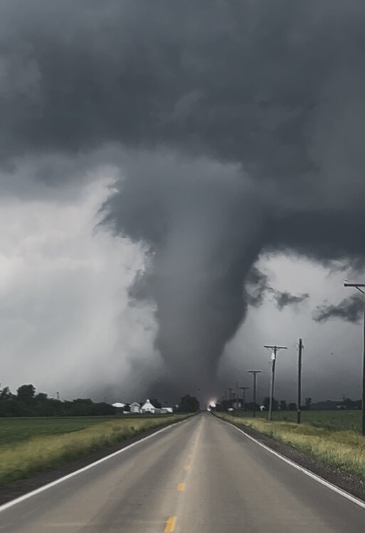
Video stills from Kankakee tornado by my son.
- 312 replies
-
- 12
-
-
Confirmed damage by my son in Kankakee south side. Speedway at 57 and route 52 destroyed.
-
- 312 replies
-
- 10
-
-
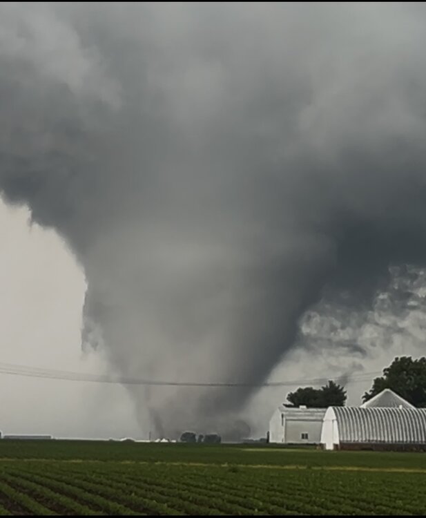
Pic from my son on the Pontiac cell.
- 312 replies
-
- 13
-
-
1/30-1/31 Lake Effect Snow Threat - SE WI, NE IL, and NW IN
vortex replied to A-L-E-K's topic in Lakes/Ohio Valley
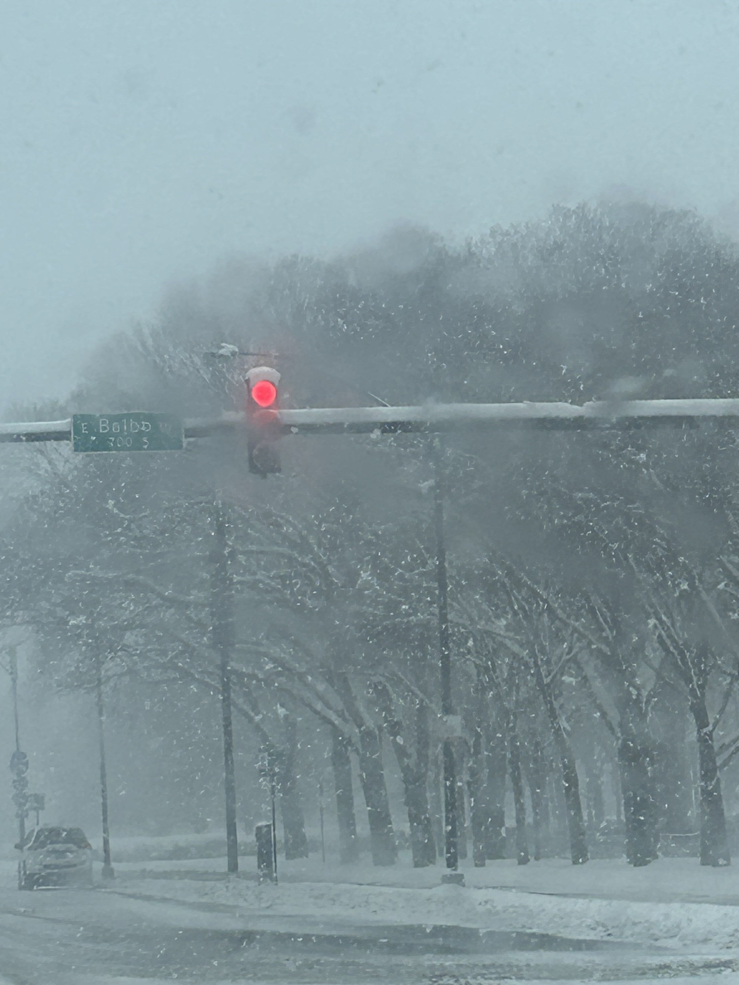
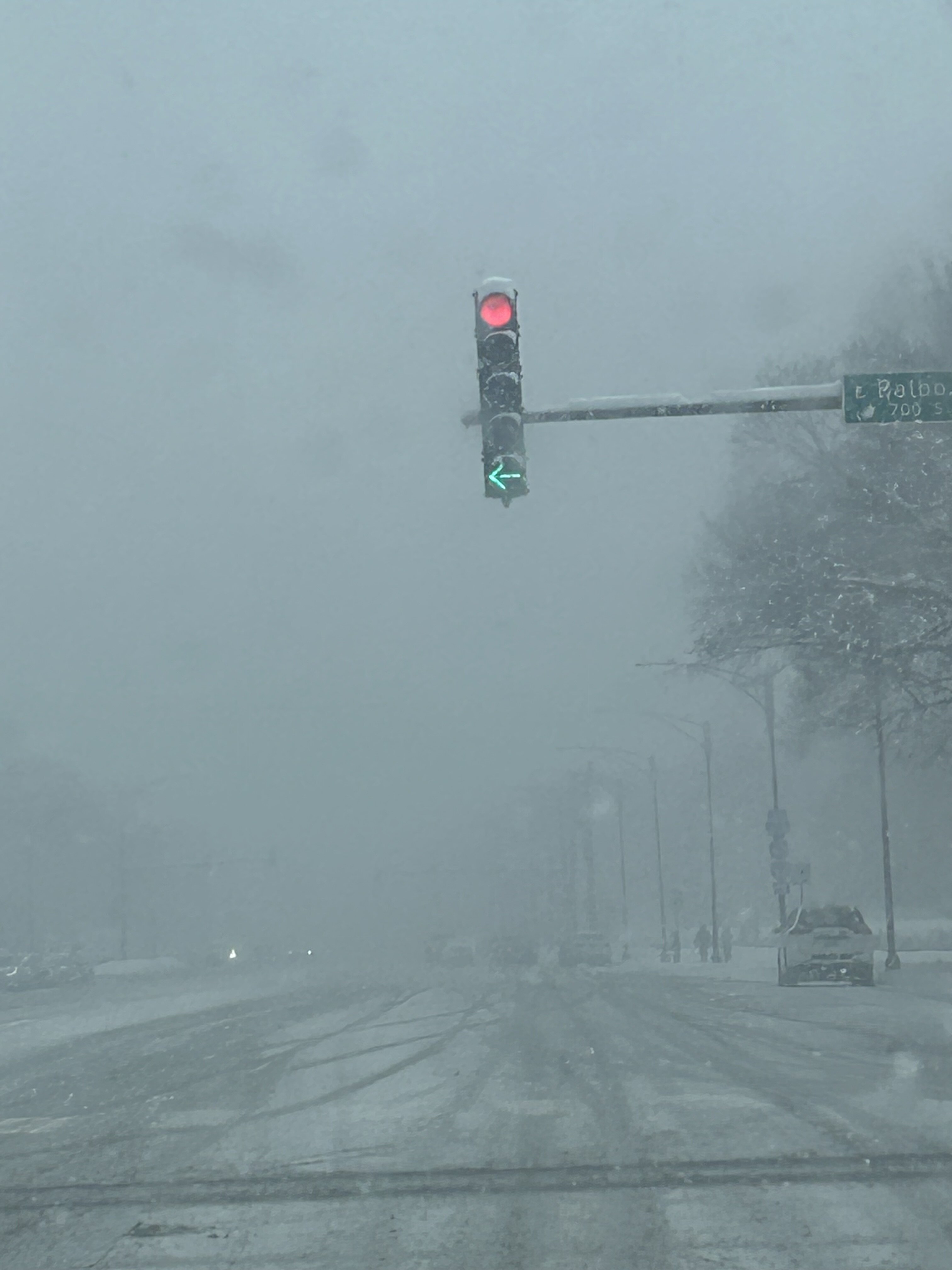
Visibility down to 2 blocks downtown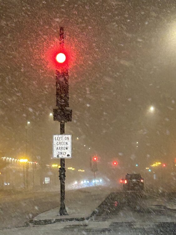
-
1/24-1/25 Major Winter Storm - S. IL, IN, and OH
vortex replied to A-L-E-K's topic in Lakes/Ohio Valley
Lake effect bands are def legit Looking north up Columbus.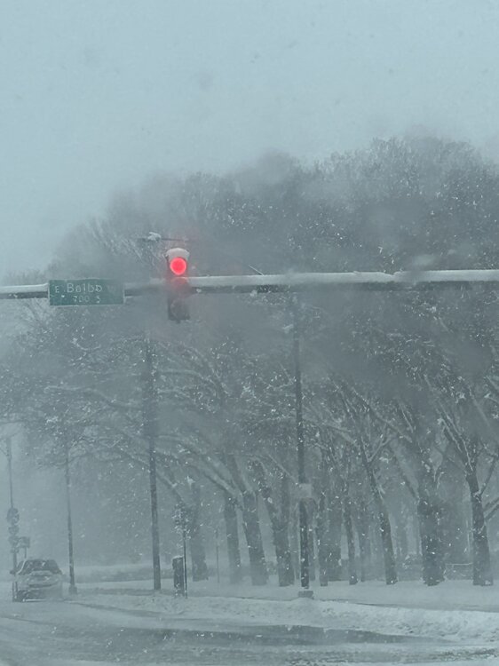
-
Winter 2025-26 Short Range Discussion
vortex replied to SchaumburgStormer's topic in Lakes/Ohio Valley
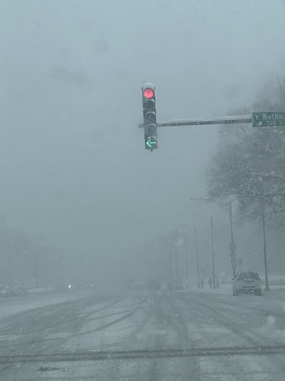
Had a nice little burst in the West Loop to whiten the grassy areas.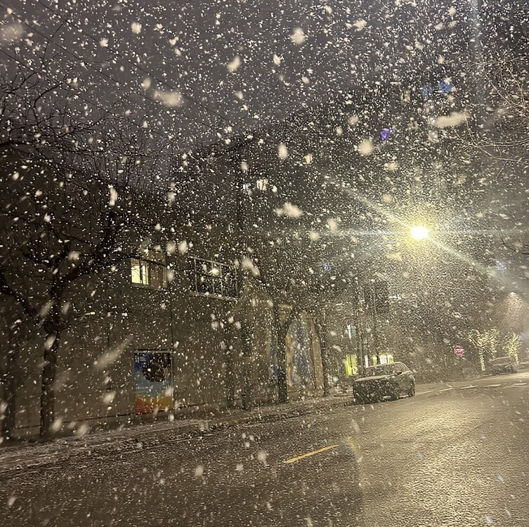
-
5 confirmed tornadoes so far by LOT from last night.
-
Yes there was
-
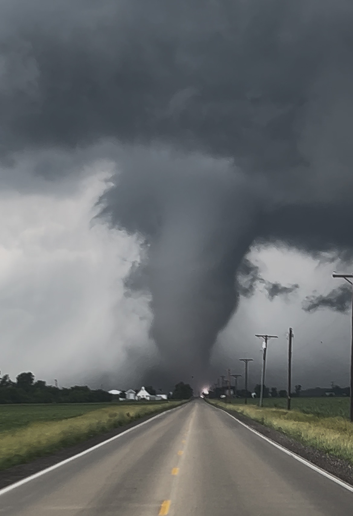
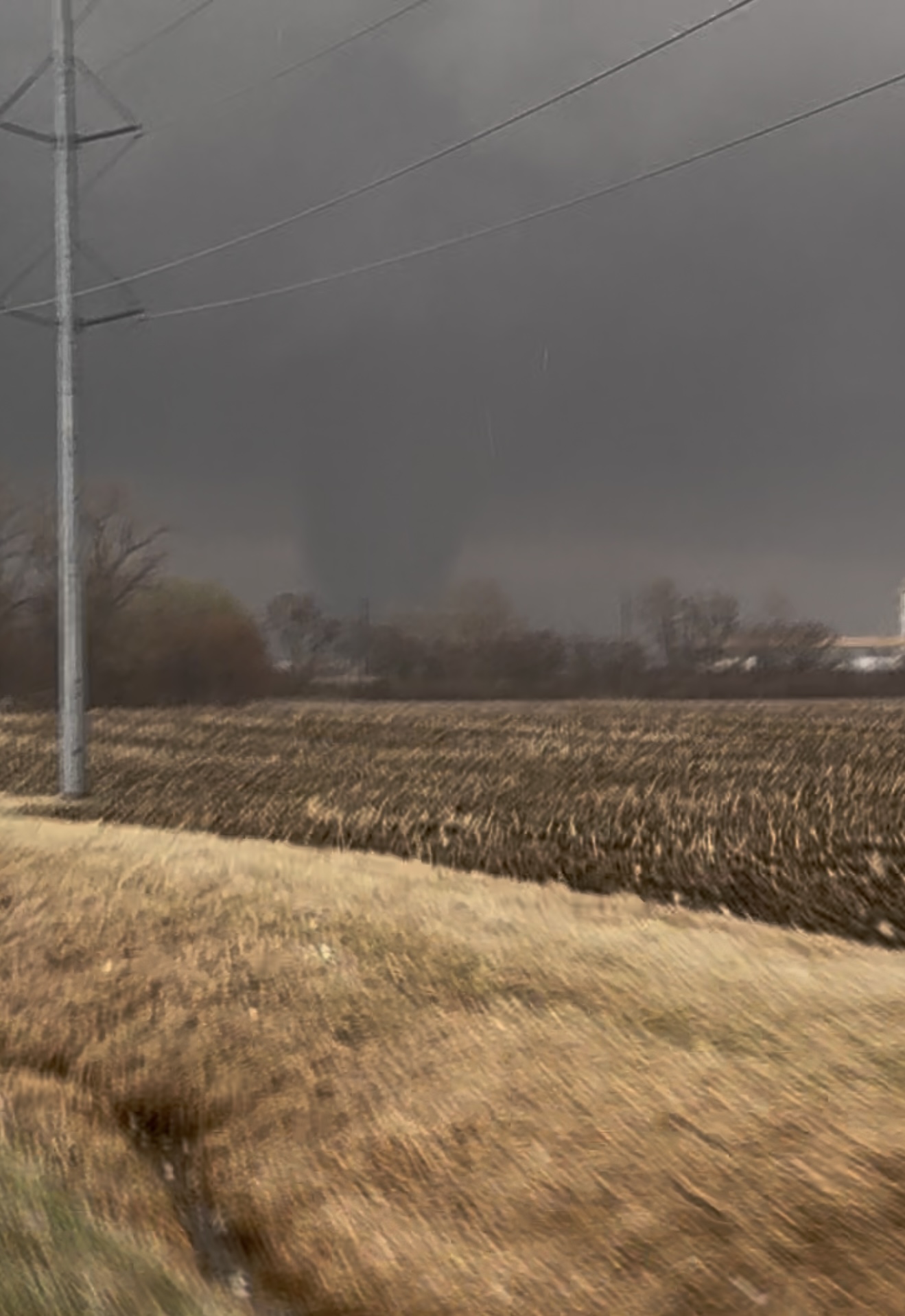
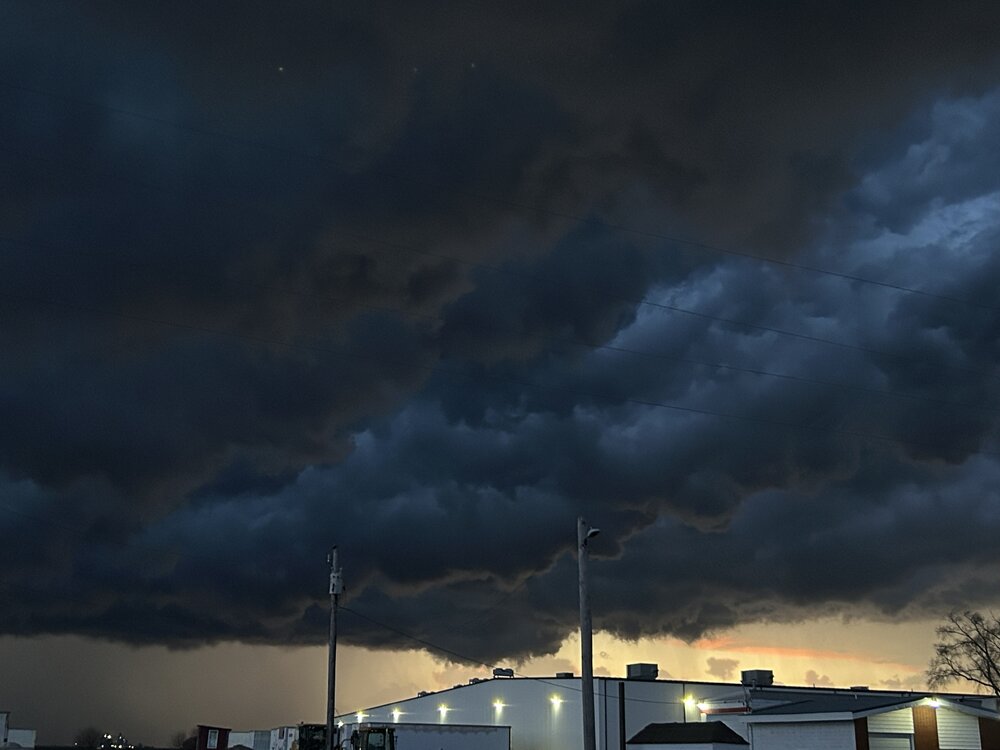
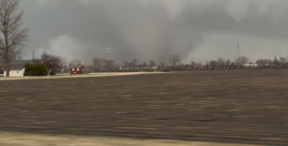
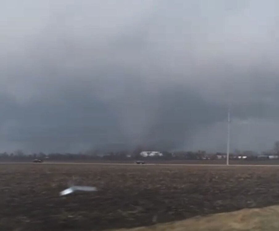
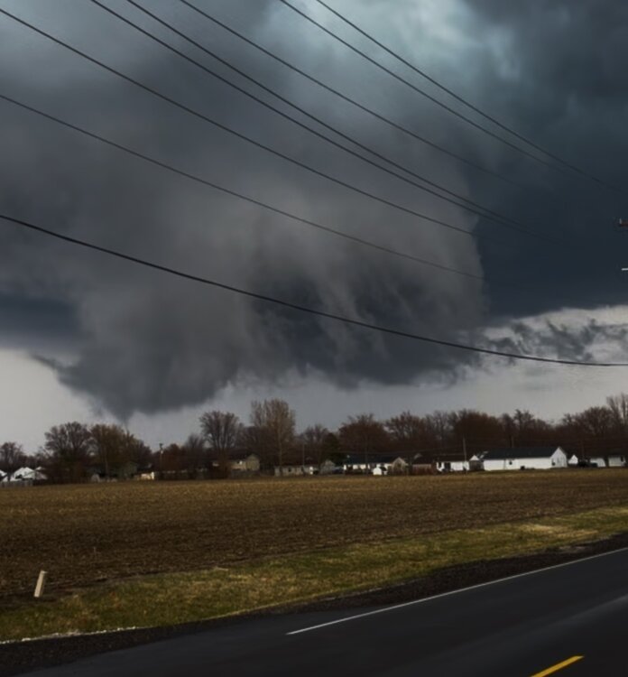
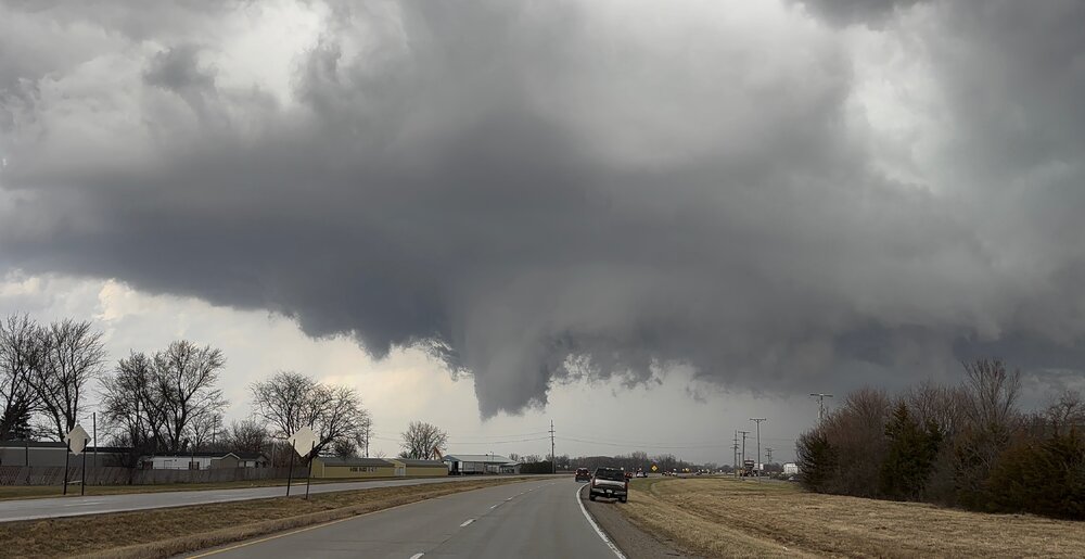
Nice lil local chase. Tor warned cell northwest of Gilman, IL before getting wrapped in rain and touching down east of Clifton, IL Damage pics east of Clifton, IL
-
Currently in LA but my son sent me this from Kankakee earlier
-
Nov 28-30th Post Turkey Day Winter Storm
vortex replied to Chicago Storm's topic in Lakes/Ohio Valley
Maggie Daley Park about an hour ago. -
Nov 28-30th Post Turkey Day Winter Storm
vortex replied to Chicago Storm's topic in Lakes/Ohio Valley
Pic from the West Loop a few minutes ago- 711 replies
-
- 14
-
-
-
11/8-11/10 First Snow and Lake Effect Event
vortex replied to Geoboy645's topic in Lakes/Ohio Valley
From a friend who lives between Kankakee and Momence.- 213 replies
-
- 10
-
-
-
11/8-11/10 First Snow and Lake Effect Event
vortex replied to Geoboy645's topic in Lakes/Ohio Valley
Earth Cam from Chicago just now, compared to what it normally looked like earlier in the evening. -
Breeze felt good today.