Castaway
-
Posts
414 -
Joined
-
Last visited
Content Type
Profiles
Blogs
Forums
American Weather
Media Demo
Store
Gallery
Everything posted by Castaway
-

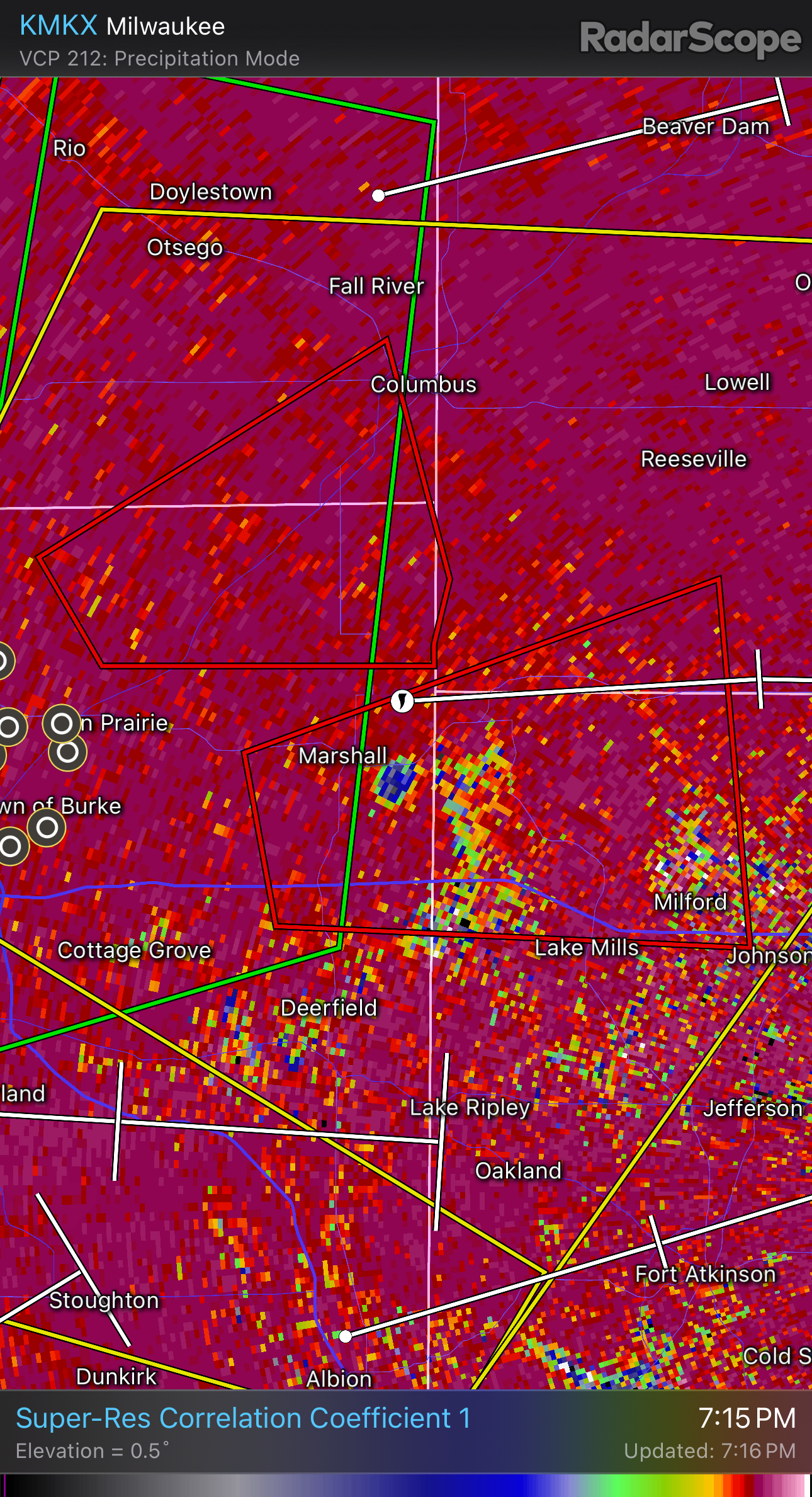
2024 Short/Medium Range Severe Weather Discussion
Castaway replied to Chicago Storm's topic in Lakes/Ohio Valley
Interestingly new development popped ahead of it to its southeast right afterwards.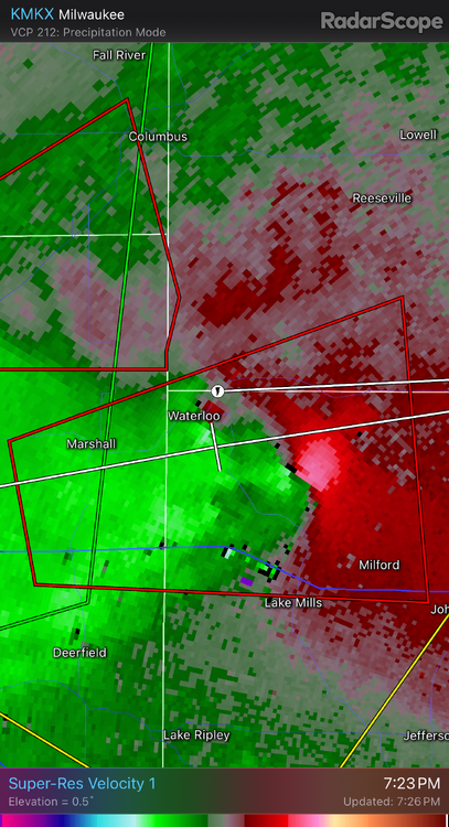
-
2024 Short/Medium Range Severe Weather Discussion
Castaway replied to Chicago Storm's topic in Lakes/Ohio Valley
Well defined debris hole.
-
2024 Short/Medium Range Severe Weather Discussion
Castaway replied to Chicago Storm's topic in Lakes/Ohio Valley
Seems to be heading by Waterloo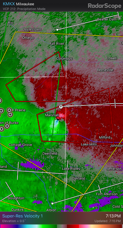
-
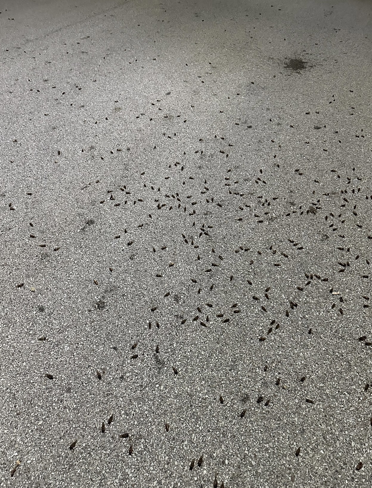
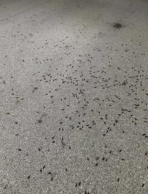
Went to go for a quick night time bike ride to the store and enjoy the cicadathon ambiance around etc. Then quickly started coming across huge Cicada spots under the street lights ahead everywhere. I was like what the. Put the bike back. And walked instead. They’re everywhere. Seen a bunch new ones still climbing everywhere unhatched/hatching etc. Definitely been pitching past days. Neighborhood is a few hairs away getting swamped with them everywhere. With a possible call for a state of emergency. Like a cicada blizzard. Residents trapped and having to call in work with a margarita in hand and while the brooding that has unearthed upon us is buzzing and mating away ok I’m done
-
Personally I love em. The ones here in dupage are the 17 year ones. At night, it’s the females I think that make clicking sounds. They remind me of little frogs in trees etc, that adds a rare ambiance around. Where as it would be quiet and boring imo. They also are a natural soil aerator. I’m guessing lawns/gardens around are going to be lush as ever. Older trees is where the main breeding grounds are I noticed. And there’s a few big ones around the lot that are complete nesting grounds. Yesterday, I went outside and sat by the smoker/grill thinking to do barbecue. And just sat there talking to a friend on the phone and barely heard him. Just in awe. They also get to a pitch where the buzzing is so loud and concentrated that it creates a background howl. Last week when I walked outside and first noticed it, I thought there was some electrical sounding alarm that was going off on some storefront or something in the distance. Insect wise, they’re probably my favorite. Don’t bite or cause havoc. Only the sheer volume can be somewhat annoying at times. Definitely rather have them around over mosquitoes etc.
-
Ready 2 b shelved One of the memorable shelf clouds I saw was in Schaumburg 10 years ago that rolled in the morning also. I wasn’t expecting it walking outside lol. Was in awe. Looked like a long ufo. Dark front with glacierish teal hues behind it etc.
-
The initial wording in the Tornado watch on the iOS weather app caught my eye Severity: Extreme Extraordinary threat to life or property
-
Seems like a break in the howling now. Was constant in the background for a bit.
-
Glad it came back. Power is still down here in Oak Brook. Going to check the outage map. Hopefully gets up soon. Branches and everything are weighted down. Winds are howling.
-
Power just went out in the neighborhood. Damn it. Hopefully it gets back up within the hour
-
Oak Brook here. Mental alarm hit earlier than normal. Passed out early last night. Awesome rates past hr. Everything looks plastered. Told my gf yesterday that it wasn’t going to start til later on in the day today. Whoops. Text her good morning and no response yet. (sips coffee) I’m just going to stick my guns and say this isn’t even the main event yet/just some freakish frontal that passed through etc
-
Decent band over i-80. Aurora looking good coming up

-
Pretty much how I’m feeling lol Haven’t been following this at all until yesterday. And it has been ticking south since. Daddy like.
-
Wanted to share
-
Texas/Oklahoma 2023 Obs and Discussion
Castaway replied to Ed, snow and hurricane fan's topic in Central/Western States
I’m in Oklahoma City for a bit. Was watching a nice tower form to the east and went severe warned. Hot day around 95 -
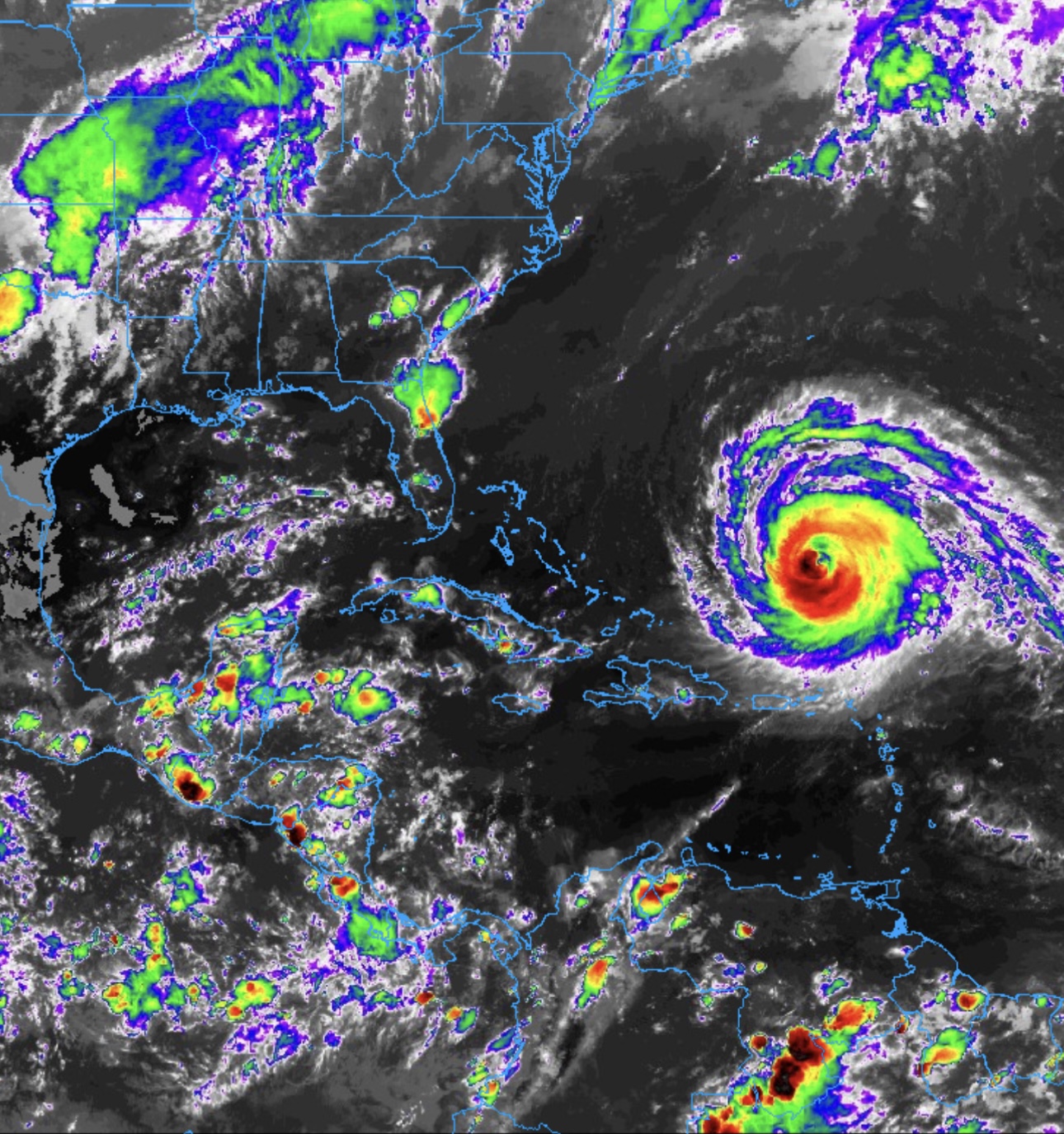
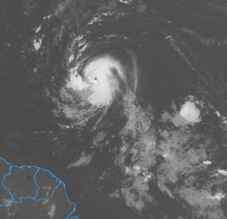
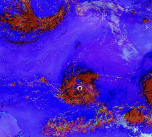
Waiting for the next frame. If it’s starting to look like I think it’s starting to look, the eye is looking insane and with potentially more strengthing ahead.

-
Some of those classic high end EPAC hurricanes remind me of a spinning skateboard wheel that got caught in seaweed or something lol Lee appears to have popped an eye couple hrs ago. Confirmed tower action formed southwest of the circulation earlier with it wrapping around full circle now.
-
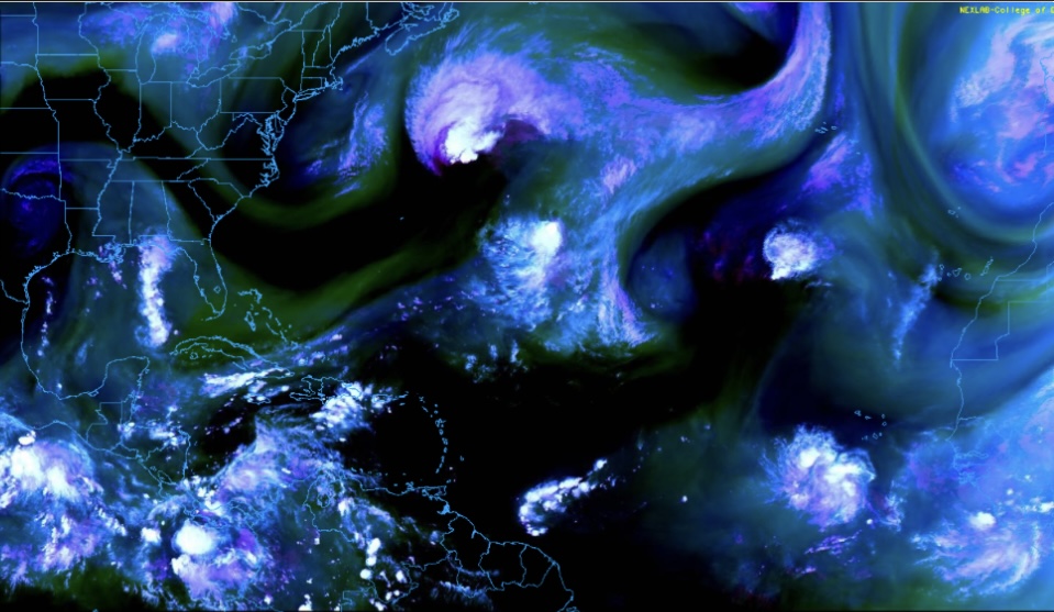
Speaking of Shrimp, after eyeballing this thing on satellite loop past hrs lol, I kept recalling Dorian when it was in its shrimp phase before taking off and eventually becoming a beast. Even though Dorian developed it more west around Barbados I believe. Catching similar vibes, especially if it’s headed on track towards the east side of the Bahamas area. Might be premature, but wouldn’t be surprised this is hurricane status after a few more cycles in the next few hours or so.
-
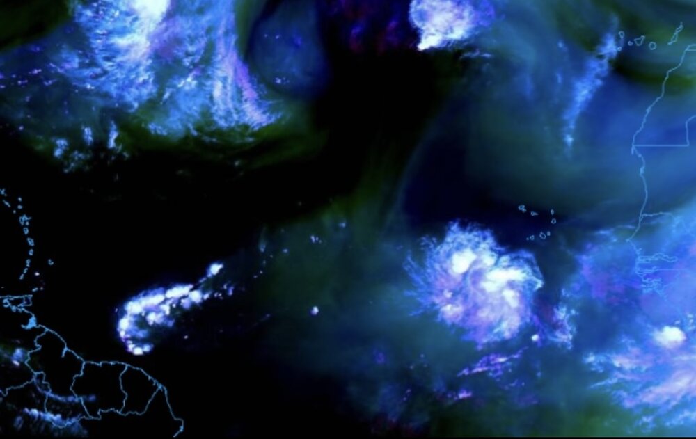
Nice! The general area of circulation has become more evident from watching it on and off past hours. It’s getting it’s act together.
-
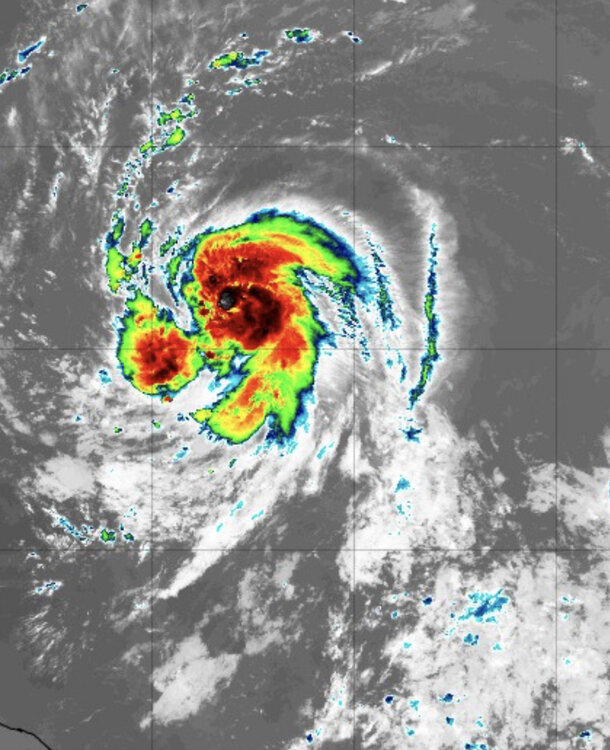
Still early obviously, but there’s definitely an ominous overall feel to this one imo. Especially being this far out, and with the broad turning in the low levels as mentioned earlier. This looks like it has a strong potential of displaying a mean buzzsaw representation in the incoming future with a broad robust CDO doughnut .
-
Denver got 99’d yesterday? Just 1 French fry away from a 100. ruff.
-
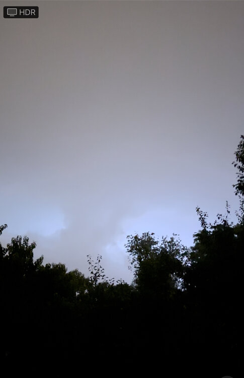
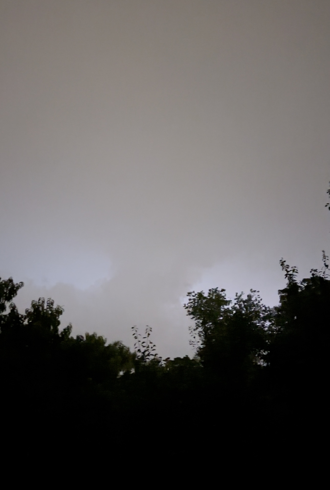
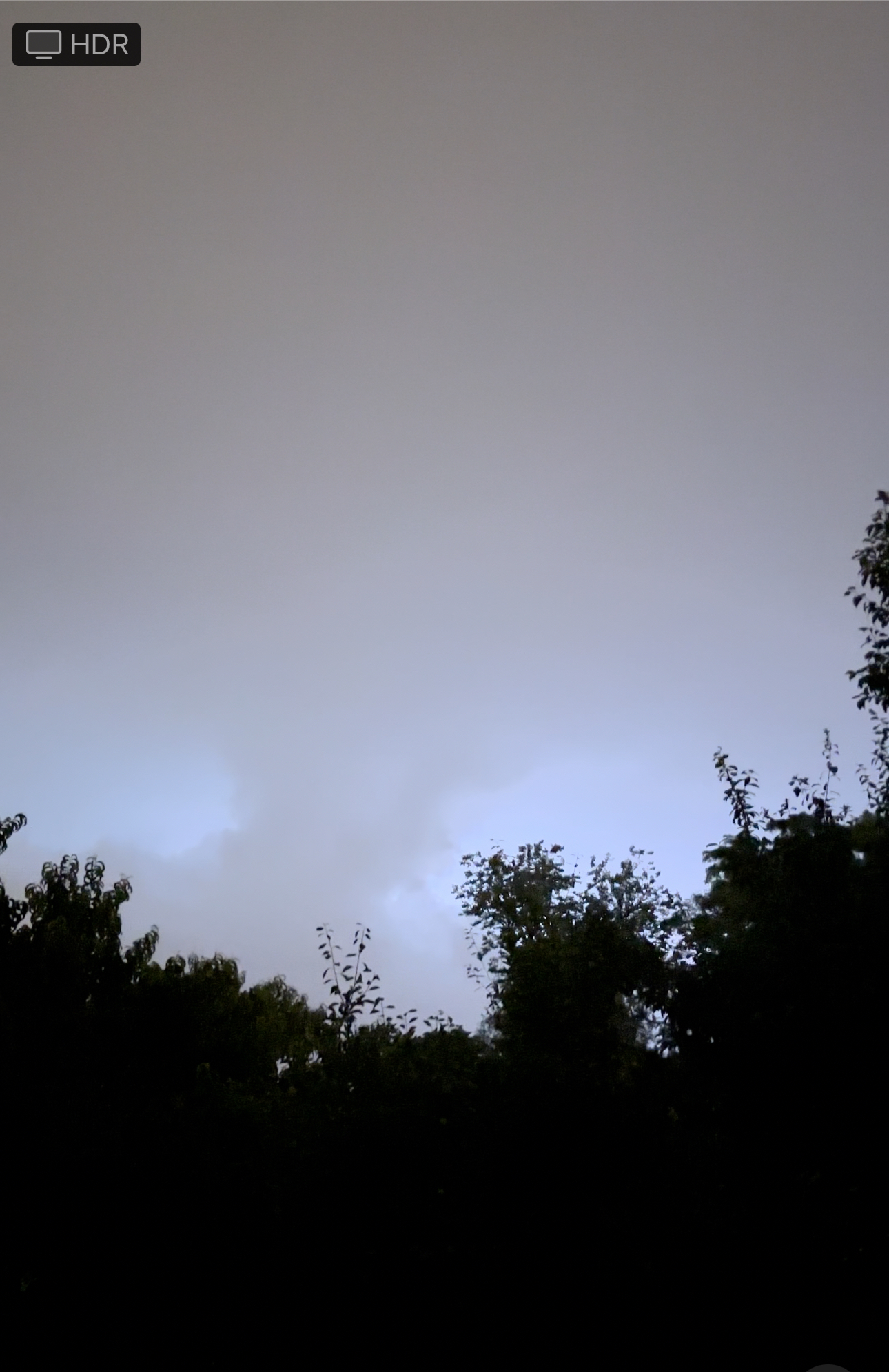
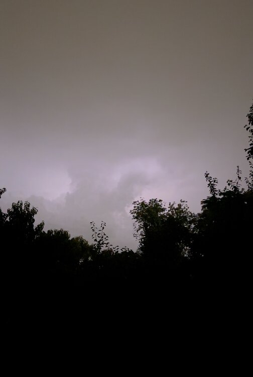
Yeah it was definitely nice. Was under the overshoot for awhile here in Oak Brook. Constant rumbling.

-
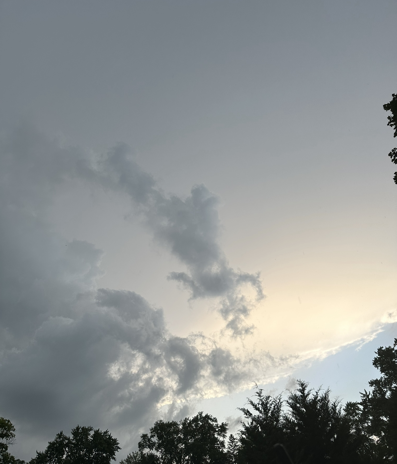
Yeah just had a visual looking outside. Some nice explosive looking towers popped up
-
2023 Short/Medium Range Severe Weather Discussion
Castaway replied to Chicago Storm's topic in Lakes/Ohio Valley
-
2023 Short/Medium Range Severe Weather Discussion
Castaway replied to Chicago Storm's topic in Lakes/Ohio Valley
Was able to catch some timelapse footage, looking West towards Glen Ellyn, between Roosevelt Rd. and Butterfield Rd. Will post more.