Castaway
-
Posts
414 -
Joined
-
Last visited
Content Type
Profiles
Blogs
Forums
American Weather
Media Demo
Store
Gallery
Everything posted by Castaway
-
89/75 sweaty balls today. Somehow managed to gather strength to smoke/grill on the pitboss pellet grill twice before each rd in oak brook. the img compressor shit here sucks
-
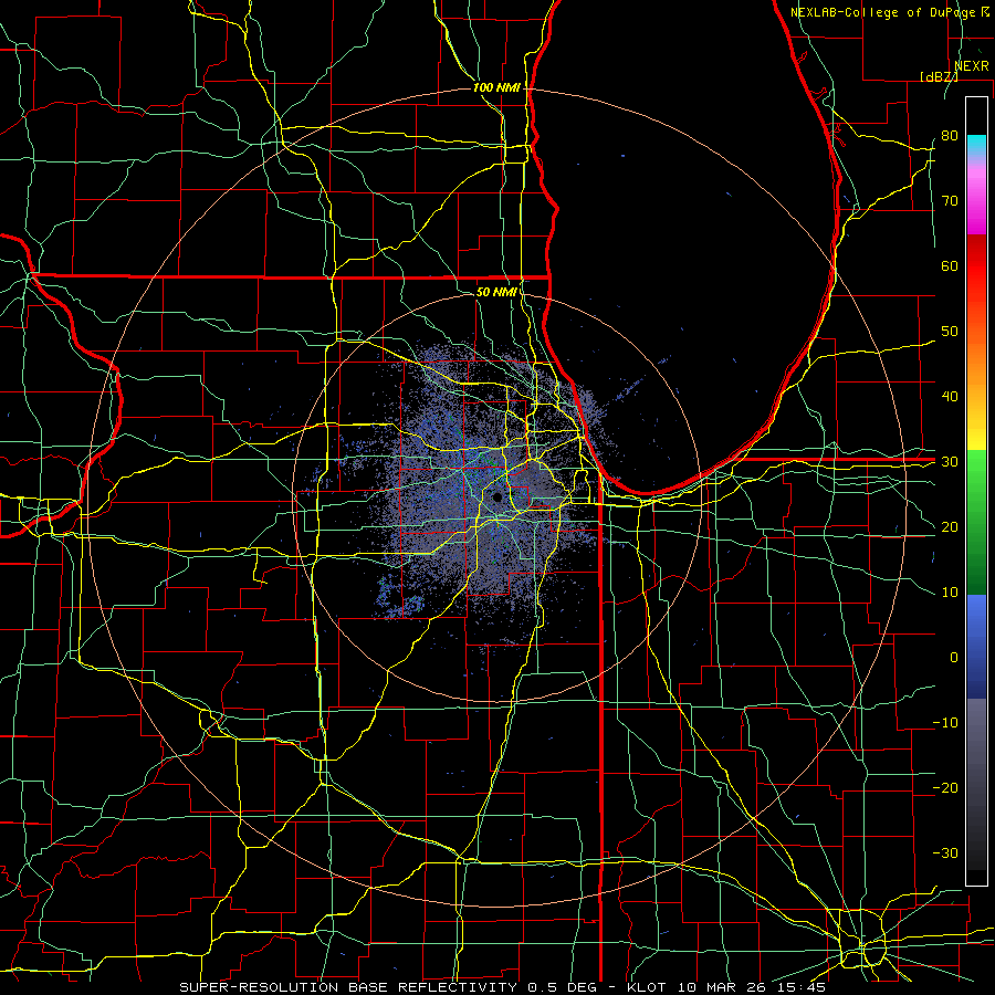
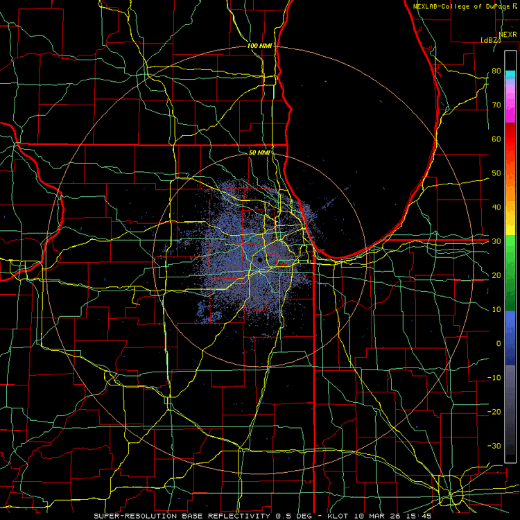
Everything is training just north of me. Looks like a barrage. Nonstop lighting. Barely a drop here. Best atmosphere to chill outside or take a walk
-
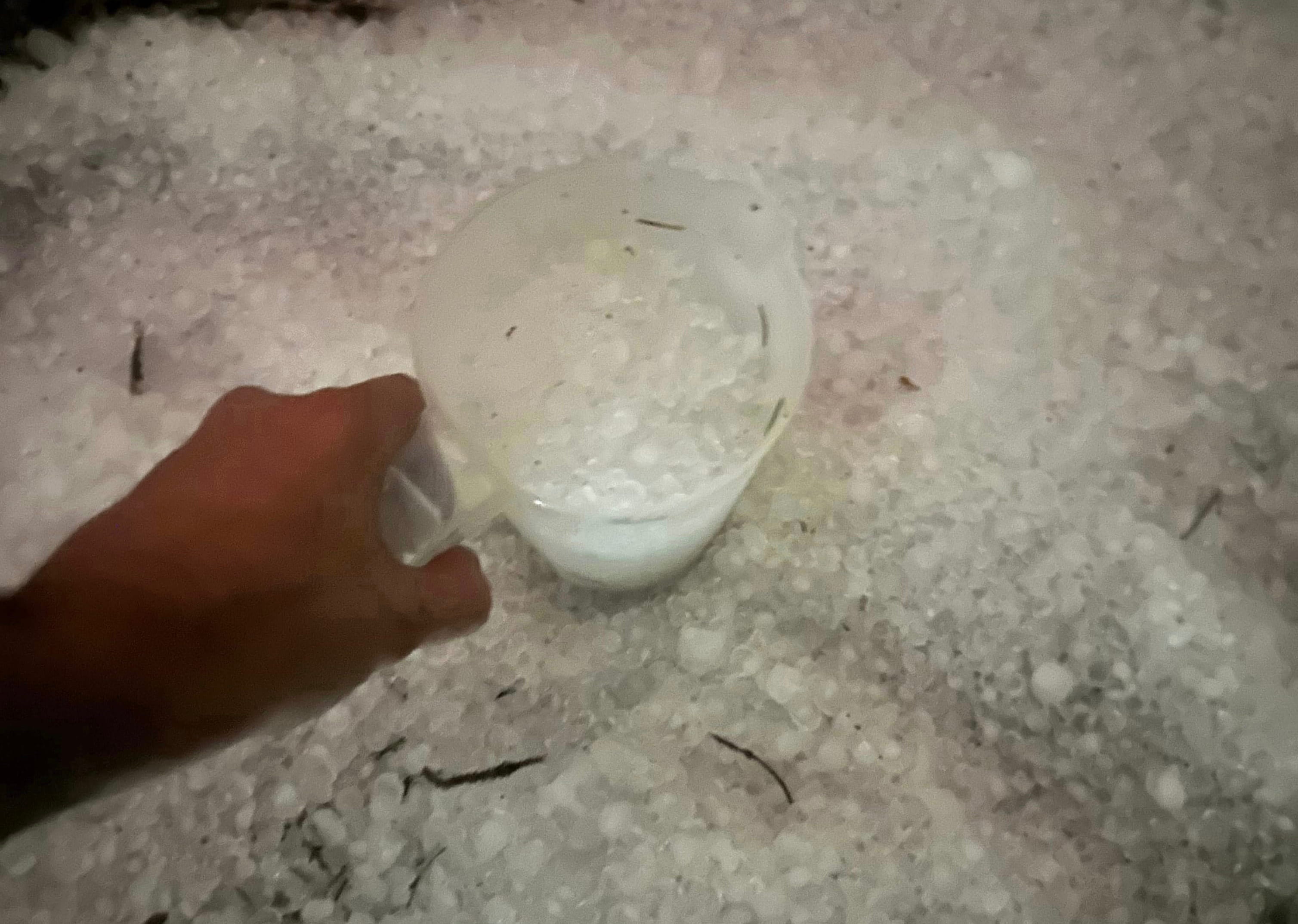
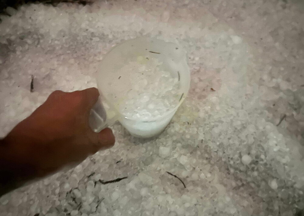
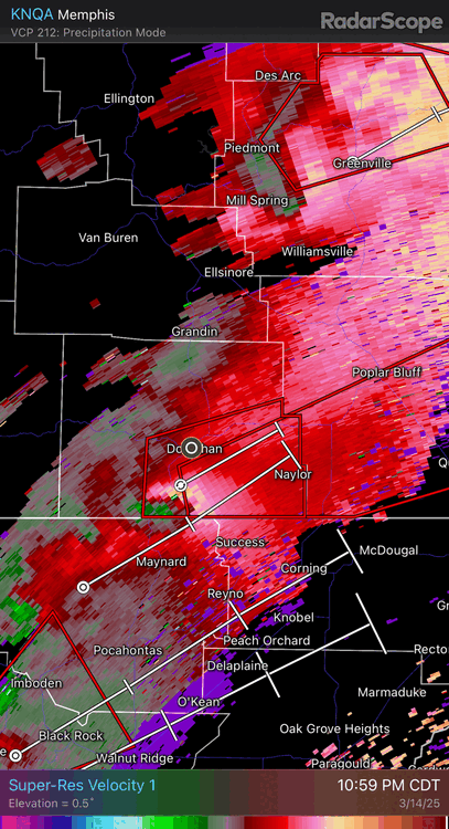
Same here by Oak Brook. This was about 20 mins later also. Best hail so far this year. Light show was top notch. Been a while a storm like this hit in March imby. Definitely one of the best ones In awhile. Not sure another one will hit like this with the hail but if anything tops this coming up this summer it would have to be a totg or top tier derecho etc
-
Has anyone seen my pit boss smoker cover?
-
Best one I’ve seen around the area in a while
-
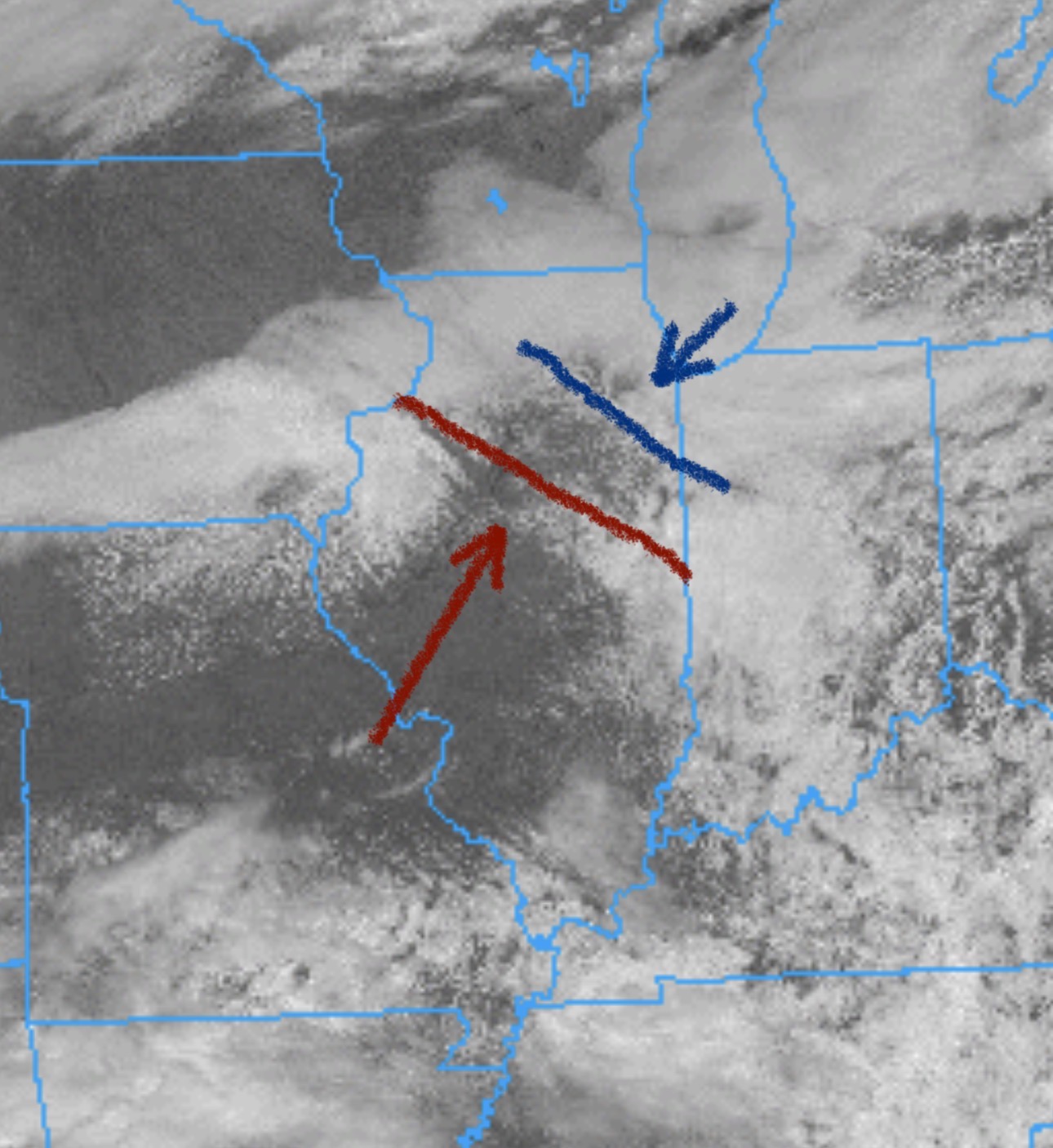
Looks like the Pontiac cell is heading into stable air
-
T warned now
-
Yeah the one nw of Pontiac is looking to drop one any minute now
-
-
-
-
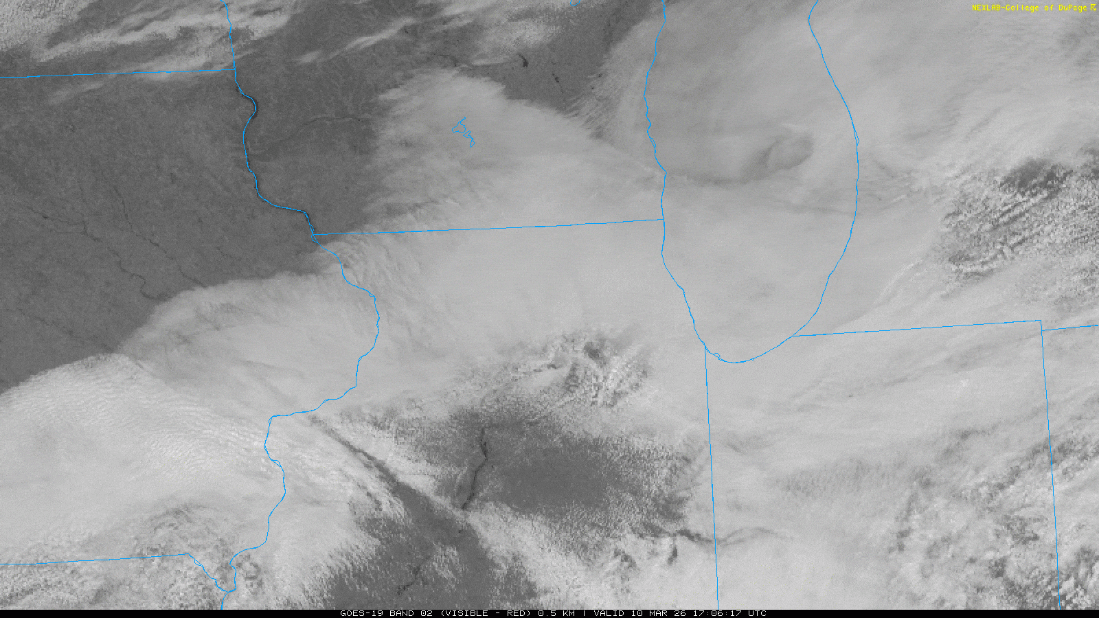
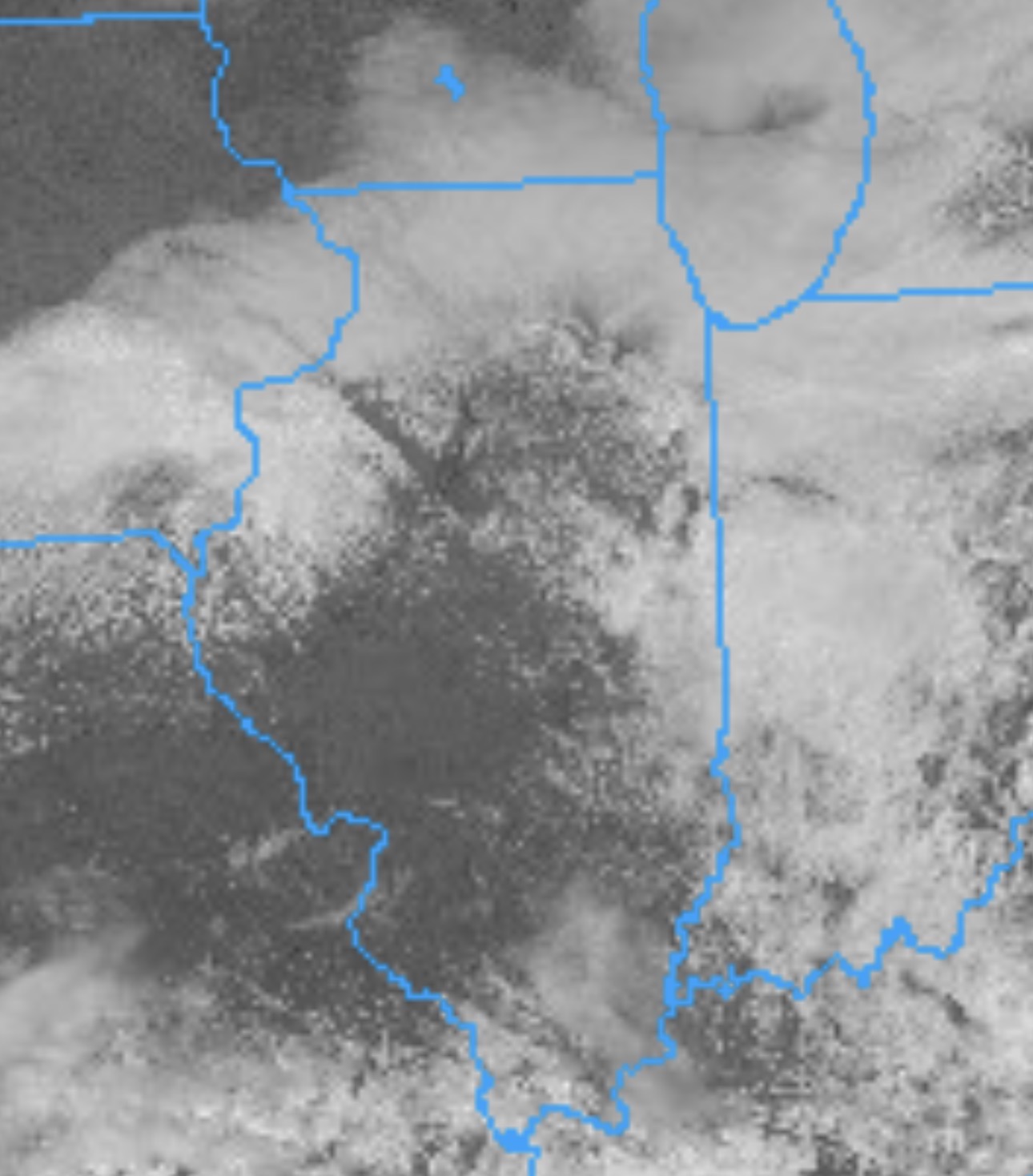
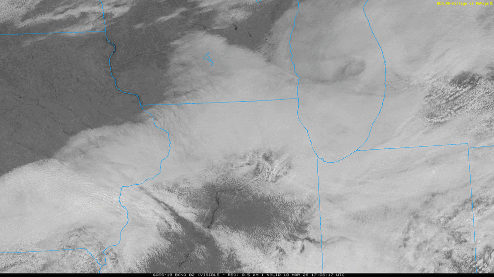
At least the clouds are clearing out more in northern and central il

-
-

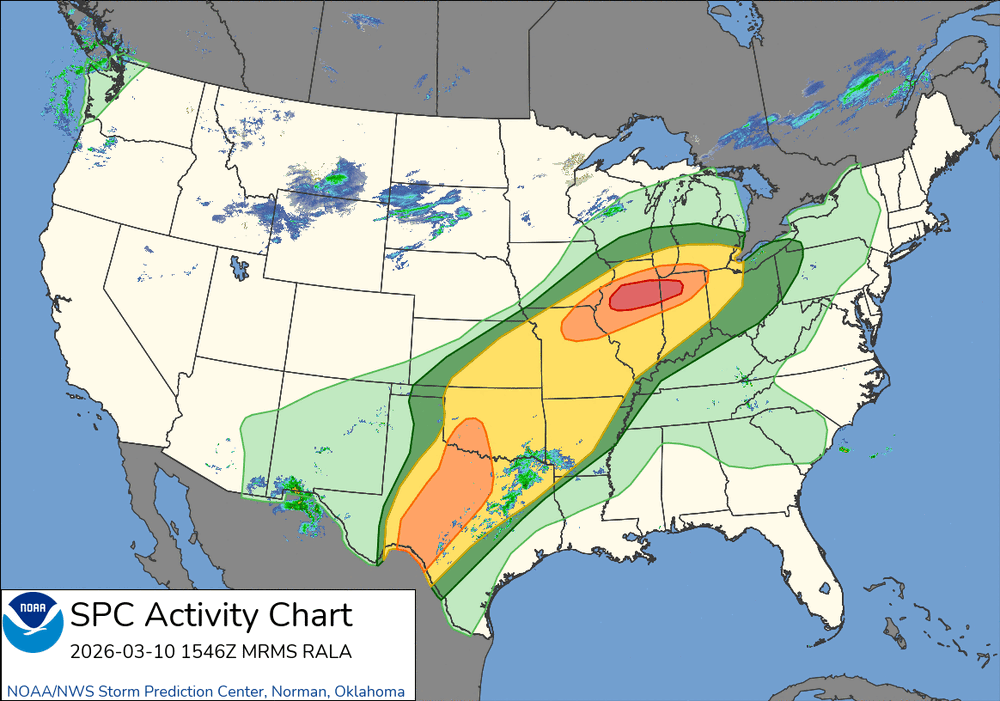
2025 Short Range Severe Weather Discussion
Castaway replied to Chicago Storm's topic in Lakes/Ohio Valley
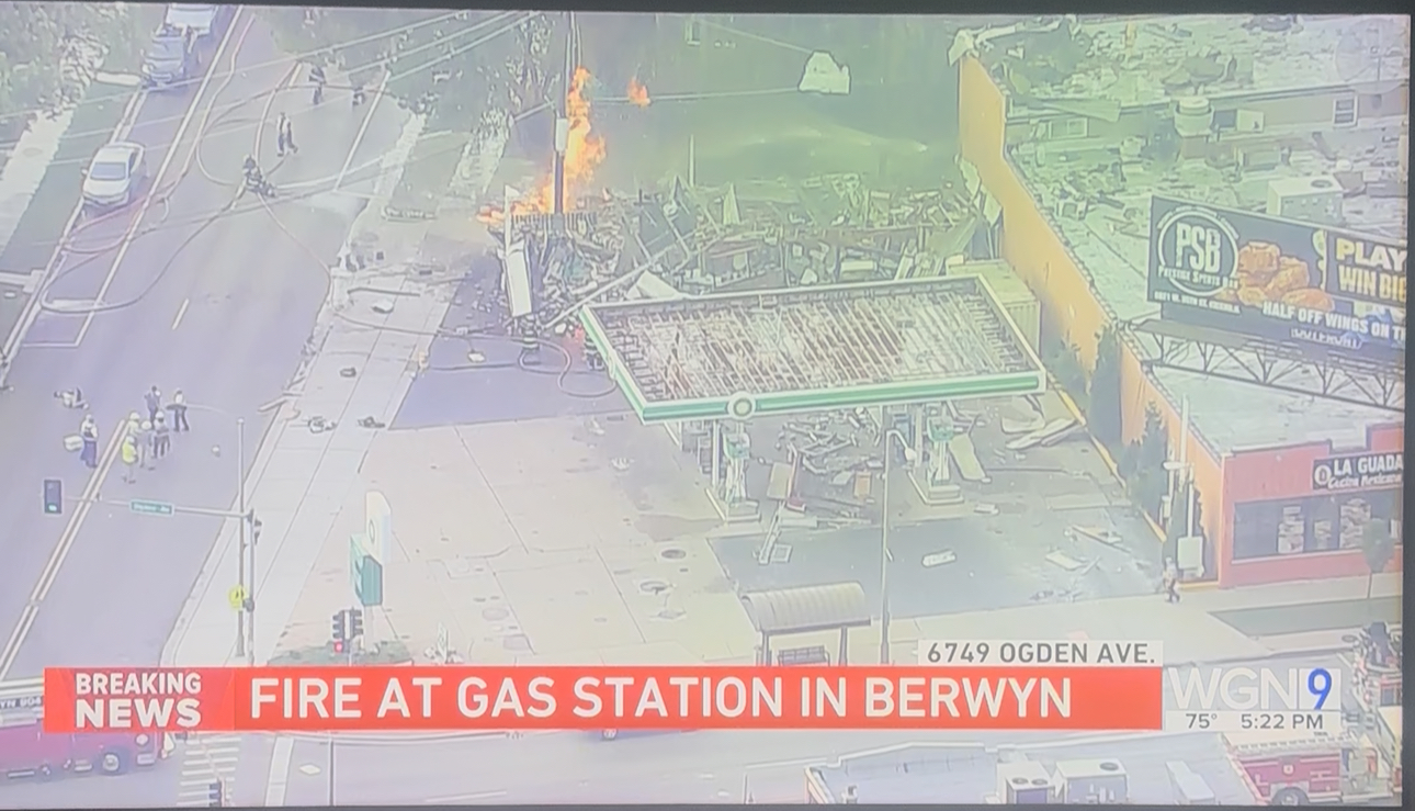
Tree down at my old neighborhood in Cicero. Possible lightning strike. Also a gas station blew up on oak park and Ogden in Berwyn. Still going on. People said they heard/felt an explosion all the way near Austin and Ogden.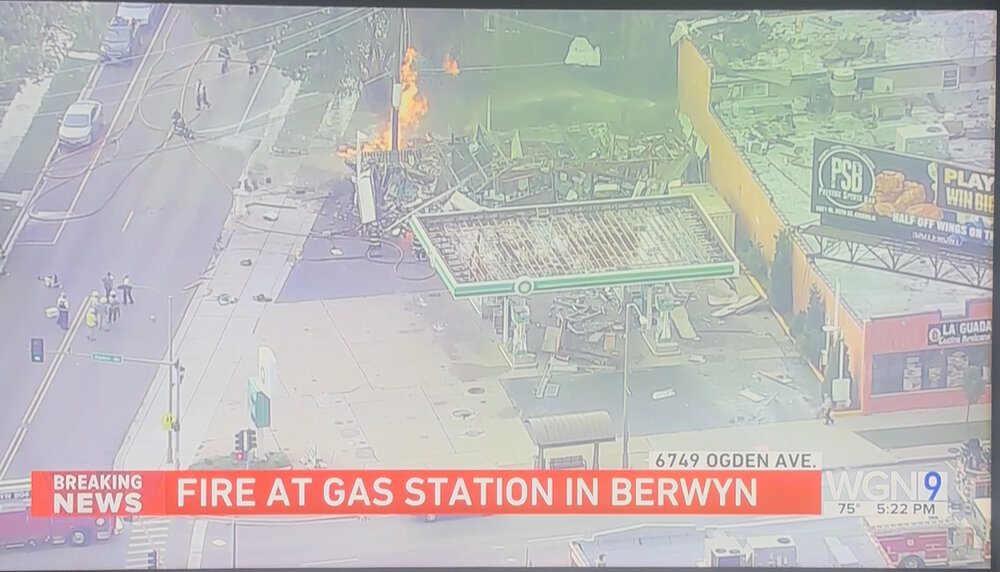
-
2025 Short Range Severe Weather Discussion
Castaway replied to Chicago Storm's topic in Lakes/Ohio Valley
Looked near white out by Lombard/Downers grove area. Had some solid bangers. Probably best storm so far
-
87 with dews now up at 69 with gusts up to 34mph imby
-
86 right now with 68 dews and 14mph southerly winds in imby in dupage
-
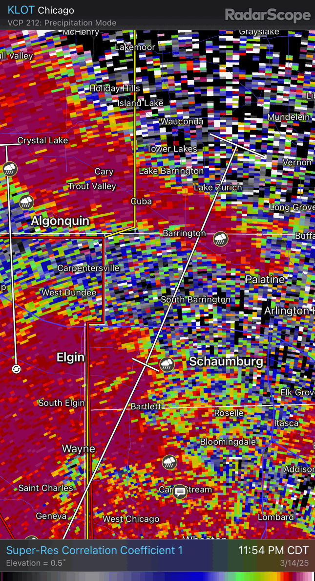
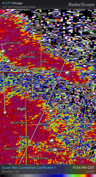
Yeah it was right by a buddy of mine in Elgin. I caught it last minute while watching other cells everywhere. Didn’t look impressive velocity wise but was surprised seeing the cc drop
-
-
-
-
-
2024 Short/Medium Range Severe Weather Discussion
Castaway replied to Chicago Storm's topic in Lakes/Ohio Valley
Feeling the cool down. Moisture was piping right til it got here half hr ago. Took a quick walk to get some beers and heard the sirens. Definitely felt beefy with a rolling barrage coming in. -
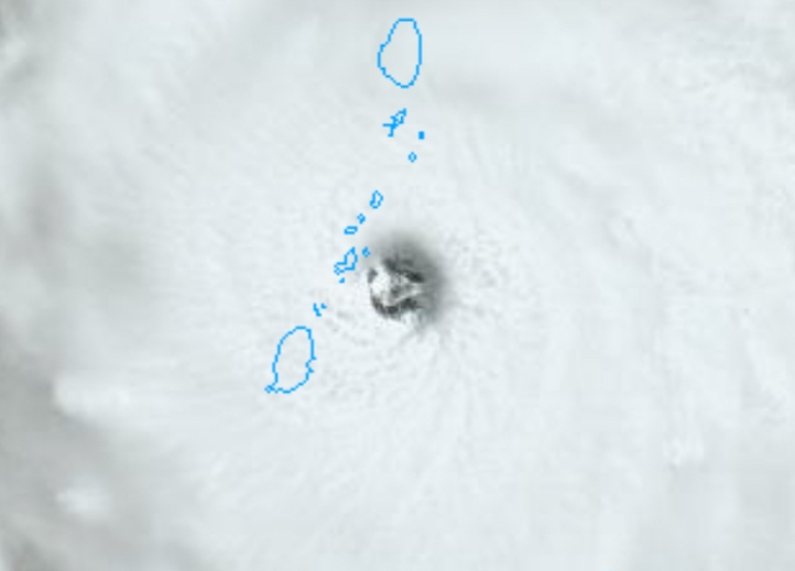
Wonder what the pressure readings are on Petit Martinique. Should be dropping fast right now.
-
Hurricane Beryl is enjoying the depths by the Guiana Basin. It’ll pick up obviously as it approaches the islands. Currently where this beast popped up has depths of 4000 meters, or just east of it. Also according to wiki: “The beaches on the southern margin are important hatching grounds for the vulnerable Leatherback sea turtle, with the region supporting the largest Leatherback nesting area in the world.[13] [13]” Luckily for them it’s north and moving west of them. The newly discovered large oil field isn’t far from there also.