andyhb
-
Posts
20,454 -
Joined
-
Last visited
Content Type
Profiles
Blogs
Forums
American Weather
Media Demo
Store
Gallery
Everything posted by andyhb
-
-
Absolutely insane tornado today in SW OK, pics to come.
-
IMO a number of those photos show at minimum high end EF4 damage.
-
Some FEMA CAP images showing incredible damage from the Greenfield tornado both in and southwest of town: http://fema-cap-imagery.s3-website-us-east-1.amazonaws.com/Images/CAP_-_Spring_Storms_2024/Source/24-1-5261/Sortie_7_AerialOblique/
-
Strong tornado WNW of San Angelo right now.
-
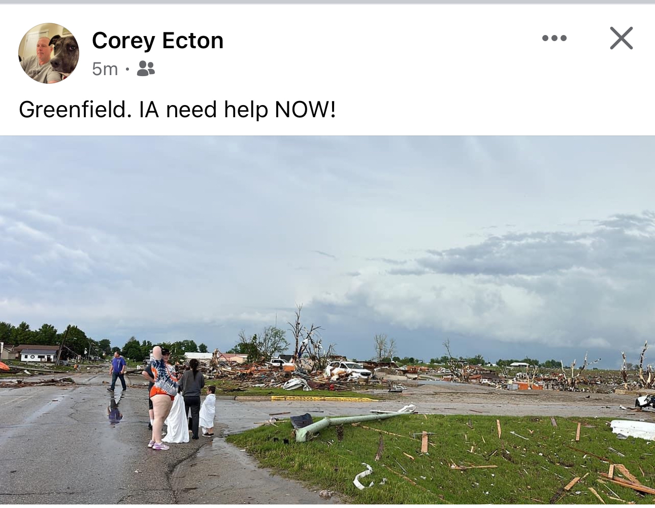
KCRG-TV9 reports at least 4 fatalities in Greenfield.
-
DOW finding winds well in excess of the EF5 threshold 44 m AGL while the tornado was in Greenfield.
-
No rest for the weary. Saturday (Southern Plains) and Sunday further east are looking pretty impressive on the various 00z model runs.
-
Can we at least wait for the surveys to get in? And also, yes this tornado will get EF4+. We can have the other debate when it's finalized.
-
Catastrophic damage in Greenfield IA. TDS went up over 40,000 feet.
-
Large tornado confirmed on this storm.
-

2024 Short/Medium Range Severe Weather Discussion
andyhb replied to Chicago Storm's topic in Lakes/Ohio Valley
Tuesday has big league severe possibilities in Iowa and surrounding area. Don't see many shortwaves with 500 mb flow approaching 90 kts (and relatively low amplitude) and 850 mb flow of 50+ kts this time of year. Has outbreak potential, especially if the trough slows a bit and we get a solution that resembles the last few runs of the ECMWF. -
Tomorrow is looking pretty interesting on the southern periphery of the mid level wave ejecting into KS. Multiple 12z CAMs with supercells on the nose of the higher theta-e in W OK. Got that mothership look to it with a tornado chance as the LLJ cranks towards sundown.
-
Large tornado down near Henagar AL with a debris ball.
-
Maury County TN tornado.
-
Significant damage reported in Fairhaven WV from that tornado WNW of Pittsburgh earlier that had a 62.5 dBZ debris ball at one point on reflectivity.
-
Greenville OH is in a bad situation right now.
-
Pretty sure that TORE is for a signature in clear air/sidelobe contamination.
-
Large tornado moving into Portage.
-
Sig tor looks imminent on the Centreville MI cell.
-
TDS on the supercell near Dowagiac MI, heading up in the direction of K'zoo and Portage.
-
I think the extent of the tree damage probably pushed them over the threshold for EF4. That stuff was high end, especially just NE of town.
-
Barnsdall rated EF4.