forkyfork
-
Posts
30,824 -
Joined
-
Last visited
Content Type
Profiles
Blogs
Forums
American Weather
Media Demo
Store
Gallery
Everything posted by forkyfork
-
lucky you. buckets of cold rain in nj. i'd love to trade
-

Wake Me Up When September Ends..Obs/Diso
forkyfork replied to 40/70 Benchmark's topic in New England
hi guys congrats on one of the warmest sept weeks ever -
how many nyc residents live in a forest?
-
let's see the weekly average on sunday
-
Extended summer stormlover74 future snow hole banter thread 23
forkyfork replied to BxEngine's topic in New York City Metro
let those words rattle around in your heads. none of the others had this duration of high heat indices -
Extended summer stormlover74 future snow hole banter thread 23
forkyfork replied to BxEngine's topic in New York City Metro
who knew our worst september heat wave on record would trigger people -
6th day over 90 at ewr which makes this its longest september heat wave on record
-
E PA/NJ/DE Fall 2023 OBS/Discussion Thread
forkyfork replied to Rtd208's topic in Philadelphia Region
it's not a climate change discussion -
E PA/NJ/DE Fall 2023 OBS/Discussion Thread
forkyfork replied to Rtd208's topic in Philadelphia Region
oh you're one of those nutters. carry on -
E PA/NJ/DE Fall 2023 OBS/Discussion Thread
forkyfork replied to Rtd208's topic in Philadelphia Region
your station is nestled in a bunch of trees. of course you're not hitting 90. lol -
the south shore finally has a chance
-
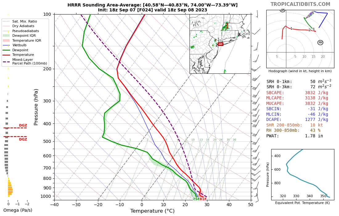
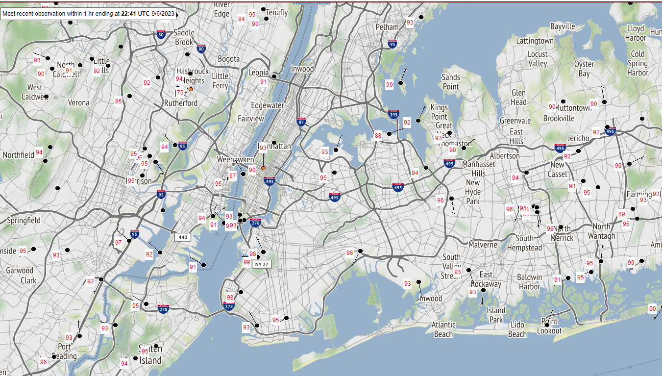
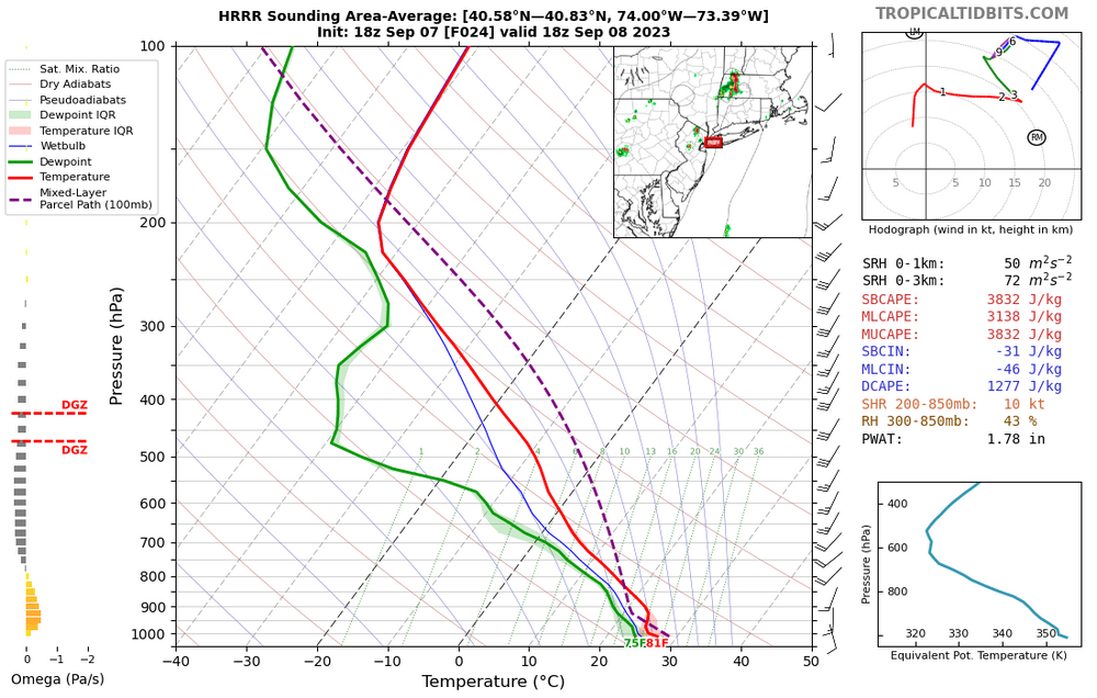
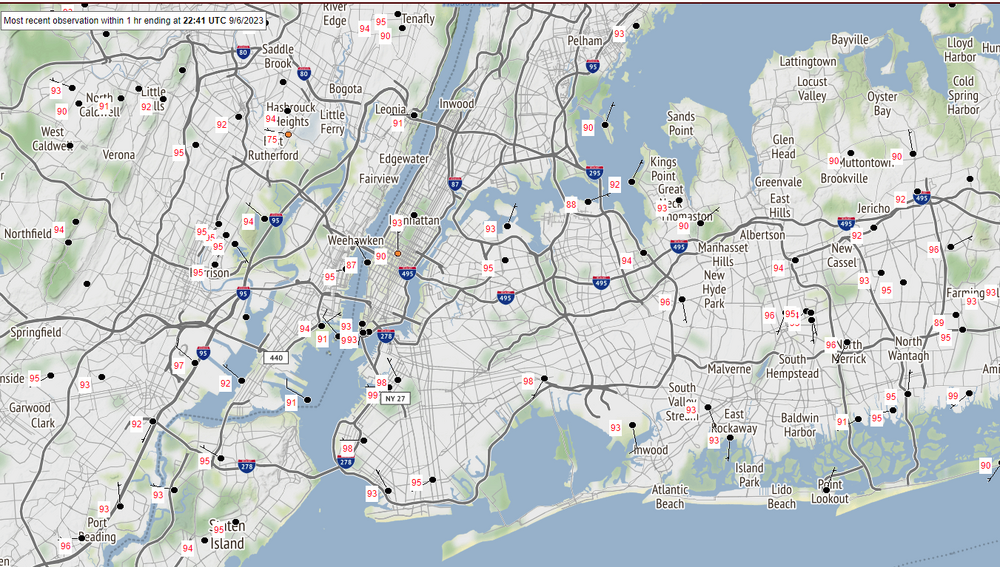
edison is 96/75 right now
-
looks like the sea breeze moved in too early for 100. still crazy to hit 96 on se winds in september
-
ewr 97 before noon lol
-
the temperature just doesn't exist in the middle of queens
-
i'm sorry you're upset that these heat waves keep happening
-
all the downplaying when i posted ensemble images and now newark could get its latest 100 ever. why should anyone take this place seriously?
-
ewr 94 which is 4 degrees ahead of yesterday
-
ewr is probably going to get a seabreeze later this afternoon. the little compressional boost ahead of it could be enough for 100
-
ewr is already 90
-
that breaks the previous record high min by 6 degrees if there's no convection later
-
what point are you trying to make
-
lots of 95+ highs in the city today including two 99s. the park's temps are bullshit, sorry you don't like when people point it out
-
Wake Me Up When September Ends..Obs/Diso
forkyfork replied to 40/70 Benchmark's topic in New England
with a top ten warm july sprinkled in -
Wake Me Up When September Ends..Obs/Diso
forkyfork replied to 40/70 Benchmark's topic in New England
actually moist air contains more heat than dry air