cyclone77
-
Posts
18,885 -
Joined
-
Last visited
Content Type
Profiles
Blogs
Forums
American Weather
Media Demo
Store
Gallery
Everything posted by cyclone77
-
Yeah we're in Day5-7 here. Love 2c it..
-
Just had a nice burst of sleet even though the temp is a relatively balmy 43 degrees.
-
Radar estimates over 2 inches of QPF fell in south-central IA overnight. Likely overestimated due to bright banding, but some big amounts may have happened in a narrow corridor if the snow wasn't too mixy with rain.
-
Could be an interesting night in southern Iowa. Some of the models are suggesting a very narrow swath of 6" or more of snow from a very intense stationary band of snow to develop.
-
Another 0.75" overnight brings the total since Monday night to 3.25" of much needed rains.
-
Far different air mass here compared to yesterday evening. Cold northeast winds from Alekville have kept us north of the warm front, and thus reducing the nader threat to zero.
-
Looking like more opportunities for beneficial rains through the 10 day period. Luv 2c it.
-
I vote for Mazooweather.
-
Picked up over another inch with this evening's severe. Now up to 2.09" since last night.
-
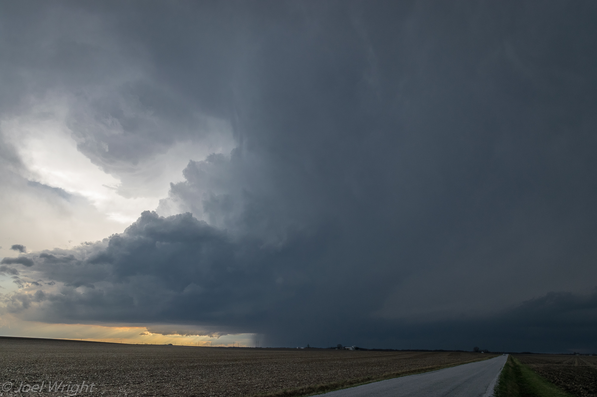
Nice ragged/elongated wall cloud passed just southeast. It was trying it's best to wrap up. Had a period of quarter size hail and torrential rain from core right after the wall cloud passed by.
-
Picked up 1.01" so far since last evening. I'll take it.
-
Nice sup heading right at us. If it can get it's act together this could get interesting.
-
Looks like a very nice soaker on the way for tonight through tomorrow night. Best rains in a loooong time. The degree of the severe threat is a bit questionable. Models show lots of ongoing rounds of precip through much of the day in the warm sector, so instability may be knocked back some. Still a nice setup though overall.
-
0.41" today. Will finish March with 3.14".
-
Had a brief period of marbles around 6am here. Picked up 0.11" overnight.
-
Severe to the east near Chicago, severe to the west near Des Moines. Here in the middle, crickets.
-
18 degrees 2 days ago, and today a new record high of 85 at MLI.
-
I saw on a show a long time ago that the huge natural aquifer out in the Plains is being quickly depleted by all of the crop irrigation taking place. So water issues may arise out there someday if that's true.
-
Hopefully the prefrontal precip shown on some of the models for Tue morning pans out, as it looks like the late day convection will be another miss southeast. Luckily a nice wet system looks to be on the way for Thursday.
-
From 80s last week back down to 18 here this morning. Grass is really greening up now. Some understory shrubs have leafed out in the wooded areas.
-
Had a few sprinkles here today. SPC FTL with yesterday's day2 outlook for northwest IL/east IA.
-
Glad I held off putting the tree fertilizer spikes in as we received nothing for rainfall today.
-
SPC risk needs to be shaved off over northwest IL and eastern IA. Will be a whiff east/southeast.
-
Very nice. It looks like my cell merged with a another storm from just south and produced your tor. One small thing I'll always regret about that chase was leaving my original position just to the south of Good Hope. Sat there for a short while with an excellent view of the approaching wall cloud, but repositioned a bit south to get out of the large hail threat. If I would have stayed there I would have captured a very nice long-lived time lapse of the approaching sup and evolution of the developing tor at very close range, as it passed very close to the original location. Here's where I wish I stayed put...

-
It's been like a summer evening. Still 72 at midnight at MLI, 70 at DVN.