cyclone77
-
Posts
18,902 -
Joined
-
Last visited
Content Type
Profiles
Blogs
Forums
American Weather
Media Demo
Store
Gallery
Everything posted by cyclone77
-
Think this is the first time I can remember seeing snow on the ground with temps in the mid 70s.
-
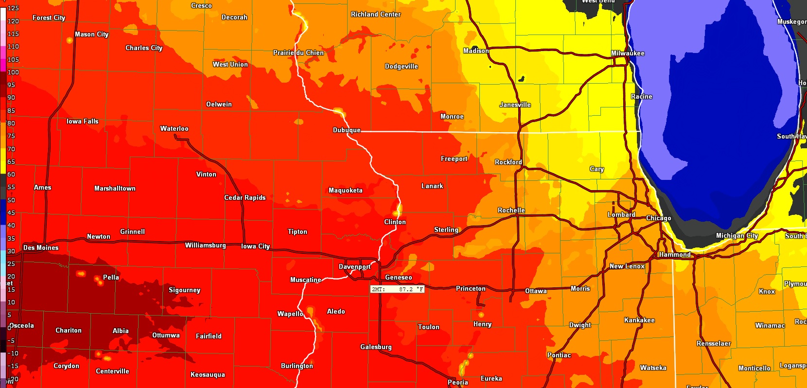
00z HRRR going bonkers and showing 87 for the QC on Saturday.

-
MLI tagged 70. The 7 inches there from Monday is toast.
-
Yeah already 62 here, MLI at 64.
-
The strength of the mid March sun did work yesterday. Down to just drifts already, albeit they are still big drifts. Low to mid 60s today should really shrink those by this evening.
-
Got 0.3" overnight. 72 Fri, 82 Saturday.
-
5 degrees with a wind chill of -9. Now looks like lower 80s just 4 days from now on Saturday.
-
Final storm stats here 0.48" rain, 6.3" snow. Also a trace of sleet thrown in as well. Guessing around 1.10" total QPF give or take.
-
A different type of frozen object falling from the sky this week eh?
-
The end of the drive keeps getting snow deposited from plows that keep going past. Snow keeps drifting across the road just to the north where there's an open field to the west. Snow blower (and me lol) getting a good workout.
-
Only 60 more model cycles to go lol.
-
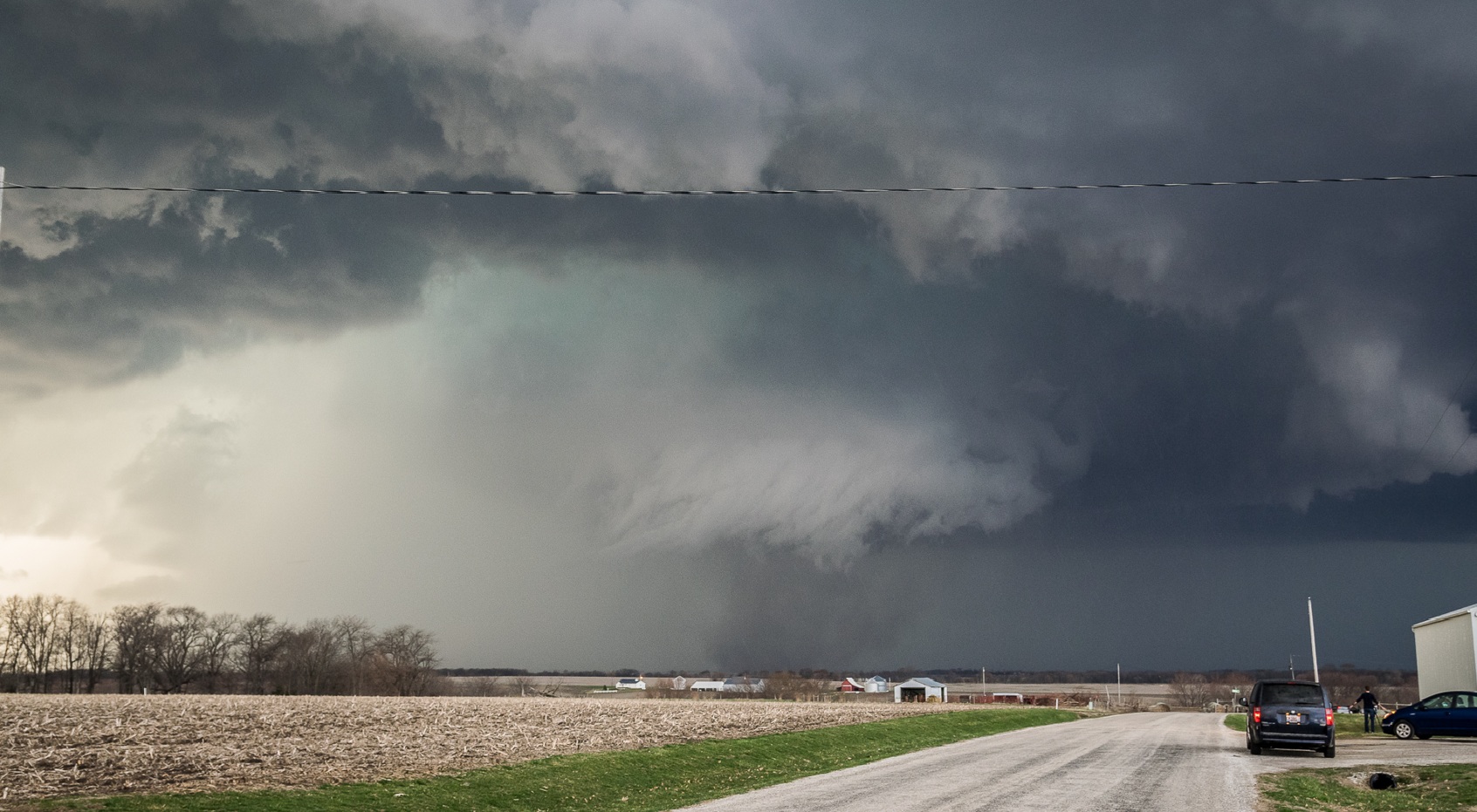
Probably the hardest snow event I've ever attempted to measure. A lot of areas of the yard are completely scoured free of snow, with other areas buried 1-3ft with snow drifts. Still in heavy snow right now with this narrow band. Came up with an average of 6.3", but the real amount is likely higher than that. A lot of granulation going on at ground level with these steady 40+mph winds blowing in off of the farm fields. Definitely looks like a legit blizzard out there this morning.
- 716 replies
-
- 10
-

-

-
Blizzard today, mid 70s by Friday. Maybe near 80 on Saturday. Gotta love March in the Midwest.
-
Still ripping pretty nicely with this final band rotating though. Vis is pretty low with the 45+mph winds.
-
It was off by a few days timing wise, but this actually kind of came to fruition.
-
I was very skeptical for the majority of the leadup to this storm, as it seems pretty unusual to get one of these to time out just right to hit a given location. Looks like this one timed up pretty well for this area, and points northeast.
-
Rip city here atm with heavy snow. Estimating a good 2" down now. Starting to blow around more and more.
-
Several 60-65mph wind gust reports out in central Iowa over the past hour or so. I-80 closed between Des Moines and Omaha.
-
Funny that this evening we're dealing with a developing blizzard when 10 years ago on this date I was looking at this down by Good Hope IL.
-
Eyeballing about an inch here. Pavement has been just wet despite the good rates, but starting to whiten up there now as well.
-
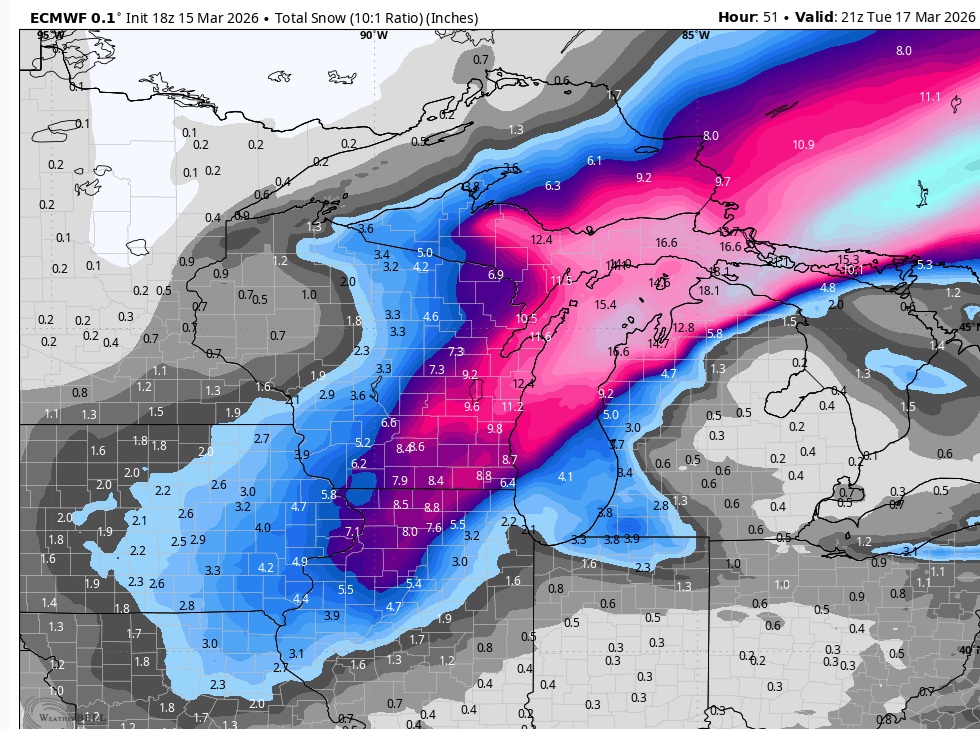
10:1, so bump it up to whatever you're thinking is for LSRs.
-
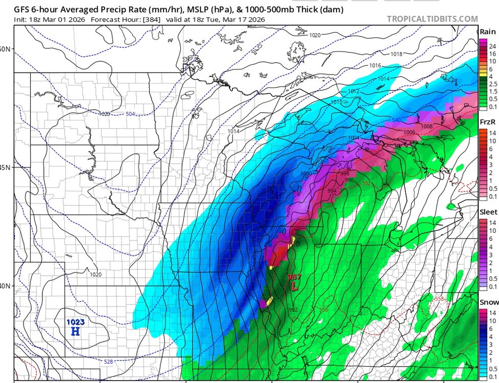
Nowcast time but 18z Euro was pretty juicy for northern IL.
-
Already moderate snow no longer with sleet. Ground already DABd. Changeover process evolved very quickly.
-
Sleet now mixing with large flakes.
-
We've switched over to sleet here, and down to 31.