cyclone77
-
Posts
18,892 -
Joined
-
Last visited
Content Type
Profiles
Blogs
Forums
American Weather
Media Demo
Store
Gallery
Everything posted by cyclone77
-
Don't think I've ever seen this much drought throughout the entire country. Where the hell have all the weather systems gone?
-

Fall 2025 Medium/Long Range Discussion
cyclone77 replied to Chicago Storm's topic in Lakes/Ohio Valley
The AI Euro has been selling a storm system next weekend pretty consistently for days. Hopefully it's on the right track. -
0.54" overnight/early this morning here.
-
That late week system had been looking quite nice for several days on multiple models. A real shame to see it crap the bed across the board today. Next mirage storm coming around the 25th.
-
72 here today. MLI missed the record by a few degrees with a 73.
-
I think we all deserve a front, middle, and end loaded winter lol.
-
Was perfect timing as well. Early evening, perfectly clear skies, and the moon didn't rise until almost midnight.
-
Wow that was an incredible burst of pinks. Best I've ever seen for sure.
-
11/8-11/10 First Snow and Lake Effect Event
cyclone77 replied to Geoboy645's topic in Lakes/Ohio Valley
Nino is making a run at you though lol. Congrats! -
11/8-11/10 First Snow and Lake Effect Event
cyclone77 replied to Geoboy645's topic in Lakes/Ohio Valley
I'm surprised @RCNYILWX hasn't chimed in as of yet. -
Feels like deep winter out there today. Gonna be 60 already by Thu though, and 70 by Saturday.
-
Northern red is at full peak. Oaks running a little behind this year in color, but most are nearing peak now.
-
11/8-11/10 First Snow and Lake Effect Event
cyclone77 replied to Geoboy645's topic in Lakes/Ohio Valley

-
11/8-11/10 First Snow and Lake Effect Event
cyclone77 replied to Geoboy645's topic in Lakes/Ohio Valley
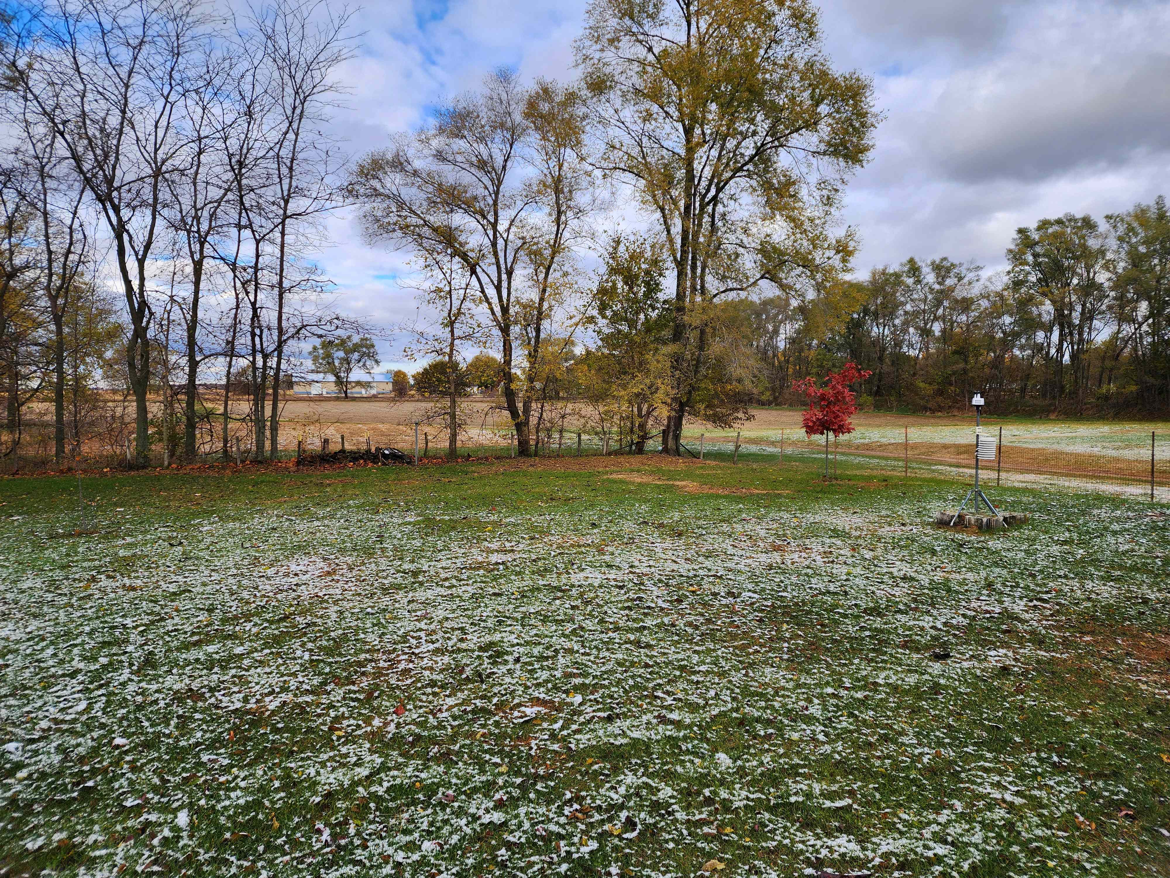
On the board with 0.3" here. Looks nice with the trees still colorful. Looking forward to watching how this LE monster evolves tonight. -
11/8-11/10 First Snow and Lake Effect Event
cyclone77 replied to Geoboy645's topic in Lakes/Ohio Valley
Ripping cotton balls right now. Ground has quickly whitened.- 213 replies
-
- 11
-

-

-
11/8-11/10 First Snow and Lake Effect Event
cyclone77 replied to Geoboy645's topic in Lakes/Ohio Valley
First flakes of the season here, as we now have wet flakes mixing in. Temp dropped pretty quickly from near 40 to 35 in the past hour or so. 0.58" rain so far. -
11/8-11/10 First Snow and Lake Effect Event
cyclone77 replied to Geoboy645's topic in Lakes/Ohio Valley
Looks like even out this way we may get a burst of decent wet snow later this evening. Wouldn't be surprised to see a DAB+ -
First flakes on the way for Sun night for this area. If tomorrow's wave were more potent (or it was a few weeks later) we'd have a nice little snow system.
-
Picked up 0.01" overnight.
-
Euro seems to be trending towards what the GFS has been showing for days. Looks like the Euro may be getting schooled by the GFS if trends continue.
-
Saw some graupel in Rock Falls an hour ago or so. First winter precip on the books.
-
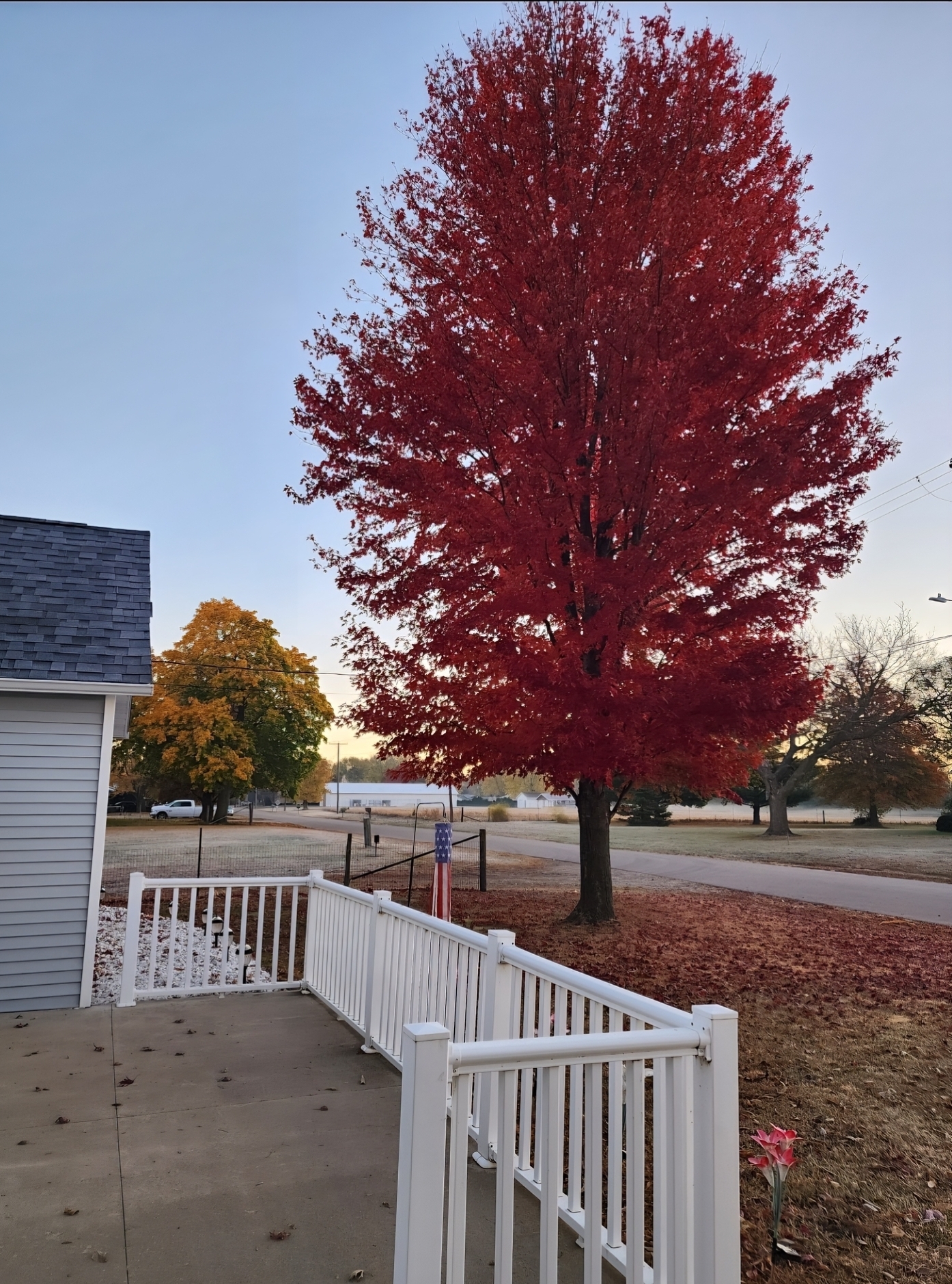
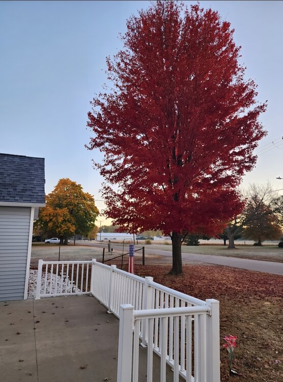
Autumn blaze here is popping as well.
-
Oct 2023 had a 16 page general disco thread. 2024 had a 10 page thread. This October has a 6 page thread. Not the most scientific example but sure seems like weather has had extremely long stretches with nothing to talk about the past few years.
-
Fall 2025 Medium/Long Range Discussion
cyclone77 replied to Chicago Storm's topic in Lakes/Ohio Valley
Looking very quiet through mid November. -
Picked up 0.40" since yesterday. Will finish Oct with 3.60", 3+ inches more than September.